Bamban | |
---|---|
Municipality of Bamban | |
Location within the Philippines | |
Coordinates: 15°16′27″N120°34′01″E / 15.2742°N 120.5669°E | |
Country | Philippines |
Region | Central Luzon |
Province | Tarlac |
District | 3rd district |
Founded | June 6, 1710 |
Barangays | 15 (see Barangays) |
Government | |
• Type | Sangguniang Bayan |
• Mayor | Alice L. Guo |
• Vice Mayor | Leonardo D. Anunciacion |
• Representative | Noel N. Rivera |
• Municipal Council | Members |
• Electorate | 45,008 voters (2022) |
Area | |
• Total | 251.98 km2 (97.29 sq mi) |
Elevation | 89 m (292 ft) |
Highest elevation | 265 m (869 ft) |
Lowest elevation | 48 m (157 ft) |
Population (2020 census) [3] | |
• Total | 78,260 |
• Density | 310/km2 (800/sq mi) |
• Households | 17,695 |
Economy | |
• Income class | 2nd municipal income class |
• Poverty incidence | 13.47 |
• Revenue | ₱ 244.7 million (2020) |
• Assets | ₱ 521.7 million (2020) |
• Expenditure | ₱ 246.1 million (2020) |
• Liabilities | ₱ 79.01 million (2020) |
Service provider | |
• Electricity | Tarlac 2 Electric Cooperative (TARELCO 2) |
Time zone | UTC+8 (PST) |
ZIP code | 2317, 2023 (portions under Clark Freeport and Special Economic Zone) |
PSGC | |
IDD : area code | +63 (0)45 |
Native languages | Kapampangan Tagalog Ilocano |
Website | bambantarlac |
Bamban, officially the Municipality of Bamban (Kapampangan : Balen ning Bamban; Filipino : Bayan ng Bamban), is a 2nd class municipality in the province of Tarlac, Philippines. According to the 2020 census, it has a population of 78,260 people. [3]
The municipality derives its name from the bamban plants (Donax canniformis) that once dominated large areas of land along the river near the foothills. It was initially called cabambanan or mabamban, but was later called simply as bamban. [5]
The site of Bamban was originally a vast track of wild land extending eastward; and on the west side, composed of forested foothills and mountains lush with tall trees extending deep into the Zambales ranges. The thick forest and mountains were then inhabited by the Aetas (locally known as Baluga), and the Zambal, both of whom subsisted only on fishing and native or wild animals which abounded in the place. Occasionally, traders from Pampanga and the Tagalog provinces braved the wilderness to go northward to Capas and Tarlac.
Before the advent of the Spanish era, small settlers came, attracted by the fertile land sustained by the river. The settlers started small clearings in the thick growth of bamban plants which covered vast portions of the land bordering the river a small distance from the foothills. Because of these plants, the place was eventually named Bamban. About 1700, Augustinian Recollects came and established the Mission de Pueblos de Bamban. Originally a part of Pampanga, in 1837, a new boundary line was established, thereby permanently making Bamban part of the province of Tarlac.
Official recognition as a town was sanctioned by the gobernadorcillos in Tarlac town. Don Martín Sibal was subsequently appointed head and commissioned with the rank of "Capitán". Among the first settlers were the Sibal, Lugtu, Dayrit, Macale, Vergara, Manipon, and de la Cruz clans.
During the revolution of 1896, Bamban was one of the first towns to take up arms against the Spaniards. Northwest of the town situated among the hills are remnants of strongholds built by Bambanenses who joined Gen. Servillano Aquino in the uprising in Tarlac. Up to this time, a portion of the foothills in the area is called "Batiawan" or look-out point.
When the Americans came in 1900, the pueblo gradually grew into a town. The Bamban Sugar Central was established. Don Pablo Lagman was the first to be appointed presidente and Don Laureano Campo as vice-presidente under the American military government. Other prominent families then took over the helm of government. During the Commonwealth era, the Sibals, the Lumboys, the Santoses, the Punsalangs, to mention a few, enjoyed political power until the outbreak of World War II. The whole población was devastated and burned during the liberation. Rebuilding began despite the ongoing fighting in the mountains. Growth was fast because of proximity of Clark Air Base. However, prominent families left the town for the city to establish big business and names for themselves.
The 1991 Mount Pinatubo volcanic eruption and the subsequent flow of lahar to the lowlands of Bamban forced residents to move out or to stay at the Dapdap Resettlement Area, which is on higher grounds.
Bamban is the southernmost town of Tarlac. It has a common boundary with Mabalacat, Pampanga, and in the west, with Zambales. The boundary is defined by the Parua River, which is a source of irrigation water, food, and sand and gravel for infrastructure projects. The mountainous region situated in the western part comprises almost two-thirds of the total land area, which used to be within the US Military Reservations. Nestled in this part are the BLISS projects and to the north, the MAR settlement project.
Bamban is 99 kilometers (62 mi) from Manila and is 25 kilometers (16 mi) from the provincial capital, Tarlac City.
Bamban is politically subdivided into 15 barangays. [6] Each barangay consists of puroks and some have sitios.
Climate data for Bamban, Tarlac | |||||||||||||
---|---|---|---|---|---|---|---|---|---|---|---|---|---|
Month | Jan | Feb | Mar | Apr | May | Jun | Jul | Aug | Sep | Oct | Nov | Dec | Year |
Mean daily maximum °C (°F) | 30 (86) | 31 (88) | 33 (91) | 35 (95) | 33 (91) | 31 (88) | 30 (86) | 29 (84) | 29 (84) | 30 (86) | 31 (88) | 30 (86) | 31 (88) |
Mean daily minimum °C (°F) | 19 (66) | 19 (66) | 20 (68) | 22 (72) | 24 (75) | 24 (75) | 24 (75) | 24 (75) | 23 (73) | 22 (72) | 21 (70) | 20 (68) | 22 (71) |
Average precipitation mm (inches) | 3 (0.1) | 2 (0.1) | 5 (0.2) | 10 (0.4) | 80 (3.1) | 107 (4.2) | 138 (5.4) | 147 (5.8) | 119 (4.7) | 70 (2.8) | 26 (1.0) | 8 (0.3) | 715 (28.1) |
Average rainy days | 2.0 | 1.7 | 2.7 | 4.6 | 16.1 | 20.8 | 24.0 | 23.0 | 21.4 | 15.5 | 8.0 | 3.2 | 143 |
Source: Meteoblue [7] |
|
| |||||||||||||||||||||||||||||||||||||||||||||||||||
Source: Philippine Statistics Authority [8] [9] [10] [11] |
In the 2020 census, the population of Bamban, was 78,260 people, [3] with a density of 310 inhabitants per square kilometer or 800 inhabitants per square mile.
Poverty Incidence of Bamban
2.5 5 7.5 10 12.5 15 2006 7.60 2009 10.60 2012 4.61 2015 12.56 2018 10.30 2021 13.47 Source: Philippine Statistics Authority [12] [13] [14] [15] [16] [17] [18] [19] |
Mabalacat, officially Mabalacat City, is a 3rd class component city in the province of Pampanga, Philippines. According to the 2020 census, it has a population of 293,244 people.
San Antonio, officially the Municipality of San Antonio, is a 1st class municipality in the province of Nueva Ecija, Philippines. According to the 2020 census, it has a population of 83,060 people.
Floridablanca, officially the Municipality of Floridablanca is a 1st class municipality in the province of Pampanga, Philippines. According to the 2020 census, it has a population of 135,542 people. Floridablanca is a part of the province of the Pampanga located in Central Luzon lying north of Dinalupihan, Bataan and south-southwest of San Fernando, Pampanga.
San Fernando, officially the City of San Fernando, is a 1st class component city and capital of the province of Pampanga, Philippines. According to the 2020 census, it has a population of 354,666 people.
Macabebe, officially the Municipality of Macabebe, is a 1st class municipality in the province of Pampanga, Philippines. According to the 2020 census, it has a population of 78,151 people.
Porac, officially the Municipality of Porac, is a 1st class municipality in the province of Pampanga, Philippines. According to the 2020 census, it has a population of 140,751 people.
San Luis, officially the Municipality of San Luis, is a 3rd class municipality in the province of Pampanga, Philippines. According to the 2020 census, it had a population of 58,551 people.
San Simon, officially the Municipality of San Simon, is a 3rd class municipality in the province of Pampanga, Philippines. According to the 2020 census, it has a population of 59,182 people.
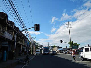
Santo Tomas, officially the Municipality of Santo Tomas, is a 4th class municipality in the province of Pampanga, Philippines. According to the 2020 census, it has a population of 42,846 people.
Anao, officially the Municipality of Anao, is a 5th class municipality in the province of Tarlac, Philippines. According to the 2020 census, it has a population of 12,208 people, making it the least populated municipality in the province.
Capas, officially the Municipality of Capas, is a 1st class municipality in the province of Tarlac, Philippines, and one of the richest towns in the province. The town also consists of numerous subdivisions and exclusive villages.
Concepcion, officially the Municipality of Concepcion, is a 1st class municipality in the province of Tarlac, Philippines. According to the 2020 census, it has a population of 169,953 people.
Mayantoc, officially the Municipality of Mayantoc, is a 3rd class municipality in the province of Tarlac, Philippines. According to the 2020 census, it has a population of 32,597 people.
San Clemente, officially the Municipality of San Clemente, is a 5th class municipality in the province of Tarlac, Philippines. According to the 2020 census, it has a population of 13,181 people.
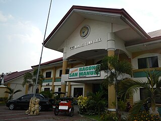
San Manuel, officially the Municipality of San Manuel, is a municipality in the province of Tarlac, Philippines. According to the 2020 census, it has a population of 28,387 people.
Santa Ignacia, officially the Municipality of Santa Ignacia, is a 2nd class municipality in the province of Tarlac, Philippines. Santa Ignacia has a total land area of 14,607 hectares. According to the 2020 census, it has a population of 51,626 people.
Tarlac City, officially the City of Tarlac, is a 1st class component city and capital of the province of Tarlac, Philippines. According to the 2020 census, it has a population of 385,398 people.
Tagkawayan, officially the Municipality of Tagkawayan, is a 1st class municipality in the province of Quezon, Philippines. According to the 2020 census, it has a population of 54,003 people.
Bongabon, officially the Municipality of Bongabon, is a 2nd class municipality in the province of Nueva Ecija, Philippines. According to the 2020 census, it has a population of 66,839 people.
Laur, officially the Municipality of Laur, is a 3rd class municipality in the province of Nueva Ecija in Central Luzon region of Philippines. According to the 2020 census, it has a population of 38,263 people. Laur is located at the foothills of the Sierra Madre Mountains.
{{cite encyclopedia}}
: CS1 maint: numeric names: authors list (link)