Bangs, Texas

Last updated

Bangs, Texas
BangsTexas (1 of 1).jpg
Bangs, Texas
Bangs, Texas
Bangs, Texas
Bangs, Texas
USA Texas location map.svg
Red pog.svg
Bangs
Usa edcp location map.svg
Red pog.svg
Bangs
North America laea location map.svg
Red pog.svg
Bangs
Coordinates: 31°42′58″N99°7′49″W / 31.71611°N 99.13028°W / 31.71611; -99.13028
Country United States
State Texas
County Brown
Area
[1]
  Total1.50 sq mi (3.88 km2)
  Land1.50 sq mi (3.88 km2)
  Water0.00 sq mi (0.00 km2)
Elevation
[2]
1,608 ft (490 m)
Population
 (2020)
  Total1,540
  Density1,000/sq mi (400/km2)
Time zone UTC-6 (Central (CST))
  Summer (DST) UTC-5 (CDT)
ZIP code
76823
Area code 325
FIPS code 48-05552 [3]
GNIS feature ID2409783 [2]
Website cityofbangs.org

Bangs is a city located in Brown County in west-central Texas, United States. The population was 1,540 at the 2020 census. [4]

Contents

Geography

U.S. Routes 67 and 84 run concurrently through the city, leading east 9 miles (14 km) to Brownwood, the county seat, and west 11 miles (18 km) to Santa Anna in Coleman County.

According to the United States Census Bureau, the city has a total area of 1.5 square miles (3.8 km2), all land. [5]

Demographics

Historical population
CensusPop.Note
1910 512
1920 70938.5%
1930 7171.1%
1940 7565.4%
1950 93523.7%
1960 9673.4%
1970 1,21425.5%
1980 1,71641.4%
1990 1,555−9.4%
2000 1,6204.2%
2010 1,603−1.0%
2020 1,540−3.9%
U.S. Decennial Census [6]

2020 census

Bangs racial composition [4]
(NH = Non-Hispanic) [lower-alpha 1]
RaceNumberPercentage
White (NH)1,10471.69%
Black or African American (NH)503.25%
Native American or Alaska Native (NH)120.78%
Asian (NH)50.32%
Mixed/Multi-Racial (NH)714.61%
Hispanic or Latino 29819.35%
Total1,540

As of the 2020 United States census, there were 1,540 people, 586 households, and 365 families residing in the city.

2000 census

As of the census [3] of 2000, 1,620 people, 633 households, and 419 families resided in the city. The population density was 1,171.9 inhabitants per square mile (452.5/km2). There were 733 housing units at an average density of 530.3 per square mile (204.7/km2). The racial makeup of the city was 86.91% White, 4.75% African American, 0.37% Native American, 6.42% from other races, and 1.54% from two or more races. Hispanics or Latinos of any race were 12.72% of the population.

Of the 633 households, 33.2% had children under the age of 18 living with them, 51.5% were married couples living together, 12.6% had a female householder with no husband present, and 33.8% were not families. About 32.5% of all households were made up of individuals, and 18.5% had someone living alone who was 65 years of age or older. The average household size was 2.44 and the average family size was 3.10.

In the city, the population was distributed as 26.9% under the age of 18, 6.2% from 18 to 24, 24.6% from 25 to 44, 21.9% from 45 to 64, and 20.4% who were 65 years of age or older. The median age was 39 years. For every 100 females, there were 81.0 males. For every 100 females age 18 and over, there were 73.5 males.

The median income for a household in the city was $23,690, and for a family was $30,208. Males had a median income of $27,212 versus $19,141 for females. The per capita income for the city was $14,216. About 17.4% of families and 20.0% of the population were below the poverty line, including 21.1% of those under age 18 and 27.8% of those age 65 or over.

History

Bangs was named after Samuel Bangs, who was given the land due to his services as a printer in the Texas Revolution, but he reportedly never saw the land. In 1886, tracks were laid from Brownwood to San Angelo with a depot in Bangs. The same year, a man opened a general store and applied to have a post office established there, with the application approved on May 24, 1886. In 1892, the first school was built with the population of 50 and eight established businesses. Bangs incorporated in 1915 with 600 residents and 21 businesses. The following year, a water system was installed followed by natural gas lines. Bangs Independent School District was formed in 1927, which eventually consolidated nine other school districts. In 1937, US Highway 67 was built through the town, and after World War II saw the development of new housing.

In 1948, when the population of Bangs was 756, the arrival of senatorial candidate Lyndon Johnson by helicopter was greeted by a crowd estimated to number 700 by accompanying reporters. [8]

Bangs is the birthplace of Major League Baseball batting champion Debs Garms.

The station is featured in one of Coffey Anderson's music videos titled "15 Minutes" [9] Anderson, a country and Christian music singer, songwriter was born in Bangs, Texas.

Related Research Articles

<span class="mw-page-title-main">Cooke County, Texas</span> County in Texas, United States

Cooke County is a county in the U.S. state of Texas. At the 2020 census, its population was 41,668. The county seat is Gainesville. The county was founded in 1848 and organized the next year. It is named for William Gordon Cooke, a soldier during the Texas Revolution. It is a part of the Texoma region.

<span class="mw-page-title-main">Coleman County, Texas</span> County in Texas, United States

Coleman County is a county located in the U.S. state of Texas. As of the 2020 census, its population was 7,684. The county seat is Coleman. The county was founded in 1858 and organized in 1864. It is named for Robert M. Coleman, a signer of the Texas Declaration of Independence and soldier at the Battle of San Jacinto.

<span class="mw-page-title-main">Brown County, Texas</span> County in Texas, United States

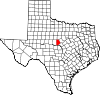
Brown County is a county in west-central Texas. As of the 2020 census, the population was 38,095. Its county seat is Brownwood. The county was founded in 1856 and organized in 1858. It is named for Henry Stevenson Brown, a commander at the Battle of Velasco, an early conflict between Texians and Mexicans.

<span class="mw-page-title-main">Blanco County, Texas</span> County in Texas, United States

Blanco County is a United States county located in the U.S. state of Texas. It is located in Central Texas and its county seat is Johnson City.

<span class="mw-page-title-main">Gridley, Kansas</span> City in Coffey County, Kansas

Gridley is a city in Coffey County, Kansas, United States. As of the 2020 census, the population of the city was 313.

<span class="mw-page-title-main">LeRoy, Kansas</span> City in Coffey County, Kansas

LeRoy is a city in Coffey County, Kansas, United States. As of the 2020 census, the population of the city was 451.

<span class="mw-page-title-main">Lyndon, Kansas</span> City in Osage County, Kansas

Lyndon is a city in, and the county seat of Osage County, Kansas, United States. As of the 2020 census, the population of the city was 1,037.

<span class="mw-page-title-main">Converse, Texas</span> City in Texas, United States

Converse is a city in Bexar County, Texas, United States, 15 miles (24 km) northeast of downtown San Antonio. As of the 2020 census, it had a population of 27,466. It is part of the San Antonio Metropolitan Statistical Area.

<span class="mw-page-title-main">Johnson City, Texas</span> City in Texas, United States

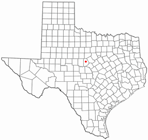
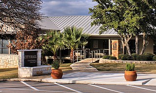
Johnson City is a city and the county seat of Blanco County, Texas, United States. The population was 1,627 at the 2020 census. Founded in 1879 by James P. Johnson, it was named for early settler Sam E. Johnson, Sr. Johnson City is part of the Texas-German belt region.

<span class="mw-page-title-main">Brownwood, Texas</span> City in Texas, United States

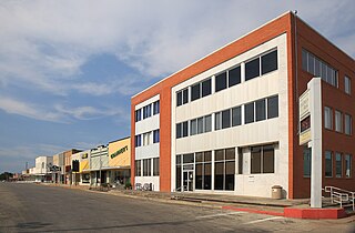
Brownwood is a city in and the county seat of Brown County, Texas, United States. The population was 18,862 as of the 2020 census. Brownwood is located in the Northern Texas Hill Country and is home to Howard Payne University, which was founded in 1889.

<span class="mw-page-title-main">Early, Texas</span> City in Texas, United States

Early is a city located in Brown County in west-central Texas, United States. It is a suburb of Brownwood, and the population was 3,087 at the 2020 census. It is named for Walter U. Early, who donated land for the local schools. It is home to the Early Independent School District and the Heartland Mall.

<span class="mw-page-title-main">Lake Brownwood, Texas</span> Census-designated place in Texas, United States

Lake Brownwood is a census-designated place (CDP) located in Brown County in central Texas, United States. The population was 1,532 at the 2010 census.

<span class="mw-page-title-main">Cottonwood Shores, Texas</span> City in Texas, United States

Cottonwood Shores is a city in Burnet County, Texas, United States. The population was 1,403 at the 2020 census.

<span class="mw-page-title-main">Granite Shoals, Texas</span> City in Texas, United States

Granite Shoals is a city in Burnet County, Texas, United States with a 2020 census population of 5,129.

<span class="mw-page-title-main">Coleman, Texas</span> City in Texas, United States

Coleman is a town in and the county seat of Coleman County, Texas, United States. As of the 2010 census, its population was 4,709.

<span class="mw-page-title-main">Fairfield, Texas</span> City in Texas, United States

Fairfield is a city and county seat of Freestone County, Texas, United States. The population was 2,850 at the 2020 census, down from 3,094 at the 2000 census. It was founded in 1851.

<span class="mw-page-title-main">Knox City, Texas</span> Town in Texas, United States

Knox City is a town in Knox County, Texas, United States. The population was 1,119 at the 2019 census.

<span class="mw-page-title-main">Sunrise Beach Village, Texas</span> City in Texas, United States

Sunrise Beach Village is a city in Llano County, Texas, United States. The village was established in 1973. The population was 713 at the 2010 census.

<span class="mw-page-title-main">Horseshoe Bay, Texas</span> City in Texas, United States

Horseshoe Bay is a city in Llano and Burnet counties in the U.S. state of Texas.

<span class="mw-page-title-main">Lebo, Kansas</span> City in Coffey County, Kansas

Lebo is a city in Coffey County, Kansas, United States. As of the 2020 census, the population of the city was 885.

References

  1. "2019 U.S. Gazetteer Files". United States Census Bureau. Retrieved August 7, 2020.
  2. 1 2 U.S. Geological Survey Geographic Names Information System: Bangs, Texas
  3. 1 2 "U.S. Census website". United States Census Bureau . Retrieved January 31, 2008.
  4. 1 2 "Explore Census Data". data.census.gov. Retrieved May 20, 2022.
  5. "Geographic Identifiers: 2010 Demographic Profile Data (G001): Bangs city, Texas". U.S. Census Bureau, American Factfinder. Archived from the original on February 12, 2020. Retrieved April 22, 2014.
  6. "Census of Population and Housing". Census.gov. Retrieved June 4, 2015.
  7. "About the Hispanic Population and its Origin". www.census.gov. Retrieved May 18, 2022.
  8. Robert Caro, The Years of Lyndon Johnson: Means of Ascent , New York: Alfred A. Knopf, 1990, p. 221.
  9. YouTube: Coffey Anderson - "15 Minutes" music video
  1. Note: the US Census treats Hispanic/Latino as an ethnic category. This table excludes Latinos from the racial categories and assigns them to a separate category. Hispanics/Latinos can be of any race. [7]