Bardwell, Texas | |
---|---|
Coordinates: 32°16′3″N96°41′42″W / 32.26750°N 96.69500°W | |
Country | United States |
State | Texas |
County | Ellis |
Area | |
• Total | 0.30 sq mi (0.79 km2) |
• Land | 0.30 sq mi (0.79 km2) |
• Water | 0.00 sq mi (0.00 km2) |
Elevation | 482 ft (147 m) |
Population (2020) | |
• Total | 625 |
• Density | 2,100/sq mi (790/km2) |
Time zone | UTC-6 (Central (CST)) |
• Summer (DST) | UTC-5 (CDT) |
ZIP code | 75101 |
Area code | 972 |
FIPS code | 48-05612 [2] |
GNIS feature ID | 1330034 [3] |
Bardwell is a city in Ellis County, Texas, United States. The population was 625 at the 2020 census.
Bardwell is located at 32°16′3″N96°41′42″W / 32.26750°N 96.69500°W (32.267602, –96.695028), [4] at the junction of State Highway 34 and Farm to Market Road 984 in southern Ellis County, 15 miles (24 km) southeast of Waxahachie. [5] Highway 34 leads northeast 7 miles (11 km) to Ennis and southwest 13 miles (21 km) to Italy. Lake Bardwell is 2 miles (3 km) to the east.
According to the United States Census Bureau, the city has a total area of 0.3 square miles (0.8 km2), all land. [6]
The community was settled in the early 1880s when the town's namesake, John W. Bardwell, built a cotton gin one mile south of the present-day location. A school opened in 1892 and a post office was established in 1893. [7] When the Trinity and Brazos Valley Railway was routed through Ellis County in 1907, the gin and community were moved to the nearest stretch of track. The town had its own telephone system and electricity supplied by lines from Ennis in 1914. Bardwell prospered throughout the 1920s as a cotton shipping point with three gins and six grocery stores. [5] The population grew to 650 by 1929, but the Great Depression and a subsequent drought severely impacted the community. The main road was rerouted to the new State Highway 34 in the early 1940s and most of Bardwell's businesses either closed or moved to sites along the highway. In 1958, Bardwell's school consolidated with nearby Ennis. After dropping to a low of 277 during the 1970s, the population began to grow. By 1990, 387 people lived in Bardwell. That figure had grown to 583 by 2000. [7]
Census | Pop. | Note | %± |
---|---|---|---|
1920 | 358 | — | |
1930 | 303 | −15.4% | |
1940 | 266 | −12.2% | |
1950 | 229 | −13.9% | |
1960 | 220 | −3.9% | |
1970 | 277 | 25.9% | |
1980 | 335 | 20.9% | |
1990 | 387 | 15.5% | |
2000 | 583 | 50.6% | |
2010 | 649 | 11.3% | |
2020 | 625 | −3.7% | |
U.S. Decennial Census [8] 2020 Census [9] |
As of the census [2] of 2000, 583 people, 167 households, and 139 families resided in the city. The population density was 2,093.7 inhabitants per square mile (808.4/km2). The 176 housing units averaged 632.1 per square mile (242.7/km2). The racial makeup of the city was 61.58% White, 17.50% African American, 1.37% Native American, 18.52% from other races, and 1.03% from two or more races. Hispanics or Latinos of any race were 47.51% of the population.
Of the 167 households, 47.9% had children under the age of 18 living with them, 62.3% were married couples living together, 15.0% had a female householder with no husband present, and 16.2% were not families. About 13.8% of all households were made up of individuals, and 5.4% had someone living alone who was 65 years of age or older. The average household size was 3.49 and the average family size was 3.86.
In the city, the population was distributed as 37.7% under the age of 18, 8.6% from 18 to 24, 27.8% from 25 to 44, 17.7% from 45 to 64, and 8.2% who were 65 years of age or older. The median age was 28 years. For every 100 females, there were 98.3 males. For every 100 females age 18 and over, there were 93.1 males.
The median income for a household in the city was $31,250, and for a family was $35,000. Males had a median income of $28,125 versus $16,250 for females. The per capita income for the city was $10,666. About 26.5% of families and 24.7% of the population were below the poverty line, including 26.8% of those under age 18 and 35.4% of those age 65 or over.
Bardwell is served by the Ennis Independent School District. The school district had an enrollment of 5,838 for the 2011–2012 school year.
Ellis County is a county located in the U.S. state of Texas. As of 2020, its population was estimated to be 192,455. The county seat is Waxahachie. The county was founded in 1849 and organized the next year. It is named for Richard Ellis, president of the convention that produced the Texas Declaration of Independence. Ellis County is included in the Dallas–Fort Worth–Arlington metropolitan statistical area.
Caldwell is a city in and the county seat of Burleson County, Texas, United States. The population was 3,993 at the 2020 census. It is part of the Bryan-College Station metropolitan area.
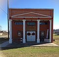
Alma is a town in Ellis County, Texas, United States. The population was 373 at the 2020 census.
Garrett is a town in Ellis County, Texas, United States. The population was 829 at the 2020 census, up from 806 at the 2010 census.
Pecan Hill is a city in Ellis County, Texas, United States. The population was 735 at the 2020 census, down from 626 at the 2010 census.
Southmayd is a city in Grayson County, Texas, United States. The population was 978 at the 2020 census. It is part of the Sherman–Denison Metropolitan Statistical Area.
Brownsboro is a city in Henderson County, Texas, United States. The population was 1,212 at the 2020 census, up from 1,039 at the 2010 census. The city is on Texas State Highway 31.
Caney City is a town in Henderson County, Texas, United States. The population was 187 at the 2020 census.
Log Cabin is a city in Henderson County, Texas, United States. The population was 678 at the 2020 census.
Malakoff is a city in Henderson County, Texas, United States. The population was 2,179 at the 2020 census. The city is named after a Russian fort of Malakoff, which played a pivotal role during the siege of Sevastopol during the Crimean War.
Payne Springs is a town in Henderson County, Texas, United States. The population was 741 at the 2020 census, down from 767 at the 2010 census.
Godley is a city in northwestern Johnson County, Texas, United States, in the Dallas–Fort Worth metroplex. It is on Texas State Highway 171, Farm Roads 2331 and 917, and the tracks of the Atchison, Topeka and Santa Fe Railway northwest of Cleburne. The population was 1,450 in 2020, up from 1,009 in 2010.
Oak Ridge is a town in Kaufman County, Texas, United States. The population was 771 at the 2020 census, up from 495 at the 2010 census.
Rosser is a village in Kaufman County, Texas, United States. The population was 301 at the 2020 census.
Barry is a city in Navarro County, in the U.S. state of Texas. The population was 220 at the 2020 census.
Eureka is a city in Navarro County, Texas, United States. The population was 313 at the 2020 census.
Kerens is a city in Navarro County, Texas, United States. The population was 1,505 at the 2020 census.
Gordon is a city in Palo Pinto County, Texas, United States. The population was 470 at the 2020 Census.
Burton is a city in Washington County, Texas, United States. Prior to the 2010 census, Burton changed its status from a town to a city. The population was 294 at the 2020 census.
Yantis is a town in Wood County, Texas, United States. The population was 405 at the 2020 census. The town is surrounded on three sides by Lake Fork Reservoir. It is located at the intersection of State Highway 154 and Farm to Market Road 17 approximately 12 miles north of the county seat of Quitman in northwestern Wood County.