Barling, Arkansas

Last updated

Barling, Arkansas
Sebastian County Arkansas Incorporated and Unincorporated areas Barling Highlighted 0503640.svg
Location of Barling in Sebastian County, Arkansas.
Coordinates: 35°20′05″N94°15′45″W / 35.33472°N 94.26250°W / 35.33472; -94.26250 [1]
Country United States
State Arkansas
County Sebastian
Area
[2]
  Total10.68 sq mi (27.67 km2)
  Land10.27 sq mi (26.60 km2)
  Water0.41 sq mi (1.07 km2)
Elevation
[1]
407 ft (124 m)
Population
 (2020)
  Total4,782
  Density465.67/sq mi (179.79/km2)
Time zone UTC-6 (Central (CST))
  Summer (DST) UTC-5 (CDT)
ZIP code
72923
Area code 479
FIPS code 05-03640
GNIS feature ID2403158 [1]

Barling is a city in Sebastian County, Arkansas, United States. It is part of the Fort Smith, Arkansas-Oklahoma Metropolitan Statistical Area. As of the 2020 Census the population was 4,782, [3] ranking it eighth in the Greater Fort Smith Area. Barling was incorporated in 1956.

Contents

Geography

Barling was named after Aaron Barling, a soldier originally posted to Fort Gibson in Indian Territory who subsequently farmed in Arkansas.

According to the United States Census Bureau, the city has a total area of 22.1 square miles (57 km2), of which 21.9 square miles (57 km2) is land and 0.1 square miles (0.26 km2) (0.59%) is water.

Climate

The climate in this area is characterized by hot, humid summers and generally mild to cool winters. According to the Köppen Climate Classification system, Barling has a humid subtropical climate, abbreviated "Cfa" on climate maps. [4]

Demographics

Historical population
CensusPop.Note
1960 770
1970 1,739125.8%
1980 3,761116.3%
1990 4,0788.4%
2000 4,1762.4%
2010 4,64911.3%
2020 4,7822.9%
U.S. Decennial Census [5]
2014 Estimate [6]

2020 census

Barling racial composition [7]
RaceNumberPercentage
White (non-Hispanic)3,41771.46%
Black or African American (non-Hispanic)1082.26%
Native American 901.88%
Asian 2134.45%
Pacific Islander 40.08%
Other/Mixed 4198.76%
Hispanic or Latino 53111.1%

As of the 2020 United States census, there were 4,782 people, 1,791 households, and 1,227 families residing in the city.

2000 census

As of the census [8] of 2000, there were 4,176 people, 1,599 households, and 1,122 families residing in the city. The population density was 190.4 inhabitants per square mile (73.5/km2). There were 1,697 housing units at an average density of 77.4 per square mile (29.9/km2). The racial makeup of the city was 87.05% White, 1.39% Black or African American, 1.87% Native American, 5.10% Asian, 0.02% Pacific Islander, 2.04% from other races, and 2.54% from two or more races. 3.98% of the population were Hispanic or Latino of any race.

There were 1,599 households, out of which 35.2% had children under the age of 18 living with them, 53.3% were married couples living together, 12.6% had a female householder with no husband present, and 29.8% were non-families. 26.5% of all households were made up of individuals, and 10.3% had someone living alone who was 65 years of age or older. The average household size was 2.54 and the average family size was 3.07.

In the city, the population was spread out, with 26.5% under the age of 18, 8.7% from 18 to 24, 30.3% from 25 to 44, 21.8% from 45 to 64, and 12.7% who were 65 years of age or older. The median age was 36 years. For every 100 females, there were 86.9 males. For every 100 females age 18 and over, there were 85.9 males.

The median income for a household in the city was $37,605, and the median income for a family was $41,421. Males had a median income of $28,218 versus $22,936 for females. The per capita income for the city was $16,485. About 10.0% of families and 11.9% of the population were below the poverty line, including 15.8% of those under age 18 and 14.3% of those age 65 or over.

Education

The following school districts include portions of Barling: [9]

Notable person

Related Research Articles

<span class="mw-page-title-main">Sebastian County, Arkansas</span> County in Arkansas, United States

Sebastian County is a county located in the U.S. state of Arkansas. As of the 2020 census, the population was 127,799, making it the fourth-most populous county in Arkansas. The county has two county seats, Greenwood and Fort Smith.

<span class="mw-page-title-main">Cedarville, Arkansas</span> City in Arkansas, United States

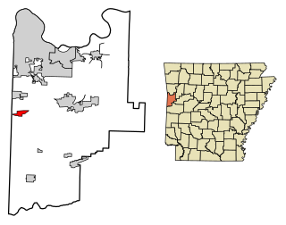
Cedarville is a city in Crawford County, Arkansas, United States. It is part of the Fort Smith, Arkansas-Oklahoma Metropolitan Statistical Area. The population was 1,410 at the 2020 census.

<span class="mw-page-title-main">Dyer, Arkansas</span> City in Arkansas, United States

Dyer is a city in Crawford County, Arkansas, United States. It is part of the Fort Smith, Arkansas-Oklahoma Metropolitan Statistical Area. The population was 876 at the 2010 census.

<span class="mw-page-title-main">Mountainburg, Arkansas</span> City in Arkansas, United States

Mountainburg is a town in Crawford County, Arkansas, United States. It is part of the Fort Smith, Arkansas-Oklahoma Metropolitan Statistical Area. As of the 2010 census the population was 631.

<span class="mw-page-title-main">Van Buren, Arkansas</span> City in Arkansas, United States

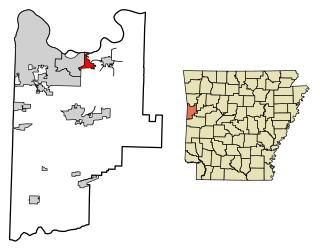
Van Buren is the second-largest city in the Fort Smith, Arkansas–Oklahoma Metropolitan Statistical Area and the county seat of Crawford County, Arkansas, United States. The city is located directly northeast of Fort Smith at the Interstate 40 – Interstate 540 junction. The city was incorporated in 1845 and as of the 2020 census had a population of 23,218, ranking it as the state's 21st largest city.

<span class="mw-page-title-main">Charleston, Arkansas</span> City in Arkansas, United States

Charleston is a city in Franklin County, Arkansas, United States, and along with Ozark is one of the two county seats of Franklin County. It is part of the Fort Smith, Arkansas-Oklahoma Metropolitan Statistical Area. The population was 2,494 at the 2010 census, down from 2,965 in 2000.

<span class="mw-page-title-main">Clarksville, Arkansas</span> City in Arkansas, United States

Clarksville is a city in Johnson County, Arkansas, United States. As of the 2010 census the population was 9,178, up from 7,719 in 2000. As of 2018, the estimated population was 9,743. The city is the county seat of Johnson County. It is nestled between the Arkansas River and the foothills of the Ozark Mountains, and Interstate 40 and US Highway 64 intersect within the city limits. Clarksville-Johnson County is widely known for its peaches, scenic byways and abundance of natural outdoor recreational activities.

<span class="mw-page-title-main">Lamar, Arkansas</span> City in Arkansas, United States

Lamar is a city in Johnson County, Arkansas, United States. The population was 1,605 at the 2010 census, up from 1,415 at the 2000 census.

<span class="mw-page-title-main">Mansfield, Arkansas</span> City in Arkansas, United States

Mansfield is a city in Scott and Sebastian counties Arkansas, United States. The Sebastian County portion of the city is part of the Fort Smith, Arkansas-Oklahoma Metropolitan Statistical Area. As of the 2010 Census, the population was 1,139. The population was 1,097 at the 2000 census.

<span class="mw-page-title-main">Waldron, Arkansas</span> City in Arkansas, United States

Waldron is a city in Scott County, Arkansas, United States. Its population was 3,386 at the 2020 census. The city is the county seat of Scott County.

<span class="mw-page-title-main">Central City, Arkansas</span> City in Arkansas, United States

Central City is a city in Sebastian County, Arkansas, United States. It is part of the Fort Smith, Arkansas-Oklahoma Metropolitan Statistical Area. At the 2010 Census, the population of Central City was 502. According to the 2018 US Census Bureau estimates, Central City had a population of 497.

<span class="mw-page-title-main">Hackett, Arkansas</span> City in Arkansas, United States

Hackett is a city in Sebastian County, Arkansas, United States. It is part of the Fort Smith, Arkansas-Oklahoma Metropolitan Statistical Area. The population was 812 at the 2010 census.

<span class="mw-page-title-main">Hartford, Arkansas</span> City in Arkansas, United States

Hartford is a city in Sebastian County, Arkansas, United States. It is part of the Fort Smith, Arkansas-Oklahoma Metropolitan Statistical Area. The population was 642 at the 2010 census.

<span class="mw-page-title-main">Huntington, Arkansas</span> City in Sebastian County, Arkansas, United States

Huntington is a city in Sebastian County, Arkansas, United States. It is part of the Fort Smith, Arkansas-Oklahoma Metropolitan Statistical Area. As of the 2010 Census the population was 635.

<span class="mw-page-title-main">Lavaca, Arkansas</span> City in Arkansas, United States

Lavaca is a city in Sebastian County, Arkansas, United States. It is part of the Fort Smith, Arkansas-Oklahoma Metropolitan Statistical Area. As of the 2010 Census the population was 2,289. Lavaca was incorporated in 1919.

<span class="mw-page-title-main">Arkoma, Oklahoma</span> Town in Oklahoma, United States

Arkoma is a town in LeFlore County, Oklahoma, United States. It is part of the Fort Smith, Arkansas-Oklahoma Metropolitan Statistical Area. The population was 1,989 at the 2010 census, a decline from 2,180 in 2000. The name of the town is a portmanteau of Arkansas and Oklahoma. Throughout its history, Arkoma has served as a "bedroom community" because many residents commuted to work in Fort Smith.

<span class="mw-page-title-main">Point Comfort, Texas</span> City in Texas, United States

Point Comfort is a city in Calhoun County, Texas, United States. It is a part of the Victoria, Texas Metropolitan Statistical Area. The population was 737 at the 2010 census.

<span class="mw-page-title-main">Port Lavaca, Texas</span> City in Texas, United States

Port Lavaca is a city in Calhoun County, located in the U.S. state of Texas. The population was 12,248 at the 2010 census and 11,557 at the 2020 census. It is the county seat of Calhoun County and part of the Port Lavaca, Texas micropolitan statistical area. Port Lavaca is 130 miles (210 km) southwest of Houston.

<span class="mw-page-title-main">Edna, Texas</span> City in Jackson County, Texas, United States

Edna is a city and the county seat of Jackson County, Texas, United States. The population was 5,499 at the 2010 census and 5,987 at the 2020 census.

<span class="mw-page-title-main">Fort Smith metropolitan area</span> Metropolitan Statistical Area in the United States

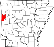
The Fort Smith Metropolitan Statistical Area, as defined by the United States Census Bureau, is a five-county area including three Arkansas counties and two Oklahoma counties, and anchored by the city of Fort Smith, Arkansas. The total MSA population in 2000 was 273,170 people, estimated by the Bureau to have grown to 289,693 people by 2007.

References

  1. 1 2 3 U.S. Geological Survey Geographic Names Information System: Barling, Arkansas
  2. "2020 U.S. Gazetteer Files". United States Census Bureau. Retrieved October 29, 2021.
  3. https://www.pressreader.com/usa/arkansas-democrat-gazette/20210822/282252373611091 Fort Smith a River Valley Growth Hub
  4. Summary for Barling, Arkansas
  5. "Census of Population and Housing". Census.gov. Retrieved June 4, 2015.
  6. "Annual Estimates of the Resident Population for Incorporated Places: April 1, 2010 to July 1, 2014". Archived from the original on May 22, 2015. Retrieved June 4, 2015.
  7. "Explore Census Data". data.census.gov. Retrieved January 1, 2022.
  8. "U.S. Census website". United States Census Bureau . Retrieved January 31, 2008.
  9. "2020 CENSUS - SCHOOL DISTRICT REFERENCE MAP: Sebastian County, AR" (PDF). U.S. Census Bureau . Retrieved September 19, 2022.