Related Research Articles

Athens County is a county in southeastern Ohio. As of the 2020 census, the population was 62,431. Its county seat and largest city is Athens. The county was formed in 1805 from Washington County. Because Ohio's first state university, Ohio University, was established here in 1804, the town and the county are named for the ancient center of learning, Athens, Greece.

The Hockhocking Adena Bikeway, known colloquially as The Bike Path or more formally as The Athens County Bike Path, is a 22-mile (35 km) long bicycle path in Athens County, Ohio, in the United States. The original section of the path was built on a levee along the Hocking River at Ohio University in Athens, on university land. It was gradually expanded and now crosses university land, city land, and county land. The greater part of the path is a rail trail,. The eastern terminus is at the western intersection of South Canaan Road and US-50. The western terminus is in Nelsonville, at the Rocky Brands Factory Outlet at the intersection of Canal Street and Myers Street, one block from the Historic Square Arts District.

Monroe Township is one of the fourteen townships of Perry County, Ohio, United States. The 2020 census found 1,356 people in the township.

Haydenville is an unincorporated community and census-designated place (CDP) in southern Green Township, Hocking County, Ohio, United States. As of the 2020 census the population of the CDP was 337.

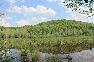
Shade is an unincorporated community in southern Lodi Township, Athens County, Ohio, United States. It has a post office with the ZIP code 45776. It lies along U.S. Route 33.
Zaleski State Forest is a state forest in the U.S. state of Ohio, located primarily in Vinton County, with areas in Athens County as well. The 28,000 acre (110 km²) forest surrounds Lake Hope State Park in Vinton County, and borders the Waterloo Wildlife Research Station in Athens County.

The Moonville Rail-Trail is a sixteen-mile rail-trail in southeast Ohio, located in Vinton and Athens Counties. It is largely embedded in the Zaleski State Forest and passes close to Lake Hope State Park. The trail is named after the Moonville Tunnel through which it passes.
Margaret Creek is a stream and state waterway in Athens and Meigs Counties, Ohio. Along with Monday, Sunday, and Federal Creeks, Margaret Creek is a principal tributary to the Hocking River. The confluence with the Hocking River is on the west side of the city of Athens, Ohio. The stream was named after Margaret Snowden, the first white woman settler in Athens County.
Pleasanton is an unincorporated community in Athens County, Ohio, United States.
Tiverton Center, or just Tiverton on some maps, is an unincorporated rural village in Coshocton County, in the U.S. state of Ohio. It is located along and about the intersection of Ohio State Highway 206 and Coshocton County Road 20. There is a church and a grange hall located there, and a number of houses, but no other businesses or services. Google Maps videographed Tiverton Center along the intersecting highways which make up its main street, but does not mark the village as distinct from its surrounding township on its maps!
Caywood is an unincorporated community in Washington County, in the U.S. state of Ohio.
Hartleyville is an unincorporated community in Athens County, in the U.S. state of Ohio. The community lies near the mouth of Johnson Run creek.
Bessemer is an unincorporated community in Athens County, in the U.S. state of Ohio.
Doanville is an unincorporated community in Athens County, in the U.S. state of Ohio.
Glen Ebon is an unincorporated community in Athens County, in the U.S. state of Ohio. The community is located at the Wayne National Forest.
Hamley Run is an unincorporated community in Athens County, in the U.S. state of Ohio.
Hebardville is an unincorporated community in Athens County, in the U.S. state of Ohio.
Luhrig is an unincorporated community in Athens County, in the U.S. state of Ohio.
Pratts Fork is an unincorporated community in Athens County, in the U.S. state of Ohio.
New Floodwood is an unincorporated community in Athens County, in the U.S. state of Ohio.
References
- ↑ U.S. Geological Survey Geographic Names Information System: Beaumont, Ohio
- ↑ "Athens County". Jim Forte Postal History. Retrieved December 31, 2015.
- ↑ Martzolff, Clement Luther (1916). A Brief History of Athens County, Ohio. The author. p. 7.
Municipalities and communities of Athens County, Ohio, United States | ||
|---|---|---|
| Cities |  | |
| Villages | ||
| Townships | ||
| CDPs | ||
| Unincorporated communities | ||
| Footnotes | ‡This populated place also has portions in an adjacent county or counties | |
39°23′08″N82°08′18″W / 39.38556°N 82.13833°W
| | This Athens County, Ohio state location article is a stub. You can help Wikipedia by expanding it. |