Related Research Articles
Chadwick is an unincorporated community in eastern Christian County, Missouri, United States. It is located approximately six miles southeast of Sparta along Missouri Route 125. The community of Oldfield is approximately three miles to the north along Route 125. It is part of the Springfield, Missouri Metropolitan Statistical Area. Its ZIP code is 65629.

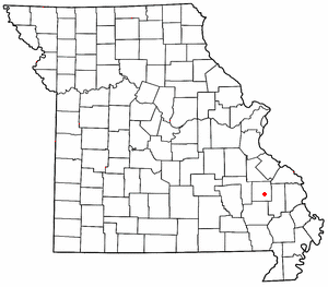
Garrison is an unincorporated community in southeast Christian County, Missouri, United States. It is located on Route 125, approximately 15 miles southeast of Sparta.
Chestnutridge is an unincorporated community in southwestern Christian County, Missouri, United States and is located approximately fourteen miles south of Ozark and about 3.5 miles southeast of Spokane. The community is located on Chestnut Ridge, at an elevation of 1325 feet. It is on Missouri Route BB just east of Missouri Route 176 and about two miles west of U.S. Route 65.
Zion is an unincorporated community in Central Township in southern Madison County, Missouri, United States. It is located on U.S. Route 67, approximately ten miles south of Fredericktown. The community is situated on the banks of Twelve Mile Creek.
Boaz is an unincorporated community in Christian County, Missouri, United States. Boaz is part of the Springfield, Missouri Metropolitan Statistical Area. The community is located approximately seven miles southwest of Nixa and is about five miles east of Clever.
Corsicana is an unincorporated community in western Barry County, in the U.S. state of Missouri. The community is located along a tributary to Shoal Creek, four miles west-southwest of Purdy.
Madry is an unincorporated community in northeast Barry County, in the U.S. state of Missouri. The community is located on Missouri Route 39, approximately 6.5 miles south of Aurora.

McDowell is an unincorporated community in Barry County, in the U.S. state of Missouri.
Travers is an unincorporated community in Barry County, in the U.S. state of Missouri. The community is on the west side of Flat Creek just north of the Twin Springs in Corder Hollow. Butterfield is approximately 3.5 miles to the west and Cassville is about five mile upstream (southwest) along Flat Creek.
Eaudevie is an extinct town in southern Christian County, in the U.S. state of Missouri. The community was located along the east bank of Bull Creek at 36°50′30″N93°10′59″W at an elevation of 900 feet. U.S. 65 passes two miles west of the location.
Elk Valley is a valley in Christian County in the Ozarks of southwest Missouri.
Lawing is an extinct town in Christian County, in the U.S. state of Missouri. The community was located on Logan Ridge along the south edge of the Springfield Plateau. Missouri Route W passes through the location and Christian Center is about one mile to the north. The city of Ozark is approximately seven miles to the north-northwest.
Selmore is an unincorporated community in Christian County, in the U.S. state of Missouri.
Charity is an unincorporated community in southern Dallas County, in the U.S. state of Missouri.
Foose is an unincorporated community in western Dallas County, in the U.S. state of Missouri. The community lies on Missouri Route EE, just west of U.S. Route 65, approximately seven miles south-southwest of Buffalo. The Dallas-Polk county line is two miles west along Route EE. The community is at an elevation of 1207 feet and Greasy Creek, a tributary of the Niangua River, drains the area to the east of Route 65.
Lindley Creek is a stream in Dallas, Hickory and Polk counties the U.S. state of Missouri. It is a tributary of the Pomme de Terre River.
Olive is an unincorporated community in southeastern Dallas County, in the U.S. state of Missouri.
Abesville is an unincorporated community in east central Stone County, in the U.S. state of Missouri. Abesville is located on Missouri Route 176, approximately two miles west of U.S. Route 160 and the Stone – Christian county line.
Tory Creek is a stream in Christian and Stone counties of southwest Missouri. It is a tributary of the James River.
Day is an unincorporated community in Taney County, in the Ozarks of southern Missouri. Day is located in the northwest part of the county, just south of the Taney-Christian county line on Missouri Route 176 and approximately one mile west of U.S. Route 65.
References
- 1 2 U.S. Geological Survey Geographic Names Information System: Bengal, Missouri
- ↑ Forsyth, MO, 1:125000 scale Topographic Map, USGS, 1907
- ↑ "Bengal Populated Place Profile / Christian County, Missouri Data". missouri.hometownlocator.com. Retrieved March 11, 2017.
- ↑ "Post Offices". Jim Forte Postal History. Archived from the original on March 6, 2016. Retrieved September 18, 2016.
- ↑ "Christian County Place Names, 1928–1945 (archived)". The State Historical Society of Missouri. Archived from the original on June 24, 2016. Retrieved September 18, 2016.
{{cite web}}: CS1 maint: bot: original URL status unknown (link)
Municipalities and communities of Christian County, Missouri, United States | ||
|---|---|---|
| Cities |  | |
| Village | ||
| Townships | ||
| CDP | ||
| Unincorporated communities | ||
| Ghost towns | ||
| Footnotes | ‡This populated place also has portions in an adjacent county or counties | |
36°54′02″N93°18′36″W / 36.90056°N 93.31000°W
| | This Christian County, Missouri state location article is a stub. You can help Wikipedia by expanding it. |