Bensley, Virginia

Last updated

Bensley, Virginia
CDP
Bensley community building.jpg
Bensley community building
VAMap-doton-Bensley.png
Location of Bensley, Virginia
Coordinates: 37°26′56″N77°26′44″W / 37.44889°N 77.44556°W / 37.44889; -77.44556
CountryUnited States
State Virginia
County Chesterfield
Area
  Total2.9 sq mi (7.5 km2)
  Land2.9 sq mi (7.4 km2)
  Water0.04 sq mi (0.1 km2)
Elevation
56 ft (17 m)
Population
 (2010)
  Total5,819
  Density2,000/sq mi (780/km2)
Time zone UTC−5 (Eastern (EST))
  Summer (DST) UTC−4 (EDT)
FIPS code 51-06728 [1]
GNIS feature ID1867584 [2]

Bensley is a census-designated place (CDP) in Chesterfield County, Virginia, United States. It is an inner suburb of Richmond, Virginia. The population was 5,819 at the 2010 census. [3] Bensley Community building is inside of Bensley park. The community building is outside of Bensley, setting in walking distance of the CDP. The community is an old village with no active government. The community is over 100 years old. A new police substation in the village is next to the old Bensley Bermuda Rescue Squad, near DuPont Spruance.

Contents

Geography

Bensley is located at 37°26′56″N77°26′44″W / 37.44889°N 77.44556°W / 37.44889; -77.44556 (37.448897, -77.445605). [4]

According to the United States Census Bureau, the CDP has a total area of 2.9 square miles (7.5 km2), of which 2.9 square miles (7.4 km2) is land and 0.02 square miles (0.06 km2), or 0.81%, is water.

Demographics

As of the census [1] of 2000, there were 5,435 people, 2,252 households, and 1,407 families residing in the CDP. The population density was 1,882.8 people per square mile (726.1/km2). There were 2,368 housing units at an average density of 820.3/sq mi (316.4/km2). The racial makeup of the CDP was 62.34% White, 24.32% African American, 0.64% Native American, 4.40% Asian, 0.11% Pacific Islander, 5.04% from other races, and 3.15% from two or more races. Hispanic or Latino of any race were 12.68% of the population.

There were 2,252 households, out of which 32.3% had children under the age of 18 living with them, 37.3% were married couples living together, 18.3% had a female householder with no husband present, and 37.5% were non-families. 30.1% of all households were made up of individuals, and 6.9% had someone living alone who was 65 years of age or older. The average household size was 2.41 and the average family size was 2.97.

In the CDP, the population was spread out, with 25.5% under the age of 18, 11.0% from 18 to 24, 32.5% from 25 to 44, 21.8% from 45 to 64, and 9.2% who were 65 years of age or older. The median age was 33 years. For every 100 females, there were 98.9 males. For every 100 females age 18 and over, there were 97.8 males.

The median income for a household in the CDP was $30,523, and the median income for a family was $35,344. Males had a median income of $28,333 versus $21,968 for females. The per capita income for the CDP was $14,896. About 13.6% of families and 14.6% of the population were below the poverty line, including 20.5% of those under age 18 and 5.7% of those age 65 or over.

Related Research Articles

<span class="mw-page-title-main">Edgemere, Maryland</span> Census-designated place in Maryland, United States

Edgemere is an unincorporated community and census-designated place in Baltimore County, Maryland, United States. The population was 8,669 at the 2010 census. Founded in 1899 as Edgemere being renamed from previous name "Fitzell". Meeting held at the Fitzell Farm which was situated where the old Rheem plant was located.

<span class="mw-page-title-main">Realitos, Texas</span> Census-designated place in Texas, United States

Realitos is an unincorporated community and census-designated place (CDP) in Duval County, Texas, United States. The population was 184 at the 2010 census.

<span class="mw-page-title-main">Bellwood, Virginia</span> CDP in Virginia, United States

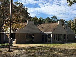
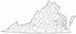
Bellwood is a census-designated place (CDP) in Chesterfield County, Virginia, United States. The population was 6,352 at the 2010 census. The community takes its name from Bellwood, one of the James River Plantations.

<span class="mw-page-title-main">Chesterfield, Virginia</span> Unincorporated community in Virginia, United States

Chesterfield is an unincorporated community that is the county seat of Chesterfield County, Virginia, United States. It was a census-designated place (CDP) at the 2020 census. It was not delineated as a CDP for the 2010 census. The Chesterfield County Courthouse and Courthouse Square are listed in the National Register of Historic Places. The area is also home of the Chesterfield County Government Complex.

<span class="mw-page-title-main">Ettrick, Virginia</span> CDP in Virginia, United States

Ettrick is a census-designated place (CDP) in Chesterfield County, Virginia, United States. Per the 2020 census, the population was 7,241. The town is home to Virginia State University and the Petersburg Amtrak train station.

<span class="mw-page-title-main">Matoaca, Virginia</span> CDP in Virginia, United States

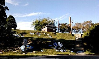
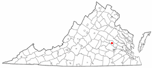
Matoaca is a census-designated place (CDP) in Chesterfield County, Virginia, United States. The population was 2,403 at the 2010 census. It is named after the Pamunkey princess Matoaka who was better known by her nickname "Pocahontas". It was near the site of an Appomattoc village Matoka or Matoks, which was reputedly her girlhood home, and the palace town of the weroansqua Oppussoquionuske.

<span class="mw-page-title-main">Lincolnia, Virginia</span> Census-designated place in Virginia, United States

Lincolnia is a census-designated place (CDP) in Fairfax County, Virginia, United States. The population was 22,828 at the 2010 census, an increase of over 44% from 2000.

<span class="mw-page-title-main">Merrifield, Virginia</span> Census-designated place in Virginia, United States

Merrifield is a census-designated place (CDP) in Fairfax County, Virginia, United States. The population was 15,212 at the 2010 census.

<span class="mw-page-title-main">Lake Monticello, Virginia</span> Census-designated place in Virginia, United States

Lake Monticello, a private gated community, is a census-designated place (CDP) in Fluvanna County, Virginia, United States. The population was 10,126 at the 2020 census. The community is centered on a lake of the same name, which is formed by a dam on a short tributary of the nearby Rivanna River. Lake Monticello is part of the Charlottesville Metropolitan Statistical Area. Lake Monticello was developed in the 1960s as a summer vacation home community but quickly evolved into a bedroom community of Charlottesville, and to a smaller extent of Richmond. It also has a sizable retirement age population.

<span class="mw-page-title-main">Chamberlayne, Virginia</span> Census-designated place in Virginia

Chamberlayne is a census-designated place (CDP) in Henrico County, Virginia, United States. The population was 5,581 at the 2020 census.

<span class="mw-page-title-main">Dumbarton, Virginia</span> Census-designated place in Virginia

Dumbarton is a census-designated place (CDP) in Henrico County, Virginia, United States. The population was 7,879 at the 2010 census.

<span class="mw-page-title-main">East Highland Park, Virginia</span> Census-designated place in Virginia

East Highland Park is a census-designated place (CDP) in Henrico County, Virginia, in the United States. The population was 15,131 at the 2020 census.

Highland Springs is a census-designated place (CDP) located in Henrico County, Virginia, United States, 4.3 miles (7 km) East of Richmond. The population was 16,604 at the 2020 census.

<span class="mw-page-title-main">Lakeside, Virginia</span> Census-designated area in Virginia

Lakeside is a census-designated place (CDP) in Henrico County, Virginia, United States. It is an inner suburb of Richmond, Virginia. The population was 11,849 at the 2010 census.

<span class="mw-page-title-main">Laurel, Virginia</span> Census-designated place in Virginia, United States

Laurel is a census-designated place (CDP) in western Henrico County, Virginia. The population was 16,713 at the 2010 United States Census. It is the county seat of Henrico County.

<span class="mw-page-title-main">Montrose, Virginia</span> Census-designated place in Virginia

Montrose is a census-designated place (CDP) in Henrico County, Virginia, United States. The population was 7,909 at the 2020 census.

Wyndham is a census-designated place (CDP) in Henrico County, Virginia, United States, in the West End area outside of Richmond. The population was 9,785 at the 2010 census. The CDP is named for Wyndham, a planned community there. It is an affluent suburb of Richmond, Virginia.

<span class="mw-page-title-main">Yorkshire, Virginia</span> CDP in Virginia, United States

Yorkshire is a census-designated place (CDP) in Prince William County, Virginia, United States. It is an annex of Manassas, Virginia. The population was 6,732 at the 2000 census.

<span class="mw-page-title-main">Maple Heights-Lake Desire, Washington</span> Census-designated place in Washington, United States

Maple Heights-Lake Desire is a census-designated place (CDP) in King County, Washington, United States. At the 2010 census, the population was 3,152.

Hollins is a census-designated place (CDP) in Botetourt and Roanoke counties in the U.S. state of Virginia. Hollins covers much of the area known locally as "North County". The population was 15,574 at the 2020 census. It is part of the Roanoke Metropolitan Statistical Area. The area is also the home of Hollins University in addition to four properties listed on the National Register of Historic Places: the Black Horse Tavern-Bellvue Hotel and Office, Harshbarger House, the Hollins College Quadrangle, and Old Tombstone.

References

  1. 1 2 "U.S. Census website". United States Census Bureau . Retrieved January 31, 2008.
  2. "US Board on Geographic Names". United States Geological Survey. October 25, 2007. Retrieved January 31, 2008.
  3. "Profile of General Population and Housing Characteristics: 2010 Demographic Profile Data (DP-1): Bensley CDP, Virginia". United States Census Bureau . Retrieved November 29, 2011.
  4. "US Gazetteer files: 2010, 2000, and 1990". United States Census Bureau. February 12, 2011. Retrieved April 23, 2011.