Chesterfield may refer to:

Chesterfield County is located just south of Richmond in the Commonwealth of Virginia. The county's borders are primarily defined by the James River to the north and the Appomattox River to the south. Its county seat is Chesterfield Court House.

Chesterfield County is a county located in the U.S. state of South Carolina. As of the 2010 census, its population was 46,734, and its estimated 2018 population had declined a little to 45,754. Its county seat is Chesterfield. The largest town in the county is Cheraw. Chesterfield County is part of the Charlotte Metropolitan Area. It is located north of the Midlands, on its border with North Carolina.

Bon Air is a census-designated place (CDP) in Chesterfield County, Virginia, United States. The population was 16,366 at the 2010 census. The community is considered a suburb of the independent city of Richmond in the Richmond-Petersburg region and is a part of the Southside neighborhoods. Originally developed as a resort, a central portion of Bon Air has been designated as a National Historic District with many structures of Victorian design from the late 19th and early 20th centuries. Its name means "good air," reflecting its role as a resort getaway that wealthy Richmonders enjoyed for its fresh air as opposed to the dirty air of Richmond's industrial downtown of the late 19th century.

Chester is a census-designated place (CDP) in Chesterfield County, Virginia, United States. The population was 20,987 at the 2010 census.
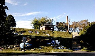
Chesterfield Court House is an unincorporated community that is the county seat of Chesterfield County, Virginia, United States. It was a census-designated place (CDP) at the 2000 census, at which time its population was 3,558. It was not delineated as a CDP for the 2010 census. The Chesterfield County Courthouse and Courthouse Square are listed in the National Register of Historic Places. The area is also home of the Chesterfield County Government Complex.
Ettrick is a census-designated place (CDP) in Chesterfield County, Virginia, United States. The population was 6,682 at the 2010 census. The town is home to Virginia State University and the Petersburg Amtrak train station.
A census-designated place (CDP) is a concentration of population defined by the United States Census Bureau for statistical purposes only. CDPs have been used in each decennial census since 1980 as the counterparts of incorporated places, such as self-governing cities, towns, and villages, for the purposes of gathering and correlating statistical data. CDPs are populated areas that generally include one officially designated but currently unincorporated community, for which the CDP is named, plus surrounding inhabited countryside of varying dimensions and, occasionally, other, smaller unincorporated communities as well. CDPs include small rural communities, edge cities, colonias located along the Mexico–United States border, and unincorporated resort and retirement communities and their environs.

Manchester is a former independent city in Virginia in the United States. Prior to receiving independent status, it served as the county seat of Chesterfield County, between 1870 and 1876. Today, it is a part of the city of Richmond, Virginia.
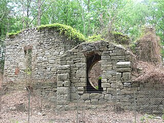
Midlothian is an unincorporated area in Chesterfield County, Virginia, U.S. Settled as a coal town, Midlothian village experienced suburbanization effects and is now part of the western suburbs of Richmond, Virginia south of the James River in the Greater Richmond Region. Because of its unincorporated status, Midlothian has no formal government, and the name is used to represent the original small Village of Midlothian and a vast expanse of Chesterfield County in the northwest portion of Southside Richmond served by the Midlothian post office.
The Southside of Richmond is an area of the Metropolitan Statistical Area surrounding Richmond, Virginia. It generally includes all portions of the City of Richmond which lie south of the James River, and includes all of the former city of Manchester. Depending on context, the term "Southside of Richmond" can include some northern areas of adjacent Chesterfield County, Virginia in the Richmond-Petersburg region. With minor exceptions near Bon Air, VA, the Chippenham Parkway forms the border between Chesterfield County and the City of Richmond portions of Southside, with some news agencies using the term "South Richmond" to refer to the locations in Southside located in the city proper.
Enon is a census-designated place (CDP) in Chesterfield County, Virginia, United States, just east of Chester. The population as of the 2010 Census was 3,466. It has the zip code 23836 and GPS coordinates 37.3504000, −77.3254000.
Brandermill is a major suburban residential and commercial development in the Southside of Richmond, Virginia. It is located near Midlothian, Virginia at the southern terminus of the Powhite Parkway and is centered on the Swift Creek Reservoir. The Census Bureau defines it as a Census-designated place (CDP), with a population of 13,173 as of the most updated estimate done in 2010.

Mathews is a census-designated place (CDP) in and the county seat of Mathews County, Virginia, United States. Established around 1700, the small town of Westville was designated as the county seat in 1791. Today, it is variously known as Mathews Court House, as well as simply "Mathews," its official postal name.
The Huntington–Ashland metropolitan area is a metropolitan area in the Appalachian Plateau region of the United States. Referred to locally as the “Tri-State area”, and colloquially as "Kyova", the region spans seven counties in the three states of West Virginia, Kentucky, and Ohio. With a population of 361,580, the Tri-State area is nestled along the banks of the Ohio River. The region offers a diverse range of outdoor activities.

Meadowbrook is a census-designated place in Chesterfield County, Virginia. The population as of the 2010 Census was 18,312.
Rockwood is a census-designated place in Chesterfield County, Virginia. The population as of the 2010 Census was 8,431.
University of Virginia is a census-designated place in Albemarle County, Virginia. The population as of the 2010 Census was 7,704. As the name infers, the CDP encompasses the University of Virginia grounds, along with several adjacent off-grounds housing areas, including University Heights, which was formerly its own CDP.
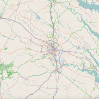
Woodlake is a census-designated place in Chesterfield County, Virginia. The population as of the 2010 Census was 7,319. The suburban community is located on the west shore of Swift Creek Reservoir.

