
Lanarkshire, also called the County of Lanark, is a historic county, lieutenancy area and registration county in the Central Lowlands of Scotland. The county is no longer used for local government purposes, but gives its name to the two modern council areas of North Lanarkshire and South Lanarkshire.

The A74 also known historically as the Glasgow to Carlisle Road, is a formerly major road in the United Kingdom, linking Glasgow in Scotland to Carlisle in the North West of England, passing through Clydesdale, Annandale and the Southern Uplands. A road in this area has existed since Roman Britain, and it was considered one of the most important roads in Scotland, being used as a regular mail service route.
Uddingston is a small town in South Lanarkshire, Scotland. It is on the north side of the River Clyde, south-east of Glasgow city centre, and acts as a dormitory suburb for the city.

Uddingston railway station serves the town of Uddingston, South Lanarkshire, Scotland. ScotRail provides passenger services to this station on the Argyle Line and Shotts Line.
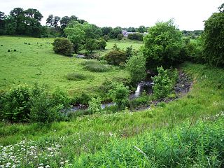
The North Calder Water is a river in North Lanarkshire, Scotland. It flows for 12 miles (19 km) from the Black Loch via the Hillend Reservoir, Caldercruix, Plains, Airdrie, Calderbank, Carnbroe and Viewpark to the River Clyde at Daldowie, south-east of Glasgow. For the last two miles of its course, it forms part of the boundary between North Lanarkshire and Glasgow. The name Calder is thought to be Brythonic and to mean 'hard cold flowing' water.

The A725 road in Scotland is a major route which is a trunk road dual carriageway for almost its whole length, connecting several of the large towns of North Lanarkshire and South Lanarkshire, linking the M8 and M74 motorways; it has been upgraded frequently since its construction, with the most recent major work completed in 2017. In combination with the A726 road which meets the M77 motorway, it forms a southern and eastern bypass for the city of Glasgow.

Smithstone is an area of Cumbernauld, North Lanarkshire. Versions of the name are recorded in the vicinity from the mid fourteenth century onwards. The area was originally a farm and the first Ordnance Survey map shows it as Smithstown. A coal mining and quarrying business had developed in the 19th century and Smithston Row and Smithston Quarry are shown on the map. North Lanarkshire Council sold off the land to developers for housing and it is now anticipated that up to 700 houses will be built in the area. In late 2005 a new road from Smithstone Road to Constarry Road outside Croy, was opened, providing a link to the separate housing estates of the area. Being west of Croy, the area is the closest point of Cumbernauld to Twechar and the Antonine Wall fort at Bar Hill.

Tannochside is a settlement approximately 8 miles (13 km) south-east of Glasgow, Scotland. Although historically considered part of Uddingston, it lies within a separate local authority area: Tannochside is contained within the boundaries of North Lanarkshire council, whereas the original village of Uddingston is in South Lanarkshire.

Craigmarloch is a private residential area of the town of Cumbernauld in North Lanarkshire, Scotland. It was the last such area that the Cumbernauld Development Corporation (CDC) laid out and began to construct. The area is designed to be like a village, with features such as: a village green, a main street, focal points, gateways, water features and recreational and community facilities. The responsibility for the development of the area passed from the CDC to North Lanarkshire Council in 1996.

Cardinal Newman High School is a Roman Catholic, co-educational, comprehensive secondary school located in Bellshill, North Lanarkshire, Scotland. The school was formed by the amalgamation of Elmwood Secondary, St. Saviour's High School and St. Catherine's. The school's catchment area includes Bellshill, Mossend, Viewpark, Birkenshaw and Tannochside. The feeder primary schools are St Gerard's, Sacred Heart, Holy Family and John Paul II.

L Motherwell was a local government district in the Strathclyde region of Scotland from 1975 to 1996, lying to the south-east of the regional capital Glasgow.
Farme Castle was located in Rutherglen, to the south-east of Glasgow, Scotland. It stood 0.5 miles (0.80 km) east of Farme Cross where the A724 meets the A749 trunk road. The castle keep acted as one corner of a courtyard, formed by an extension in the form of a castellated mansion. High walls and subsidiary buildings completed the courtyard. There was an ornate arched gateway to the courtyard adjacent to the keep. The old keep was of three storeys and a garret, above a corbelled-out parapet with machicolations and water spouts.

Uddingston Grammar School is a mainstream state school in Uddingston, South Lanarkshire, Scotland. It is one of 17 secondary schools operated by South Lanarkshire Council. Its motto is 'Virtute Crescam' which means 'May I grow in moral excellence'.

Viewpark is an area in North Lanarkshire, Scotland. Situated immediately north-east of Uddingston, Viewpark is two kilometres west of Bellshill. It has an estimated population of 13,916 in 2016, a figure which also includes the smaller adjoining neighbourhoods of Birkenshaw, Bellziehill, Calderbraes, Fallside and Tannochside under the Thorniewood ward of the local council.
Stand is a hamlet in North Lanarkshire, Scotland situated on the A73 near Airdrie. Its Ordnance Survey grid reference is NS7668.

Newton is a mainly residential district in the town of Cambuslang in Scotland; it is situated directly south of the River Clyde. Newton is within the Cambuslang East ward of the South Lanarkshire Council area. Formerly a mining settlement from the mid-19th to mid-20th centuries then sparsely populated for several decades, in the early 2000s it was designated a 'Community Growth Area' for residential development with several hundred houses, a new primary school and associated infrastructure constructed in phases over several years into the 2020s, mostly on fields previously used by a farm which had operated for several centuries before closing around the turn of the 21st century.

Blairlinn is the site of one of Cumbernauld's several industrial estates built as satellite developments on the periphery of the Scottish town's residential areas.

Thorniewood is one of the twenty-one wards used to elect members of the North Lanarkshire Council. It elects three councillors and covers the Viewpark, Tannochside and Birkenshaw areas. Its south-west boundary is the M74 motorway bordering the Bothwell and Uddingston ward of South Lanarkshire.

