New Stevenston

Last updated

New Stevenston
New Stevenston - geograph.org.uk - 3038399.jpg
New Stevenston Welcome sign.
North Lanarkshire UK location map.svg
Red pog.svg
New Stevenston
Location within North Lanarkshire
Area1.72 km2 (0.66 sq mi)  [1]
Population6,070 (mid-2020 est.) [2]
  Density 3,529/km2 (9,140/sq mi)
OS grid reference NS 7627 5976
Council area
Lieutenancy area
Country Scotland
Sovereign state United Kingdom
Post town Motherwell
Postcode district ML1 4
Dialling code 01698
Police Scotland
Fire Scottish
Ambulance Scottish
UK Parliament
Scottish Parliament
List of places
UK
Scotland
55°48′55″N3°58′34″W / 55.815247°N 3.976134°W / 55.815247; -3.976134

New Stevenston is a village situated between Motherwell and Bellshill in North Lanarkshire, Scotland. Most local amenities are shared with the adjacent villages of Carfin, Holytown and Newarthill which have a combined population of around 20,000 across the four localities.

Contents

History

The settlement first formed as part of the parish of Holytown when substantial coal workings were being exploited during the 19th century. The village prospered and so when the Church of Scotland suffered Disruption in 1843 the new Free Church was constructed in New Stevenston or Wrangholm to serve the mining community.

With the decline of coal mining and the rise of the steel and heavy engineering industries, the bulk of the population were employed until the serious industrial decline of the late 20th century, culminating in the closure of the Ravenscraig steelworks in 1992.

Employment has shifted towards more diverse occupations and housing development has continued. There has been significant redevelopment since the late-1960s when the bulk of the late 19th-century tenement flats were demolished.

Schools

The village is served by two primary schools: St. Patrick's Primary School & New Stevenston Primary School which share a joint campus incorporating New Stevenston Library. Formerly the two were on separate sites until the present campus was constructed.

Secondary education is provided at the Roman Catholic Taylor High School which is situated in the village and at the nearby non-denominational Brannock High School, Newarthill.

Originally the schools of the village were New Stevenston Public School, originally adjacent to the Free Kirk and then located further west in Clydesdale St. in 1896. It had both primary and junior secondary departments (New Stevenston Junior Secondary School) and became New Stevenston Primary School on the introduction of comprehensive education. St Patrick's RC school retained junior secondary status for longer but also became a primary school when sufficient provision of RC high schools for the area was finally made by Strathclyde Region. The two primary schools have a new joint campus on the site of the former St Patrick's buildings on Park St, opposite to the War Memorial, in 2006. The old 1896 Public School has now been demolished. The co-existence of non-denominational and Roman Catholic schools in this area, even to the extent of a joint campus is a legacy of the 1918 Education act, its origins and its continuing unfortunate aftermath.

Places of worship

Ethnic and cultural diversity has broadened and there is now a purpose-built mosque on the site of the former apprentices' training school of the old Stewarts & Lloyds tube works. The coal mining past is still significant; the area has suffered widespread undermining, which was a serious limit to new construction until relatively recently. The local church has cracked walls, garden depressions and tie bars as evidence for this.

Services and shops

New Stevenston is well supplied with shops and services for a village its size. These include: *tattoo studio (Fat Buddha Tattoo) opened 2014 by local respected artist Jason Lau, which has gained a very good reputation for such a small village competitive prices and provides full-day bookings;

In the past, there were also shops opposite St. John Bosco's church: The Dairy (Fyfe's?) and McIvor's shops where the monumental sculptor now operates. Also, there was Cochrane's shop at the corner of Jerviston St. and Woodside St. where there is now a hairdresser. There was also a John Menzies shop in the railway station.

The village also has a local amateur Sunday league football team who play in the Carluke and district league and won the 2015 divisional league trophy by beating local league rivals Forgewood by 4–5 after penalties.

Transportation

New Stevenston is served by Holytown railway station, which is in fact in the village bounds, offering services to all stations towards Glasgow Central and Edinburgh Waverley. This permits connections to all Great Britain railway stations from Wick to Penzance.

The village is also accessible by the A723 road, leading to places such as Motherwell and the M8 motorway accessing Glasgow and Edinburgh and linking to the motorway network for easy access to other parts of Scotland.

Related Research Articles

<span class="mw-page-title-main">North Lanarkshire</span> Council area of Scotland

North Lanarkshire is one of the 32 council areas of Scotland. It borders the north-east of the Glasgow City council area and contains many of Glasgow's suburbs, commuter towns, and villages. It also borders East Dunbartonshire, Falkirk, Stirling, South Lanarkshire, and West Lothian. The council area covers parts of the historic counties of Dunbartonshire, Lanarkshire, and Stirlingshire. The council is based in Motherwell.

<span class="mw-page-title-main">Lanarkshire</span> Historic county in Scotland

Lanarkshire, also called the County of Lanark, is a historic county, lieutenancy area and registration county in the Central Lowlands of Scotland. The county is no longer used for local government purposes, but gives its name to the two modern council areas of North Lanarkshire and South Lanarkshire.

<span class="mw-page-title-main">Motherwell</span> Town and administrative centre in Scotland

Motherwell is a town and former burgh in North Lanarkshire, Scotland, United Kingdom, south east of Glasgow. It has a population of around 32,120. Historically in the parish of Dalziel and part of Lanarkshire, Motherwell is the headquarters for North Lanarkshire Council. Geographically the River Clyde separates Motherwell from Hamilton to the west whereas the South Calder Water separates Motherwell from Carfin to the north-east and New Stevenston and Bellshill towards the north.

<span class="mw-page-title-main">Wishaw</span> Town North Lanarkshire, Scotland

Wishaw is a large town in North Lanarkshire, Scotland, on the edge of the Clyde Valley, 15 miles (24 km) south-east of Glasgow city centre. The Burgh of Wishaw was formed in 1855 within Lanarkshire. It formed a joint large burgh with its neighbour Motherwell from 1920 until its dissolution when Scottish local authorities were restructured in 1975, and was then in Motherwell district within the Strathclyde region until 1996. The town is part of the Motherwell and Wishaw constituency. It has the postal code of ML2 and the dialling code 01698.

<span class="mw-page-title-main">Carluke</span> Town in South Lanarkshire, Scotland

Carluke is a town that lies in the heart of the Lanarkshire countryside in South Lanarkshire, Scotland, 4+34 miles northwest of Lanark and 4+14 mi (7 km) southeast of Wishaw.

<span class="mw-page-title-main">Cleland, North Lanarkshire</span> Village in Scotland

Cleland is a village near Motherwell and Wishaw in North Lanarkshire, Scotland,. As of 2018, it has a population of about 3,000. The village has a strong coal mining heritage, and is a typical example of a working class village in North Lanarkshire and the Glasgow area. Due to its location, despite being at the heart of North Lanarkshire, the village is isolated, geographically and culturally, from surrounding towns such as Motherwell, Shotts and Wishaw.

<span class="mw-page-title-main">Newarthill</span> Human settlement in Scotland

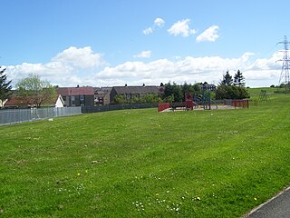
Newarthill is a village in North Lanarkshire, Scotland, situated roughly three miles north-east of the town of Motherwell. It has a population of around 6,200. Most local amenities are shared with the adjacent villages of Carfin, Holytown and New Stevenston which have a combined population of around 20,000 across the four localities.

<span class="mw-page-title-main">Carfin</span> Village in Lanarkshire, Scotland

Carfin is a village situated to the north-east of Motherwell, Scotland. Most local amenities are shared with the adjacent villages of Holytown, Newarthill and New Stevenston which have a combined population of around 20,000 across the four localities.

<span class="mw-page-title-main">Holytown railway station</span> Railway station in North Lanarkshire, Scotland

Holytown railway station is a railway station serving both Holytown and New Stevenston in North Lanarkshire, Scotland. It is located on the Shotts Line, 13 miles (21 km) south east of Glasgow Central towards Edinburgh Waverley and is also on the Argyle Line. It was opened in 1880 at the same time as the Wishaw Deviation Line from Law Junction, though the line on which it actually stands is considerably older.

Holytown is a village situated to the east of Bellshill and north of Motherwell in North Lanarkshire, Scotland. Most local amenities are shared with the adjacent villages of Carfin, Newarthill and New Stevenston which have a combined population of around 20,000 across the four localities.

<span class="mw-page-title-main">Pather</span> Human settlement in Scotland

Pather is a suburb of Wishaw, Scotland and was initially built as a council estate. It is situated around ½ miles (0.8 km) from the town centre.

<span class="mw-page-title-main">Mossend</span> Town in North Lanarkshire, Scotland

Mossend is a small town in North Lanarkshire, Scotland, located beside the town of Bellshill, west of the villages of Holytown and New Stevenston, north of the larger town of Motherwell and south of the Eurocentral industrial park and the M8 motorway. Along with Holytown, it forms a council ward which had a population of 13,480 in 2019, Mossend's estimated population being around half of that total.

Craigneuk is a suburb of Wishaw, North Lanarkshire, Scotland. The original village of Craigneuk was located in the area where Meadowhead Road meets the A721 at Craigneuk Street. It was originally part of Dalziel parish, along with the other rural weaving villages of Flemington, Motherwell and Windmillhill. Craigneuk village was located close to the boundary with Cambusnethan parish.

<span class="mw-page-title-main">Taylor High School, New Stevenston</span> Comprehensive secondary school in Motherwell, North Lanarkshire, Scotland

Taylor High School is a six-year Roman Catholic comprehensive secondary school in New Stevenston, Motherwell, Scotland. It is named after Monsignor Thomas Nimmo Taylor who was Parish Priest at St. Francis Xavier Church, Carfin for almost 50 years and who was responsible for the development of the Carfin Lourdes Grotto in 1922.

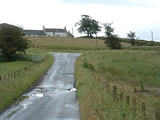
Salsburgh is a semi-rural former coal mining village in greenbelt farmland within the district of North Lanarkshire, Scotland. The closest major towns to the village are Shotts, three miles southeast, and Airdrie three miles northwest.

<span class="mw-page-title-main">Brannock High School</span> Secondary school in Newarthill, Motherwell, Scotland

Brannock High School is a non-denominational, co-educational comprehensive secondary school in Newarthill, North Lanarkshire, Scotland. It is situated on Loanhead Road.

<span class="mw-page-title-main">Chapelhall</span> Human settlement in Scotland

Chapelhall is a village outside the town of Airdrie in North Lanarkshire, Scotland. With house building, the distinction between Airdrie and Chapelhall is being eroded. Established as a small mining village in the 19th century, it now has population of around 6,560. Chapelhall is situated just off the M8 motorway 13 miles (21 km) east of Glasgow city centre and around 33 miles (53 km) west of Edinburgh. Chapelhall is also near to many of Lanarkshire's main towns, such as Bellshill, Coatbridge, Motherwell, Hamilton and Cumbernauld, as well as being around 3 miles (4.8 km) away from Airdrie town centre. The Eurocentral freight village/industrial estate is just a mile or so away and employs people from around Lanarkshire, Glasgow and West Lothian. The rail-freight village links with Grangemouth docks 28 miles (45 km) away,.

<span class="mw-page-title-main">Jerviston</span>

Jerviston is a country estate on the north-eastern edge of the Scottish town of Motherwell in North Lanarkshire which is now occupied by Colville Park Country Club.

References

  1. New Stevenston (2018 estimate), City Population
  2. "Mid-2020 Population Estimates for Settlements and Localities in Scotland". National Records of Scotland. 31 March 2022. Retrieved 31 March 2022.
  3. "Assembly Hall New Stevenston".