
Hillsborough County is located in the west-central portion of the U.S. state of Florida. In the 2020 census, the population was 1,459,762, making it the fourth-most populous county in Florida and the most populous county outside the Miami metropolitan area. A 2021 estimate has the population of Hillsborough County at 1,512,070 people with a yearly growth rate of 1.34%, which itself is greater than the populations of 12 states according to their 2019 population estimates. Its county seat and largest city is Tampa. Hillsborough County is part of the Tampa–St. Petersburg–Clearwater Metropolitan Statistical Area.

Pebble Creek is a census-designated place (CDP) in Hillsborough County, Florida, United States. The population was 9,624 at the 2020 census, up from 7,622 at the 2010 census. Pebble Creek is located in the unincorporated portion of New Tampa, and is primarily a residential zone.

Town 'n' Country is a census-designated place (CDP) in Hillsborough County, Florida, United States. The population was 85,951 at the 2020 census.
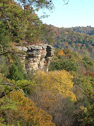
The Hocking Hills is a deeply dissected area of the Allegheny Plateau in Appalachian Ohio, primarily in Hocking County, that features cliffs, gorges, rock shelters, and waterfalls. The relatively extreme topography in this area is due to the Blackhand Sandstone, a particular formation that is thick, hard and weather-resistant, and so forms high cliffs and narrow, deep gorges.
The Potomac Highlands of West Virginia centers on five West Virginian counties in the upper Potomac River watershed in the western portion of the state's Eastern Panhandle, bordering Maryland and Virginia. Because of geographical proximity, similar topography and landscapes, and shared culture and history, the Potomac Highlands region also includes Pocahontas, Randolph, and Tucker counties, even though they are in the Monongahela River or New River watersheds and not that of the Potomac River.

Saratoga Gap Open Space Preserve is a 1540-acre regional park located near Saratoga Gap in the Santa Cruz Mountains of Santa Clara County, California. The preserve is owned and operated by the Midpeninsula Regional Open Space District. The preserve contains about 2 miles (3 km) of hiking trails, which are open to equestrians and bicycles.

The Little Manatee River flows 51 miles (82 km), from east of Fort Lonesome, Florida South of Hwy 674 and Earl Reynolds Rd In Hillsborough County through southern Hillsborough County, Florida including towns such as Sun City, Florida, and Gulf City, Florida and northern Manatee County, Florida into Tampa Bay. It has a drainage basin of 222 square miles (570 km2). It flows along the Little Manatee River State Park for part of its route. Portions of the river Such as Hayes Bayou and Mills Bayou have been designated as an Outstanding Florida Water and are part of the Cockroach Bay Aquatic Preserve.

The Withlacoochee River or Crooked River is a river in central Florida, in the United States. It originates in the Green Swamp, east of Polk City, flowing west, then north, then northwest and finally west again before emptying into the Gulf of Mexico near Yankeetown. The river is 141 miles (227 km) long and has a drainage basin of 1,170 square miles (3,000 km2).
Lettuce Lake Park is a 240-acre (97 ha) Hillsborough County-run park just outside the city limits of Tampa, Florida. It is located on Fletcher Avenue between Interstate 75 and the University of South Florida. The Hillsborough River runs through it. The park opened in 1982.
The Upper Tampa Bay Trail is a 7.25-mile long (11.67 km) paved multi-use, non-motorized, rail trail located in northwest Hillsborough County, Florida.

The Wekiva River is a 16.0-mile-long (25.7 km) river in Central Florida, north of Orlando in the United States. It originates in Apopka and joins the St. Johns River, the longest river in the state, in DeBary. The Wekiva River system includes the main stem joined by three main tributaries - Rock Springs Run, Blackwater Creek, and the Little Wekiva River - and about 30 contributing groundwater springs. It is designated as a Florida State Canoe Trail, an Outstanding Florida Water, and an Aquatic Preserve by the Florida Department of Environmental Protection. The Wekiva River system is also one of the two rivers in Florida federally designated as a National Wild and Scenic River for its scenery, recreation, geology, and diverse habitats.
The Econlockhatchee River is an 54.5-mile-long (87.7 km) north-flowing blackwater tributary of the St. Johns River. The Econ River flows through Osceola, Orange, and Seminole counties in Central Florida, just east of the Orlando Metropolitan Area. It is a designated Outstanding Florida Waters.

Blackwater Canyon is a rugged, heavily wooded, eight-mile (13 km) long gorge carved by the Blackwater River in the Allegheny Mountains of eastern West Virginia, USA. For many years, it has been the object of controversy as environmental activists have contended with industrial interests over its ultimate status.
Sweetwater Creek is an unincorporated community in Hillsborough County, Florida, United States. It is part of the census-designated place (CDP) of Town 'n' Country. The ZIP code for the community is 33634.
Rocky Creek is an unincorporated community in Hillsborough County, Florida, United States. Although a separate community, it is a part of the census-designated place (CDP) of Town 'n' Country. The ZIP code for the community is 33615.
Blackwater Creek Nature Preserve is a 1,993-acre (807 ha) area of conservation land in northeast Hillsborough County, Florida near Plant City. Hikers can enjoy 6 miles of sunny, grassy hiking trails winding through the open pine flatwoods to an overlook on Blackwater Creek.
Blackwater Creek is an approximately 19 mile riverine feature in Florida. The creek flows from Lake Norris and has a confluence with the Wekiva River near where it in turn flows into the St. Johns River. The upper sections of Black Creek are traversed by kayak and canoe. Other sections a difficult to navigate due to snags.
Cypress Creek Preserve is a 255-acre (103 ha) area of protected land in Wesley Chapel, Pasco County, Florida. It is between Interstate 75 and State Road 56 to the north at 23999 County Line Road. Visits are by scheduled appointment. The lands include cypress and hardwood forests. They were acquired in 2010 and protect parts of Cypress Creek, a tributary of the Hillsborough River.
Fish Hawk Creek Nature Preserve is a 3,286-acre (1,330 ha) nature preserve in Hillsborough County, Florida. The preserve is managed by Hillsborough County's Conservation and Environmental Lands Management Department and is located along the riparian corridor of Fish Hawk Creek, a significant tributary of the Alafia River. As a result, the acquisition and protection of the Fish Hawk Creek Nature Preserve has provided an essential link in assuring the long-term protection of a significant regional habitat corridor. Restoration projects have been initiated on the property. Habitats include pine flatwoods, sandhill, Florida scrub, and creek corridors. The preserve is bisected by Fish Hawk Blvd. and is identified by a north and a south section. The north section of the preserve includes a 2.2 mi (3.5 km) hiking trail and can be accessed through Lithia Springs Regional Park in Lithia, Florida. The south portion of the preserve can be accessed through a parking area near the intersection of Boyette Rd. and Balm Rd. and includes a 2 mi (3.2 km) hiking trail.
Wolf Branch Nature Preserve is a 1,400-acre (570 ha) nature preserve in Hillsborough County, Florida. The preserve is managed by Hillsborough County's Conservation and Environmental Lands Management Department. It offers fishing and 2 miles (3.2 km) of hiking trails in areas of natural mangrove shoreline, upland cabbage palm hammocks, offshore sea grass beds in Tampa Bay, and tidally-influenced Wolf Branch Creek.
