Blairstown, Iowa

Last updated

Blairstown, Iowa
City
Nickname: 
B-Town
Benton County Iowa Incorporated and Unincorporated areas Blairstown Highlighted.svg
Location of Blairstown, Iowa
Coordinates: 41°54′25″N92°5′0″W / 41.90694°N 92.08333°W / 41.90694; -92.08333
Country Flag of the United States.svg  United States
State Flag of Iowa.svg  Iowa
County Benton
Area
[1]
  Total0.50 sq mi (1.28 km2)
  Land0.50 sq mi (1.28 km2)
  Water0.00 sq mi (0.00 km2)
Elevation
840 ft (256 m)
Population
 (2020)
  Total713
  Density1,437.50/sq mi (555.29/km2)
Time zone UTC-6 (Central (CST))
  Summer (DST) UTC-5 (CDT)
ZIP code
52209
Area code 319
FIPS code 19-06805
GNIS feature ID0454677

Blairstown is a city in Benton County, Iowa, United States. The population was 713 at the 2020 census. [2] It is part of the Cedar Rapids Metropolitan Statistical Area.

Contents

History

Blairstown was platted in 1862. [3] It was named for John Insley Blair, a railroad official. [4]

Geography

According to the United States Census Bureau, the city has a total area of 0.52 square miles (1.35 km2), all land. [5]

Demographics

Historical populations
YearPop.±%
1870 682    
1880 652−4.4%
1890 583−10.6%
1900 592+1.5%
1910 532−10.1%
1920 540+1.5%
1930 488−9.6%
1940 525+7.6%
1950 523−0.4%
1960 583+11.5%
1970 612+5.0%
1980 695+13.6%
1990 672−3.3%
2000 682+1.5%
2010 692+1.5%
2020 713+3.0%
Source: "U.S. Census website". United States Census Bureau . Retrieved March 29, 2020. and Iowa Data Center
Source:
U.S. Decennial Census [6] [2]

2010 census

As of the census [7] of 2010, there were 692 people, 295 households, and 199 families living in the city. The population density was 1,330.8 inhabitants per square mile (513.8/km2). There were 314 housing units at an average density of 603.8 per square mile (233.1/km2). The racial makeup of the city was 97.8% White, 0.7% African American, 0.1% Native American, 0.1% Asian, 1.0% from other races, and 0.1% from two or more races. Hispanic or Latino of any race were 4.3% of the population.

There were 295 households, of which 33.2% had children under the age of 18 living with them, 53.2% were married couples living together, 7.1% had a female householder with no husband present, 7.1% had a male householder with no wife present, and 32.5% were non-families. 28.1% of all households were made up of individuals, and 14.3% had someone living alone who was 65 years of age or older. The average household size was 2.35 and the average family size was 2.79.

The median age in the city was 39 years. 25.7% of residents were under the age of 18; 7.1% were between the ages of 18 and 24; 25.6% were from 25 to 44; 24.7% were from 45 to 64; and 17.1% were 65 years of age or older. The gender makeup of the city was 50.1% male and 49.9% female.

2000 census

As of the census [8] of 2000, there were 682 people, 289 households, and 195 families living in the city. The population density was 1,434.7 inhabitants per square mile (553.9/km2). There were 309 housing units at an average density of 650.0 per square mile (251.0/km2). The racial makeup of the city was 99.41% White, 0.15% from other races, and 0.44% from two or more races. Hispanic or Latino of any race were 0.29% of the population.

There were 289 households, out of which 30.1% had children under the age of 18 living with them, 57.4% were married couples living together, 8.3% had a female householder with no husband present, and 32.2% were non-families. 28.7% of all households were made up of individuals, and 16.3% had someone living alone who was 65 years of age or older. The average household size was 2.36 and the average family size was 2.87.

24.8% are under the age of 18, 6.5% from 18 to 24, 27.1% from 25 to 44, 19.2% from 45 to 64, and 22.4% who were 65 years of age or older. The median age was 39 years. For every 100 females, there were 86.3 males. For every 100 females age 18 and over, there were 86.5 males.

The median income for a household in the city was $40,662, and the median income for a family was $47,778. Males had a median income of $36,705 versus $22,083 for females. The per capita income for the city was $16,828. About 5.9% of families and 11.0% of the population were below the poverty line, including 17.5% of those under age 18 and 11.6% of those age 65 or over.

Arts and culture

Blairstown holds an annual "Sauerkraut Days" celebration. [9]

Rolle Bolle

People playing and watching Rolle Bolle in Blairstown, June 2019. Rolle bolle Blairstown.jpg
People playing and watching Rolle Bolle in Blairstown, June 2019.

Many Blairstown residents still play the Belgian yard game Rolle Bolle (called krulbollen in Belgium), first brought to the region by Belgian immigrants in the late 19th and early 20th centuries. [10] Blairstown's courts are located in the Blairstown Ball Park. A game of Rolle Bolle is part of the annual Sauerkraut Days celebration. Rolle Bolle is also played in the nearby towns of Belle Plaine, Clutier, Victor, Marengo, and Ladora.

Education

Benton Community School District operates local public schools. [11]

See also

Related Research Articles

<span class="mw-page-title-main">Ringgold County, Iowa</span> County in Iowa, United States

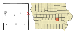
Ringgold County is a county located in the U.S. state of Iowa. As of the 2020 census, the population was 4,663, making it the Iowa county with the second-smallest population. The county seat is Mount Ayr. The county is named after Maj. Samuel Ringgold, a hero of the Battle of Palo Alto fought in May 1846, during the Mexican–American War. It is one of the 26 Iowa counties with a name that is unique across the nation.

<span class="mw-page-title-main">Benton County, Iowa</span> County in Iowa, United States

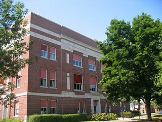
Benton County is a county in the U.S. state of Iowa. As of the 2020 census, the population was 25,575. Its county seat and largest city is Vinton. The county is named for Thomas Hart Benton, a U.S. Senator from Missouri.

<span class="mw-page-title-main">Atkins, Iowa</span> City in Iowa, United States

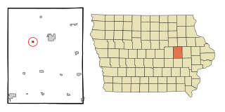
Atkins is a city in Benton County, Iowa, United States. The population was 2,056 at the 2020 census. It is part of the Cedar Rapids Metropolitan Statistical Area.

<span class="mw-page-title-main">Garrison, Iowa</span> City in Iowa, United States

Garrison is a city in Benton County, Iowa, United States. The population was 344 at the time of the 2020 census. It is part of the Cedar Rapids Metropolitan Statistical Area.

<span class="mw-page-title-main">Keystone, Iowa</span> City in Iowa, United States

Keystone is a city in Benton County, Iowa, United States. The population was 599 at the time of the 2020 census. It is part of the Cedar Rapids Metropolitan Statistical Area.

<span class="mw-page-title-main">Luzerne, Iowa</span> City in Iowa, United States

Luzerne is a city in Benton County, Iowa, United States. The population was 112 at the time of the 2020 census. It is part of the Cedar Rapids Metropolitan Statistical Area.

<span class="mw-page-title-main">Mount Auburn, Iowa</span> City in Iowa, United States

Mount Auburn is a city in Benton County, Iowa, United States. The population was 162 at the time of the 2020 census. It is part of the Cedar Rapids Metropolitan Statistical Area.

<span class="mw-page-title-main">Newhall, Iowa</span> City in Iowa, United States

Newhall is a city in Benton County, Iowa, United States. The population was 876 at the time of the 2020 census. It is part of the Cedar Rapids Metropolitan Statistical Area.

<span class="mw-page-title-main">Shellsburg, Iowa</span> City in Iowa, United States

Shellsburg is a city in Benton County, Iowa, United States. The population was 961 at the time of the 2020 census. It is part of the Cedar Rapids Metropolitan Statistical Area.

<span class="mw-page-title-main">Van Horne, Iowa</span> City in Iowa, United States

Van Horne is a city in Benton County, Iowa, United States. The population was 774 at the 2020 census. It is part of the Cedar Rapids Metropolitan Statistical Area.

<span class="mw-page-title-main">Kanawha, Iowa</span> City in Iowa, United States

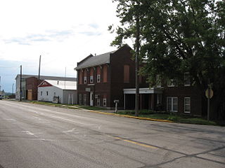
Kanawha is a city in Hancock County, Iowa, United States. The population was 658 at the time of the 2020 census.

<span class="mw-page-title-main">Ladora, Iowa</span> City in Iowa, United States

Ladora is a city in Iowa County, Iowa, United States. The population was 229 at the time of the 2020 census.

<span class="mw-page-title-main">Marengo, Iowa</span> Town in Iowa, United States

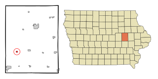
Marengo is a town in and the county seat of Iowa County, Iowa, United States. It has served as the county seat since August 1845, even though it was not incorporated until July 1859. The population was 2,435 in the 2020 census, a decline from 2,535 in 2000.

<span class="mw-page-title-main">Millersburg, Iowa</span> City in Iowa, United States

Millersburg is a city in Iowa County, Iowa, United States. The population was 135 at the time of the 2020 census.

<span class="mw-page-title-main">Benton, Iowa</span> City in Iowa, United States

Benton is a city in Ringgold County, Iowa, United States. The population was 39 at the 2020 census.

<i>Dysart, Iowa</i> City in Iowa, United States

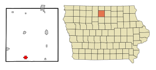
Dysart is a city in Tama County, Iowa, United States. The population was 1,281 at the 2020 census. The Mayor of Dysart is currently Tim Glenn.

<span class="mw-page-title-main">Elberon, Iowa</span> City in Iowa, United States

Elberon is a city in Tama County, Iowa, United States. The population was 184 at the time of the 2020 census.

<span class="mw-page-title-main">Benton, Missouri</span> City in Missouri, United States

Benton is a city in Scott County, Missouri, United States. The population was 863 at the 2010 census. It is the county seat of Scott County.

<span class="mw-page-title-main">Lake Benton, Minnesota</span> City in Minnesota, United States

Lake Benton is a city in Lincoln County, Minnesota, United States. The population was 683 at the 2010 census.

<span class="mw-page-title-main">Victor, Iowa</span> City in Iowa, United States

Victor is a town in Poweshiek and Iowa counties in the U.S. state of Iowa. The population was 875 in the 2020 census, a decline from the population of 952 in 2000.

References

Commons-logo.svg Media related to Blairstown, Iowa at Wikimedia Commons

  1. "2020 U.S. Gazetteer Files". United States Census Bureau. Retrieved March 16, 2022.
  2. 1 2 "2020 Census State Redistricting Data". census.gov. United states Census Bureau. Retrieved August 12, 2021.
  3. The History of Benton County, Iowa, Containing a History of the County, Its Cities, Towns, &c. Western Historical. 1878. p.  328.
  4. Henry Gannett (1905). The origin of certain place names in the United States. Govt. Print. Off. pp.  48.
  5. "US Gazetteer files 2010". United States Census Bureau. Archived from the original on January 25, 2012. Retrieved May 11, 2012.
  6. "Census of Population and Housing". Census.gov. Retrieved June 4, 2015.
  7. "U.S. Census website". United States Census Bureau . Retrieved May 11, 2012.
  8. "U.S. Census website". United States Census Bureau . Retrieved January 31, 2008.
  9. "Blairstown". County of Benton, IA. Archived from the original on February 9, 2006. Retrieved August 7, 2014.
  10. Amato, Joseph Anthony. (1990). Servants of the land : God, family, and farm : the trinity of Belgian economic folkways in southwestern Minnesota. Longmont, Colo.: Crossings Press. ISBN   0961411929. OCLC   24039158.
  11. "Benton" (PDF). Iowa Department of Education. Archived from the original (PDF) on March 27, 2020. Retrieved March 27, 2020.