County
| FIPS code [10] | County seat [4] | #
| Est. [4] [11] | Formed from [12] | Etymology [11] | Map #
| Population [13] | Area [4] | Map |
|---|
| AdairCounty | 001 | Greenfield | 01 | Jan 15, 1851 | Cass County | John Adair, Kentucky Governor | 69 | 7,389 | 569 sq mi
(1,474 km2) |  |
|---|
| AdamsCounty | 003 | Corning | 02 | Jan 15, 1851 | Taylor County | John Adams, US President | 81 | 3,544 | 424 sq mi
(1,098 km2) | 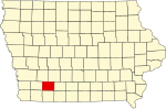 |
|---|
| AllamakeeCounty | 005 | Waukon | 03 | Feb 20, 1847 | Clayton County | Disputed, possibly Allan Makee, early trader and guide for settlers, or Meskwaki anamiki and/or Ojibwe animikii both meaning thunder or thunderer [14] : 33 | 11 | 14,074 | 640 sq mi
(1,658 km2) | 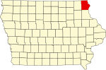 |
|---|
| AppanooseCounty | 007 | Centerville | 04 | Feb 17, 1843 | Davis County | Chief Appanoose, headed peace party in the Black Hawk War | 96 | 12,119 | 496 sq mi
(1,285 km2) | 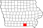 |
|---|
| AudubonCounty | 009 | Audubon | 05 | Jan 15, 1851 | Black Hawk County and Cass County | John James Audubon, ornithologist and artist | 57 | 5,534 | 443 sq mi
(1,147 km2) | 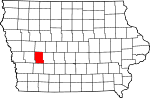 |
|---|
| BentonCounty | 011 | Vinton | 06 | Dec 21, 1837 | Native American lands and Wisconsin Territory | Thomas Hart Benton, Missouri Senator | 51 | 25,796 | 716 sq mi
(1,854 km2) | 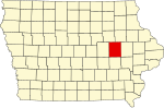 |
|---|
| Black HawkCounty | 013 | Waterloo | 07 | Feb 17, 1843 | Delaware County | Black Hawk, leader during Black Hawk War | 39 | 130,471 | 567 sq mi
(1,469 km2) |  |
|---|
| BooneCounty | 015 | Boone | 08 | Jan 13, 1846 | Polk County | Nathan Boone, one of the first to survey Iowa | 47 | 26,590 | 572 sq mi
(1,481 km2) | 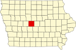 |
|---|
| BremerCounty | 017 | Waverly | 09 | Jan 15, 1851 | Native American lands and Winnebago County | Fredrika Bremer, Swedish poet and author | 30 | 25,307 | 428 sq mi
(1,109 km2) |  |
|---|
| BuchananCounty | 019 | Independence | 10 | Dec 21, 1837 | Delaware County and Wisconsin Territory | James Buchanan, US President | 40 | 20,691 | 571 sq mi
(1,479 km2) | 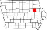 |
|---|
| Buena VistaCounty | 021 | Storm Lake | 11 | Jan 15, 1851 | Clay County and Sac County | Battle of Buena Vista, Mexican–American War | 24 | 20,567 | 575 sq mi
(1,489 km2) |  |
|---|
| ButlerCounty | 023 | Allison | 12 | Jan 15, 1851 | Black Hawk County and Buchanan County | William Orlando Butler, War of 1812 hero | 29 | 14,172 | 580 sq mi
(1,502 km2) | 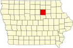 |
|---|
| CalhounCounty | 025 | Rockwell City | 13 | Jan 15, 1851 | Fox County (renamed) | John C. Calhoun, US Vice President | 34 | 9,763 | 570 sq mi
(1,476 km2) |  |
|---|
| CarrollCounty | 027 | Carroll | 14 | Jan 15, 1851 | Guthrie County | Charles Carroll, signatory of the Declaration of Independence | 45 | 20,522 | 569 sq mi
(1,474 km2) | 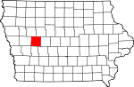 |
|---|
| CassCounty | 029 | Atlantic | 15 | Jan 15, 1851 | Pottawattamie County | Lewis Cass, Michigan Senator | 68 | 13,130 | 564 sq mi
(1,461 km2) |  |
|---|
| CedarCounty | 031 | Tipton | 16 | Dec 21, 1837 | Wisconsin Territory | Cedar River that runs through county | 65 | 18,302 | 580 sq mi
(1,502 km2) |  |
|---|
| Cerro GordoCounty | 033 | Mason City | 17 | Jan 15, 1851 | Floyd County | Battle of Cerro Gordo, Mexican–American War | 17 | 42,406 | 568 sq mi
(1,471 km2) |  |
|---|
| CherokeeCounty | 035 | Cherokee | 18 | Jan 15, 1851 | Crawford County | Cherokee People | 23 | 11,605 | 577 sq mi
(1,494 km2) | 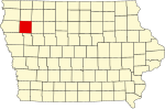 |
|---|
| ChickasawCounty | 037 | New Hampton | 19 | Jan 15, 1851 | Fayette County | Chickasaw People | 19 | 11,658 | 505 sq mi
(1,308 km2) | 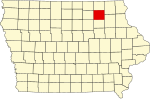 |
|---|
| ClarkeCounty | 039 | Osceola | 20 | Jan 13, 1846 | Lucas County | James Clarke, Governor of Iowa Territory | 83 | 9,588 | 431 sq mi
(1,116 km2) | 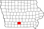 |
|---|
| ClayCounty | 041 | Spencer | 21 | Jan 15, 1851 | Native American lands | Henry Clay, Jr., officer in the Mexican–American War | 14 | 16,511 | 569 sq mi
(1,474 km2) |  |
|---|
| ClaytonCounty | 043 | Elkader | 22 | Dec 21, 1837 | Dubuque County and Wisconsin Territory | John M. Clayton, Delaware Senator | 21 | 16,969 | 779 sq mi
(2,018 km2) |  |
|---|
| ClintonCounty | 045 | Clinton | 23 | Dec 21, 1837 | Dubuque County and Wisconsin Territory | DeWitt Clinton, New York Governor | 66 | 46,158 | 695 sq mi
(1,800 km2) |  |
|---|
| CrawfordCounty | 047 | Denison | 24 | Jan 15, 1851 | Shelby County | William Harris Crawford, Georgia Senator | 44 | 16,013 | 714 sq mi
(1,849 km2) |  |
|---|
| DallasCounty | 049 | Adel | 25 | Jan 13, 1846 | Polk County | George Mifflin Dallas, US Vice President | 59 | 111,092 | 586 sq mi
(1,518 km2) | 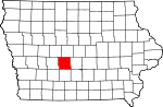 |
|---|
| DavisCounty | 051 | Bloomfield | 26 | Feb 17, 1843 | Van Buren County | Garrett Davis, Kentucky Congressman | 97 | 9,169 | 503 sq mi
(1,303 km2) | 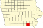 |
|---|
| DecaturCounty | 053 | Leon | 27 | Jan 13, 1846 | Appanoose County | Stephen Decatur, War of 1812 naval officer | 94 | 7,665 | 532 sq mi
(1,378 km2) |  |
|---|
| DelawareCounty | 055 | Manchester | 28 | Dec 21, 1837 | Dubuque County and Wisconsin Territory | State of Delaware, home of Iowa statehood advocate US Senator John M. Clayton | 41 | 17,600 | 578 sq mi
(1,497 km2) | 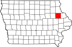 |
|---|
| Des MoinesCounty | 057 | Burlington | 29 | Sep 6, 1834 | Michigan Territory and Wisconsin Territory | Des Moines River that once ran through the county | 89 | 38,253 | 416 sq mi
(1,077 km2) |  |
|---|
| DickinsonCounty | 059 | Spirit Lake | 30 | Jan 15, 1851 | Kossuth County | Daniel Stevens Dickinson, New York Senator | 3 | 18,056 | 381 sq mi
(987 km2) |  |
|---|
| DubuqueCounty | 061 | Dubuque | 31 | Sep 6, 1834 | Michigan Territory and Wisconsin Territory | Julien Dubuque, first permanent white settler in Iowa | 42 | 98,887 | 608 sq mi
(1,575 km2) | 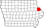 |
|---|
| EmmetCounty | 063 | Estherville | 32 | Jan 15, 1851 | Dickinson County and Kossuth County | Robert Emmet, Irish revolutionary and American republican sympathizer | 4 | 9,229 | 396 sq mi
(1,026 km2) |  |
|---|
| FayetteCounty | 065 | West Union | 33 | Dec 21, 1837 | Clayton County and Wisconsin Territory | Marquis de Lafayette, Frenchman who aided colonial forces during American Revolutionary War | 20 | 19,210 | 731 sq mi
(1,893 km2) | 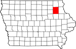 |
|---|
| FloydCounty | 067 | Charles City | 34 | Jan 15, 1851 | Chickasaw County | Charles Floyd, member of Lewis and Clark Expedition who died in Iowa | 18 | 15,326 | 501 sq mi
(1,298 km2) | 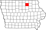 |
|---|
| FranklinCounty | 069 | Hampton | 35 | Jan 15, 1851 | Chickasaw County | Benjamin Franklin, statesman and US founding father | 28 | 9,875 | 582 sq mi
(1,507 km2) |  |
|---|
| FremontCounty | 071 | Sidney | 36 | Feb 24, 1847 | Pottawattamie County | John Charles Fremont, Mexican–American War officer | 90 | 6,458 | 511 sq mi
(1,323 km2) | 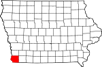 |
|---|
| GreeneCounty | 073 | Jefferson | 37 | Jan 15, 1851 | Dallas County | Nathanael Greene, American Revolutionary War general | 46 | 8,584 | 568 sq mi
(1,471 km2) | 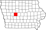 |
|---|
| GrundyCounty | 075 | Grundy Center | 38 | Jan 15, 1851 | Black Hawk County | Felix Grundy, Tennessee Congressman | 38 | 12,384 | 503 sq mi
(1,303 km2) | 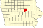 |
|---|
| GuthrieCounty | 077 | Guthrie Center | 39 | Jul 8, 1851 | Jackson County | Edwin B. Guthrie, Mexican–American War officer | 58 | 10,722 | 591 sq mi
(1,531 km2) |  |
|---|
| HamiltonCounty | 079 | Webster City | 40 | Dec 22, 1856 | Webster County | William W. Hamilton, President of Iowa Senate (1856–1857) | 36 | 14,729 | 577 sq mi
(1,494 km2) |  |
|---|
| HancockCounty | 081 | Garner | 41 | Jan 15, 1851 | Wright County | John Hancock, President of First Continental Congress | 16 | 10,615 | 571 sq mi
(1,479 km2) | 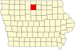 |
|---|
| HardinCounty | 083 | Eldora | 42 | Jan 15, 1851 | Black Hawk County | John J. Hardin, prominent soldier, Black Hawk War | 37 | 16,463 | 569 sq mi
(1,474 km2) |  |
|---|
| HarrisonCounty | 085 | Logan | 43 | Jan 15, 1851 | Pottawattamie County | William Henry Harrison, US President | 55 | 14,670 | 697 sq mi
(1,805 km2) |  |
|---|
| HenryCounty | 087 | Mount Pleasant | 44 | Dec 7, 1836 | Wisconsin Territory | Disputed, see reference [15] | 88 | 19,547 | 434 sq mi
(1,124 km2) | 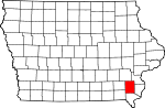 |
|---|
| HowardCounty | 089 | Cresco | 45 | Jan 15, 1851 | Chickasaw County | Tilghman Howard, US Representative from Indiana | 9 | 9,376 | 473 sq mi
(1,225 km2) |  |
|---|
| HumboldtCounty | 091 | Dakota City | 46 | Feb 26, 1857 | Webster County | Alexander von Humboldt, German scientist | 26 | 9,500 | 434 sq mi
(1,124 km2) |  |
|---|
| IdaCounty | 093 | Ida Grove | 47 | Jan 15, 1851 | Cherokee County | Either Mount Ida in Greece or Ida Smith, child of early settlers [16] | 32 | 6,833 | 432 sq mi
(1,119 km2) | 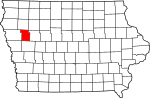 |
|---|
| IowaCounty | 095 | Marengo | 48 | Feb 17, 1843 | Washington County | Iowa River that flows through the county | 63 | 16,381 | 586 sq mi
(1,518 km2) | 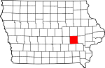 |
|---|
| JacksonCounty | 097 | Maquoketa | 49 | Dec 21, 1837 | Wisconsin Territory | Andrew Jackson, US President | 54 | 19,342 | 636 sq mi
(1,647 km2) | 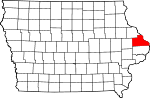 |
|---|
| JasperCounty | 099 | Newton | 50 | Jan 13, 1846 | Mahaska County | William Jasper, American Revolutionary War sergeant | 61 | 37,919 | 730 sq mi
(1,891 km2) | 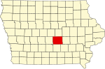 |
|---|
| JeffersonCounty | 101 | Fairfield | 51 | Jan 21, 1839 | Native American lands | Thomas Jefferson, US President | 87 | 15,440 | 435 sq mi
(1,127 km2) | 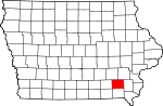 |
|---|
| JohnsonCounty | 103 | Iowa City | 52 | Dec 21, 1837 | Des Moines County, Iowa and Wisconsin Territory | Richard Mentor Johnson, US Vice President; officially renamed after Lulu Johnson (1907-1995) [17] | 64 | 157,528 | 614 sq mi
(1,590 km2) |  |
|---|
| JonesCounty | 105 | Anamosa | 53 | Dec 21, 1837 | Wisconsin Territory | George Wallace Jones, Iowa Senator | 53 | 20,900 | 575 sq mi
(1,489 km2) |  |
|---|
| KeokukCounty | 107 | Sigourney | 54 | Dec 21, 1837 | Washington County | Chief Keokuk | 74 | 9,914 | 579 sq mi
(1,500 km2) |  |
|---|
| KossuthCounty | 109 | Algona | 55 | Jan 15, 1851 | Webster County | Lajos Kossuth, Hungarian revolutionary inspired by American democratic ideals | 5 | 14,396 | 973 sq mi
(2,520 km2) |  |
|---|
| LeeCounty | 111 | Fort Madison and Keokuk | 56 | Dec 7, 1836 | Des Moines County | William Elliott Lee, businessman from the New York Land Company, who sold the county's first tracts of land | 99 | 32,565 | 517 sq mi
(1,339 km2) |  |
|---|
| LinnCounty | 113 | Cedar Rapids | 57 | Dec 21, 1837 | Wisconsin Territory | Lewis Fields Linn, doctor and Missouri Senator | 52 | 228,972 | 718 sq mi
(1,860 km2) |  |
|---|
| LouisaCounty | 115 | Wapello | 58 | Dec 7, 1836 | Des Moines County | Disputed, see reference [18] | 76 | 10,513 | 402 sq mi
(1,041 km2) | 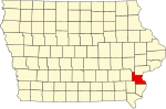 |
|---|
| LucasCounty | 117 | Chariton | 59 | Jan 13, 1846 | Monroe County | Robert Lucas, first Governor of Iowa Territory | 84 | 8,747 | 431 sq mi
(1,116 km2) | 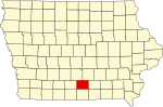 |
|---|
| LyonCounty | 119 | Rock Rapids | 60 | Jan 15, 1851 | Woodbury County, Iowa | Nathaniel Lyon, first Union general to be killed in the American Civil War, (formerly named Buncombe County) | 1 | 12,324 | 588 sq mi
(1,523 km2) |  |
|---|
| MadisonCounty | 121 | Winterset | 61 | Jan 13, 1846 | Polk County | James Madison, US President | 70 | 16,971 | 561 sq mi
(1,453 km2) |  |
|---|
| MahaskaCounty | 123 | Oskaloosa | 62 | Feb 17, 1843 | Fox and Sac Indian lands | Chief Mahaska | 73 | 21,874 | 571 sq mi
(1,479 km2) |  |
|---|
| MarionCounty | 125 | Knoxville | 63 | Jun 10, 1845 | Washington County | Francis Marion, American Revolutionary War general | 72 | 33,770 | 554 sq mi
(1,435 km2) |  |
|---|
| MarshallCounty | 127 | Marshalltown | 64 | Jan 13, 1846 | Jasper County | John Marshall, Chief Justice of the United States Supreme Court | 49 | 40,014 | 572 sq mi
(1,481 km2) |  |
|---|
| MillsCounty | 129 | Glenwood | 65 | Jan 15, 1851 | Pottawattamie County | Frederick Mills, major killed during the Battle of Churubusco, Mexican–American War | 79 | 14,633 | 437 sq mi
(1,132 km2) |  |
|---|
| MitchellCounty | 131 | Osage | 66 | Jan 15, 1851 | Chickasaw County | John Mitchel, Irish revolutionary who operated out of the US | 8 | 10,518 | 469 sq mi
(1,215 km2) |  |
|---|
| MononaCounty | 133 | Onawa | 67 | Jan 15, 1851 | Harrison County | Probably from the name of a fictional Native American character in a play [14] : 295 | 43 | 8,493 | 693 sq mi
(1,795 km2) |  |
|---|
| MonroeCounty | 135 | Albia | 68 | Feb 17, 1843 | Wapello County | James Monroe, US President | 85 | 7,504 | 433 sq mi
(1,121 km2) |  |
|---|
| MontgomeryCounty | 137 | Red Oak | 69 | Jan 15, 1851 | Polk County | Richard Montgomery, American Revolutionary War general | 80 | 10,139 | 424 sq mi
(1,098 km2) |  |
|---|
| MuscatineCounty | 139 | Muscatine | 70 | Dec 7, 1836 | Des Moines County | debated, possibly Mascouten People | 77 | 42,218 | 439 sq mi
(1,137 km2) |  |
|---|
| O'BrienCounty | 141 | Primghar | 71 | Jan 15, 1851 | Cherokee County | William Smith O'Brien, Irish revolutionary inspired by American democratic ideals | 13 | 14,012 | 573 sq mi
(1,484 km2) |  |
|---|
| OsceolaCounty | 143 | Sibley | 72 | Jan 15, 1851 | Woodbury County | Osceola, Seminole leader | 2 | 5,978 | 399 sq mi
(1,033 km2) |  |
|---|
| PageCounty | 145 | Clarinda | 73 | Feb 24, 1847 | Pottawattamie County | John Page, officer killed in Battle of Palo Alto, Mexican–American War | 91 | 15,014 | 535 sq mi
(1,386 km2) |  |
|---|
| Palo AltoCounty | 147 | Emmetsburg | 74 | Jan 15, 1851 | Kossuth County | Battle of Palo Alto, Mexican–American War | 15 | 8,810 | 564 sq mi
(1,461 km2) |  |
|---|
| PlymouthCounty | 149 | Le Mars | 75 | Jan 15, 1851 | Woodbury County | Plymouth, Massachusetts | 22 | 25,722 | 864 sq mi
(2,238 km2) |  |
|---|
| PocahontasCounty | 151 | Pocahontas | 76 | Jan 15, 1851 | Greene County and Humboldt County | Pocahontas, famous Native American woman | 25 | 6,976 | 578 sq mi
(1,497 km2) | 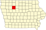 |
|---|
| PolkCounty | 153 | Des Moines | 77 | Jan 13, 1846 | Native American lands | James K. Polk, US President | 60 | 505,255 | 570 sq mi
(1,476 km2) |  |
|---|
| PottawattamieCounty | 155 | Council Bluffs | 78 | Feb 24, 1847 | Native American lands | Potawatomi People | 67 | 93,179 | 954 sq mi
(2,471 km2) | 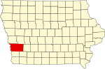 |
|---|
| PoweshiekCounty | 157 | Montezuma | 79 | Feb 17, 1843 | Meskwaki lands | Chief Poweshiek, Meskwaki | 62 | 18,453 | 585 sq mi
(1,515 km2) |  |
|---|
| RinggoldCounty | 159 | Mount Ayr | 80 | Feb 24, 1847 | Taylor County | Samuel Ringgold, major killed in the Mexican–American War | 93 | 4,642 | 538 sq mi
(1,393 km2) | 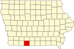 |
|---|
| SacCounty | 161 | Sac City | 81 | Jan 15, 1851 | Greene County | Sauk (Sac) People | 33 | 9,686 | 576 sq mi
(1,492 km2) |  |
|---|
| ScottCounty | 163 | Davenport | 82 | Dec 21, 1837 | Wisconsin Territory | Winfield Scott, War of 1812 General | 78 | 174,270 | 458 sq mi
(1,186 km2) | 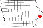 |
|---|
| ShelbyCounty | 165 | Harlan | 83 | Jan 15, 1851 | Cass County | Isaac Shelby, American Revolutionary War General, War of 1812 | 56 | 11,806 | 591 sq mi
(1,531 km2) | 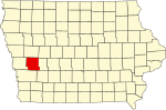 |
|---|
| SiouxCounty | 167 | Orange City | 84 | Jan 15, 1851 | Plymouth County | Sioux People | 12 | 36,246 | 768 sq mi
(1,989 km2) | 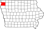 |
|---|
| StoryCounty | 169 | Nevada | 85 | Jan 13, 1846 | Boone County, Jasper County, and Polk County | Joseph Story, US Supreme Court Justice | 48 | 98,566 | 573 sq mi
(1,484 km2) |  |
|---|
| TamaCounty | 171 | Toledo | 86 | Feb 17, 1843 | Benton County and Boone County | Disputed, see reference [19] | 50 | 16,833 | 721 sq mi
(1,867 km2) |  |
|---|
| TaylorCounty | 173 | Bedford | 87 | Feb 24, 1847 | Page County | Zachary Taylor, US President | 92 | 5,924 | 534 sq mi
(1,383 km2) |  |
|---|
| UnionCounty | 175 | Creston | 88 | Jan 15, 1851 | Clarke County | The union of the states | 82 | 11,906 | 424 sq mi
(1,098 km2) | 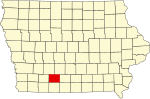 |
|---|
| Van BurenCounty | 177 | Keosauqua | 89 | Dec 7, 1836 | Des Moines County | Martin Van Buren, US President | 98 | 7,266 | 485 sq mi
(1,256 km2) |  |
|---|
| WapelloCounty | 179 | Ottumwa | 90 | Feb 17, 1843 | Native American lands | Chief Wapello | 86 | 35,166 | 432 sq mi
(1,119 km2) |  |
|---|
| WarrenCounty | 181 | Indianola | 91 | Jan 13, 1846 | Polk County | Joseph Warren, American Revolutionary War General | 71 | 55,205 | 572 sq mi
(1,481 km2) |  |
|---|
| WashingtonCounty | 183 | Washington | 92 | Jan 25, 1839 | Wisconsin Territory | George Washington, US President | 75 | 22,560 | 569 sq mi
(1,474 km2) |  |
|---|
| WayneCounty | 185 | Corydon | 93 | Jan 13, 1846 | Appanoose County | Anthony Wayne, American Revolutionary War General | 95 | 6,557 | 526 sq mi
(1,362 km2) |  |
|---|
| WebsterCounty | 187 | Fort Dodge | 94 | Jan 12, 1853 | Risley County and Yell County (defunct IA counties) [20] | Daniel Webster, Massachusetts Senator | 35 | 36,485 | 715 sq mi
(1,852 km2) |  |
|---|
| WinnebagoCounty | 189 | Forest City | 95 | Jan 15, 1851 | Kossuth County | Winnebago (Ho–Chunk) People | 6 | 10,571 | 400 sq mi
(1,036 km2) |  |
|---|
| WinneshiekCounty | 191 | Decorah | 96 | Feb 20, 1847 | Native American lands | Chief Winneshiek | 10 | 19,815 | 690 sq mi
(1,787 km2) | 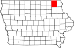 |
|---|
| WoodburyCounty | 193 | Sioux City | 97 | Jan 12, 1853 | Wahkaw County (renamed), Polk County | Levi Woodbury, New Hampshire Governor | 31 | 105,951 | 873 sq mi
(2,261 km2) |  |
|---|
| WorthCounty | 195 | Northwood | 98 | Jan 15, 1851 | Mitchell County | William Jenkins Worth, Black Hawk War and Mexican–American War officer | 7 | 7,297 | 400 sq mi
(1,036 km2) | 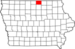 |
|---|
| WrightCounty | 197 | Clarion | 99 | Jan 15, 1851 | Webster County and Kossuth County | Silas Wright, New York Governor, and Joseph Albert Wright, Indiana Governor (brothers) | 27 | 12,656 | 581 sq mi
(1,505 km2) |  |
|---|