Davis County, Iowa

Last updated

Davis County
Bloomfield Iowa.JPG
Map of Iowa highlighting Davis County.svg
Location within the U.S. state of Iowa
Iowa in United States.svg
Iowa's location within the U.S.
Coordinates: 40°44′40″N92°24′48″W / 40.744444444444°N 92.413333333333°W / 40.744444444444; -92.413333333333
CountryFlag of the United States.svg United States
StateFlag of Iowa.svg  Iowa
Founded1843
Named for Garrett Davis
Seat Bloomfield
Largest cityBloomfield
Area
  Total505 sq mi (1,310 km2)
  Land502 sq mi (1,300 km2)
  Water2.7 sq mi (7 km2)  0.5%
Population
 (2020)
  Total9,110
  Estimate 
(2021) [1]
9,138
  Density18/sq mi (7.0/km2)
Time zone UTC−6 (Central)
  Summer (DST) UTC−5 (CDT)
Congressional district 2nd
Website www.daviscountyiowa.org

Davis County is a county located in the U.S. state of Iowa. As of the 2020 census, the population was 9,110. [2] The county seat is Bloomfield. [3]

Contents

Davis County is included in the Ottumwa, IA Micropolitan Statistical Area.

History

Davis County was named in honor of Garrett Davis, a Congressman from Kentucky from March 4, 1839, until March 3, 1847, and later a US Senator from Kentucky. [4] [5]

Geography

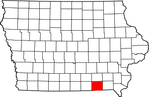
According to the U.S. Census Bureau, the county has a total area of 505 square miles (1,310 km2), of which 502 square miles (1,300 km2) is land and 2.7 square miles (7.0 km2) (0.5%) is water. [6]

Major highways

Adjacent counties

Demographics

Historical population
CensusPop.Note
1850 7,264
1860 13,76489.5%
1870 15,56513.1%
1880 16,4685.8%
1890 15,258−7.3%
1900 15,6202.4%
1910 13,315−14.8%
1920 12,574−5.6%
1930 11,150−11.3%
1940 11,136−0.1%
1950 9,959−10.6%
1960 9,199−7.6%
1970 8,207−10.8%
1980 9,10410.9%
1990 8,312−8.7%
2000 8,5412.8%
2010 8,7532.5%
2020 9,1104.1%
2023 (est.)9,169 [7] 0.6%
U.S. Decennial Census [8]
1790-1960 [9] 1900-1990 [10]
1990-2000 [11] 2010-2018 [12]
Population of Davis County from US census data DavisCountyIowaPop2020.png
Population of Davis County from US census data

2020 census

2022 US Census population pyramid for Davis County from ACS 5-year estimates DavisCountyIA2022PopPyr.png
2022 US Census population pyramid for Davis County from ACS 5-year estimates

The 2020 census recorded a population of 9,110 in the county, with a population density of

2010 census

The 2010 census recorded a population of 8,753 in the county, with a population density of

2000 census

As of the census [14] of 2000, there were 8,541 people, 3,207 households, and 2,286 families residing in the county. The population density was 17 people per square mile (6.6 people/km2). There were 3,530 housing units at an average density of 7 units per square mile (2.7 units/km2). The racial makeup of the county was 98.35% White, 0.18% Black or African American, 0.21% Native American, 0.20% Asian, 0.05% Pacific Islander, 0.21% from other races, and 0.81% from two or more races. 0.71% of the population were Hispanic or Latino of any race. 10.4% of the population speak either German or Pennsylvania German at home. [15]

There were 3,207 households, out of which 32.00% had children under the age of 18 living with them, 62.70% were married couples living together, 5.20% had a female householder with no husband present, and 28.70% were non-families. 25.00% of all households were made up of individuals, and 13.80% had someone living alone who was 65 years of age or older. The average household size was 2.61 and the average family size was 3.13.

In the county, the population was spread out, with 27.10% under the age of 18, 7.40% from 18 to 24, 25.20% from 25 to 44, 22.90% from 45 to 64, and 17.40% who were 65 years of age or older. The median age was 38 years. For every 100 females there were 97.90 males. For every 100 females age 18 and over, there were 94.10 males.

The median income for a household in the county was $32,864, and the median income for a family was $40,982. Males had a median income of $26,818 versus $21,726 for females. The per capita income for the county was $15,127. About 9.00% of families and 11.90% of the population were below the poverty line, including 12.70% of those under age 18 and 12.80% of those age 65 or over.

Religion

Religion in Davis County,according to ARDA (2020) [16] [ failed verification ]

  Anabaptist Churches (Amish and Mennonite) (23.3%)
  Mainline Protestant Churches (11.5%)
  Evangelical Churches (5.1%)
  Catholic Churches (1.2%)
  None* (59%)

* "Nones" is an unclear category. [17] [18] It is a heterogenous group of the not religious and intermittently religious. [19] Researchers argue that most of the "Nones" should be considered "unchurched", rather than objectively nonreligious; [18] [20] [21] [22] especially since most "Nones" do hold some religious-spiritual beliefs and a notable amount participate in behaviors. [18] [20] [23] [24] For example, 72% of American "Nones" believe in God or a Higher Power. [25]

Communities

Cities

Unincorporated communities

Townships

Davis County is divided into these townships:

Population ranking

The population ranking of the following table is based on the 2020 census of Davis County. [2]

county seat

RankCity/Town/etc.Municipal typePopulation (2020 Census)
1 Bloomfield City2,682
2 Pulaski City264
3 Drakesville City164
4 Floris City116

Notable people

Politics

United States presidential election results for Davis County, Iowa [27]
Year Republican Democratic Third party
No.%No.%No.%
2020 3,03273.92%1,01324.70%571.39%
2016 2,72370.14%97725.17%1824.69%
2012 2,13856.67%1,52040.29%1153.05%
2008 2,02953.14%1,68044.00%1092.85%
2004 2,14854.82%1,73144.18%391.00%
2000 1,95652.05%1,69145.00%1112.95%
1996 1,44538.44%1,89450.39%42011.17%
1992 1,34433.26%1,96248.55%73518.19%
1988 1,56340.61%2,24658.35%401.04%
1984 1,95646.77%2,18752.30%390.93%
1980 2,00350.97%1,68942.98%2386.06%
1976 1,63139.50%2,42658.76%721.74%
1972 2,28754.61%1,80643.12%952.27%
1968 2,01647.12%1,90444.51%3588.37%
1964 1,42432.35%2,96667.38%120.27%
1960 2,64153.36%2,30346.53%50.10%
1956 2,66151.88%2,45847.92%100.19%
1952 3,19558.14%2,28341.55%170.31%
1948 2,27642.90%2,98256.21%470.89%
1944 2,55948.12%2,72751.28%320.60%
1940 2,97546.65%3,37452.91%280.44%
1936 2,81544.59%3,46354.86%350.55%
1932 1,75733.82%3,35164.50%871.67%
1928 3,09754.52%2,55945.04%250.44%
1924 2,80448.76%1,80231.33%1,14519.91%
1920 3,11756.31%2,35342.51%651.17%
1916 1,47644.14%1,81154.16%571.70%
1912 1,18438.63%1,45347.41%42813.96%
1908 1,48444.98%1,74953.02%662.00%
1904 1,72250.92%1,53345.33%1273.76%
1900 1,65642.76%2,15555.64%621.60%
1896 1,65240.87%2,36758.56%230.57%

See also

References

  1. "QuickFacts: Davis County, Iowa". Census.gov. Retrieved May 20, 2022.
  2. 1 2 3 "2020 Census State Redistricting Data". census.gov. United states Census Bureau. Retrieved August 12, 2021.
  3. "Find a County". National Association of Counties. Archived from the original on May 31, 2011. Retrieved June 7, 2011.
  4. "Profile for Davis County, Iowa, IA". ePodunk. Archived from the original on February 2, 2013. Retrieved October 4, 2012.
  5. Gannett, Henry (1905). The Origin of Certain Place Names in the United States. Govt. Print. Off. pp.  101.
  6. "US Gazetteer files: 2010, 2000, and 1990". United States Census Bureau. February 12, 2011. Retrieved April 23, 2011.
  7. "Annual Estimates of the Resident Population for Counties: April 1, 2020 to July 1, 2023". United States Census Bureau. Retrieved April 2, 2024.
  8. "U.S. Decennial Census". United States Census Bureau. Retrieved July 16, 2014.
  9. "Historical Census Browser". University of Virginia Library. Archived from the original on August 11, 2012. Retrieved July 16, 2014.
  10. "Population of Counties by Decennial Census: 1900 to 1990". United States Census Bureau. Retrieved July 16, 2014.
  11. "Census 2000 PHC-T-4. Ranking Tables for Counties: 1990 and 2000" (PDF). United States Census Bureau. Archived (PDF) from the original on March 27, 2010. Retrieved July 16, 2014.
  12. "State & County QuickFacts". United States Census Bureau. Archived from the original on June 7, 2011. Retrieved July 16, 2014.
  13. "Population & Housing Occupancy Status 2010" (PDF). United States Census Bureau American FactFinder. Archived (PDF) from the original on October 16, 2020. Retrieved May 7, 2011.
  14. "U.S. Census website". United States Census Bureau . Retrieved January 31, 2008.
  15. "Find US, State, Region, or Division language statistics". MLA Language Map Data Center. Retrieved May 7, 2011.
  16. "Davis County, Ohio - County Membership Report (2020)". The Association of Religion Data Archives.
  17. Wuthnow, Robert (2015). Inventing American Religion : Polls, Surveys, and the Tenuous Quest for a Nation's Faith. Oxford University Press. pp. 151–155. ISBN   9780190258900.
  18. 1 2 3 Johnson, Byron; Stark, Rodney; Bradshaw, Matt; Levin, Jeff (2022). "Are Religious "Nones" Really Not Religious?: Revisiting Glenn, Three Decades Later". Interdisciplinary Journal of Research on Religion. 18 (7).
  19. Blankholm, Joseph (2022). The Secular Paradox : On the Religiosity of the Not Religious. New York: New York University Press. p. 7. ISBN   9781479809509.
  20. 1 2 Johnson, Todd; Zurlo, Gina (2016). "Unaffiliated, Yet Religious: A Methodological and Demographic Analysis". In Cipriani, Roberto; Garelli, Franco (eds.). Annual Review of the Sociology of Religion: Volume 7: Sociology of Atheism. Leiden: Brill. pp. 58–60. ISBN   9789004317536.
  21. Hout, Michael; Fischer, Claude S. (October 13, 2014). "Explaining Why More Americans Have No Religious Preference: Political Backlash and Generational Succession, 1987-2012". Sociological Science. 1: 423–447. doi: 10.15195/v1.a24 .
  22. Hout, Michael (November 2017). "American Religion, All or Nothing at All". Contexts. 16 (4): 78–80. doi: 10.1177/1536504217742401 . S2CID   67327797.
  23. Drescher, Elizabeth (2016). Choosing our Religion: The Spiritual Lives of America's Nones. New York. pp. 21–26. ISBN   9780199341221.{{cite book}}: CS1 maint: location missing publisher (link)
  24. Cox, Kiana (March 17, 2021). "Nine-in-ten Black 'nones' believe in God, but fewer pray or attend services". Pew Research Center.
  25. "Key findings about Americans' belief in God". Pew Research Center. April 25, 2018.
  26. "PICKLER, John Alfred, (1844 - 1910)". Biographical Directory of the United States Congress. Retrieved October 4, 2012.
  27. Leip, David. "Dave Leip's Atlas of U.S. Presidential Elections". uselectionatlas.org. Retrieved April 25, 2018.


40°44′40″N92°24′48″W / 40.74444°N 92.41333°W / 40.74444; -92.41333