Shelby County, Iowa

Last updated

Shelby County
Shelby County IA Courthouse.jpg
Map of Iowa highlighting Shelby County.svg
Location within the U.S. state of Iowa
Iowa in United States.svg
Iowa's location within the U.S.
Coordinates: 41°40′53″N95°18′46″W / 41.681388888889°N 95.312777777778°W / 41.681388888889; -95.312777777778
CountryFlag of the United States.svg United States
StateFlag of Iowa.svg  Iowa
Founded1851
Named for Isaac Shelby
Seat Harlan
Largest cityHarlan
Area
  Total598 sq mi (1,550 km2)
  Land598 sq mi (1,550 km2)
  Water0.6 sq mi (2 km2)  0.1%
Population
 (2020)
  Total11,746
  Density20/sq mi (7.6/km2)
Time zone UTC−6 (Central)
  Summer (DST) UTC−5 (CDT)
Congressional district 4th
Website shelbycounty.iowa.gov

Shelby County is a county located in the U.S. state of Iowa. As of the 2020 census, the population was 11,746. [1] The county seat is Harlan. [2] Its name is in honor of Isaac Shelby, the first Governor of Kentucky.

Contents

History

Shelby County was established on January 15, 1851. It was named after General Isaac Shelby, a hero in the American Revolutionary War and the first Governor of Kentucky.

Early settling in Shelby County began in 1848 in Galland's Grove. [3] On February 4, 1855, Shelbyville was designated the county seat. In April 1859, the seat was moved to Harlan. One year later the first courthouse was erected and a second courthouse was constructed in 1875. In 1892, the construction of the present courthouse was begun, this time of stone and three storeys high. The construction was completed in 1893 with the dedication on September 14. The 1892 Shelby County Courthouse and the surrounding buildings are all listed in the National Register of Historic places effective September 23, 1994. [4] In 1978, the building was extensively restored and still serves as the courthouse.

Geography

According to the U.S. Census Bureau, the county has a total area of 591 square miles (1,530 km2), of which 591 square miles (1,530 km2) is land and 0.6 square miles (1.6 km2) (0.1%) is water. [5]

Major highways

Attractions

Adjacent counties

Demographics

Historical population
CensusPop.Note
1860 818
1870 2,540210.5%
1880 12,696399.8%
1890 17,61138.7%
1900 17,9321.8%
1910 16,552−7.7%
1920 16,065−2.9%
1930 17,1316.6%
1940 16,720−2.4%
1950 15,942−4.7%
1960 15,825−0.7%
1970 15,528−1.9%
1980 15,043−3.1%
1990 13,230−12.1%
2000 13,173−0.4%
2010 12,167−7.6%
2020 11,746−3.5%
2023 (est.)11,806 [6] 0.5%
U.S. Decennial Census [7]
1790-1960 [8] 1900-1990 [9]
1990-2000 [10] 2010-2018 [11]
Population of Shelby County from US census data ShelbyCountyIowaPop2020.png
Population of Shelby County from US census data

2020 census

2022 US Census population pyramid for Shelby County from ACS 5-year estimates ShelbyCountyIA2022PopPyr.png
2022 US Census population pyramid for Shelby County from ACS 5-year estimates

The 2020 census recorded a population of 11,746 in the county, with a population density of

2010 census

The 2010 census recorded a population of 12,167 in the county, with a population density of

2000 census

As of the census [13] of 2000, there were 13,173 people, 5,173 households, and 3,703 families residing in the county. The population density was 22 people per square mile (8.5 people/km2). There were 5,459 housing units at an average density of 9 per square mile (3.5/km2). The racial makeup of the county was 98.68% White, 0.10% Black or African American, 0.29% Native American, 0.27% Asian, 0.18% from other races, and 0.48% from two or more races. 0.67% of the population were Hispanic or Latino of any race.

There were 5,173 households, out of which 32.60% had children under the age of 18 living with them, 62.30% were married couples living together, 6.80% had a female householder with no husband present, and 28.40% were non-families. 25.20% of all households were made up of individuals, and 13.60% had someone living alone who was 65 years of age or older. The average household size was 2.49 and the average family size was 2.99.

In the county, the population was spread out, with 26.40% under the age of 18, 5.70% from 18 to 24, 25.20% from 25 to 44, 22.40% from 45 to 64, and 20.40% who were 65 years of age or older. The median age was 40 years. For every 100 females there were 95.90 males. For every 100 females age 18 and over, there were 93.30 males.

The median income for a household in the county was $37,442, and the median income for a family was $44,681. Males had a median income of $29,402 versus $20,296 for females. The per capita income for the county was $16,969. About 4.30% of families and 6.00% of the population were below the poverty line, including 6.00% of those under age 18 and 7.60% of those age 65 or over.

Communities

Cities

Census-designated places

Other unincorporated places

Townships

Population ranking

The population ranking of the following table is based on the 2020 census of Shelby County. [1]

county seat

RankCity/Town/etc.Municipal typePopulation (2020 Census)
1 Harlan City4,893
2 Shelby (partially in Pottawattamie County )City716 (727 total)
3 Elk Horn City601
4 Earling City397
5 Irwin City319
6 Defiance City245
7 Panama City235
8 Portsmouth City182
9 Westphalia City126
10 Tennant City78
11 Kirkman City56
12 Corley CDP31
13 Jacksonville CDP29

Politics

United States presidential election results for Shelby County, Iowa [14]
Year Republican Democratic Third party
No.%No.%No.%
2020 4,69769.12%1,95928.83%1392.05%
2016 4,36268.48%1,66226.09%3465.43%
2012 3,91160.33%2,46938.08%1031.59%
2008 3,48854.04%2,86344.35%1041.61%
2004 4,25663.81%2,35535.31%590.88%
2000 3,65560.83%2,17936.26%1752.91%
1996 3,05651.44%2,17636.63%70911.93%
1992 2,80942.92%2,09432.00%1,64125.08%
1988 3,01951.52%2,80647.88%350.60%
1984 4,20064.25%2,29135.05%460.70%
1980 4,14764.03%1,89229.21%4386.76%
1976 3,30152.72%2,85145.54%1091.74%
1972 4,05262.93%2,25935.08%1281.99%
1968 3,88658.65%2,36535.69%3755.66%
1964 2,92841.03%4,14858.12%610.85%
1960 4,21055.08%3,42744.83%70.09%
1956 4,42556.78%3,30042.35%680.87%
1952 5,13564.68%2,76234.79%420.53%
1948 3,30147.60%3,49950.45%1351.95%
1944 3,87355.86%2,97842.95%821.18%
1940 4,61354.53%3,81145.05%360.43%
1936 3,49042.40%4,26451.80%4775.80%
1932 2,47832.86%4,94065.52%1221.62%
1928 3,45948.85%3,60450.90%180.25%
1924 3,25247.96%2,29733.88%1,23118.16%
1920 4,62170.55%1,88228.73%470.72%
1916 1,89847.50%2,06051.55%380.95%
1912 87222.63%1,84147.78%1,14029.59%
1908 1,97349.34%1,93548.39%912.28%
1904 2,31057.69%1,58439.56%1102.75%
1900 2,18251.47%2,01047.42%471.11%
1896 2,01947.85%2,17551.55%250.59%

See also

Related Research Articles

<span class="mw-page-title-main">Clay County, Iowa</span> County in Iowa, United States

Clay County is a county located in the U.S. state of Iowa. As of the 2020 census, the population was 16,384. Its county seat is Spencer. Its name is in honor of Henry Clay Jr., a colonel who died in action in the Mexican–American War, and son of Henry Clay, famous American statesman from Kentucky.

<span class="mw-page-title-main">Montgomery County, Iowa</span> County in Iowa, United States

Montgomery County is a county located in the southwestern area of the U.S. state of Iowa. As of the 2020 census, the population was 10,330. Its population has declined since a peak in 1900, since urbanization and decline of family farms. The county seat is Red Oak. The county was founded by European-American migrants from eastern areas in 1851. It was named in honor of Richard Montgomery, an American Revolutionary War general killed in 1775 while trying to capture Quebec City, Canada.

<span class="mw-page-title-main">Van Buren County, Iowa</span> County in Iowa, United States

Van Buren County is a county located in the U.S. state of Iowa. As of the 2020 census the population was 7,203, making it the state's tenth-least populous county. The county seat is Keosauqua, which contains the oldest continuously operational courthouse in the state of Iowa, and second oldest in the United States.

<span class="mw-page-title-main">Polk County, Iowa</span> County in Iowa, United States

Polk County is located in the U.S. state of Iowa. As of the 2020 census, the population was 492,401. It is Iowa's most populous county, and home to over 15% of the state's residents. The county seat is Des Moines, which is also the capital city of Iowa. Polk County is included in the Des Moines–West Des Moines, IA Metropolitan Statistical Area.

<span class="mw-page-title-main">Page County, Iowa</span> County in Iowa, United States

Page County is a county located in the U.S. state of Iowa. As of the 2020 census, the population was 15,211. The county seat is Clarinda. The county is named in honor of Captain John Page of the 4th U.S. Infantry, who was mortally wounded in the Battle of Palo Alto.

<span class="mw-page-title-main">O'Brien County, Iowa</span> County in Iowa, United States

O'Brien County is a county in the U.S. state of Iowa. As of the 2020 United States Census, the population was 14,182. The county seat is Primghar.

<span class="mw-page-title-main">Mitchell County, Iowa</span> County in Iowa, United States

Mitchell County is a county located in the U.S. state of Iowa. As of the 2020 census, the population was 10,565. The county seat is Osage. It is not clear whom the county is named after: the county website mentions John Mitchell, an early surveyor, and an Irish patriot John Mitchel.

<span class="mw-page-title-main">Harrison County, Iowa</span> County in Iowa, United States

Harrison County is a county located in the U.S. state of Iowa. As of the 2020 census, the population was 14,582. The county seat is Logan. The county was formed in 1851. It was named for the ninth US President William Henry Harrison.

<span class="mw-page-title-main">Hancock County, Iowa</span> County in Iowa, United States

Hancock County is a county in the U.S. state of Iowa. As of the 2020 census, the population was 10,795. The county seat is Garner. The county was founded on January 15, 1851, and named in honor of John Hancock, a leader of the Continental Congress during the American Revolution.

<span class="mw-page-title-main">Grundy County, Iowa</span> County in Iowa, United States

Grundy County is a county located in the U.S. state of Iowa. At the 2020 census, the population was 12,329. The county seat is Grundy Center. The county is named for Felix Grundy, former U.S. Attorney General.

<span class="mw-page-title-main">Crawford County, Iowa</span> County in Iowa, United States

Crawford County is a county located in the U.S. state of Iowa. As of the 2020 census, the population was 16,525. Its county seat is Denison. The county was named for William Harris Crawford, U.S. senator from Georgia and United States Secretary of the Treasury.

<span class="mw-page-title-main">Cass County, Iowa</span> County in Iowa, United States

Cass County is a county located in the U.S. state of Iowa. As of the 2020 census, the population was 13,127. Its county seat is Atlantic. It was named to honor Lewis Cass, who was the 1848 Democratic nominee for president.

<span class="mw-page-title-main">Carroll County, Iowa</span> County in Iowa, United States

Carroll County is a county located in the U.S. state of Iowa. As of the 2020 census, the population was 20,760. Its county seat is Carroll. The county is named in honor of Charles Carroll of Carrollton, signer of the Declaration of Independence.

<span class="mw-page-title-main">Audubon County, Iowa</span> County in Iowa, United States

Audubon County is a county in the U.S. state of Iowa. As of the 2020 census, the population was 5,674, making it Iowa's third-least populous county. Its county seat is Audubon. The county was named after John James Audubon, the naturalist and artist.

<span class="mw-page-title-main">Appanoose County, Iowa</span> County in Iowa, United States

Appanoose County is a county in the U.S. state of Iowa. As of the 2020 census, the population was 12,317. Its county seat is Centerville.

<span class="mw-page-title-main">Earling, Iowa</span> City in Iowa, United States

Earling is a city in Shelby County, Iowa, United States. The population was 397 at the time of the 2020 census.

<span class="mw-page-title-main">Harlan, Iowa</span> City in Iowa, United States

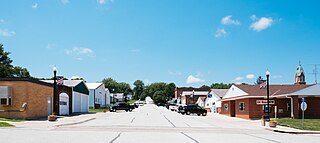
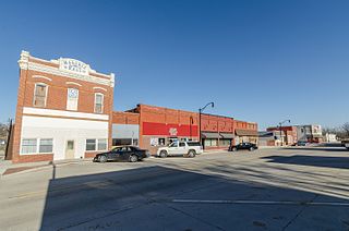
Harlan is a city in Shelby County, Iowa, along the West Nishnabotna River. The population was 4,893 at the time of the 2020 census. It is the county seat of Shelby County.

<span class="mw-page-title-main">Panama, Iowa</span> City in Iowa, United States

Panama is a city in Shelby County, Iowa, United States. The population was 235 at the time of the 2020 census.

<span class="mw-page-title-main">Westphalia, Iowa</span> City in Iowa, United States

Westphalia is a city in Shelby County, Iowa, United States. The population was 126 at the time of the 2020 census.

<span class="mw-page-title-main">Shelby, Iowa</span> City in Iowa, United States

Shelby is a city in Pottawattamie and Shelby counties in the U.S. state of Iowa. The population was 727 at the time of the 2020 census.

References

  1. 1 2 3 "2020 Census State Redistricting Data". census.gov. United states Census Bureau. Retrieved August 12, 2021.
  2. "Find a County". National Association of Counties. Retrieved June 7, 2011.
  3. A brief history, Shelby County Iowa website
  4. Shelby County Attractions
  5. "US Gazetteer files: 2010, 2000, and 1990". United States Census Bureau. February 12, 2011. Retrieved April 23, 2011.
  6. "Annual Estimates of the Resident Population for Counties: April 1, 2020 to July 1, 2023". United States Census Bureau. Retrieved April 2, 2024.
  7. "U.S. Decennial Census". United States Census Bureau. Retrieved July 20, 2014.
  8. "Historical Census Browser". University of Virginia Library. Retrieved July 20, 2014.
  9. "Population of Counties by Decennial Census: 1900 to 1990". United States Census Bureau. Retrieved July 20, 2014.
  10. "Census 2000 PHC-T-4. Ranking Tables for Counties: 1990 and 2000" (PDF). United States Census Bureau. Retrieved July 20, 2014.
  11. "State & County QuickFacts". United States Census Bureau. Archived from the original on June 7, 2011. Retrieved July 20, 2014.
  12. "Population & Housing Occupancy Status 2010" (PDF). United States Census Bureau American FactFinder. Retrieved August 15, 2022.
  13. "U.S. Census website". United States Census Bureau . Retrieved January 31, 2008.
  14. Leip, David. "Dave Leip's Atlas of U.S. Presidential Elections". uselectionatlas.org. Retrieved April 28, 2018.

41°40′53″N95°18′46″W / 41.68139°N 95.31278°W / 41.68139; -95.31278