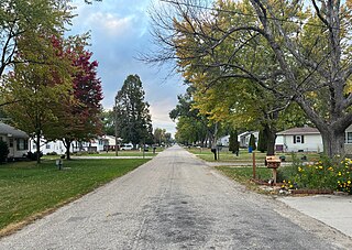
Washburn is an unincorporated town and census-designated place (CDP) in Black Hawk County, Iowa, United States. Washburn lies south of Waterloo on U.S. Route 218. Other towns near Washburn are Gilbertville and La Porte City. The community is part of the Waterloo–Cedar Falls Metropolitan Statistical Area.
Sperry is an unincorporated community in central Des Moines County, Iowa, United States. It lies along local roads north of the city of Burlington, the county seat of Des Moines County. Its elevation is 751 feet (229 m). Although Sperry is unincorporated, it has a post office with the ZIP code of 52650, which opened on 5 February 1870.
Conroy is an unincorporated community and census-designated place (CDP) in central Iowa County, Iowa, United States. It lies along local roads southeast of the city of Marengo, the county seat of Iowa County. Its elevation is 879 feet (268 m). Conroy has a post office with the ZIP Code of 52220, which opened on 5 January 1885. As of the 2010 census the population was 259.
Green Mountain is a rural unincorporated community and census-designated place (CDP) in Marshall County, Iowa, United States. It is located in Marion Township. As of the 2020 census the population of Green Mountain was 113.
Zaneta is an unincorporated community in Grundy County, Iowa, United States.

Downey is an unincorporated community in Cedar County, Iowa.
Mederville is an unincorporated community in Clayton County, Iowa, United States.
Irvington is an unincorporated community and census-designated place (CDP) in Irvington Township, Kossuth County, Iowa, United States. As of the 2010 census it had a population of 38.
New Haven is an unincorporated community and census-designated place in Mitchell County, Iowa, United States. As of the 2020 census the population of New Haven was 77.
Corley is an unincorporated community and census-designated place in Shelby County, Iowa, in the United States. As of the 2010 Census the population of Corley was 26.
Botna is an unincorporated community in Shelby County, Iowa, in the United States, located near the West Nishnabotna River.
Miller is an unincorporated community and census-designated place in Hancock County, Iowa, United States. As of the 2010 census, the population was 60.
Hutchins is an unincorporated community and census-designated place in Hancock County, Iowa, United States. As of the 2010 census the population was 28.
Poplar is a rural unincorporated community in Audubon County, Iowa, in the United States. It is part of the Poplar Rural District which is recognized as a rural historic district and was the largest rural settlement of Danish immigrants in the United States.
St. Joseph is an unincorporated community and census-designated place (CDP) in Riverdale Township, Kossuth County, Iowa, United States. As of the 2010 census the population was 61.
Holmes is an unincorporated community in Lake Township, Wright County, Iowa, United States. Holmes is located along County Highway R33, 5 miles (8.0 km) west of Clarion.
Page Center is an unincorporated community in Harlan Township, Page County, Iowa, United States. Page Center is located along County Highway M60, 5.2 miles (8.4 km) west-southwest of Clarinda.

Plainview is an unincorporated community in Cleona and Hickory Grove Townships, Scott County, Iowa, United States. Plainview is located along Iowa Highway 130 5.7 miles (9.2 km) north of Walcott.
Jerico is an unincorporated community in Chickasaw County, in the U.S. state of Iowa.
Saude is an unincorporated community in northern Chickasaw County, in the U.S. state of Iowa.


