Westphalia, Iowa

Last updated

Westphalia, Iowa
St. Boniface Catholic Church (Westphalia,Iowa).jpg
St. Boniface Catholic Church
Shelby County Iowa Incorporated and Unincorporated areas Westphalia Highlighted.svg
Location of Westphalia, Iowa
Coordinates: 41°43′09″N95°23′37″W / 41.71917°N 95.39361°W / 41.71917; -95.39361
Country Flag of the United States.svg  United States
State Flag of Iowa.svg  Iowa
County Shelby
Area
[1]
  Total0.10 sq mi (0.25 km2)
  Land0.10 sq mi (0.25 km2)
  Water0.00 sq mi (0.00 km2)
Elevation
[2]
1,411 ft (430 m)
Population
 (2020)
  Total126
  Density1,326.32/sq mi (509.49/km2)
Time zone UTC-6 (Central (CST))
  Summer (DST) UTC-5 (CDT)
ZIP code
51578
Area code 712
FIPS code 19-84540
GNIS feature ID2397283 [2]
Website www.netins.net/ricweb/community/westphal/westphal.htm

Westphalia is a city in Shelby County, Iowa, United States. The population was 126 at the time of the 2020 census. [3]

Contents

History

Westphalia was founded in 1872 as a colony of German Catholic farmers and small merchants. It was named after the Province of Westphalia, in Germany. [4]

Geography

According to the United States Census Bureau, the city has a total area of 0.10 square miles (0.26 km2), all of it land. [5] The City of Westphalia is surrounded by Westphalia Township. [6]

Demographics

Historical populations
YearPop.±%
1880 55    
1920 115+109.1%
1930 118+2.6%
1940 126+6.8%
1950 160+27.0%
1960 131−18.1%
1970 121−7.6%
1980 169+39.7%
1990 144−14.8%
2000 160+11.1%
2010 127−20.6%
2020 126−0.8%
Source: "U.S. Census website". United States Census Bureau . Retrieved March 29, 2020. and Iowa Data Center
Source:
U.S. Decennial Census [7] [3]

2010 census

At the 2010 census there were 127 people in 59 households, including 36 families, in the city. The population density was 1,270.0 inhabitants per square mile (490.3/km2). There were 62 housing units at an average density of 620.0 per square mile (239.4/km2). The racial makup of the city was 100.0% White. Hispanic or Latino of any race were 3.9%. [8]

Of the 59 households 25.4% had children under the age of 18 living with them, 50.8% were married couples living together, 8.5% had a female householder with no husband present, 1.7% had a male householder with no wife present, and 39.0% were non-families. 39.0% of households were one person and 15.3% were one person aged 65 or older. The average household size was 2.15 and the average family size was 2.89.

The median age was 45.5 years. 20.5% of residents were under the age of 18; 8.6% were between the ages of 18 and 24; 20.4% were from 25 to 44; 33% were from 45 to 64; and 17.3% were 65 or older. The gender makeup of the city was 50.4% male and 49.6% female.

2000 census

At the 2000 census there were 160 people in 61 households, including 43 families, in the city. The population density was 1,761.4 inhabitants per square mile (680.1/km2). There were 64 housing units at an average density of 704.6 per square mile (272.0/km2). The racial makup of the city was 100.00% White. [9] Of the 61 households 37.7% had children under the age of 18 living with them, 62.3% were married couples living together, 3.3% had a female householder with no husband present, and 29.5% were non-families. 26.2% of households were one person and 18.0% were one person aged 65 or older. The average household size was 2.62 and the average family size was 3.26.

The age distribution was 30.6% under the age of 18, 5.0% from 18 to 24, 33.8% from 25 to 44, 13.8% from 45 to 64, and 16.9% 65 or older. The median age was 37 years. For every 100 females, there were 86.0 males. For every 100 females age 18 and over, there were 88.1 males.

The median household income was $35,938 and the median family income was $47,500. Males had a median income of $35,833 versus $20,417 for females. The per capita income for the city was $17,066. About 7.9% of families and 11.2% of the population were below the poverty line, including 18.6% of those under the age of eighteen and 16.7% of those sixty five or over.

Education

The Harlan Community School District operates local public schools. The district serves the towns of Harlan, Defiance, Earling, Panama, Portsmouth and Westphalia, the unincorporated communities of Jacksonville and Corley, and the surrounding rural areas. [10]

See also

Related Research Articles

<span class="mw-page-title-main">Shelby County, Iowa</span> County in Iowa, United States

Shelby County is a county located in the U.S. state of Iowa. As of the 2020 census, the population was 11,746. The county seat is Harlan. Its name is in honor of Isaac Shelby, the first Governor of Kentucky.

<span class="mw-page-title-main">Nodaway, Iowa</span> City in Iowa, United States

Nodaway is a city in Nodaway Township, Adams County, Iowa, United States. The population was 74 at the time of the 2020 census. Nodaway was incorporated in 1900.

<span class="mw-page-title-main">Shellsburg, Iowa</span> City in Iowa, United States

Shellsburg is a city in Benton County, Iowa, United States. The population was 961 at the time of the 2020 census. It is part of the Cedar Rapids Metropolitan Statistical Area.

<span class="mw-page-title-main">Rinard, Iowa</span> City in Iowa, United States

Rinard is a city in Calhoun County, Iowa, United States. The population was 38 at the time of the 2020 census.

<span class="mw-page-title-main">Grand River, Iowa</span> City in Iowa, United States

Grand River is a city in northwest Decatur County, Iowa, United States. The population was 196 at the time of the 2020 census.

<span class="mw-page-title-main">Van Wert, Iowa</span> City in Iowa, United States

Van Wert is a city in northern Decatur County, Iowa, United States. The population was 178 at the time of the 2020 census.

<span class="mw-page-title-main">Wyoming, Iowa</span> City in Iowa, United States

Wyoming is a city in Jones County, Iowa, United States. The population was 523 at the time of the 2020 census. It is part of the Cedar Rapids Metropolitan Statistical Area.

<span class="mw-page-title-main">Thornburg, Iowa</span> City in Iowa, United States

Thornburg is a village in Keokuk County, Iowa, United States. The population was 45 at the time of the 2020 census. Its sole enterprise is the Tri-County Community School, a public school serving grades K-12.

<span class="mw-page-title-main">Cotter, Iowa</span> City in Iowa, United States

Cotter is a city in western Louisa County, Iowa, United States. The population was 39 at the 2020 census. It is part of the Muscatine Micropolitan Statistical Area.

<span class="mw-page-title-main">Defiance, Iowa</span> City in Iowa, United States

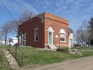
Defiance is a city in Shelby County, Iowa, United States, along the West Branch of the West Nishnabotna River. The population was 245 at the time of the 2020 census.

<span class="mw-page-title-main">Earling, Iowa</span> City in Iowa, United States

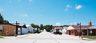
Earling is a city in Shelby County, Iowa, United States. The population was 397 at the time of the 2020 census.

<span class="mw-page-title-main">Harlan, Iowa</span> City in Iowa, United States

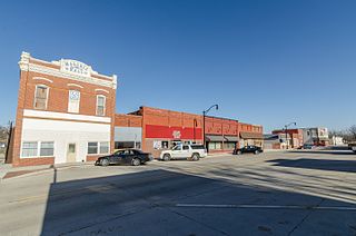
Harlan is a city in Shelby County, Iowa, along the West Nishnabotna River. The population was 4,893 at the time of the 2020 census. It is the county seat of Shelby County.

<span class="mw-page-title-main">Panama, Iowa</span> City in Iowa, United States

Panama is a city in Shelby County, Iowa, United States. The population was 235 at the time of the 2020 census.

<span class="mw-page-title-main">Portsmouth, Iowa</span> City in Iowa, United States

Portsmouth is a city in Shelby County, Iowa, United States. The population was 182 at the time of the 2020 census.

<span class="mw-page-title-main">Spring Hill, Iowa</span> City in Iowa, United States

Spring Hill is a city in Warren County, Iowa, United States. The population was 68 at the time of the 2020 census. It is part of the Des Moines–West Des Moines Metropolitan Statistical Area.

<span class="mw-page-title-main">St. Marys, Iowa</span> City in Iowa, United States

St. Marys or Saint Marys is a city in Warren County, Iowa, United States. The population was 108 at the time of the 2020 census.

<span class="mw-page-title-main">Crawfordsville, Iowa</span> City in Iowa, United States

Crawfordsville is a city in Washington County, Iowa, United States. It is part of the Iowa City, Iowa Metropolitan Statistical Area. The population was 277 at the 2020 census.

<span class="mw-page-title-main">West Chester, Iowa</span> City in Iowa, United States

West Chester is a city in Washington County, Iowa, United States. It is part of the Iowa City, Iowa Metropolitan Statistical Area. The population was 144 at the time of the 2020 census.

<span class="mw-page-title-main">Castalia, Iowa</span> City in Iowa, United States

Castalia is a city in Winneshiek County, Iowa, United States. The population was 145 at the 2020 census.

<span class="mw-page-title-main">Shelby, Iowa</span> City in Iowa, United States

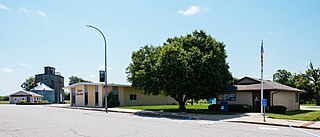
Shelby is a city in Pottawattamie and Shelby counties in the U.S. state of Iowa. The population was 727 at the time of the 2020 census.

References

  1. "2020 U.S. Gazetteer Files". United States Census Bureau. Retrieved March 16, 2022.
  2. 1 2 U.S. Geological Survey Geographic Names Information System: Westphalia, Iowa
  3. 1 2 "2020 Census State Redistricting Data". census.gov. United states Census Bureau. Retrieved August 12, 2021.
  4. White, Edward Speer (1915). Past and Present of Shelby County, Iowa, Volume 1. B.F. Bowen. pp. 277–278.
  5. "US Gazetteer files 2010". United States Census Bureau . Retrieved May 11, 2012.
  6. Shelby County Township Map. Iowa GenWeb. Accessed 30 September 2023.
  7. "Census of Population and Housing". Census.gov. Retrieved June 4, 2015.
  8. "U.S. Census website". United States Census Bureau . Retrieved May 11, 2012.
  9. "U.S. Census website". United States Census Bureau . Retrieved January 31, 2008.
  10. "FY20_HARLAN" (PDF). Iowa Department of Education. Retrieved July 31, 2020.