Monona County, Iowa

Last updated

Monona County
MONONA COUNTY COURTHOUSE, ONAWA, IOWA.JPG
Map of Iowa highlighting Monona County.svg
Location within the U.S. state of Iowa
Iowa in United States.svg
Iowa's location within the U.S.
Coordinates: 42°02′50″N95°58′07″W / 42.047222222222°N 95.968611111111°W / 42.047222222222; -95.968611111111
CountryFlag of the United States.svg United States
StateFlag of Iowa.svg  Iowa
Founded1851
Seat Onawa
Largest cityOnawa
Area
  Total699 sq mi (1,810 km2)
  Land694 sq mi (1,800 km2)
  Water4.9 sq mi (13 km2)  0.7%
Population
 (2020)
  Total8,751
  Density13/sq mi (4.8/km2)
Time zone UTC−6 (Central)
  Summer (DST) UTC−5 (CDT)
Congressional district 4th
Website www.mononacounty.org

Monona County is a county located in the U.S. state of Iowa. As of the 2020 census, the population was 8,751. [1] The county seat is Onawa. [2] [3]

Contents

History

The area around present-day Onawa was a stopping point in 1804 for Meriwether Lewis and William Clark during their exploration of the newly obtained Louisiana Purchase. Many years later, that site was memorialized as the Lewis and Clark State Park. [4]

Monona County was formed in 1851. It was perhaps named for an Indian word meaning "beautiful valley." [5]

Monona County was organized officially in the spring of 1854 having been a part of Benton County (every county west of Benton in a line) in 1851 and afterwards Harrison County between 1852 and 1854. [6]

When Ashton (originally called Bloomfield) was named the county seat in the fall of 1854, a log house served as the first courthouse. [7] Ashton remained the county seat for only four years. That designation was moved to Onawa on April 5, 1858, and the first Monona County Courthouse was completed that same year. [8]

Geography

According to the U.S. Census Bureau, the county has a total area of 699 square miles (1,810 km2), of which 694 square miles (1,800 km2) is land and 4.9 square miles (13 km2) (0.7%) is water. [9]

Major highways

Adjacent counties

Demographics

Historical population
CensusPop.Note
1860 832
1870 3,654339.2%
1880 9,055147.8%
1890 14,51560.3%
1900 17,98023.9%
1910 16,633−7.5%
1920 17,1253.0%
1930 18,2136.4%
1940 18,2380.1%
1950 16,303−10.6%
1960 13,916−14.6%
1970 12,069−13.3%
1980 11,692−3.1%
1990 10,034−14.2%
2000 10,020−0.1%
2010 9,243−7.8%
2020 8,751−5.3%
2023 (est.)8,493 [10] −2.9%
U.S. Decennial Census [11]
1790-1960 [12] 1900-1990 [13]
1990-2000 [14] 2010-2018 [15]
Population of Monona County from US census data MononaCountyIowaPop2020.png
Population of Monona County from US census data

2020 census

2022 US Census population pyramid for Monona County from ACS 5-year estimates MononaCountyIA2022PopPyr.png
2022 US Census population pyramid for Monona County from ACS 5-year estimates

The 2020 census recorded a population of 8,751 in the county, with a population density of

2010 census

The 2010 census recorded a population of 9,243 in the county, with a population density of

2000 census

As of the census [17] of 2000, there were 10,020 people, 4,211 households, and 2,737 families residing in the county. The population density was 14 people per square mile (5.4 people/km2). There were 4,660 housing units at an average density of 7 units per square mile (2.7 units/km2). The racial makeup of the county was 98.34% White, 0.08% Black or African American, 0.76% Native American, 0.12% Asian, 0.04% Pacific Islander, 0.08% from other races, and 0.58% from two or more races. 0.70% of the population were Hispanic or Latino of any race.

There were 4,211 households, out of which 26.70% had children under the age of 18 living with them, 54.50% were married couples living together, 7.10% had a female householder with no husband present, and 35.00% were non-families. 31.00% of all households were made up of individuals, and 17.50% had someone living alone who was 65 years of age or older. The average household size was 2.31 and the average family size was 2.88.

In the county, the population was spread out, with 23.20% under the age of 18, 6.20% from 18 to 24, 23.30% from 25 to 44, 23.30% from 45 to 64, and 23.90% who were 65 years of age or older. The median age was 43 years. For every 100 females, there were 94.20 males. For every 100 females age 18 and over, there were 90.50 males.

The median income for a household in the county was $33,235, and the median income for a family was $41,172. Males had a median income of $27,349 versus $19,607 for females. The per capita income for the county was $17,477. About 6.60% of families and 9.40% of the population were below the poverty line, including 8.90% of those under age 18 and 9.50% of those age 65 or over.

Communities

Unincorporated communities

Ticonic

Townships

Population ranking

The population ranking of the following table is based on the 2020 census of Monona County. [1]

county seat

RankCity/Town/etc.Population (2020 Census)
1 Onawa 2,906
2 Mapleton 1,165
3 Whiting 745
4 Ute 338
5 Blencoe 233
6 Moorhead 199
7 Soldier 184
8 Castana 107
9 Turin 72
10 Rodney 45

Politics

For over a century, Monona County was close to a national bellwether. Between 1900 & 2004, it only failed to back the national winner in 1960 & 1988. However, this bellwether status no longer applies. Barack Obama failed to carry the county in both of his electoral victories statewide & nationally, while Donald Trump in 2020 earned the highest percentage of any candidate since Franklin D. Roosevelt in 1932, in spite of his unsuccessful reelection bid.

United States presidential election results for Monona County, Iowa [18]
Year Republican Democratic Third party
No.%No.%No.%
2020 3,24868.70%1,40729.76%731.54%
2016 3,12068.24%1,24727.27%2054.48%
2012 2,55753.92%2,10144.31%841.77%
2008 2,41150.26%2,29547.84%911.90%
2004 2,57551.32%2,39747.77%460.92%
2000 2,30450.53%2,08645.75%1703.73%
1996 1,67439.50%1,95246.06%61214.44%
1992 1,66034.23%1,93939.99%1,25025.78%
1988 2,06846.05%2,40853.62%150.33%
1984 2,74655.37%2,15943.54%541.09%
1980 3,26861.85%1,66031.42%3566.74%
1976 2,63649.09%2,66149.55%731.36%
1972 3,23758.91%2,18939.84%691.26%
1968 2,98053.12%2,18438.93%4467.95%
1964 2,20835.69%3,97164.18%80.13%
1960 3,86354.64%3,20745.36%00.00%
1956 3,85452.47%3,47747.34%140.19%
1952 4,84962.29%2,91837.49%170.22%
1948 3,17943.28%4,09855.79%690.94%
1944 3,58348.64%3,76151.06%220.30%
1940 4,19246.63%4,78353.20%150.17%
1936 3,00835.39%5,34662.89%1461.72%
1932 2,18127.92%5,53770.88%941.20%
1928 3,74556.55%2,83642.82%420.63%
1924 3,19550.94%1,27120.26%1,80628.79%
1920 4,56969.49%1,96029.81%460.70%
1916 1,77747.87%1,91051.45%250.67%
1912 1,10929.00%1,35835.51%1,35735.49%
1908 1,97752.58%1,73246.06%511.36%
1904 2,27464.80%1,01628.95%2196.24%
1900 2,16151.53%1,93446.11%992.36%
1896 1,52636.86%2,55861.79%561.35%

See also

Related Research Articles

<span class="mw-page-title-main">Osceola County, Iowa</span> County in Iowa, United States

Osceola County is a county located in the U.S. state of Iowa. As of the 2020 census the population was 6,192, making it the state's fifth-least populous county. It is named for Seminole war chief Osceola. The county seat is Sibley, named for H. H. Sibley of Minnesota.

<span class="mw-page-title-main">Monroe County, Iowa</span> County in Iowa, United States

Monroe County is a county located in the south central part of the U.S. state of Iowa. In the early 20th century, it was a center of bituminous coal mining and in 1910 had a population of more than 25,000. As mining declined, people moved elsewhere for work. In the 2020 census, the population was 7,577. The county seat is Albia. The county, originally called Kishkekosh County after a famous chief of the Meskwaki, was renamed for James Monroe, fifth President of the United States.

<span class="mw-page-title-main">Mitchell County, Iowa</span> County in Iowa, United States

Mitchell County is a county located in the U.S. state of Iowa. As of the 2020 census, the population was 10,565. The county seat is Osage. It is not clear whom the county is named after: the county website mentions John Mitchell, an early surveyor, and an Irish patriot John Mitchel.

<span class="mw-page-title-main">Harrison County, Iowa</span> County in Iowa, United States

Harrison County is a county located in the U.S. state of Iowa. As of the 2020 census, the population was 14,582. The county seat is Logan. The county was formed in 1851. It was named for the ninth US President William Henry Harrison.

<span class="mw-page-title-main">Hardin County, Iowa</span> County in Iowa, United States

Hardin County is a county located in the U.S. state of Iowa. As of the 2020 census, the population was 16,878. The county seat is Eldora. The county was named in honor of Col. John J. Hardin, of Illinois, who was killed in the Mexican–American War.

<span class="mw-page-title-main">Decatur County, Iowa</span> County in Iowa, United States

Decatur County is a county located in the U.S. state of Iowa. As of the 2020 census, the population was 7,645. The county seat is Leon. This county is named for Stephen Decatur Jr., a hero in the War of 1812.

<span class="mw-page-title-main">Crawford County, Iowa</span> County in Iowa, United States

Crawford County is a county located in the U.S. state of Iowa. As of the 2020 census, the population was 16,525. Its county seat is Denison. The county was named for William Harris Crawford, U.S. senator from Georgia and United States Secretary of the Treasury.

<span class="mw-page-title-main">Clayton County, Iowa</span> County in Iowa, United States

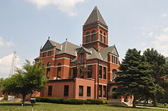
Clayton County is a county located in the U.S. state of Iowa. As of the 2020 census, the population was 17,043. Its county seat is Elkader. The county was established in 1837 and was named in honor of John M. Clayton, United States Senator from Delaware and later Secretary of State under President Zachary Taylor.

<span class="mw-page-title-main">Cass County, Iowa</span> County in Iowa, United States

Cass County is a county located in the U.S. state of Iowa. As of the 2020 census, the population was 13,127. Its county seat is Atlantic. It was named to honor Lewis Cass, who was the 1848 Democratic nominee for president.

<span class="mw-page-title-main">Audubon County, Iowa</span> County in Iowa, United States

Audubon County is a county in the U.S. state of Iowa. As of the 2020 census, the population was 5,674, making it Iowa's third-least populous county. Its county seat is Audubon. The county was named after John James Audubon, the naturalist and artist.

<span class="mw-page-title-main">Monona, Iowa</span> City in Iowa, United States

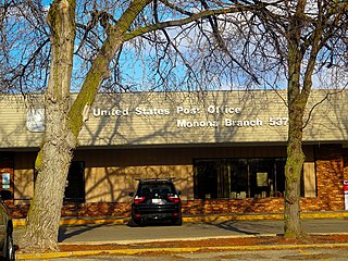
Monona is a city in Clayton County, Iowa, United States. The population was 1,471 at the time of the 2020 census.

<span class="mw-page-title-main">Blencoe, Iowa</span> City in Iowa, United States

Blencoe is a city in Monona County, Iowa, United States. The population was 233 at the 2020 census.

<span class="mw-page-title-main">Castana, Iowa</span> City in Iowa, United States

Castana is a city in Monona County, Iowa, United States. The population was 107 at the time of the 2020 census.

<span class="mw-page-title-main">Moorhead, Iowa</span> City in Iowa, United States

Moorhead is a city in Monona County, Iowa, United States. Moorhead stands along the Soldier River. The population was 199 at the time of the 2020 census.

<span class="mw-page-title-main">Onawa, Iowa</span> City in Iowa, USA

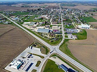
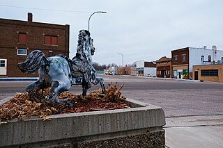
Onawa is a city in, and the county seat of, Monona County, Iowa, United States. The population was 2,906 at the time of the 2020 Census. It is the largest town on the Iowa side of the Missouri River between Council Bluffs and Sioux City.

<span class="mw-page-title-main">Soldier, Iowa</span> City in Iowa, United States

Soldier is a city in Monona County, Iowa, United States, along the Soldier River. The population was 184 at the time of the 2020 census.

<span class="mw-page-title-main">Turin, Iowa</span> City in Iowa, United States

Turin is a city in Monona County, Iowa, United States. The population was 72 at the time of the 2020 census.

<span class="mw-page-title-main">Ute, Iowa</span> City in Iowa, United States

Ute is a city in Monona County, Iowa, United States, along the Soldier River. The population was 338 at the time of the 2020 census.

<span class="mw-page-title-main">Whiting, Iowa</span> City in Iowa, United States

Whiting is a city in Monona County, Iowa, United States. The population was 745 at the time of the 2020 census.

<span class="mw-page-title-main">Monona, Wisconsin</span> City in Wisconsin, United States

Monona is a city in Dane County, Wisconsin, United States. A suburb of the state capital, Madison, the city lies on the southeastern shore of Lake Monona, from which the city gets its name. The population was 8,624 at the 2020 census.

References

  1. 1 2 3 "2020 Census State Redistricting Data". census.gov. United states Census Bureau. Retrieved August 12, 2021.
  2. "Find a County". National Association of Counties. Retrieved June 7, 2011.
  3. Monona County Economic Development Partnership for Growth
  4. About Monona County
  5. Monona County Archived July 3, 2007, at archive.today
  6. History of Monona County, Iowa: Containing Full-page Portraits and Biographical Sketches of Prominent and Representative Citizens of the County, Together with Portraits and Biographies of All the Governors of Iowa, and of the Presidents of the United States. National Publishing Company. 1890. pp. 166 .
  7. "Excerpt from: "The Counties and Courthouses of Iowa"". Archived from the original on April 5, 2016. Retrieved April 30, 2016.
  8. History of Western Iowa, Its Settlement and Growth. Western Publishing Company. 1882. pp.  249.
  9. "US Gazetteer files: 2010, 2000, and 1990". United States Census Bureau. February 12, 2011. Retrieved April 23, 2011.
  10. "Annual Estimates of the Resident Population for Counties: April 1, 2020 to July 1, 2023". United States Census Bureau. Retrieved April 2, 2024.
  11. "U.S. Decennial Census". United States Census Bureau. Retrieved July 20, 2014.
  12. "Historical Census Browser". University of Virginia Library. Retrieved July 20, 2014.
  13. "Population of Counties by Decennial Census: 1900 to 1990". United States Census Bureau. Retrieved July 20, 2014.
  14. "Census 2000 PHC-T-4. Ranking Tables for Counties: 1990 and 2000" (PDF). United States Census Bureau. Archived (PDF) from the original on March 27, 2010. Retrieved July 20, 2014.
  15. "State & County QuickFacts". United States Census Bureau. Archived from the original on June 7, 2011. Retrieved July 20, 2014.
  16. "Population & Housing Occupancy Status 2010" (PDF). United States Census Bureau – American FactFinder. Archived (PDF) from the original on October 16, 2020. Retrieved August 15, 2022.
  17. "U.S. Census website". United States Census Bureau. Retrieved January 31, 2008.
  18. Leip, David. "Dave Leip's Atlas of U.S. Presidential Elections". uselectionatlas.org. Retrieved April 27, 2018.

42°02′50″N95°58′07″W / 42.04722°N 95.96861°W / 42.04722; -95.96861