Union County, Iowa

Last updated

Union County
Union County IA Courthouse.jpg
Map of Iowa highlighting Union County.svg
Location within the U.S. state of Iowa
Iowa in United States.svg
Iowa's location within the U.S.
Coordinates: 41°01′33″N94°14′29″W / 41.025833333333°N 94.241388888889°W / 41.025833333333; -94.241388888889
CountryFlag of the United States.svg United States
StateFlag of Iowa.svg  Iowa
FoundedJanuary 15, 1851
Seat Creston
Largest cityCreston
Area
  Total426 sq mi (1,100 km2)
  Land424 sq mi (1,100 km2)
  Water2.2 sq mi (6 km2)  0.5%
Population
 (2020)
  Total12,138
  Density28/sq mi (11/km2)
Time zone UTC−6 (Central)
  Summer (DST) UTC−5 (CDT)
Congressional district 3rd
Website unioncountyiowa.gov

Union County is a county located in the southern part of the U.S. state of Iowa. As of the 2020 Census, the population was 12,138. [1] The county seat is Creston. [2] Organized at a time of tensions before the Civil War, the county was named in 1853 for the union that people wanted to preserve. Union County peaked in population at the 1900 Census. Its economy is based on agriculture and related industries.

Contents

History

The first permanent European-American settlers came in 1849 and 1850. Mormons had earlier established Mt. Pisgah in the eastern part of the county as a way station as they traveled west, but had left this area by 1848. Settlers used Pisgah as a base to establish farms along the Grand and Platte rivers that run through the county. They found a market for their produce with the emigrants traveling overland to California to take part in the Gold Rush. Travelers often sought shelter with the settlers along the way. In 1851 one settler counted 2,600 teams driven by emigrants to California; they often drove herds of sheep and cattle, trying to get animals to the gold fields to feed the miners, but many died along the way. [3]

The first village was Petersville, founded in 1853, the same year that the county was organized. The county was named for the union which many people wanted to preserve, at a time of rising tensions between the North and the South. [4]

After the American Civil War, railroad construction linked the areas of the county, giving rise to new towns, and gave access to other markets. In 1868 the railroad reached Afton, Iowa, and the next year Creston, the county seat, was made a division point. The railroad built service facilities there, a roundhouse and related structures. The railroad brought immigrants and migrants to the area, who were attracted to the fertile soil as farmland. Immigrants came from across central and eastern Europe, as well as from eastern states of the US. The Burlington Northern Santa Fe Railroad (BNSF) continues to be important in the area, serving as the chief network for hauling grain and coal. Over the years, it drew workers from industrial cities such as Chicago to Creston.

The county has a fair each year. In the late 19th century, southwestern Iowa claimed the title of Bluegrass Capital, having cultivated bluegrass throughout the area. In 1889 the Bluegrass Association was founded, made up of representatives of the 18 counties in this region. They built a Bluegrass Palace on the Union County Fairgrounds. It was designed by Louis Syberkro, an artist, and constructed by J. C. Woodruff, both of Creston. Made of sod and baled hay on a wood frame, the building was 100 feet square, with corner turrets and a central tower 92 feet high. It held exhibits of farm products and resource commodities from counties of the association, including wood, coal, sandstone, and marble. The palace was such a success that the Bluegrass Association commissioned a larger one the following year, which supplied about three times as much space. In a separate wing was an auditorium large enough to hold 2,000 people. [5]

Geography

According to the U.S. Census Bureau, the county has a total area of 426 square miles (1,100 km2), of which 424 square miles (1,100 km2) is land and 2.2 square miles (5.7 km2) (0.5%) is water. [6]

Major highways

Adjacent counties

Demographics

Historical population
CensusPop.Note
1860 2,012
1870 5,986197.5%
1880 14,980150.3%
1890 16,90012.8%
1900 19,92817.9%
1910 16,616−16.6%
1920 17,2683.9%
1930 17,4351.0%
1940 16,280−6.6%
1950 15,651−3.9%
1960 13,712−12.4%
1970 13,557−1.1%
1980 13,8582.2%
1990 12,750−8.0%
2000 12,309−3.5%
2010 12,5341.8%
2020 12,138−3.2%
2023 (est.)11,906 [7] −1.9%
U.S. Decennial Census [8]
1790-1960 [9] 1900-1990 [10]
1990-2000 [11] 2010-2018 [12]
Population of Union County from US census data UnionCountyIowaPop2020.png
Population of Union County from US census data

2020 census

2022 US Census population pyramid for Union County from ACS 5-year estimates UnionCountyIA2022PopPyr.png
2022 US Census population pyramid for Union County from ACS 5-year estimates

The 2020 census recorded a population of 12,138 in the county, with a population density of

2010 census

The 2010 census recorded a population of 12,534 in the county, with a population density of

2000 census

As of the census [14] of 2000, there were 12,309 people, 5,242 households, and 3,354 families residing in the county. The population density was 29 people per square mile (11 people/km2). There were 5,657 housing units at an average density of 13 units per square mile (5.0 units/km2). The racial makeup of the county was 98.44% White, 0.23% Black or African American, 0.17% Native American, 0.25% Asian, 0.32% from other races, and 0.58% from two or more races. 1.02% of the population were Hispanic or Latino of any race.

There were 5,242 households, out of which 27.50% had children under the age of 18 living with them, 53.10% were married couples living together, 8.00% had a female householder with no husband present, and 36.00% were non-families. 31.30% of all households were made up of individuals, and 14.40% had someone living alone who was 65 years of age or older. The average household size was 2.29 and the average family size was 2.87.

In the county, the population was spread out, with 23.30% under the age of 18, 8.70% from 18 to 24, 25.30% from 25 to 44, 24.00% from 45 to 64, and 18.70% who were 65 years of age or older. The median age was 40 years. For every 100 females there were 92.10 males. For every 100 females age 18 and over, there were 89.00 males.

The median income for a household in the county was $31,905, and the median income for a family was $41,453. Males had a median income of $27,700 versus $20,760 for females. The per capita income for the county was $16,690. About 7.40% of families and 11.40% of the population were below the poverty line, including 13.80% of those under age 18 and 9.30% of those age 65 or over.

Communities

Cities

Unincorporated communities

Townships

Census-designated place

Population ranking

The population ranking of the following table is based on the 2020 census of Union County. [1]

county seat

RankCity/Town/etc.Municipal typePopulation (2020 Census)
1 Creston City7,536
2 Afton City874
3 Lorimor City386
4 Cromwell City105
5 Arispe City96
6 Shannon City (partially in Ringgold County )City67 (73 total)
7 Thayer City51
8 Kent CDP37

Politics

Union County was a bellwether county from 1952 to 2016, backing the nationwide winner in every election in that span except for 1960 and 1988. The county is now safely Republican, as Donald Trump won it in 2020 with nearly 65% of the vote and a margin of victory of nearly 32%, turning in the best performance and margin of victory for a candidate of any party since Dwight D. Eisenhower won the county in 1952 during his nationwide landslide.

United States presidential election results for Union County, Iowa [15]
Year Republican Democratic Third party
No.%No.%No.%
2020 4,01064.83%2,06133.32%1141.84%
2016 3,52560.44%1,92232.96%3856.60%
2012 2,81347.22%3,04351.08%1011.70%
2008 2,78147.02%3,00050.73%1332.25%
2004 3,16552.94%2,74745.95%661.10%
2000 3,00352.32%2,54044.25%1973.43%
1996 2,15638.11%2,78749.27%71412.62%
1992 2,22436.45%2,56542.04%1,31321.52%
1988 2,75145.54%3,23653.57%540.89%
1984 3,58354.49%2,87543.72%1181.79%
1980 3,37256.40%2,18236.49%4257.11%
1976 2,87348.30%2,95549.68%1202.02%
1972 3,73462.47%2,11235.34%1312.19%
1968 3,36557.05%2,13736.23%3966.71%
1964 2,50239.95%3,75159.89%100.16%
1960 4,41761.85%2,72038.08%50.07%
1956 4,66662.21%2,82837.70%70.09%
1952 5,74268.92%2,56630.80%240.29%
1948 4,13855.81%3,21843.40%580.78%
1944 4,56661.29%2,86138.40%230.31%
1940 5,42162.54%3,22937.25%180.21%
1936 4,64753.42%3,93845.27%1141.31%
1932 3,04342.96%3,96756.01%731.03%
1928 5,43266.71%2,65132.56%600.74%
1924 4,25054.15%1,16614.86%2,43230.99%
1920 4,46665.63%2,22832.74%1111.63%
1916 2,05049.95%1,98548.37%691.68%
1912 1,09628.15%1,52839.25%1,26932.60%
1908 2,20752.36%1,84343.72%1653.91%
1904 2,67462.16%1,32230.73%3067.11%
1900 2,46250.86%2,21845.82%1613.33%
1896 2,19646.83%2,42551.72%681.45%

See also

Related Research Articles

<span class="mw-page-title-main">Clinton County, Iowa</span> County in Iowa, United States

Clinton County is a county located in the U.S. state of Iowa. As of the 2020 census, the population was 46,460. Its county seat is Clinton. Its name is in honor of the seventh Governor of New York State, DeWitt Clinton.

<span class="mw-page-title-main">Fontanelle, Iowa</span> City in Iowa, United States

Fontanelle is a city in Summerset Township, Adair County, Iowa, United States. The population was 676 at the time of the 2020 census.

<span class="mw-page-title-main">Prescott, Iowa</span> City in Iowa, United States

Prescott is a city in Prescott Township, Adams County, Iowa, United States. The population was 191 at the time of the 2020 census.

<span class="mw-page-title-main">Tipton, Iowa</span> City in Iowa, United States

Tipton (/ˈtɪptən/) is a city in Cedar County, Iowa, United States. The population was 3,149 at the time of the 2020 census. It is the county seat of Cedar County.

<span class="mw-page-title-main">Lawler, Iowa</span> City in Iowa, United States

Lawler is a city in Chickasaw County, Iowa, United States. The population was 406 at the time of the 2020 census.

<span class="mw-page-title-main">Peterson, Iowa</span> City in Iowa, United States

Peterson is a city in Clay County, Iowa, United States. The population was 322 in the 2020 census, a decline from 372 in 2000.

<span class="mw-page-title-main">Kellogg, Iowa</span> City in Iowa, United States

Kellogg is a city in Jasper County, Iowa, United States. The population was 606 at the time of the 2020 census. It was originally named Manning's Station, then carried the names Jasper City, Kimball, and then finally Kellogg, named for the pioneer settler Judge Abel Avery Kellogg.

<span class="mw-page-title-main">Knoxville, Iowa</span> City in Iowa, United States

Knoxville is a city and county seat of Marion County, Iowa, United States. The population was 7,595 at the time of the 2020 census, an increase from 7,313 in the 2010 census. Knoxville is home of the National Sprint Car Hall of Fame & Museum, located next to the famous Knoxville Raceway dirt track.

<span class="mw-page-title-main">Schaller, Iowa</span> City in Iowa, United States

Schaller is a city in Sac County, Iowa, United States. The population was 729 at the time of the 2020 census.

<span class="mw-page-title-main">Bedford, Iowa</span> City in Iowa, United States

Bedford is a city in Taylor County, Iowa, United States. The population was 1,508 at the 2020 census. It is the county seat of Taylor County. Lake of Three Fires State Park is located several miles northeast of Bedford.

<span class="mw-page-title-main">Arispe, Iowa</span> City in Iowa, United States

Arispe is a city in Union County, Iowa, United States. The population was 96 at the 2020 census. It is closely related to the nearby town of Creston.

<span class="mw-page-title-main">Lorimor, Iowa</span> City in Iowa, United States

Lorimor is a city in Union County, Iowa, United States. The population was 386 at the time of the 2020 census.

<span class="mw-page-title-main">Kalona, Iowa</span> City in Iowa, United States

Kalona is a city in Washington County, Iowa. It is part of the Iowa City metropolitan area. The population was 2,630 at the time of the 2020 census. Kalona is the second-largest city in Washington County.

<span class="mw-page-title-main">Lineville, Iowa</span> City in Iowa, United States

Lineville is a city in Wayne County, Iowa, United States. The population was 195 at the time of the 2020 census.

<span class="mw-page-title-main">Creston, Washington</span> Town in Washington, United States

Creston is a town in Lincoln County, Washington, United States. The population was 236 at the 2010 census.

<span class="mw-page-title-main">Tabor, Iowa</span> City in Iowa, United States

Tabor is a city in Fremont County and extends northward into Mills County in the U.S. state of Iowa. The population was 928 at the time of the 2020 census.

<span class="mw-page-title-main">West Bend, Iowa</span> Village in Iowa, United States

West Bend is a village in Kossuth and Palo Alto (originally) counties in the U.S. state of Iowa. The population was 791 at the time of the 2020 census.

<span class="mw-page-title-main">Creston, Ohio</span> Village in Ohio, United States

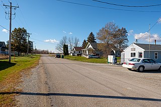
Creston is a village in Medina and Wayne counties in the U.S. state of Ohio. The population was 2,139 at the 2020 census.

<span class="mw-page-title-main">Creston, Iowa</span> City in Iowa, United States

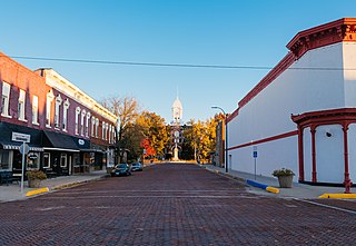
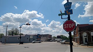
Creston is a city in and the county seat of Union County, Iowa. The population was 7,536 at the time of the 2020 Census.

<span class="mw-page-title-main">Nevada, Iowa</span> City in Iowa, United States

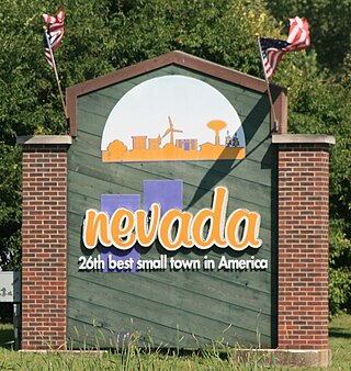
Nevada is a city in, and the county seat of, Story County, Iowa, United States. The population was 6,925 in the 2020 census, an increase from 6,658 in 2000. Nevada is part of the Ames, Iowa Metropolitan Statistical Area, which is a part of the larger Ames-Boone, Iowa Combined Statistical Area. Nevada is the second-most populous city in Story County. The city's name is pronounced differently from the U.S. state of Nevada.

References

  1. 1 2 3 "2020 Census State Redistricting Data". census.gov. United states Census Bureau. Retrieved August 12, 2021.
  2. "Find a County". National Association of Counties. Retrieved June 7, 2011.
  3. "Petersville and other early settlements", Union County Early Settlers and the Mormons, 2012-2014, Iowa GenWeb
  4. "Union County History", 2012-2014, Iowa GenWeb
  5. Adapted from original article from The Goldfinch 6, No. 1 (October 1984). Iowa City: State Historical Society of Iowa
  6. "US Gazetteer files: 2010, 2000, and 1990". United States Census Bureau. February 12, 2011. Retrieved April 23, 2011.
  7. "Annual Estimates of the Resident Population for Counties: April 1, 2020 to July 1, 2023". United States Census Bureau. Retrieved April 2, 2024.
  8. "U.S. Decennial Census". United States Census Bureau. Retrieved July 20, 2014.
  9. "Historical Census Browser". University of Virginia Library. Retrieved July 20, 2014.
  10. "Population of Counties by Decennial Census: 1900 to 1990". United States Census Bureau. Retrieved July 20, 2014.
  11. "Census 2000 PHC-T-4. Ranking Tables for Counties: 1990 and 2000" (PDF). United States Census Bureau. Archived (PDF) from the original on March 27, 2010. Retrieved July 20, 2014.
  12. "State & County QuickFacts". United States Census Bureau. Archived from the original on June 7, 2011. Retrieved July 20, 2014.
  13. "Population & Housing Occupancy Status 2010" (PDF). United States Census Bureau - American FactFinder. Archived (PDF) from the original on October 16, 2020. Retrieved August 15, 2022.
  14. "U.S. Census website". United States Census Bureau. Retrieved January 31, 2008.
  15. Leip, David. "Dave Leip's Atlas of U.S. Presidential Elections". uselectionatlas.org. Retrieved April 28, 2018.


41°01′33″N94°14′29″W / 41.02583°N 94.24139°W / 41.02583; -94.24139