Lucas County, Iowa

Last updated

Lucas County
Lucas County, Iowa Courthouse.jpg
Map of Iowa highlighting Lucas County.svg
Location within the U.S. state of Iowa
Iowa in United States.svg
Iowa's location within the U.S.
Coordinates: 41°01′34″N93°19′42″W / 41.026111111111°N 93.328333333333°W / 41.026111111111; -93.328333333333
CountryFlag of the United States.svg United States
StateFlag of Iowa.svg  Iowa
Founded1846
Named for Robert Lucas
Seat Chariton
Largest cityChariton
Area
  Total434 sq mi (1,120 km2)
  Land431 sq mi (1,120 km2)
  Water3.8 sq mi (10 km2)  0.9%
Population
 (2020)
  Total8,634
  Density20/sq mi (7.7/km2)
Time zone UTC−6 (Central)
  Summer (DST) UTC−5 (CDT)
Congressional district 2nd

Lucas County is a county located in the U.S. state of Iowa. As of the 2020 census, the population was 8,634. [1] The county seat is Chariton. [2] The county was formed in 1846 [3] and was named for Robert Lucas, a Governor of the Territory. [4]

Contents

Geography

According to the U.S. Census Bureau, the county has a total area of 434 square miles (1,120 km2), of which 431 square miles (1,120 km2) is land and 3.8 square miles (9.8 km2) (0.9%) is water. [5]

Major highways

Adjacent counties

Demographics

Historical population
CensusPop.Note
1850 471
1860 5,7661,124.2%
1870 10,38880.2%
1880 14,53039.9%
1890 14,5630.2%
1900 16,12610.7%
1910 13,462−16.5%
1920 15,68616.5%
1930 15,114−3.6%
1940 14,571−3.6%
1950 12,069−17.2%
1960 10,923−9.5%
1970 10,163−7.0%
1980 10,3131.5%
1990 9,070−12.1%
2000 9,4223.9%
2010 8,898−5.6%
2020 8,634−3.0%
2023 (est.)8,747 [6] 1.3%
U.S. Decennial Census [7]
1790-1960 [8] 1900-1990 [9]
1990-2000 [10] 2010-2018 [11]
Population of Lucas County from US census data LucasCountyIowaPop2020.png
Population of Lucas County from US census data

2020 census

2022 US Census population pyramid for Lucas County from ACS 5-year estimates LucasCountyIA2022PopPyr.png
2022 US Census population pyramid for Lucas County from ACS 5-year estimates

The 2020 census recorded a population of 8,634 in the county, with a population density of

2010 census

The 2010 census recorded a population of 8,898 in the county, with a population density of

2000 census

As of the census [13] of 2000, there were 9,422 people, 3,811 households, and 2,560 families residing in the county. The population density was 22 people per square mile (8.5 people/km2). There were 4,239 housing units at an average density of 10 units per square mile (3.9 units/km2). The racial makeup of the county was 98.44% White, 0.13% Black or African American, 0.11% Native American, 0.30% Asian, 0.01% Pacific Islander, 0.37% from other races, and 0.65% from two or more races. 0.87% of the population were Hispanic or Latino of any race.

There were 3,811 households, out of which 28.30% had children under the age of 18 living with them, 56.70% were married couples living together, 7.00% had a female householder with no husband present, and 32.80% were non-families. 28.70% of all households were made up of individuals, and 14.60% had someone living alone who was 65 years of age or older. The average household size was 2.42 and the average family size was 2.98.

In the county, the population was spread out, with 25.40% under the age of 18, 7.30% from 18 to 24, 24.60% from 25 to 44, 23.40% from 45 to 64, and 19.30% who were 65 years of age or older. The median age was 40 years. For every 100 females there were 94.50 males. For every 100 females age 18 and over, there were 91.10 males.

The median income for a household in the county was $30,876, and the median income for a family was $38,352. Males had a median income of $31,243 versus $21,293 for females. The per capita income for the county was $15,341. About 8.40% of families and 13.70% of the population were below the poverty line, including 19.10% of those under age 18 and 9.60% of those age 65 or over.

Athletics

Communities

Cities

Townships

Unincorporated areas

Population ranking

The population ranking of the following table is based on the 2020 census of Lucas County. [1]

county seat

RankCity/Town/etc.Municipal typePopulation (2020 Census)
1 Chariton City4,193
2 Russell City472
3 Lucas City172
4 Williamson City120
5 Derby City90

Notable people

Politics

Lucas county is a stronghold for the GOP. Republicans have won the county every year since 2000, with Donald Trump receiving a stellar 70% of the vote in 2020.

United States presidential election results for Lucas County, Iowa [14] [15]
Year Republican Democratic Third party
No.%No.%No.%
2020 3,28770.99%1,28427.73%591.27%
2016 2,87766.08%1,23928.46%2385.47%
2012 2,25452.14%1,98745.96%821.90%
2008 2,33052.06%2,02945.33%1172.61%
2004 2,54355.63%1,98743.47%410.90%
2000 2,26252.57%1,93444.95%1072.49%
1996 1,58637.68%2,16851.51%45510.81%
1992 1,73437.10%2,07244.33%86818.57%
1988 1,77641.86%2,45457.84%130.31%
1984 2,63051.72%2,42247.63%330.65%
1980 2,59352.61%1,98940.35%3477.04%
1976 2,07142.32%2,73355.84%901.84%
1972 2,85160.79%1,75937.51%801.71%
1968 2,54353.18%1,94240.61%2976.21%
1964 1,93536.79%3,31062.93%150.29%
1960 3,51259.88%2,34439.97%90.15%
1956 3,39758.25%2,43141.68%40.07%
1952 3,92163.09%2,21735.67%771.24%
1948 2,65648.51%2,69749.26%1222.23%
1944 3,13954.94%2,52644.21%480.84%
1940 3,80653.24%3,25545.53%881.23%
1936 3,41446.25%3,77351.11%1952.64%
1932 2,38139.84%3,43457.46%1612.69%
1928 3,81166.01%1,88832.70%741.28%
1924 3,28852.64%82413.19%2,13434.17%
1920 3,77568.56%1,46326.57%2684.87%
1916 1,67247.91%1,53644.01%2828.08%
1912 93932.11%96833.11%1,01734.78%
1908 1,75755.41%1,26739.96%1474.64%
1904 2,25965.73%87825.55%3008.73%
1900 2,22557.58%1,48838.51%1513.91%
1896 1,85952.43%1,62145.71%661.86%

See also

Related Research Articles

<span class="mw-page-title-main">Warren County, Iowa</span> County in Iowa, United States

Warren County is a county located in the U.S. state of Iowa. As of the 2020 census, the population was 52,403. The county seat is Indianola.

<span class="mw-page-title-main">Monroe County, Iowa</span> County in Iowa, United States

Monroe County is a county located in the south central part of the U.S. state of Iowa. In the early 20th century, it was a center of bituminous coal mining and in 1910 had a population of more than 25,000. As mining declined, people moved elsewhere for work. In the 2020 census, the population was 7,577. The county seat is Albia. The county, originally called Kishkekosh County after a famous chief of the Meskwaki, was renamed for James Monroe, fifth President of the United States.

<span class="mw-page-title-main">Marion County, Iowa</span> County in Iowa, United States

Marion County is a county in the U.S. state of Iowa. As of the 2020 census, the population was 33,414. The county seat is Knoxville. It is named for Francis Marion, a brigadier general from South Carolina in the American Revolutionary War.

<span class="mw-page-title-main">Kossuth County, Iowa</span> County in Iowa, United States

Kossuth County is a county in the U.S. state of Iowa. As of the 2020 census, the population was 14,828. The county seat is Algona.

<span class="mw-page-title-main">Fayette County, Iowa</span> County in Iowa, United States

Fayette County is a county located in the U.S. state of Iowa. As of the 2020 census, the population was 19,509. The county seat is West Union.

<span class="mw-page-title-main">Appanoose County, Iowa</span> County in Iowa, United States

Appanoose County is a county in the U.S. state of Iowa. As of the 2020 census, the population was 12,317. Its county seat is Centerville.

<span class="mw-page-title-main">Rosedale, California</span> Census-designated place in California, United States

Rosedale is a census-designated place (CDP) in Kern County, California, United States. The population was 14,058 at the 2010 census, up from 8,445 at the 2000 census. Formerly a country town 10 miles (16 km) west of Bakersfield, it is now surrounded by suburban housing and currently has the highest household income in Kern County, according to Census estimates.

<span class="mw-page-title-main">Rathbun, Iowa</span> City in Iowa, USA

Rathbun is a city in Appanoose County, Iowa, United States. The population was 43 at the time of the 2020 census.

<span class="mw-page-title-main">St. Lucas, Iowa</span> City in Iowa, United States

St. Lucas is a city in Fayette County, Iowa, United States. The population was 167 at the time of the 2020 census.

<span class="mw-page-title-main">Monroe, Iowa</span> City in Iowa, United States

Monroe is a city in Jasper and Marion counties in Iowa, United States. The population was 1,967 at the time of the 2020 census.

<span class="mw-page-title-main">Chariton, Iowa</span> City in Iowa, USA

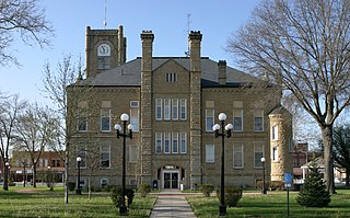
Chariton is a city in, and the county seat of, Lucas County, Iowa, United States. The population was 4,193 at the 2020 census. Lucas is the primary distribution center for and the former corporate headquarters of the Hy-Vee supermarket chain.

<span class="mw-page-title-main">Derby, Iowa</span> City in Iowa, United States

Derby is a city in Lucas County, Iowa, United States. The population was 90 at the time of the 2020 census.

<span class="mw-page-title-main">Lucas, Iowa</span> City in Iowa, USA

Lucas is a city in Lucas County, Iowa, United States. The population was 172 at the time of the 2020 census.

<span class="mw-page-title-main">Russell, Iowa</span> City in Iowa, United States

Russell is a city in Lucas County, Iowa, United States. The population was 472 in the 2020 census, a decline from the 559 population in 2000.

<span class="mw-page-title-main">Williamson, Iowa</span> City in Iowa, United States

Williamson is a city in Lucas County, Iowa, United States. The population was 120 at the time of the 2020 census.

<span class="mw-page-title-main">Emerson, Iowa</span> City in Iowa, United States

Emerson is a city in Mills County, Iowa, United States. The population was 403 at the time of the 2020 census.

<span class="mw-page-title-main">Minden, Iowa</span> City in Iowa, United States

Minden is a city in Pottawattamie County, Iowa, United States. The population was 600 at the time of the 2020 census. It has possessed a post office since 1875.

<span class="mw-page-title-main">Velda City, Missouri</span> City in Missouri, United States

Velda City is a city in St. Louis County, Missouri, United States. The population was 1,420 at the 2010 census.

<span class="mw-page-title-main">Grass Range, Montana</span> Town in Montana, United States

Grass Range is a town in Fergus County, Montana, United States. The population was 110 in both the 2010 census and 2020 census.

<span class="mw-page-title-main">Valley-Hi, Pennsylvania</span> Borough in Pennsylvania, United States

Valley-Hi is a borough in Fulton County, Pennsylvania, United States. The population was 7 at the 2020 census.

References

  1. 1 2 3 "2020 Census State Redistricting Data". census.gov. United states Census Bureau. Retrieved August 12, 2021.
  2. "Find a County". National Association of Counties. Retrieved June 7, 2011.
  3. Lucas County (archived)
  4. Stuart, Theodore M. (1913). Past and Present of Lucas and Wayne Counties, Iowa: A Record of Settlement, Organization, Progress and Achievement, Volume 1. S. J. Clarke Publishing Company. p. 10.
  5. "US Gazetteer files: 2010, 2000, and 1990". United States Census Bureau. February 12, 2011. Retrieved April 23, 2011.
  6. "Annual Estimates of the Resident Population for Counties: April 1, 2020 to July 1, 2023". United States Census Bureau. Retrieved April 2, 2024.
  7. "U.S. Decennial Census". United States Census Bureau. Retrieved August 1, 2013.
  8. "Historical Census Browser". University of Virginia Library. Retrieved July 20, 2014.
  9. "Population of Counties by Decennial Census: 1900 to 1990". United States Census Bureau. Retrieved July 20, 2014.
  10. "Census 2000 PHC-T-4. Ranking Tables for Counties: 1990 and 2000" (PDF). United States Census Bureau. Archived (PDF) from the original on March 27, 2010. Retrieved July 20, 2014.
  11. "State & County QuickFacts". United States Census Bureau. Archived from the original on June 7, 2011. Retrieved July 18, 2014.
  12. "Population & Housing Occupancy Status 2010" (PDF). United States Census Bureau American FactFinder. Archived (PDF) from the original on October 16, 2020. Retrieved August 15, 2022.
  13. "U.S. Census website". United States Census Bureau . Retrieved January 31, 2008.
  14. Leip, David. "Dave Leip's Atlas of U.S. Presidential Elections". uselectionatlas.org. Retrieved April 27, 2018.
  15. The leading "other" candidate, Progressive Theodore Roosevelt, received 855 votes, while Socialist candidate Eugene Debs received 110 votes, Prohibition candidate Eugene Chafin received 52 votes.

Further reading

41°01′34″N93°19′42″W / 41.02611°N 93.32833°W / 41.02611; -93.32833