Whitebreast Township, Lucas County, Iowa

Last updated

Whitebreast Township is a township in Lucas County, Iowa, USA. [1]

A township in the United States is a small geographic area.

Lucas County, Iowa County in the United States

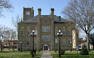
Lucas County is a county located in the U.S. state of Iowa. As of the 2010 census, the population was 8,898. The county seat is Chariton. The county was formed in 1846 and was named for Robert Lucas, a Governor of the Territory.

Iowa State of the United States of America

Iowa is a state in the Midwestern United States, bordered by the Mississippi River to the east and the Missouri River and Big Sioux River to the west. It is bordered by six states; Wisconsin to the northeast, Illinois to the east, Missouri to the south, Nebraska to the west, South Dakota to the northwest and Minnesota to the north.

History

Whitebreast Township was established in 1852. [2]

Related Research Articles

Benton Township is a township in Lucas County, Iowa, United States.

English Township is a township in Lucas County, Iowa, USA.

Cedar Township is a township in Lucas County, Iowa, USA.

Union Township is a township in Lucas County, Iowa, USA.

Washington Township is a township in Lucas County, Iowa, USA.

Warren Township is a township in Lucas County, Iowa, USA.

Liberty Township is a township in Lucas County, Iowa, USA.

Otter Creek Township is a township in Lucas County, Iowa, USA.

Pleasant Township is a township in Lucas County, Iowa, USA.

Jackson Township is a township in Lucas County, Iowa, USA.

Lincoln Township is a township in Lucas County, Iowa, USA.

State Center Township is a township in Marshall County, Iowa, USA.

Allen Township is a township in Polk County, Iowa, USA.

Lincoln Township is a township in Polk County, Iowa, USA.

Washington Township is a township in Polk County, Iowa, USA.

Walnut Township is a township in Polk County, Iowa, USA.

Webster Township is a township in Polk County, Iowa, USA.

Douglas Township is a township in Polk County, Iowa, USA.

Franklin Township is a township in Polk County, Iowa, USA.

Clay Township is a township in Polk County, Iowa, USA.

References

Coordinates: 41°02′03″N93°22′50″W / 41.0342°N 93.3806°W / 41.0342; -93.3806

Geographic coordinate system Coordinate system

A geographic coordinate system is a coordinate system that enables every location on Earth to be specified by a set of numbers, letters or symbols. The coordinates are often chosen such that one of the numbers represents a vertical position and two or three of the numbers represent a horizontal position; alternatively, a geographic position may be expressed in a combined three-dimensional Cartesian vector. A common choice of coordinates is latitude, longitude and elevation. To specify a location on a plane requires a map projection.