Monroe County, Iowa

Last updated

Monroe County
Monroe County, Iowa Courthouse.jpg
The courthouse in Albia is on the NRHP
Map of Iowa highlighting Monroe County.svg
Location within the U.S. state of Iowa
Iowa in United States.svg
Iowa's location within the U.S.
Coordinates: 41°01′42″N92°52′12″W / 41.028333333333°N 92.87°W / 41.028333333333; -92.87
CountryFlag of the United States.svg United States
StateFlag of Iowa.svg  Iowa
Founded1843
Seat Albia
Largest cityAlbia
Area
  Total434 sq mi (1,120 km2)
  Land434 sq mi (1,120 km2)
  Water0.6 sq mi (2 km2)  0.1%
Population
 (2020)
  Total7,577
  Density17/sq mi (6.7/km2)
Time zone UTC−6 (Central)
  Summer (DST) UTC−5 (CDT)
Congressional district 2nd
Website monroecounty.iowa.gov

Monroe County is a county located in the south central part of the U.S. state of Iowa. In the early 20th century, it was a center of bituminous coal mining and in 1910 had a population of more than 25,000. As mining declined, people moved elsewhere for work. In the 2020 census, the population was 7,577. [1] The county seat is Albia. [2] The county, originally called Kishkekosh County after a famous chief of the Meskwaki, [3] was renamed for James Monroe, fifth President of the United States. [4]

Contents

Geography

According to the U.S. Census Bureau, the county has a total area of 434 square miles (1,120 km2), of which 434 square miles (1,120 km2) is land and 0.6 square miles (1.6 km2) (0.1%) is water. [5]

Major highways

Adjacent counties

Demographics

Historical population
CensusPop.Note
1850 2,884
1860 8,612198.6%
1870 12,72447.7%
1880 13,7197.8%
1890 13,666−0.4%
1900 17,98531.6%
1910 25,42941.4%
1920 23,467−7.7%
1930 15,010−36.0%
1940 14,553−3.0%
1950 11,814−18.8%
1960 10,463−11.4%
1970 9,357−10.6%
1980 9,209−1.6%
1990 8,114−11.9%
2000 8,016−1.2%
2010 7,970−0.6%
2020 7,577−4.9%
2023 (est.)7,504 [6] −1.0%
U.S. Decennial Census [7]
1790-1960 [8] 1900-1990 [9]
1990-2000 [10] 2010-2018 [11]
Population of Monroe County from US census data MonroeCountyIowaPop22020.png
Population of Monroe County from US census data

2020 census

2022 US Census population pyramid for Monroe County from ACS 5-year estimates MonroeCountyIA2022PopPyr.png
2022 US Census population pyramid for Monroe County from ACS 5-year estimates

The 2020 census recorded a population of 7,577 in the county, with a population density of

2010 census

The 2010 census recorded a population of 7,970 in the county, with a population density of

2000 census

As of the census [13] of 2000, there were 8,016 people, 3,228 households, and 2,211 families in the county. The population density was 18 people per square mile (6.9 people/km2). There were 3,588 housing units at an average density of 8 units per square mile (3.1 units/km2). The racial makeup of the county was 98.40% White, 0.20% Black or African American, 0.36% Native American, 0.40% Asian, 0.12% from other races, and 0.51% from two or more races. 0.50% of the population were Hispanic or Latino of any race.

Of the 3,228 households, 30.50% had children under the age of 18 living with them, 56.20% were married couples living together, 8.60% had a female householder with no husband present, and 31.50% were non-families. 28.00% of households were one person, and 15.30% were one person aged 65 or older. The average household size was 2.43 and the average family size was 2.97.

In the county, the population was spread out, with 25.30% under the age of 18, 7.20% from 18 to 24, 25.00% from 25 to 44, 23.00% from 45 to 64, and 19.50% 65 or older. The median age was 40 years. For every 100 females there were 94.90 males. For every 100 females age 18 and over, there were 92.60 males.

The median household income was $34,877 and the median family income was $41,611. Males had a median income of $31,667 versus $21,401 for females. The per capita income for the county was $17,155. About 5.60% of families and 9.00% of the population were below the poverty line, including 12.20% of those under age 18 and 5.90% of those age 65 or over.

Chief Kishkekosh of the Meskwaki, after whom the county was originally named Kishkekosh, A Chief of the Fox Indians - History of Iowa.jpg
Chief Kishkekosh of the Meskwaki, after whom the county was originally named

Communities

Cities

Unincorporated communities

Ghost town

Townships

Population ranking

The population ranking of the following table is based on the 2020 census of Monroe County. [1]

county seat

RankCity/Town/etc.Municipal typePopulation (2020 Census)
1 Albia City3,721
2 Eddyville (mostly in Mahaska and Wapello Counties )City970
3 Moravia (mostly in Appanoose County )City637
4 Lovilia City472
5 Melrose City110

Politics

United States presidential election results for Monroe County, Iowa [14] [15]
Year Republican Democratic Third party
No.%No.%No.%
2020 2,97572.77%1,07826.37%350.86%
2016 2,63868.25%1,05627.32%1714.42%
2012 2,02652.90%1,73145.20%731.91%
2008 2,00051.63%1,79846.41%761.96%
2004 2,06752.16%1,85546.81%411.03%
2000 1,85850.95%1,69946.59%902.47%
1996 1,27236.21%1,88453.63%35710.16%
1992 1,32334.98%1,82948.36%63016.66%
1988 1,31335.81%2,33863.76%160.44%
1984 1,92744.91%2,34254.58%220.51%
1980 2,00348.65%1,86645.32%2486.02%
1976 1,58139.56%2,36059.06%551.38%
1972 2,35756.73%1,73641.78%621.49%
1968 2,14345.55%2,24047.61%3226.84%
1964 1,58833.15%3,18666.50%170.35%
1960 2,92254.20%2,45945.61%100.19%
1956 2,98453.17%2,61646.61%120.21%
1952 3,21953.28%2,78546.09%380.63%
1948 2,37140.01%3,44558.13%1101.86%
1944 2,62544.27%3,25854.95%460.78%
1940 3,27044.57%3,99454.44%720.98%
1936 3,00140.22%4,20556.36%2553.42%
1932 2,45838.25%3,71657.83%2523.92%
1928 4,06058.16%2,81940.38%1021.46%
1924 4,09850.92%1,38817.25%2,56231.83%
1920 4,50061.21%2,08128.31%77110.49%
1916 2,14445.15%2,09544.11%51010.74%
1912 1,38526.22%1,48528.11%2,41245.66%
1908 2,68651.58%1,97938.01%54210.41%
1904 3,24962.17%1,18222.62%79515.21%
1900 2,23351.62%1,70539.41%3888.97%
1896 1,83645.69%2,08651.92%962.39%

See also

Related Research Articles

<span class="mw-page-title-main">Ringgold County, Iowa</span> County in Iowa, United States

Ringgold County is a county located in the U.S. state of Iowa. As of the 2020 census, the population was 4,663, making it the Iowa county with the second-smallest population. The county seat is Mount Ayr. The county is named after Maj. Samuel Ringgold, a hero of the Battle of Palo Alto fought in May 1846, during the Mexican–American War. It is one of the 26 Iowa counties with a name that is unique across the nation.

<span class="mw-page-title-main">Pocahontas County, Iowa</span> County in Iowa, United States

Pocahontas County is a county located in Iowa, United States. As of the 2020 census the population was 7,078, making it the state's ninth-least populous county. The county seat is Pocahontas. The county was formed in 1851.

<span class="mw-page-title-main">Marion County, Iowa</span> County in Iowa, United States

Marion County is a county in the U.S. state of Iowa. As of the 2020 census, the population was 33,414. The county seat is Knoxville. It is named for Francis Marion, a brigadier general from South Carolina in the American Revolutionary War.

<span class="mw-page-title-main">Mahaska County, Iowa</span> County in Iowa, United States

Mahaska County is a county located in the U.S. state of Iowa. As of the 2020 census, the population was 22,190. The county seat is Oskaloosa.

<span class="mw-page-title-main">Emmet County, Iowa</span> County in Iowa, United States

Emmet County is a county located in the U.S. state of Iowa. As of the 2020 census, the population was 9,388. The county seat is Estherville.

<span class="mw-page-title-main">Delaware County, Iowa</span> County in Iowa, United States

Delaware County is a county located in the U.S. state of Iowa. As of the 2020 census, the population was 17,488. The county seat is Manchester. The county takes its name after the U.S. state of Delaware.

<span class="mw-page-title-main">Butler County, Iowa</span> County in Iowa, United States

Butler County is a county located in the U.S. state of Iowa. As of the 2020 census, the population was 14,334. Its county seat is Allison. The county was organized in 1854 and named for General William O. Butler.

<span class="mw-page-title-main">Audubon County, Iowa</span> County in Iowa, United States

Audubon County is a county in the U.S. state of Iowa. As of the 2020 census, the population was 5,674, making it Iowa's third-least populous county. Its county seat is Audubon. The county was named after John James Audubon, the naturalist and artist.

<span class="mw-page-title-main">Monroe, Iowa</span> City in Iowa, United States

Monroe is a city in Jasper and Marion counties in Iowa, United States. The population was 1,967 at the time of the 2020 census.

<span class="mw-page-title-main">Reasnor, Iowa</span> City in Iowa, United States

Reasnor is a city in Jasper County, Iowa, United States. The population was 152 at the time of the 2020 census.

<span class="mw-page-title-main">Bussey, Iowa</span> City in Iowa, United States

Bussey is a city in southeast Marion County, Iowa, United States. The population was 387 at the time of the 2020 census.

<span class="mw-page-title-main">Albia, Iowa</span> City in Iowa, United States

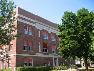
Albia is a city in and the county seat of Monroe County, in southern Iowa, United States. The population was 3,721 at the 2020 census.

<span class="mw-page-title-main">Lovilia, Iowa</span> City in Iowa, United States

Lovilia is a city in Monroe County, Iowa, United States. The population was 472 at the time of the 2020 census.

<span class="mw-page-title-main">Melrose, Iowa</span> City in Iowa, United States

Melrose is a community in Monroe County, Iowa, United States. The population was 110 at the time of the 2020 census. Melrose is known as Iowa's "Little Ireland". As such, the majority of the 130 population are Irish Catholics.

<span class="mw-page-title-main">Redding Township, Michigan</span> Civil township in Michigan, United States

Redding Township is a civil township of Clare County in the U.S. state of Michigan. The population was 459 at the 2020 census.

<span class="mw-page-title-main">Spring Arbor Township, Michigan</span> Civil township in Michigan, United States

Spring Arbor Township is a civil township of Jackson County in the U.S. state of Michigan. The population was 8,267 at the 2010 census, up from 7,577 at the 2000 census.

<span class="mw-page-title-main">Tse Bonito, New Mexico</span> CDP in New Mexico, United States

Tse Bonito is a census-designated place (CDP) in McKinley County, New Mexico, United States and is part of the greater Window Rock, Arizona population center, and seat of the Navajo Nation government. The population was 261 at the 2000 census.

<span class="mw-page-title-main">Jaconita, New Mexico</span> Census-designated place in New Mexico, United States

Jaconita is a census-designated place (CDP) in Santa Fe County, New Mexico, United States. It is part of the Santa Fe, New Mexico Metropolitan Statistical Area. The population was 332 at the 2010 census. It is considered to be a part of the Pojoaque Valley.

<span class="mw-page-title-main">Lindley, New York</span> Town in New York, United States

Lindley is a town in southern Steuben County, New York, United States. The population was 1,816 at the 2020 census. The town was named after the early settler Eleazer Lindsley.

<span class="mw-page-title-main">Monroe, Ohio</span> City in Ohio, United States

Monroe is a city in east central Butler and west central Warren counties in the southwestern part of the U.S. state of Ohio. The population was 15,412 at the 2020 census. Monroe is a part of the Cincinnati metropolitan area.

References

  1. 1 2 3 "2020 Census State Redistricting Data". census.gov. United states Census Bureau. Retrieved August 12, 2021.
  2. "Find a County". National Association of Counties. Retrieved June 7, 2011.
  3. Stanek, Edward and Jacqueline (1976). Iowa's Magnificent County Courthouses. Des Moines: Wallace-Homestead. p. 142. ISBN   0-87069-189-9.
  4. Gannett, Henry (1905). The Origin of Certain Place Names in the United States. U.S. Government Printing Office. p.  212.
  5. "US Gazetteer files: 2010, 2000, and 1990". United States Census Bureau. February 12, 2011. Retrieved April 23, 2011.
  6. "Annual Estimates of the Resident Population for Counties: April 1, 2020 to July 1, 2023". United States Census Bureau. Retrieved April 2, 2024.
  7. "U.S. Decennial Census". United States Census Bureau. Retrieved July 20, 2014.
  8. "Historical Census Browser". University of Virginia Library. Retrieved July 20, 2014.
  9. "Population of Counties by Decennial Census: 1900 to 1990". United States Census Bureau. Retrieved July 20, 2014.
  10. "Census 2000 PHC-T-4. Ranking Tables for Counties: 1990 and 2000" (PDF). United States Census Bureau. Archived (PDF) from the original on March 27, 2010. Retrieved July 20, 2014.
  11. "State & County QuickFacts". United States Census Bureau. Archived from the original on June 7, 2011. Retrieved July 20, 2014.
  12. "Population & Housing Occupancy Status 2010" (PDF). United States Census Bureau – American FactFinder. Archived (PDF) from the original on October 16, 2020. Retrieved August 15, 2022.
  13. "U.S. Census website". United States Census Bureau. Retrieved January 31, 2008.
  14. Leip, David. "Dave Leip's Atlas of U.S. Presidential Elections". uselectionatlas.org. Retrieved April 27, 2018.
  15. The leading "other" candidate, Progressive Theodore Roosevelt, received 1,121 votes, while Socialist candidate Eugene Debs received 104 votes, Prohibition candidate Eugene Chafin received 86 votes.

41°01′42″N92°52′12″W / 41.02833°N 92.87000°W / 41.02833; -92.87000