Onawa, Iowa | |
---|---|
Coordinates: 42°1′39″N96°5′47″W / 42.02750°N 96.09639°W | |
Country | USA |
State | Iowa |
County | Monona |
Area | |
• Total | 5.27 sq mi (13.64 km2) |
• Land | 5.27 sq mi (13.64 km2) |
• Water | 0.00 sq mi (0.00 km2) |
Elevation | 1,050 ft (320 m) |
Population (2020) | |
• Total | 2,906 |
• Density | 551.63/sq mi (212.98/km2) |
Time zone | UTC-6 (Central (CST)) |
• Summer (DST) | UTC-5 (CDT) |
ZIP code | 51040 |
Area code | 712 |
FIPS code | 19-59115 |
GNIS feature ID | 0459865 |
Website | www |
Onawa is a city in, and the county seat of, Monona County, Iowa, United States. [2] The population was 2,906 at the time of the 2020 Census. [3] [4] It is the largest town on the Iowa side of the Missouri River between Council Bluffs and Sioux City.
Onawa was named for a character mentioned in the poem The Song of Hiawatha by Henry Wadsworth Longfellow. [5] Onawa was platted in 1857, and the railway arrived to the city in 1867. [6] The city is known for having the widest main street in the continental United States. [7]
Onawa was the site of a prisoner-of-war (POW) camp for captured German soldiers between 1944 and 1946. [8] Historical documents indicate there were never more than 50 POWs in camp. A larger camp existed near the central Iowa town of Algona, and housed as many as 5,400 German POWs.
Onawa's longitude and latitude coordinates in decimal form are 42.027490, -96.096513. [9]
According to the United States Census Bureau, the city has a total area of 5.19 square miles (13.44 km2), all land. [10]
Onawa is located in the Loess Hills region of western Iowa, a unique geological and environmental area. Nearby are such natural areas as Lewis & Clark State Park, Preparation Canyon State Park, and the Loess Hills State Forest.
Year | Pop. | ±% |
---|---|---|
1870 | 478 | — |
1880 | 882 | +84.5% |
1890 | 1,358 | +54.0% |
1900 | 1,933 | +42.3% |
1910 | 2,026 | +4.8% |
1920 | 2,256 | +11.4% |
1930 | 2,538 | +12.5% |
1940 | 3,438 | +35.5% |
1950 | 3,498 | +1.7% |
1960 | 3,176 | −9.2% |
1970 | 3,154 | −0.7% |
1980 | 3,283 | +4.1% |
1990 | 2,936 | −10.6% |
2000 | 3,091 | +5.3% |
2010 | 2,998 | −3.0% |
2020 | 2,906 | −3.1% |
Source: "U.S. Census website". United States Census Bureau . Retrieved March 29, 2020. and Iowa Data Center Source: |
As of the 2010 Census, there were 2,998 people, 1,345 households, and 756 families living in the city. [4] The population density was 577.6 inhabitants per square mile (223.0/km2). There were 1,519 housing units at an average density of 292.7 per square mile (113.0/km2). [10] The racial makeup of the city was 95.4% non-Hispanic White, 0.4% non-Hispanic Black or African American, 1.7% Native American, 0.3% Asian, 0.1% from other races, and 1.0% from two or more races. Hispanic or Latino people of any race were 1.2% of the population. [4]
There were 1,345 households, of which 25.8% had children under the age of 18 living with them, 41.6% were married couples living together, 9.7% had a female householder with no husband present, 4.9% had a male householder with no wife present, and 43.8% were non-families. Thirty-eight point nine percent of all households were made up of individuals, and 20.9% had someone living alone who was 65 years of age or older. The average household size was 2.18 and the average family size was 2.91. [4]
The median age in the city was 44.8 years. Twenty-three point two of residents were under the age of 18; 6.2% were between the ages of 18 and 24; 20.8% were from 25 to 44; 25.8% were from 45 to 64; and 24% were 65 years of age or older. The gender makeup of the city was 47.5% male and 52.5% female.
As of the census [12] of 2000, there were 3,091 people, 1,329 households, and 796 families living in the city. The population density was 629.1 inhabitants per square mile (242.9/km2). There were 1,452 housing units at an average density of 295.5 per square mile (114.1/km2). The racial makeup of the city was 97.86% White, 0.03% African American, 1.16% Native American, 0.19% Asian, 0.03% Pacific Islander, 0.03% from other races, and 0.68% from two or more races. 1.07% of the population are Hispanic or Latino of any race.
There were 1,329 households, out of which 25.4% had children under the age of 18 living with them, 47.3% were married couples living together, 9.4% had a female householder with no husband present, and 40.1% were non-families. 35.0% of all households were made up of individuals, and 20.2% had someone living alone who was 65 years of age or older. The average household size was 2.25 and the average family size was 2.89.
Population spread: 22.8% under the age of 18, 6.1% from 18 to 24, 24.4% from 25 to 44, 21.2% from 45 to 64, and 25.4% who were 65 years of age or older. The median age was 42 years. For every 100 females, there were 88.1 males. For every 100 females age 18 and over, there were 83.2 males.
The median income for a household in the city was $34,796, and the median income for a family was $41,250. Males had a median income of $27,981 versus $20,292 for females. The per capita income for the city was $17,928. About 3.3% of families and 6.3% of the population were below the poverty line, including 4.9% of those under age 18 and 8.2% of those age 65 or over.
West Monona Community School District operates public schools serving the community. [13]
The Eskimo Pie was created in Onawa in 1920 by Chris Nelson, an ice cream shop owner.[ citation needed ]
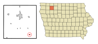
Monona County is a county located in the U.S. state of Iowa. As of the 2020 census, the population was 8,751. The county seat is Onawa.
Linn Grove is a city in Buena Vista County, Iowa, United States. The population was 163 at the time of the 2020 census. The nearby Chan-Ya-Ta Site contains the remains of a 1000-year-old prehistoric village, and is on the National Register of Historic Places.
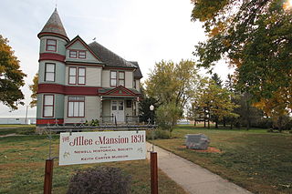
Newell is a city in Buena Vista County, Iowa, United States. The population was 906 according to the 2020 census.
Rembrandt is a city in Buena Vista County, Iowa, United States. The population was 209 at the time of the 2020 census.
Webb is a city in Clay County, Iowa, United States. The population was 138 in the 2020 census, a decline from 165 in 2000.
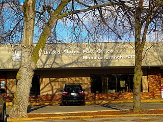
Monona is a city in Clayton County, Iowa, United States. The population was 1,471 at the time of the 2020 census.
Spirit Lake is a city in Dickinson County, Iowa, United States. The population was 5,439 at the 2020 census. It is the county seat of Dickinson County.
Little Sioux is a city in Harrison County, Iowa, United States. The population was 166 at the time of the 2020 census. The city is most known for Little Sioux Scout Ranch of the Boy Scouts of America.
Blencoe is a city in Monona County, Iowa, United States. The population was 233 at the 2020 census.
Castana is a city in Monona County, Iowa, United States. The population was 107 at the time of the 2020 census.
Moorhead is a city in Monona County, Iowa, United States. Moorhead stands along the Soldier River. The population was 199 at the time of the 2020 census.
Soldier is a city in Monona County, Iowa, United States, along the Soldier River. The population was 184 at the time of the 2020 census.
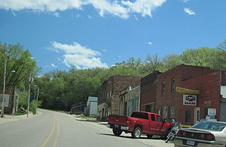
Turin is a city in Monona County, Iowa, United States. The population was 72 at the time of the 2020 census.
Whiting is a city in Monona County, Iowa, United States. The population was 745 at the time of the 2020 census.
Ashton is a city in Osceola County, Iowa, United States. The population was 436 at the 2020 census.
Chatsworth is a city in Sioux County, Iowa, United States. The population was 75 at the 2020 census.
Correctionville is a city in Woodbury County, Iowa, United States. It is part of the Sioux City, IA–NE–SD Metropolitan Statistical Area. The population was 766 at the time of the 2020 census. The town name comes from the original survey of the town. Correctionville has been noted for its unusual place name. It is supposedly the longest single-word place name in the state of Iowa.
Lawton is a city in Woodbury County, Iowa, Iowa, United States. It is part of the Sioux City metropolitan area. The population was 943 at the time of the 2020 census.
Oto is a city in Woodbury County, Iowa, United States. It is part of the Sioux City, IA–NE–SD Metropolitan Statistical Area. The population was 72 at the time of the 2020 census.
Monona is a city in Dane County, Wisconsin, United States. A suburb of the state capital, Madison, the city lies on the southeastern shore of Lake Monona, from which the city gets its name. The population was 8,624 at the 2020 census.