Pulaski, Iowa | |
---|---|
Coordinates: 40°41′47″N92°16′22″W / 40.69639°N 92.27278°W Coordinates: 40°41′47″N92°16′22″W / 40.69639°N 92.27278°W | |
Country | United States |
State | Iowa |
County | Davis |
Area | |
• Total | 0.44 sq mi (1.14 km2) |
• Land | 0.44 sq mi (1.14 km2) |
• Water | 0.00 sq mi (0.00 km2) |
Elevation | 833 ft (254 m) |
Population (2020) | |
• Total | 264 |
• Density | 602.74/sq mi (232.50/km2) |
Time zone | UTC-6 (Central (CST)) |
• Summer (DST) | UTC-5 (CDT) |
ZIP code | 52584 |
Area code | 641 |
FIPS code | 19-65055 |
GNIS feature ID | 0460469 [2] |
Pulaski is a city in Davis County, Iowa, United States. The population was 264 at the time of the 2020 census. [3]
Pulaski was founded in 1856. It is named for Casimir Pulaski. [4]
The Pulaski Corn Show, held annually on a September weekend, is a citywide celebration with a parade. [5]
Pulaski is located on Iowa Highway 2 southeast of the county seat of Bloomfield and west of Milton. [6]
According to the United States Census Bureau, the city has a total area of 0.51 square miles (1.32 km2), all land. [7]
Iowa Highway 2 passes through Pulaski.
Year | Pop. | ±% |
---|---|---|
1880 | 196 | — |
1900 | 302 | +54.1% |
1910 | 382 | +26.5% |
1920 | 419 | +9.7% |
1930 | 376 | −10.3% |
1940 | 400 | +6.4% |
1950 | 381 | −4.7% |
1960 | 299 | −21.5% |
1970 | 255 | −14.7% |
1980 | 267 | +4.7% |
1990 | 262 | −1.9% |
2000 | 249 | −5.0% |
2010 | 260 | +4.4% |
2020 | 264 | +1.5% |
Source: "U.S. Census website". United States Census Bureau . Retrieved 2020-03-29. and Iowa Data Center Source: |
As of the census [9] of 2010, there were 260 people, 104 households, and 80 families residing in the city. The population density was 509.8 inhabitants per square mile (196.8/km2). There were 117 housing units at an average density of 229.4 per square mile (88.6/km2). The racial makeup of the city was 100.0% White. Hispanic or Latino of any race were 0.8% of the population.
There were 104 households, of which 38.5% had children under the age of 18 living with them, 57.7% were married couples living together, 10.6% had a female householder with no husband present, 8.7% had a male householder with no wife present, and 23.1% were non-families. 20.2% of all households were made up of individuals, and 5.8% had someone living alone who was 65 years of age or older. The average household size was 2.50 and the average family size was 2.83.
The median age in the city was 39.7 years. 26.5% of residents were under the age of 18; 8.1% were between the ages of 18 and 24; 21.6% were from 25 to 44; 30% were from 45 to 64; and 13.8% were 65 years of age or older. The gender makeup of the city was 52.7% male and 47.3% female.
As of the census [10] of 2000, there were 249 people, 103 households, and 70 families residing in the city. The population density was 669.3 inhabitants per square mile (258.4/km2). There were 113 housing units at an average density of 303.7 per square mile (117.3/km2). The racial makeup of the city was 97.19% White, 0.40% Native American, and 2.41% from two or more races.
There were 103 households, out of which 31.1% had children under the age of 18 living with them, 59.2% were married couples living together, 3.9% had a female householder with no husband present, and 32.0% were non-families. 30.1% of all households were made up of individuals, and 24.3% had someone living alone who was 65 years of age or older. The average household size was 2.42 and the average family size was 2.99.
In the city, the population was spread out, with 27.7% under the age of 18, 4.0% from 18 to 24, 24.5% from 25 to 44, 25.3% from 45 to 64, and 18.5% who were 65 years of age or older. The median age was 40 years. For every 100 females, there were 84.4 males. For every 100 females age 18 and over, there were 80.0 males.
The median income for a household in the city was $30,694, and the median income for a family was $38,750. Males had a median income of $24,318 versus $23,750 for females. The per capita income for the city was $14,334. About 6.6% of families and 10.8% of the population were below the poverty line, including 19.7% of those under the age of eighteen and 14.0% of those 65 or over.
Harpers Ferry is a city in Taylor Township, Allamakee County, Iowa, United States. The population was 262 at the time of the 2020 census.
Moulton is a city in Appanoose County, Iowa, United States. The population was 607 at the time of the 2020 census.
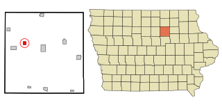
Bristow is a city in Butler County, Iowa, United States. The population was 145 at the 2020 census.
St. Olaf is a city in Clayton County, Iowa, United States. The population was 106 at the time of the 2020 census, down from 136 in 2000. Swiss Valley has a large cheese packaging plant in St. Olaf.
Orleans is a city in Dickinson County, Iowa, United States. The population was 521 at the time of the 2020 census. Orleans is part of the Iowa Great Lakes region, located along Spirit Lake. Numerous state parks are located within a few miles of the town, including Marble Beach and Mini-Wakan.
Maynard is a city in Fayette County, Iowa, United States. The population was 476 at the time of the 2020 census.
Little Sioux is a city in Harrison County, Iowa, United States. The population was 166 at the time of the 2020 census. The city is most known for Little Sioux Scout Ranch of the Boy Scouts of America.
Hills is a city in Johnson County, Iowa, United States. It is part of the Iowa City, Iowa Metropolitan Statistical Area. The population was 863 at the time of the 2020 census. It is part of the Iowa City Community School District.
Wapello is a city in and the county seat of Louisa County, Iowa, United States. The population was 2,084 at the time of the 2020 census.
Braddyville is a city in Page County, Iowa, United States. The population was 147 at the 2020 census.
Runnells is a city in the southeastern corner of Polk County, Iowa, United States. The population was 457 at the time of the 2020 census. It is part of the Des Moines–West Des Moines Metropolitan Statistical Area.
Carson is a city in Pottawattamie County, Iowa, United States. The population was 766 at the 2020 census.
Hancock is a city in Pottawattamie County, Iowa, United States, along the West Nishnabotna River. The population was 200 at the time of the 2020 census.
Minden is a city in Pottawattamie County, Iowa, United States. The population was 600 at the time of the 2020 census. It has possessed a post office since 1875.
Dixon is a city in Scott County, Iowa, United States. The population was 202 at the time of the 2020 census.
Donahue is a city in Scott County, Iowa, United States. The population was 335 at the 2020 census. The city has a mayor-council form of government.
Maysville is a city in Scott County, Iowa, United States. The population was 156 at the time of the 2020 census.
Cambridge is a city in Story County, Iowa, United States. The population was 827 at the 2020 census. It is part of the Ames, Iowa Metropolitan Statistical Area, which is a part of the larger Ames-Boone, Iowa Combined Statistical Area.
Pulaski is a town in Iowa County, Wisconsin, United States. The population was 3,591 at the 2018 census.
Pulaski is a village in Brown, Oconto, and Shawano counties in the U.S. state of Wisconsin. The population was 3,539 at the 2010 census. Of this, 3,321 were in Brown County, 218 in Shawano County, and none in Oconto County.
Media related to Pulaski, Iowa at Wikimedia Commons