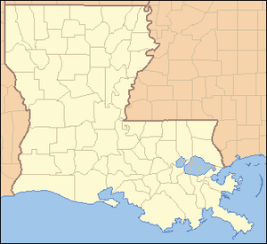
Parish
| FIPS code [4] | Parish Seat [5] | Est. [5] | Origin | Etymology [6] | Population [7] | Area [5] | Map |
|---|
| AcadiaParish | 001 | Crowley | 1886 | from part of St. Landry Parish. | From Acadian French. Named for the Acadians who settled the area. | 56,489 | 658 sq mi
(1,704 km2) |  |
|---|
| AllenParish | 003 | Oberlin | 1912 | from part of Calcasieu Parish. | Henry Watkins Allen, the Confederate governor of Louisiana | 22,112 | 766 sq mi
(1,984 km2) |  |
|---|
| AscensionParish | 005 | Donaldsonville | 1807 | One of the original 19 parishes. | Named for the Ascension of Our Lord Catholic Church in Donaldsonville, Louisiana, which was named after the Ascension of Jesus into Heaven | 131,632 | 303 sq mi
(785 km2) |  |
|---|
| AssumptionParish | 007 | Napoleonville | 1807 | One of the original 19 parishes. | Named for Church of the Assumption of the Blessed Virgin Mary in Plattenville, the oldest in the state, which was named after the Assumption of the Virgin Mary | 20,160 | 364 sq mi
(943 km2) |  |
|---|
| AvoyellesParish | 009 | Marksville | 1807 | One of the original 19 parishes. | The Avoyel Native American people | 38,408 | 866 sq mi
(2,243 km2) |  |
|---|
| BeauregardParish | 011 | DeRidder | 1912 | from part of Calcasieu Parish. | Confederate general P. G. T. Beauregard | 36,827 | 1,166 sq mi
(3,020 km2) |  |
|---|
| BienvilleParish | 013 | Arcadia | 1848 | from part of Claiborne Parish. | Named after the founder of the city of New Orleans, Jean-Baptiste Le Moyne de Bienville | 12,366 | 822 sq mi
(2,129 km2) |  |
|---|
| BossierParish | 015 | Benton | 1843 | from part of Claiborne Parish. | U.S. Representative Pierre Bossier | 129,795 | 867 sq mi
(2,246 km2) |  |
|---|
| CaddoParish | 017 | Shreveport | 1838 | from part of Natchitoches Parish. | Named for the Caddo Native American people | 226,386 | 937 sq mi
(2,427 km2) |  |
|---|
| CalcasieuParish | 019 | Lake Charles | 1840 | from part of St. Landry Parish. | From Atakapa Calcasieu, meaning crying eagle, is said to be the name of an Atakapa Native American leader | 203,761 | 1,094 sq mi
(2,833 km2) |  |
|---|
| CaldwellParish | 021 | Columbia | 1838 | from part of Catahoula Parish and Ouachita Parish. | Named for the Caldwell family, which owned a large plantation and remains politically active in the state. | 9,389 | 541 sq mi
(1,401 km2) |  |
|---|
| CameronParish | 023 | Cameron | 1870 | from parts of Calcasieu Parish and Vermilion Parish. | U.S. Secretary of War Simon Cameron | 4,768 | 1,932 sq mi
(5,004 km2) |  |
|---|
| CatahoulaParish | 025 | Harrisonburg | 1808 | from parts of Ouachita Parish and Rapides Parish. | Catahoula Lake, formerly within the parish's boundaries and named from a Taensa/Natchez word meaning big, clear lake | 8,414 | 739 sq mi
(1,914 km2) |  |
|---|
| ClaiborneParish | 027 | Homer | 1828 | from part of Natchitoches Parish. | Governor of Louisiana William C. C. Claiborne | 13,670 | 768 sq mi
(1,989 km2) |  |
|---|
| ConcordiaParish | 029 | Vidalia | 1807 | One of the original 19 parishes. | Name is of uncertain origin; may be from an early land grant called New Concordia, from the "concord" reached by local authorities over a mutual surrender of slaves or for a mansion called Concord which was owned by Spanish governor Manuel Gayoso de Lemos and located in Natchez, Mississippi | 17,688 | 749 sq mi
(1,940 km2) |  |
|---|
| DeSotoParish | 031 | Mansfield | 1843 | from parts of Caddo Parish and Natchitoches Parish. | Spanish explorer Hernando de Soto | 27,114 | 895 sq mi
(2,318 km2) |  |
|---|
| East Baton RougeParish | 033 | Baton Rouge | 1810 | from West Florida territory. | French bâton rouge meaning red stick. A red stake was used by local Native Americans to mark the boundaries between tribal territories | 448,467 | 471 sq mi
(1,220 km2) | 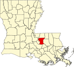 |
|---|
| East CarrollParish | 035 | Lake Providence | 1877 | when Carroll Parish was divided. | Charles Carroll of Carrollton, the last surviving signer of the U.S. Declaration of Independence | 6,829 | 442 sq mi
(1,145 km2) |  |
|---|
| East FelicianaParish | 037 | Clinton | 1824 | when Feliciana Parish was divided. | Felicite de Gálvez, the wife of Bernardo de Gálvez, a Spanish governor of Louisiana (New Spain) | 19,229 | 456 sq mi
(1,181 km2) |  |
|---|
| EvangelineParish | 039 | Ville Platte | 1910 | from part of St. Landry Parish. | Acadian heroine of the poem "Evangeline" by Henry Wadsworth Longfellow | 31,754 | 680 sq mi
(1,761 km2) |  |
|---|
| FranklinParish | 041 | Winnsboro | 1843 | from parts of Carroll Parish, Catahoula Parish, Madison Parish and Ouachita Parish | Founding Father Benjamin Franklin | 19,285 | 636 sq mi
(1,647 km2) |  |
|---|
| GrantParish | 043 | Colfax | 1869 | from parts of Rapides Parish and Winn Parish. | U.S. President Ulysses S. Grant | 21,911 | 664 sq mi
(1,720 km2) |  |
|---|
| IberiaParish | 045 | New Iberia | 1868 | from parts of St. Martin Parish and St. Mary Parish. | Named by Spanish settlers in honor of the Iberian Peninsula | 67,659 | 1,031 sq mi
(2,670 km2) |  |
|---|
| IbervilleParish | 047 | Plaquemine | 1807 | One of the original 19 parishes. | Explorer Pierre Le Moyne d'Iberville, the brother of Jean-Baptiste Le Moyne de Bienville | 29,617 | 653 sq mi
(1,691 km2) | 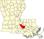 |
|---|
| JacksonParish | 049 | Jonesboro | 1845 | from parts of Claiborne Parish, Ouachita Parish and Union Parish | U.S. President Andrew Jackson | 14,746 | 580 sq mi
(1,502 km2) |  |
|---|
| JeffersonParish | 051 | Gretna | 1825 | from part of Orleans Parish | Founding Father Thomas Jefferson | 421,777 | 642 sq mi
(1,663 km2) |  |
|---|
| Jefferson DavisParish | 053 | Jennings | 1912 | from part of Calcasieu Parish. | Jefferson Davis, president of the Confederate States of America | 31,553 | 659 sq mi
(1,707 km2) | 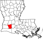 |
|---|
| LafayetteParish | 055 | Lafayette | 1823 | from part of St. Martin Parish. | French-born American Revolutionary War hero, the Marquis de Lafayette | 249,750 | 270 sq mi
(699 km2) |  |
|---|
| LafourcheParish | 057 | Thibodaux | 1807 | One of the original 19 parishes. Was named Interior Parish until 1812 and Lafourche Interior Parish until 1853. | French phrase la fourche or in English, the fork; Bayou Lafourche, or Fork Bayou, is a fork of the Mississippi River | 95,056 | 1,472 sq mi
(3,812 km2) |  |
|---|
| LaSalleParish | 059 | Jena | 1910 | from west half of Catahoula Parish. | Explorer René-Robert Cavelier, Sieur de La Salle | 14,800 | 663 sq mi
(1,717 km2) |  |
|---|
| LincolnParish | 061 | Ruston | 1873 | from parts of Bienville Parish, Claiborne Parish, Jackson Parish and Union Parish. | U.S. President Abraham Lincoln | 47,962 | 472 sq mi
(1,222 km2) |  |
|---|
| LivingstonParish | 063 | Livingston | 1832 | from part of St. Helena Parish. | U.S. Secretary of State Edward Livingston, brother of Robert R. Livingston who negotiated the Louisiana Purchase | 150,145 | 703 sq mi
(1,821 km2) |  |
|---|
| MadisonParish | 065 | Tallulah | 1838 | from Concordia Parish. | U.S. President James Madison | 9,246 | 651 sq mi
(1,686 km2) |  |
|---|
| MorehouseParish | 067 | Bastrop | 1844 | from parts of Carroll Parish and Ouachita Parish. | Abraham Morehouse, who led the first settlers into the region | 23,955 | 805 sq mi
(2,085 km2) | 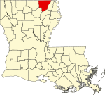 |
|---|
| NatchitochesParish | 069 | Natchitoches | 1807 | One of the original 19 parishes. | The Natchitoches Native American people | 36,291 | 1,299 sq mi
(3,364 km2) | 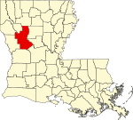 |
|---|
| OrleansParish | 071 | New Orleans | 1807 | One of the original 19 parishes. Today coterminous with the City of New Orleans. | Named after Philippe, Duke of Orléans, the regent of France | 364,136 | 350 sq mi
(906 km2) |  |
|---|
| OuachitaParish | 073 | Monroe | 1807 | One of the original 19 parishes. | The Ouachita Native American people | 157,568 | 633 sq mi
(1,639 km2) |  |
|---|
| PlaqueminesParish | 075 | Pointe à la Hache | 1807 | One of the original 19 parishes. | A word meaning persimmons created from the Louisiana Creole and the Atakapa language | 22,386 | 2,429 sq mi
(6,291 km2) |  |
|---|
| Pointe CoupeeParish | 077 | New Roads | 1807 | One of the original 19 parishes. | French phrase la pointe coupée or in English, the cut-off point, which refers to a bend in the Mississippi River | 20,000 | 591 sq mi
(1,531 km2) |  |
|---|
| RapidesParish | 079 | Alexandria | 1807 | One of the original 19 parishes. | Named for local river rapids (French: rapides) | 126,260 | 1,362 sq mi
(3,528 km2) |  |
|---|
| Red RiverParish | 081 | Coushatta | 1871 | from parts of Bienville Parish, Bossier Parish, Caddo Parish and Natchitoches Parish. | Named for the Red River, which is part of the Mississippi River watershed | 7,356 | 402 sq mi
(1,041 km2) |  |
|---|
| RichlandParish | 083 | Rayville | 1868 | from parts of Carroll Parish, Franklin Parish, Morehouse Parish and Ouachita Parish. | Named for its rich land | 19,712 | 564 sq mi
(1,461 km2) |  |
|---|
| SabineParish | 085 | Many | 1843 | from parts of Caddo Parish and Natchitoches Parish. | Named for the Sabine River and the so-called Sabine Free State | 21,906 | 1,012 sq mi
(2,621 km2) |  |
|---|
| St. BernardParish | 087 | Chalmette | 1807 | One of the original 19 parishes. | Saint Bernard, patron saint of Bernardo de Gálvez, the Spanish governor who granted land to the Canary Islanders settling the area in 1778 | 44,463 | 1,794 sq mi
(4,646 km2) | 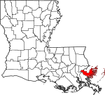 |
|---|
| St. CharlesParish | 089 | Hahnville | 1807 | One of the original 19 parishes. | Saint Charles | 50,620 | 410 sq mi
(1,062 km2) |  |
|---|
| St. HelenaParish | 091 | Greensburg | 1810 | from West Florida territory. | Saint Helena | 10,774 | 409 sq mi
(1,059 km2) |  |
|---|
| St. JamesParish | 093 | Convent | 1807 | One of the original 19 parishes. | Saint James the Great | 19,191 | 258 sq mi
(668 km2) | 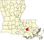 |
|---|
| St. John the BaptistParish | 095 | Edgard | 1807 | One of the original 19 parishes. | Saint John the Baptist | 39,592 | 348 sq mi
(901 km2) |  |
|---|
| St. LandryParish | 097 | Opelousas | 1807 | One of the original 19 parishes. | Saint Landry of Paris | 81,464 | 939 sq mi
(2,432 km2) |  |
|---|
| St. MartinParish | 099 | St. Martinville | 1807 | One of the original 19 parishes. | Saint Martin of Tours | 51,057 | 817 sq mi
(2,116 km2) | 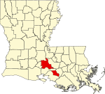 |
|---|
| St. MaryParish | 101 | Franklin | 1811 | from part of St. Martin Parish. | Saint Mary | 47,055 | 612 sq mi
(1,585 km2) |  |
|---|
| St. TammanyParish | 103 | Covington | 1810 | from West Florida territory. | Legendary Indian Chief Tamanend. | 275,583 | 1,124 sq mi
(2,911 km2) |  |
|---|
| TangipahoaParish | 105 | Amite City | 1869 | from parts of Livingston Parish, St. Helena Parish, St. Tammany Parish and Washington Parish. | Comes from an Acolapissa word meaning ear of corn or those who gather corn | 138,064 | 823 sq mi
(2,132 km2) |  |
|---|
| TensasParish | 107 | St. Joseph | 1843 | from part of Concordia Parish. | The Taensa Native American people. | 3,764 | 641 sq mi
(1,660 km2) |  |
|---|
| TerrebonneParish | 109 | Houma | 1822 | from part of Lafourche Interior Parish. | French phrase terre bonne or in English, "good earth" | 103,616 | 2,080 sq mi
(5,387 km2) | 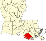 |
|---|
| UnionParish | 111 | Farmerville | 1839 | from part of Ouachita Parish. | Named for the union of states which make up the U.S. | 20,650 | 905 sq mi
(2,344 km2) | 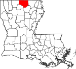 |
|---|
| VermilionParish | 113 | Abbeville | 1844 | from part of Lafayette Parish. | Both the Vermilion River and Vermilion Bay | 56,992 | 1,538 sq mi
(3,983 km2) | 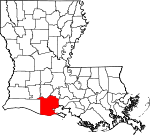 |
|---|
| VernonParish | 115 | Leesville | 1871 | from parts of Natchitoches Parish, Rapides Parish and Sabine Parish. | Mount Vernon, the home of George Washington, the first U.S. President | 46,250 | 1,341 sq mi
(3,473 km2) |  |
|---|
| WashingtonParish | 117 | Franklinton | 1819 | from part of St. Tammany Parish. | U.S. President George Washington | 44,865 | 676 sq mi
(1,751 km2) |  |
|---|
| WebsterParish | 119 | Minden | 1871 | from parts of Bienville Parish, Bossier Parish and Claiborne Parish. | U.S. Secretary of State Daniel Webster | 35,238 | 615 sq mi
(1,593 km2) |  |
|---|
| West Baton RougeParish | 121 | Port Allen | 1807 | One of the original 19 parishes. Was named Baton Rouge Parish until 1812. | French phrase bâton rouge meaning red stick. A red stick was used by local Native Americans to mark the boundaries between tribal territories | 28,266 | 203 sq mi
(526 km2) |  |
|---|
| West CarrollParish | 123 | Oak Grove, West Carroll Parish | 1877 | when Carroll Parish was divided. | Charles Carroll of Carrollton, the last surviving signer of the U.S. Declaration of Independence | 9,323 | 360 sq mi
(932 km2) |  |
|---|
| West FelicianaParish | 125 | St. Francisville | 1824 | when Feliciana Parish was divided. | Felicite de Gálvez, the wife of Bernardo de Gálvez, a Spanish governor of Louisiana (New Spain) | 15,371 | 426 sq mi
(1,103 km2) |  |
|---|
| WinnParish | 127 | Winnfield | 1852 | from parts of Catahoula Parish, Natchitoches Parish and Rapides Parish. | Louisiana state legislator Walter Winn | 13,216 | 957 sq mi
(2,479 km2) |  |
|---|