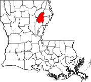
Franklin Parish, Louisiana

Last updated

Franklin Parish
Franklin Parish Courthouse in Winnsboro, LA.jpg
Franklin Parish Courthouse in Winnsboro
Map of Louisiana highlighting Franklin Parish.svg
Location within the U.S. state of Louisiana
Louisiana in United States.svg
Louisiana's location within the U.S.
Coordinates: 32°08′N91°40′W / 32.14°N 91.67°W / 32.14; -91.67
CountryFlag of the United States.svg United States
StateFlag of Louisiana.svg  Louisiana
Founded1843
Named for Benjamin Franklin
Seat Winnsboro
Largest cityWinnsboro
Area
  Total635 sq mi (1,640 km2)
  Land625 sq mi (1,620 km2)
  Water11 sq mi (30 km2)  1.7%
Population
 (2020)
  Total19,774
  Density31/sq mi (12/km2)
Time zone UTC−6 (Central)
  Summer (DST) UTC−5 (CDT)
Congressional district 5th
Franklin Parish Veterans Memorial sign in Winnsboro, Louisiana Franklin Parish Veterans Memorial, Winnsboro, LA IMG 0324.JPG
Franklin Parish Veterans Memorial sign in Winnsboro, Louisiana
Franklin Parish Library in downtown Winnsboro historic district Franklin Parish Library, Winnsboro, LA IMG 1279.JPG
Franklin Parish Library in downtown Winnsboro historic district

Franklin Parish (French : Paroisse de Franklin, Spanish : Parroquia de Franklin) is a parish located in the northeastern part of the U.S. state of Louisiana. As of the 2020, its population was 19,774. [1] The parish seat is Winnsboro. [2] The parish was founded in 1843 and named for Benjamin Franklin. [3] [4]

Contents

Geography

According to the U.S. Census Bureau, the parish has a total area of 635 square miles (1,640 km2), of which 625 square miles (1,620 km2) is land and 11 square miles (28 km2) (1.7%) is water. [5]

Major highways

Adjacent parishes

National protected area

Communities

City

Town

Villages

Unincorporated community

Demographics

Historical population
CensusPop.Note
1850 3,251
1860 6,16289.5%
1870 5,078−17.6%
1880 6,49527.9%
1890 6,9006.2%
1900 8,89028.8%
1910 11,98934.9%
1920 24,100101.0%
1930 30,53026.7%
1940 32,3826.1%
1950 29,376−9.3%
1960 26,088−11.2%
1970 23,946−8.2%
1980 24,1410.8%
1990 22,387−7.3%
2000 21,263−5.0%
2010 20,767−2.3%
2020 19,774−4.8%
U.S. Decennial Census [6]
1790-1960 [7] 1900-1990 [8]
1990-2000 [9] 2010-2013 [10]
Franklin Parish racial composition as of 2020 [1]
RaceNum.Perc.
White (non-Hispanic)12,43062.86%
Black or African American (non-Hispanic)6,50832.91%
Native American 260.13%
Asian 380.19%
Other/Mixed 4962.51%
Hispanic or Latino 2761.4%

As of the 2020 United States census, there were 19,774 people, 7,423 households, and 5,130 families residing in the parish.

Education

Franklin Parish School Board operates local public schools. Franklin Parish High School is the sole public high school in the parish.

The parish also hosts two private schools. One of them, Franklin Academy in Winnsboro, was opened as a segregation academy on September 14, 1970, three weeks after parish schools were ordered by a federal judge to desegregate. [11] [12] Franklin Academy's student body is 97% white, while Franklin Parish High School's is majority Black. [13] [14]

Culture

Franklin Parish hosts the annual Franklin Parish Catfish Festival with music, attractions and hundreds of vendors. The 2018 festival was attended by over 10,000 people in bad weather but usually the draw is between 15,000 and 20,000. People from across the region are attracted by the relatively high vendor count and this has an important economic contribution for local businesses. In past years the festival has included an antique car show, a zoo exhibit for children and an exhibit about Louisiana's contributions during World War II, along with performances from Grammy-winning artists Jo-El Sonnier and Jason Crabb. [15]

Notable people

Politics

United States presidential election results for Franklin Parish, Louisiana [16]
Year Republican Democratic Third party
No.%No.%No.%
2020 6,97071.71%2,65827.35%920.95%
2016 6,51471.10%2,50627.35%1421.55%
2012 6,29467.42%2,92131.29%1211.30%
2008 6,27867.09%2,96131.64%1191.27%
2004 6,14167.46%2,82831.07%1341.47%
2000 5,36364.18%2,79233.41%2012.41%
1996 3,96144.01%4,07645.29%96310.70%
1992 3,88940.29%4,12742.75%1,63716.96%
1988 5,52062.19%3,04334.28%3133.53%
1984 6,70867.80%2,93729.68%2492.52%
1980 5,30154.38%4,17742.85%2702.77%
1976 3,94749.39%3,82447.85%2202.75%
1972 4,96773.76%1,27218.89%4957.35%
1968 1,05214.76%6819.56%5,39475.68%
1964 5,47087.82%75912.18%00.00%
1960 1,33633.08%1,21330.03%1,49036.89%
1956 1,13032.69%1,35239.11%97528.20%
1952 1,61436.29%2,83363.71%00.00%
1948 1493.84%1,85747.80%1,87948.37%
1944 59719.43%2,47680.57%00.00%
1940 2928.46%3,15991.54%00.00%
1936 2317.25%2,94892.50%80.25%
1932 782.59%2,93097.34%20.07%
1928 49230.13%1,14169.87%00.00%
1924 14317.23%68782.77%00.00%
1920 17316.15%89883.85%00.00%
1916 101.44%68498.56%00.00%
1912 81.37%44976.88%12721.75%

See also

Related Research Articles

<span class="mw-page-title-main">Adams County, Mississippi</span> County in Mississippi, United States

Adams County is a county located in the U.S. state of Mississippi. As of the 2020 census, the population was 29,538. The county seat is Natchez.

<span class="mw-page-title-main">Jefferson County, Mississippi</span> County in Mississippi, United States

Jefferson County is a county located in the U.S. state of Mississippi; its western border is formed by the Mississippi River. As of the 2020 census, the population was 7,260, making it the fourth-least populous county in Mississippi. Its county seat is Fayette. The county is named for U.S. President Thomas Jefferson.
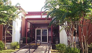
<span class="mw-page-title-main">Winn Parish, Louisiana</span> Parish in Louisiana, United States

Winn Parish is a parish located in the U.S. state of Louisiana. As of the 2020 census, the population was 13,755. Its seat is Winnfield. The parish was founded in 1852. It is last in alphabetical order of Louisiana's sixty-four parishes. Winn is separated from Natchitoches Parish along U.S. Highway 71 by Saline Bayou, the first blackwater protected waterway in the American South.

<span class="mw-page-title-main">Tensas Parish, Louisiana</span> Parish in Louisiana, United States

Tensas Parish is a parish located in the northeastern section of the State of Louisiana; its eastern border is the Mississippi River. As of the 2020 census, the population was 4,147. It is the least populated parish in Louisiana. The parish seat is St. Joseph. The name Tensas is derived from the historic indigenous Taensa people. The parish was founded in 1843 following Indian Removal.

<span class="mw-page-title-main">St. Mary Parish, Louisiana</span> Parish in Louisiana, United States

St. Mary Parish is a parish located in the U.S. state of Louisiana. As of the 2020 census, the population was 49,406. The parish seat is Franklin. The parish was created in 1811.

<span class="mw-page-title-main">St. Martin Parish, Louisiana</span> Parish in Louisiana, United States

St. Martin Parish is a parish located in the U.S. state of Louisiana, founded in 1811. Its parish seat is St. Martinville, and the largest city is Breaux Bridge. At the 2020 census, the population was 51,767. St. Martin Parish is part of the Lafayette metropolitan area in the region of Acadiana, along the Gulf Coast.
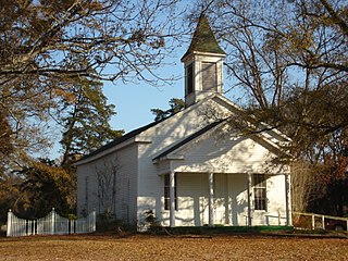
<span class="mw-page-title-main">Richland Parish, Louisiana</span> Parish in Louisiana, United States

Richland Parish is a parish located in the North Louisiana Delta Country in the U.S. state of Louisiana, known for its fertile, flat farmland, cane brakes, and open spaces. The parish had a population of 20,043 at the 2020 United States census. The name Richland was chosen due to the rich production from farming. The parish seat and largest community is Rayville.

<span class="mw-page-title-main">Rapides Parish, Louisiana</span> Parish in Louisiana, United States

Rapides Parish is a parish located in the U.S. state of Louisiana. As of the 2020 census, the population was 130,023. The parish seat is Alexandria, which developed along the Red River of the South. Rapides is the French word for "rapids". The parish was created in 1807 after the United States acquired this territory in the Louisiana Purchase.

<span class="mw-page-title-main">Ouachita Parish, Louisiana</span> Parish in Louisiana, United States

Ouachita Parish is located in the northern part of the U.S. state of Louisiana. As of the 2020 census, the population was 160,368. The parish seat is Monroe. The parish was formed in 1807.

<span class="mw-page-title-main">Morehouse Parish, Louisiana</span> Parish in Louisiana, United States

Morehouse Parish is a parish located in the U.S. state of Louisiana. As of the 2020 census, the population was 25,629. The parish seat is Bastrop. The parish was formed in 1844.

<span class="mw-page-title-main">Madison Parish, Louisiana</span> Parish in Louisiana, United States

Madison Parish is a parish located on the northeastern border of the U.S. state of Louisiana, in the delta lowlands along the Mississippi River. As of the 2020 census, the population was 10,017. Its parish seat is Tallulah. The parish was formed in 1839.

<span class="mw-page-title-main">Lincoln Parish, Louisiana</span> Parish in Louisiana, United States

Lincoln Parish is a parish located in the U.S. state of Louisiana. As of the 2020 census, the population was 48,396. The parish seat is Ruston. The parish was created on February 24, 1873, from parts of Bienville, Claiborne, Union, and Jackson parishes, and its boundaries have changed only once. This makes Lincoln Parish one of the Reconstruction parishes.

<span class="mw-page-title-main">LaSalle Parish, Louisiana</span> Parish in Louisiana, United States

LaSalle Parish is a parish located in the U.S. state of Louisiana. As of the 2020 United States Census, the population was 14,791. The parish seat is Jena. The parish was created in 1910 from the western section of Catahoula Parish and named for René-Robert Cavelier, Sieur de La Salle.

<span class="mw-page-title-main">Concordia Parish, Louisiana</span> Parish in Louisiana, United States

Concordia Parish borders the Mississippi River in eastern central Louisiana. As of the 2020 census, the population was 18,687. The parish seat is Vidalia. The parish was formed in 1807.

<span class="mw-page-title-main">Catahoula Parish, Louisiana</span> Parish in Louisiana, United States

Catahoula Parish is a parish in the U.S. state of Louisiana. As of the 2020 census, the population was 8,906. Its seat is Harrisonburg, on the Ouachita River. The parish was formed in 1808, shortly after the United States acquired this territory in the Louisiana Purchase of 1803.

<span class="mw-page-title-main">Caldwell Parish, Louisiana</span> Parish in Louisiana, United States

Caldwell Parish is a parish located in the U.S. state of Louisiana. As of 2020, its population was 9,645. The parish seat is Columbia.

<span class="mw-page-title-main">Assumption Parish, Louisiana</span> Parish in Louisiana, United States

Assumption Parish is a parish located in the U.S. state of Louisiana. As of the 2020 census, the population was 21,039. Its parish seat is Napoleonville. Assumption Parish was established in 1807, as one of the original parishes of the Territory of Orleans.

<span class="mw-page-title-main">Sicily Island, Louisiana</span> Village in Louisiana, United States

Sicily Island is a village in Catahoula Parish, Louisiana, United States. The population was 336 at the 2020 census.

<span class="mw-page-title-main">Clayton, Louisiana</span> Town in Louisiana, United States

Clayton is a town in northern Concordia Parish, Louisiana, United States. The population was 711 at the 2010 census. Cotton is a principal commodity in the area. Clayton is located on the Tensas River, important for fishing and boating, promoted through a U.S. Army Corps of Engineers-maintained boat launch. The Tensas River merges with the Black River in Jonesville in Catahoula Parish.

<span class="mw-page-title-main">Winnsboro, Louisiana</span> City in Louisiana, United States

Winnsboro is a city in, and the parish seat of Franklin Parish, Louisiana, United States. As of 2020, its population was 4,862.

References

  1. 1 2 "Explore Census Data". data.census.gov. Retrieved December 19, 2021.
  2. "Find a County". National Association of Counties. Archived from the original on May 31, 2011. Retrieved June 7, 2011.
  3. "Franklin Parish". Center for Cultural and Eco-Tourism. Retrieved September 4, 2014.
  4. Gannett, Henry (1905). The Origin of Certain Place Names in the United States. Govt. Print. Off. pp.  131.
  5. "2010 Census Gazetteer Files". United States Census Bureau. August 22, 2012. Archived from the original on September 28, 2013. Retrieved August 20, 2014.
  6. "U.S. Decennial Census". United States Census Bureau. Retrieved August 20, 2014.
  7. "Historical Census Browser". University of Virginia Library. Retrieved August 20, 2014.
  8. "Population of Counties by Decennial Census: 1900 to 1990". United States Census Bureau. Retrieved August 20, 2014.
  9. "Census 2000 PHC-T-4. Ranking Tables for Counties: 1990 and 2000" (PDF). United States Census Bureau. Archived (PDF) from the original on March 27, 2010. Retrieved August 20, 2014.
  10. "State & County QuickFacts". United States Census Bureau. Archived from the original on June 6, 2011. Retrieved August 9, 2013.
  11. Hassell, Otis (January 1, 1971). "Assessments Show Gain Of $500,000 In Franklin". The Monroe News-Star. p. 20. Retrieved July 4, 2022.
  12. "United States v. Franklin Parish Sch. Bd., CIVIL ACTION NO. 70-15632". casetext.com. Retrieved July 4, 2022.
  13. "Explore Franklin Academy in Winnsboro, LA". GreatSchools.org. Retrieved July 4, 2022.
  14. "Explore Franklin Parish High School in Winnsboro, LA". GreatSchools.org. Retrieved July 4, 2022.
  15. "Annual festival draws large crowd, positively affects local economy". Hanna Newspapers.
  16. Leip, David. "Dave Leip's Atlas of U.S. Presidential Elections". uselectionatlas.org. Retrieved March 7, 2018.

32°08′N91°40′W / 32.14°N 91.67°W / 32.14; -91.67