A ZIP Code is a system of postal codes used by the United States Postal Service (USPS). The term ZIP was chosen to suggest that the mail travels more efficiently and quickly when senders use the code in the postal address.
Braithwaite is an unincorporated community in Plaquemines Parish, Louisiana, United States. Braithwaite is located on the Mississippi River and Louisiana Highway 39 in northern Plaquemines Parish, 9.6 miles (15.4 km) southeast of New Orleans. Braithwaite has a post office with ZIP code 70040, which opened on September 19, 1902. Two of the first deaths in the United States caused by Hurricane Isaac in 2012 occurred in Braithwaite, where a couple drowned in their home on August 30.
Gardner is an unincorporated community in Rapides Parish, Louisiana, United States. Gardner is part of the Alexandria Metropolitan Statistical Area. It is located at the junction of Louisiana highways 28 and 121, 15 miles (24 km) west-southwest of Alexandria. Gardner has a population of 1,965. Gardner's post office ZIP code 71431. China Grove, a house listed on the National Register of Historic Places, is located in Gardner.
Weyanoke is an unincorporated community in West Feliciana Parish, Louisiana, United States. Weyanoke is located on Louisiana Highway 66, 12.2 miles (19.6 km) north-northwest of St. Francisville. Weyanoke has a post office with ZIP code 70787. Some sites that are listed on the National Register of Historic Places within Weyanoke are St. Mary's Episcopal Church and Rosebank Plantation House.
Pelican is an unincorporated community in DeSoto Parish, Louisiana, United States. The community is at the junction of Louisiana Highways 483 and 513, 12.6 miles (20.3 km) south-southeast of Mansfield and 30 miles (48 km) north-northwest of Natchitoches. Pelican has a post office with ZIP code 71063. With the population being an estimated 705 people, Pelican is also near an area where a "Civil War Battlefield" takes place. Pelican, Louisiana also has forests but they are know as "woods", in this area. Deer hunting is a common activity participated in the community whenever Deer season arrives. Pelican is set at a location very near, from Mansfield, Louisiana.
Singer is an unincorporated community and census-designated place in Beauregard Parish, Louisiana, United States. Its population was 287 as of the 2010 census. Its ZIP code is 70660.
Pine Grove is an unincorporated community in St. Helena Parish, Louisiana, United States. Pine Grove is located at the junction of Louisiana highways 16 and 449, 9.7 miles (15.6 km) southwest of Greensburg. The community has a post office with ZIP code 70453.
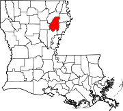
Evangeline is an unincorporated community in Acadia Parish, Louisiana, United States. The community is located at the junction of Louisiana Highways 97 and 100, 5.9 miles (9.5 km) east-northeast of Jennings. Evangeline has a post office with ZIP code 70537.
Ragley is an unincorporated community in Beauregard Parish, Louisiana, United States. The community is located at the junction of U.S. routes 171 and 190, 20 miles (32 km) north of Lake Charles. Ragley has a post office with ZIP code 70657.
Batchelor is an unincorporated community in Pointe Coupee Parish, Louisiana, United States. The community is located at the intersection of Louisiana highways 1 and 419 near the south bank of the Mississippi River, and runs north-northwest up from the village of Morganza. Batchelor has a post office with ZIP code 70715, which opened on July 26, 1902. Down in the rural area of Batchelor is Raccourci Old River and Oxbow Lake in the Mississippi River System.
Paulina is an unincorporated community and census-designated place in St. James Parish, Louisiana, United States. It was first listed in the 2010 census with a population of 1,178. The community is located on the east bank of the Mississippi River in the eastern part of the parish, west of Lutcher and across the river from Vacherie. Paulina has a post office with ZIP code 70763.
Fairbanks is an unincorporated community in Ouachita Parish, Louisiana, United States. The community is located along Louisiana Highway 134 near U.S. Route 165, 10.5 miles (16.9 km) north-northeast of downtown Monroe. Fairbanks has a post office with ZIP code 71240.
Jones is an unincorporated community in Morehouse Parish, Louisiana, United States. The community is located along U.S. Route 165, 3.7 miles (6.0 km) north-northeast of Bonita. Jones has a post office with ZIP code 71250.
Sondheimer is an unincorporated community in East Carroll Parish, Louisiana, United States. The community is located on U.S. Route 65, 17.5 miles (28.2 km) south of Lake Providence. Sondheimer has a post office with ZIP code 71276.
Rhinehart is an unincorporated community in La Salle and Catahoula parishes, Louisiana, United States. The community is located on Louisiana Highway 8, 8.1 miles (13.0 km) east-southeast of Jena. Rhinehart has a post office with ZIP code 71363.
Ruby is an unincorporated community in Rapides Parish, Louisiana, United States. It is a populated place located within the Parish Governing Authority District C. The community is located on Louisiana Highway 454, 14.3 miles (23.0 km) southeast of Alexandria. Ruby had a post office from April 18, 1900, until October 8, 2011; it still has its own ZIP code, 71365. The elevation of Ruby is 98 feet. Rapides Parish is in the Central Time Zone.
Trout is an unincorporated community and census-designated place in La Salle Parish, Louisiana, United States. The community is located on U.S. Route 84, 2.8 miles (4.5 km) west of Jena. Trout has a post office with ZIP code 71371.
Wildsville is an unincorporated community in Concordia Parish, Louisiana, United States. The community is located on U.S. Route 84, 2 miles (3.2 km) east of Jonesville. Wildsville had a post office until May 13, 1995; it still has its own ZIP code, 71377.
Elmer is an unincorporated community in Rapides Parish, Louisiana, United States. The community is located on Louisiana Highway 112, 18.6 miles (29.9 km) southwest of Alexandria. Elmer has a post office with ZIP code 71424, which opened on May 15, 1888.
Gorum is an unincorporated community in Natchitoches Parish, Louisiana, United States. The community is located on Louisiana Highway 119, 24 miles (39 km) south-southeast of Natchitoches. Gorum has a post office with ZIP code 71434, which opened on November 21, 1890.