East Carroll Parish, Louisiana

Last updated

East Carroll Parish
East Carroll Parish, LA, Courthouse IMG 7409.JPG
East Carroll Parish Courthouse in Lake Providence
Map of Louisiana highlighting East Carroll Parish.svg
Location within the U.S. state of Louisiana
Louisiana in United States.svg
Louisiana's location within the U.S.
Coordinates: 32°44′N91°14′W / 32.73°N 91.24°W / 32.73; -91.24
CountryFlag of the United States.svg United States
StateFlag of Louisiana.svg  Louisiana
FoundedMarch 26, 1877
Named for Charles Carroll of Carrollton
Seat Lake Providence
Largest townLake Providence
Area
  Total442 sq mi (1,140 km2)
  Land421 sq mi (1,090 km2)
  Water22 sq mi (60 km2)  4.9%
Population
 (2020)
  Total7,459
  Density17/sq mi (6.5/km2)
Time zone UTC−6 (Central)
  Summer (DST) UTC−5 (CDT)
Congressional district 5th

East Carroll Parish (French : Paroisse de Carroll Est) is a parish located in the Mississippi Delta in northeastern Louisiana. As of 2020, its population was 7,459. [1] The parish seat is Lake Providence. [2] An area of cotton plantations in the antebellum era, the parish in the early 21st century has about 74% of its land devoted to agriculture.

Contents

History

This area is part of the delta along the western edge of the Mississippi River, long subject to the seasonal flooding that gave the area fertile soils. It was occupied by indigenous peoples for thousands of years. European explorers encountered the historic tribes of the Caddo and Choctaw in this area, as well as the Natchez on the east side of the Mississippi River.

In the 1830s, the United States forced out most of the people of the Five Civilized Tribes from the Southeast to west of the Mississippi River in Indian Territory to make way for development by European Americans. Areas along the river were cleared and developed for cultivation of cotton, the major commodity crop in the Deep South before the Civil War. The cotton was cultivated and processed on plantations by large groups of enslaved African-American laborers.

Prior to 1814, all of the territory covered by the current East Carroll Parish was part of the now defunct Warren Parish. The original Carroll Parish, before it was divided into "East" and "West" segments after Reconstruction, was named for Charles Carroll of Carrollton, [3] Maryland, the only Roman Catholic signer of the Declaration of Independence. This and other nearby parishes along the Mississippi River were called the Natchez District, referring to the major port on the Mississippi side of the river. Both areas were developed for cotton plantations.

Given the dependence of plantation agriculture on enslaved workers, the population of this area was majority African American well before the American Civil War. Carroll Parish had 11,000 slaves in 1860, more than three times the white population of the total parish. [4] Most were located on the plantations in the floodplain along the Mississippi River. During the war, many slaves joined Union lines and served in the United States Colored Troops; Louisiana had more former slaves enlisted in the USCT than six other southern states combined. [5]

Carroll Parish covered a large area and the parish was split by the state legislature in 1877, following the Reconstruction era. [6] West Carroll Parish, with territory west of the Bayou Macon, was majority-white and voted Democratic.

After the war, this area continued to be dominated by agriculture and was largely rural. Numerous black Union veterans settled in East Carroll Parish and some owned their own land, especially in an area called Soldiers' Rest, site of a former Union camp. They developed an independent community. With blacks outnumbering whites in Carroll Parish by a seven-to-one margin, and with combat experience, they resisted efforts in the 1870s to suppress their population. Voters in the larger Carroll Parrish elected blacks to the positions of sheriff, state representative, clerk of the court, and several justices of the peace, and hired black constables, giving blacks a voice at the local level. [7]

But white conservative Democrats formed groups noted as Bulldozers, conducting violence against black voters, teachers, and supporters to suppress their activities. [8] White conservatives succeeded in regaining control of the state legislature by the end of Reconstruction. By creating West Carroll Parish in 1877, they had an additional jurisdiction dominated by white Democrats.

Two decades later, at the end of the 19th century, the state legislature passed a new constitution in 1898 that raised barriers to voter registration, with rules applied against African Americans. They were effectively disenfranchised well into the 1960s. The legislature passed segregation and Jim Crow laws of increasing severity into the early 20th century. [9]

In 1907 U.S. President Theodore Roosevelt came to East Carroll Parish near Lake Providence for a black bear hunt. When a particular bear managed to elude the hunters, the president's camp was moved to Bear Lake in Madison Parish near Tallulah. The 21-year-old Arthur Spencer of Richland Parish took a photograph of Roosevelt with the heavily armed hunting party. Among the hunters was John M. Parker, future governor of Louisiana and the vice-presidential choice of the Bull Moose Party ticket in the 1912 presidential election. [10]

Law and government

From 1922 to 1962, African Americans were prohibited from registering to vote in East Carroll Parish through a combination of laws and practices such as literacy tests. [11] The first African Americans were registered after the ruling in U.S. v. Manning (1962) found that the prohibition of voter registration for Black people violated the Civil Rights Act of 1960. It was not, however, until the Voting Rights Act of 1965 became law that large numbers of African Americans became registered to vote, and they continued to vote at high levels. They have tended to support Democratic Party candidates, as the national party had supported the civil rights movement. As East Carroll Parish is majority black, its voters still favor Democratic Party candidates. Most conservative whites have shifted since the late 20th century to the Republican Party, which candidates dominate elections in majority-white areas of the state.

In 1988, Governor Michael S. Dukakis of Massachusetts carried East Carroll Parish over then Vice President George Herbert Walker Bush, 1,809 votes (52.3 percent) to 1,536 (44.4 percent). [12] In the 2004 presidential race, East Carroll gave the Democrat John Kerry - John Edwards slate 1,980 ballots (58 percent) to 1,357 votes (40 percent) for the George W. Bush - Richard B. Cheney slate. [13]

In 2012, U.S. President Barack H. Obama swept the parish with 2,478 votes (61.8 percent) to Republican Mitt Romney's 1,508 (37.6 percent). [14] In 2008, Obama had handily defeated John McCain in East Carroll Parish, 2,267 (63.7 percent) to 1,254 (35.2 percent). [15]

Geography

According to the U.S. Census Bureau, the parish has a total area of 442 square miles (1,140 km2), of which 421 square miles (1,090 km2) is land and 22 square miles (57 km2) (4.9%) is water. [16]

Major highways

Adjacent counties and parishes

Communities

Towns

Unincorporated communities

Demographics

Historical population
CensusPop.Note
1880 12,134
1890 12,3621.9%
1900 11,373−8.0%
1910 11,6372.3%
1920 11,231−3.5%
1930 15,81540.8%
1940 19,02320.3%
1950 16,302−14.3%
1960 14,433−11.5%
1970 12,884−10.7%
1980 11,772−8.6%
1990 9,709−17.5%
2000 9,421−3.0%
2010 7,759−17.6%
2020 7,459−3.9%
U.S. Decennial Census [17]
1790-1960 [18] 1900-1990 [19]
1990-2000 [20] 2010 [21]

2020 census

East Carroll Parish, Louisiana – Racial and ethnic composition
Note: the US Census treats Hispanic/Latino as an ethnic category. This table excludes Latinos from the racial categories and assigns them to a separate category. Hispanics/Latinos may be of any race.
Race / Ethnicity (NH = Non-Hispanic)Pop 2000 [22] Pop 2010 [23] Pop 2020 [24] % 2000% 2010% 2020
White alone (NH)2,9332,1982,03431.13%28.33%27.27%
Black or African American alone (NH)6,2975,3245,16466.84%68.62%69.23%
Native American or Alaska Native alone (NH)171620.18%0.21%0.03%
Asian alone (NH)3144170.33%0.57%0.23%
Pacific Islander alone (NH)0000.00%0.00%0.00%
Other race alone (NH)2050.02%0.00%0.07%
Mixed race or Multiracial (NH)29501220.31%0.64%1.64%
Hispanic or Latino (any race)1121271151.19%1.64%1.54%
Total9,4217,7597,459100.00%100.00%100.00%

As of the 2020 United States census, there were 7,459 people, 2,037 households, and 1,193 families residing in the parish.

Economy and poverty data

East Carroll Parish is still largely agricultural, with 74% of its land devoted to crops. As farm labor needs have been reduced by mechanization and farms have been consolidated into larger units, jobs in the area have been reduced. Agriculture may take the form of aquaculture, and row crops.

Of 3,197 counties ranked by the U.S. Census Bureau in 2011 for "estimated percent of people of all ages in poverty", East Carroll Parish was fifth. It was estimated that 44 percent of the rural county's residents lived in poverty. [25]

Education

Public schools in East Carroll Parish are operated by the East Carroll Parish School Board. In an infographic released by Graphiq, East Carroll Parish is ranked as the least educated parish in Louisiana with 32.29% of 25 year-olds without a high school diploma and 9.4% of 25 year-olds with a bachelor's degree or higher. [26]

Notable people

Politics

Unlike neighbouring West Carroll Parish, and Louisiana generally, East Carroll Parish is a Democratic stronghold, owing primarily to its majority African-American population. It was one of just two parishes (the other being Orleans Parish, home to New Orleans) to support the Democratic candidate in the 1999 Louisiana gubernatorial election. [27] Furthermore, in presidential elections, it has not supported a Republican since 1972, when Republican incumbent Richard Nixon carried 63 of the state's 64 parishes, and East Carroll was still Nixon's fourth weakest parish in the state. East Carroll rejected Ronald Reagan in both 1980 and 1984. The last Democratic candidate to win less than 60% of the parish's vote in a presidential was John Kerry, who ran against President George W. Bush of neighboring Texas. Four years prior, in 2000, it had been Al Gore's fourth best parish statewide. However, East Carroll was previously known to support third-party segregationists. In 1948, it gave Strom Thurmond over 60% of the vote (Republican candidate Thomas Dewey won less than a fifth as many votes as Thurmond). In 1960, it gave a plurality to George Wallace of Alabama. And in 1964, the parish gave 85% of its vote to Republican Barry Goldwater, who lost in a landslide to Lyndon Johnson nationally, compared to just 15% for Lyndon Johnson. Before 1964, like most of the south, East Carroll was powerfully Democratic, giving just 3 votes to Republican Charles Evans Hughes, and even giving 77% of its vote to Al Smith, who performed considerably worse in the south than past Democratic candidates, losing traditionally Democratic strongholds including Texas, Florida and North Carolina. More recently, East Carroll has trended further and further Democratic. In fact, in 2012 Barack Obama won more votes than Bill Clinton in 1996, and in 2016 Hillary Clinton won more votes than her husband, Bill Clinton, had won in 1992 (albeit by a very thin margin of three votes). [28]

United States presidential election results for East Carroll Parish, Louisiana [29]
Year Republican Democratic Third party
No.%No.%No.%
2020 1,08035.57%1,90062.58%561.84%
2016 1,05936.03%1,83862.54%421.43%
2012 1,50837.62%2,47861.83%220.55%
2008 1,25435.23%2,26763.70%381.07%
2004 1,35739.97%1,98058.32%581.71%
2000 1,28039.45%1,87657.81%892.74%
1996 1,00829.55%2,14963.00%2547.45%
1992 1,14233.84%1,83554.37%39811.79%
1988 1,53644.39%1,80952.28%1153.32%
1984 1,97447.77%2,08950.56%691.67%
1980 1,86744.13%2,28353.96%811.91%
1976 1,68140.43%2,36756.93%1102.65%
1972 1,73648.40%1,66146.31%1905.30%
1968 58613.89%1,92645.66%1,70640.45%
1964 1,48684.96%26315.04%00.00%
1960 44829.40%36423.88%71246.72%
1956 41530.81%54540.46%38728.73%
1952 75745.19%91854.81%00.00%
1948 11610.51%32329.26%66560.24%
1944 35727.85%92572.15%00.00%
1940 27020.85%1,02579.15%00.00%
1936 9510.49%81189.51%00.00%
1932 243.10%75196.90%00.00%
1928 13022.97%43677.03%00.00%
1924 7120.40%27779.60%00.00%
1920 83.14%24796.86%00.00%
1916 31.35%21998.65%00.00%
1912 42.14%16186.10%2211.76%

See also

Related Research Articles

<span class="mw-page-title-main">Macon County, Alabama</span> County in Alabama, United States

Macon County is a county located in the east central part of the U.S. state of Alabama. As of the 2020 census, the population was 19,532. Its county seat is Tuskegee. Its name is in honor of Nathaniel Macon, a member of the United States Senate from North Carolina.

<span class="mw-page-title-main">Newton County, Texas</span> County in Texas, United States

Newton County is the easternmost county in the U.S. state of Texas. As of the 2020 census, its population was 12,217. Its county seat is Newton. The county is named for John Newton, a veteran of the American Revolutionary War.

<span class="mw-page-title-main">King County, Texas</span> County in Texas, United States

King County is a county located in the U.S. state of Texas. The population was 265 at the 2020 census, making it the second-least populated county in Texas and the third-least populated county in the United States. King County has no incorporated communities. Its county seat is the census-designated place (CDP) of Guthrie. The county was created in 1876 and organized in 1891. It is named for William Philip King, who died at the Battle of the Alamo.

<span class="mw-page-title-main">Hancock County, Georgia</span> County in Georgia, United States

Hancock County is a county located in the U.S. state of Georgia. As of the 2020 census, the population was 8,735. The county seat is Sparta. The county was created on December 17, 1793, and named for John Hancock, a Founding Father of the American Revolution.

<span class="mw-page-title-main">West Carroll Parish, Louisiana</span> Parish in Louisiana, United States

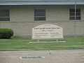
West Carroll Parish is a parish located in the northeastern part of the U.S. state of Louisiana. As of the 2020 census, the population was 9,751. The parish seat is Oak Grove. The parish was founded in 1877, when Carroll Parish was divided.

<span class="mw-page-title-main">Webster Parish, Louisiana</span> Parish in Louisiana, United States

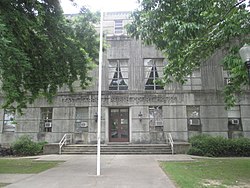
Webster Parish is a parish located in the northwestern section of the U.S. state of Louisiana. The seat of the parish is Minden.

<span class="mw-page-title-main">Tensas Parish, Louisiana</span> Parish in Louisiana, United States

Tensas Parish is a parish located in the northeastern section of the State of Louisiana; its eastern border is the Mississippi River. As of the 2020 census, the population was 4,147. It is the least populated parish in Louisiana. The parish seat is St. Joseph. The name Tensas is derived from the historic indigenous Taensa people. The parish was founded in 1843 following Indian Removal.

<span class="mw-page-title-main">St. James Parish, Louisiana</span> Parish in Louisiana, United States

St. James Parish is a parish located in the U.S. state of Louisiana. The parish seat is Convent. The parish was created in 1807. St. James Parish is a part of the New Orleans–Metairie, Louisiana metropolitan statistical area, sitting between New Orleans and Baton Rouge on the Mississippi River. According to the 2020 United States census, the population was 20,192.

<span class="mw-page-title-main">Rapides Parish, Louisiana</span> Parish in Louisiana, United States

Rapides Parish is a parish located in the U.S. state of Louisiana. As of the 2020 census, the population was 130,023. The parish seat is Alexandria, which developed along the Red River of the South. Rapides is the French word for "rapids". The parish was created in 1807 after the United States acquired this territory in the Louisiana Purchase.

<span class="mw-page-title-main">Plaquemines Parish, Louisiana</span> Parish in Louisiana, United States

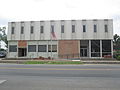
Plaquemines Parish is a parish located in the U.S. state of Louisiana. With a population of 23,515 at the 2020 census, the parish seat is Pointe à la Hache and the largest community is Belle Chasse. The parish was formed in 1807.

<span class="mw-page-title-main">Natchitoches Parish, Louisiana</span> Parish in Louisiana, United States

Natchitoches Parish is a parish located in the U.S. state of Louisiana. As of the 2020 census, the population was 37,515. The parish seat and most populous municipality is Natchitoches, the largest by land area is Ashland, and the most density populated area is Campti. The parish was formed in 1805.

<span class="mw-page-title-main">Morehouse Parish, Louisiana</span> Parish in Louisiana, United States

Morehouse Parish is a parish located in the U.S. state of Louisiana. As of the 2020 census, the population was 25,629. The parish seat is Bastrop. The parish was formed in 1844.

<span class="mw-page-title-main">Madison Parish, Louisiana</span> Parish in Louisiana, United States

Madison Parish is a parish located on the northeastern border of the U.S. state of Louisiana, in the delta lowlands along the Mississippi River. As of the 2020 census, the population was 10,017. Its parish seat is Tallulah. The parish was formed in 1839.

<span class="mw-page-title-main">Jackson Parish, Louisiana</span> Parish in Louisiana, United States

Jackson Parish is a parish in the northern part of the U.S. state of Louisiana. As of the 2020 census, the population was 15,031. The parish seat is Jonesboro. The parish was formed in 1845 from parts of Claiborne, Ouachita, and Union Parishes. In the twentieth century, this part of the state had several small industrial mill towns, such as Jonesboro.

<span class="mw-page-title-main">Grant Parish, Louisiana</span> Parish in Louisiana, United States

Grant Parish is a parish located in the North Central portion of the U.S. state of Louisiana. As of the 2020 census, the population was 22,169. The parish seat is Colfax. The parish was founded in 1869 during the Reconstruction era.

<span class="mw-page-title-main">East Baton Rouge Parish, Louisiana</span> Parish in Louisiana, United States

East Baton Rouge Parish is the most populous parish in the U.S. state of Louisiana. Its population was 456,781 at the 2020 census. The parish seat is Baton Rouge, Louisiana's state capital. East Baton Rouge Parish is located within the Greater Baton Rouge area.

<span class="mw-page-title-main">Concordia Parish, Louisiana</span> Parish in Louisiana, United States

Concordia Parish borders the Mississippi River in eastern central Louisiana. As of the 2020 census, the population was 18,687. The parish seat is Vidalia. The parish was formed in 1807.

<span class="mw-page-title-main">Claiborne Parish, Louisiana</span> Parish in Louisiana, United States

Claiborne Parish is a parish located in the northwestern section of the U.S. state of Louisiana. The parish was formed in 1828, and was named for the first Louisiana governor, William C. C. Claiborne. As of the 2020 census, the population was 14,170. The parish seat is Homer.

<span class="mw-page-title-main">Bossier Parish, Louisiana</span> Parish in Louisiana, United States

Bossier Parish is a parish located in the northwestern part of the U.S. state of Louisiana. At the 2020 census, the population was 128,746.

<span class="mw-page-title-main">Lake Providence, Louisiana</span> Town in Louisiana, United States

Lake Providence is a town in, and the parish seat of, East Carroll Parish in northeastern Louisiana. The population was 5,104 at the 2000 census and declined by 21.8 percent to 3,991 in 2010. The town's poverty rate is approximately 55 percent; the average median household income is $16,500, and the average age is 31.

References

  1. "Explore Census Data". data.census.gov. Retrieved December 19, 2021.
  2. "Find a County". National Association of Counties. Archived from the original on July 12, 2012. Retrieved June 7, 2011.
  3. Gannett, Henry (1905). The Origin of Certain Place Names in the United States. Govt. Print. Off. pp.  112.
  4. Scott (2003), p. 17
  5. Scott (2003), p. 18
  6. "East Carroll Parish". Center for Cultural and Eco-tourism. Retrieved September 4, 2014.
  7. Scott (2003), p. 19
  8. Scott (2003), p. 20
  9. Adam Fairclough, Race & Democracy: The Civil Rights Struggle in Louisiana, 1915-1972, University of Georgia Press, 1999
  10. "East Carroll Parish Genealogy". eastcarrollparishlouisianagenealogy.blogspot.com. Retrieved June 10, 2013.
  11. John H. Scott with Cleo Scott Brown, Witness to the Truth, University of South Carolina Press, 2003
  12. "East Carroll Parish presidential election returns, November 8, 1988". staticresults.sos.la.gov. Retrieved November 20, 2012.
  13. "East Carroll Parish presidential election returns, November 2, 2004". staticresults.sos.la.gov. Retrieved November 20, 2012.
  14. "Louisiana general election returns, November 6, 2012". staticresults.sos.la.gov. Retrieved November 11, 2012.
  15. "East Carroll Parish presidential election returns, November 4, 2008". staticresults.sos.la.gov. Retrieved November 20, 2012.
  16. "2010 Census Gazetteer Files". United States Census Bureau. August 22, 2012. Archived from the original on September 28, 2013. Retrieved August 20, 2014.
  17. "U.S. Decennial Census". United States Census Bureau. Retrieved August 20, 2014.
  18. "Historical Census Browser". University of Virginia Library. Retrieved August 20, 2014.
  19. "Population of Counties by Decennial Census: 1900 to 1990". United States Census Bureau. Retrieved August 20, 2014.
  20. "Census 2000 PHC-T-4. Ranking Tables for Counties: 1990 and 2000" (PDF). United States Census Bureau. Archived (PDF) from the original on March 27, 2010. Retrieved August 20, 2014.
  21. "State & County QuickFacts". United States Census Bureau. Archived from the original on June 6, 2011. Retrieved August 9, 2013.
  22. "P004: Hispanic or Latino, and Not Hispanic or Latino by Race – 2000: DEC Summary File 1 – East Carroll Parish, Louisiana". United States Census Bureau. Retrieved January 26, 2024.
  23. "P2: Hispanic or Latino, and Not Hispanic or Latino by Race – 2010: DEC Redistricting Data (PL 94-171) – East Carroll Parish, Louisiana". United States Census Bureau. Retrieved January 26, 2024.
  24. "P2: Hispanic or Latino, and Not Hispanic or Latino by Race – 2020: DEC Redistricting Data (PL 94-171) – East Carroll Parish, Louisiana". United States Census Bureau. Retrieved January 26, 2024.
  25. "Table 1: 2011 Poverty and Median Income Estimates - Counties". Small Area Income and Poverty Estimates. U.S. Census Bureau. 2011. Archived from the original on October 10, 2013.
  26. "The least educated place in every state". www.msn.com. Archived from the original on January 4, 2017. Retrieved January 3, 2017.
  27. "1999 Gubernatorial General Election Results". uselectionsatlas.org.
  28. Leip, David. "Dave Leip's Atlas of U.S. Presidential Elections".
  29. Leip, David. "Dave Leip's Atlas of U.S. Presidential Elections". uselectionatlas.org. Retrieved March 7, 2018.

Further reading

32°44′N91°14′W / 32.73°N 91.24°W / 32.73; -91.24