Caldwell Parish, Louisiana

Last updated

Caldwell Parish
Caldwell Parish Courthouse, Columbia, LA IMG 2712.JPG
Caldwell Parish Courthouse in Columbia
Map of Louisiana highlighting Caldwell Parish.svg
Location within the U.S. state of Louisiana
Louisiana in United States.svg
Louisiana's location within the U.S.
Coordinates: 32°05′N92°07′W / 32.09°N 92.12°W / 32.09; -92.12
CountryFlag of the United States.svg United States
StateFlag of Louisiana.svg  Louisiana
Founded1838
Named for Local Caldwell family
Seat Columbia
Largest village Clarks
Area
  Total541 sq mi (1,400 km2)
  Land529 sq mi (1,370 km2)
  Water11 sq mi (30 km2)  2.1%
Population
 (2020)
  Total9,645
  Density18/sq mi (6.9/km2)
Time zone UTC−6 (Central)
  Summer (DST) UTC−5 (CDT)
Congressional district 5th
Website www.caldwellparish.org
Caldwell Parish sign, LA, IMG 2755.JPG

Caldwell Parish (French : Paroisse de Caldwell) is a parish located in the U.S. state of Louisiana. As of 2020, its population was 9,645. [1] The parish seat is Columbia. [2]

Contents

Geography

According to the U.S. Census Bureau, the parish has a total area of 541 square miles (1,400 km2), of which 529 square miles (1,370 km2) is land and 11 square miles (28 km2) (2.1%) is water. [3]

Major highways

Adjacent parishes

Communities

Town

Villages

Census-designated place

Unincorporated communities

Demographics

Historical population
CensusPop.Note
1840 2,017
1850 2,81539.6%
1860 4,83371.7%
1870 4,820−0.3%
1880 5,76719.6%
1890 5,8140.8%
1900 6,91719.0%
1910 8,59324.2%
1920 9,51410.7%
1930 10,4309.6%
1940 12,04615.5%
1950 10,293−14.6%
1960 9,004−12.5%
1970 9,3543.9%
1980 10,76115.0%
1990 9,810−8.8%
2000 10,5607.6%
2010 10,132−4.1%
2020 9,645−4.8%
U.S. Decennial Census [4]
1790-1960 [5] 1900-1990 [6]
1990-2000 [7] 2010-2013 [8]
Caldwell Parish racial composition as of 2020 [1]
RaceNumberPercentage
White (non-Hispanic)7,55178.29%
Black or African American (non-Hispanic)1,52815.84%
Native American 190.2%
Asian 420.44%
Pacific Islander 30.03%
Other/Mixed 2812.91%
Hispanic or Latino 2212.29%

As of the 2020 United States census, there were 9,645 people, 3,665 households, and 2,534 families residing in the parish. As of the census [9] of 2000, there were 10,560 people, 3,941 households, and 2,817 families residing in the parish. The population density was 20 people per square mile (7.7 people/km2). There were 5,035 housing units at an average density of 10 per square mile (3.9/km2).

In 2000, the racial makeup of the parish was 80.43% White, 17.90% Black or African American, 0.45% Native American, 0.14% Asian, 0.47% from other races, and 0.61% from two or more races. 1.49% of the population were Hispanic or Latino of any race. In 2020, its racial makeup was 78.29% non-Hispanic white, 15.84% African American, 0.2% Native American, 0.445 Asian, 0.03% Pacific Islander, 2.91% multiracial or other, and 2.29% Hispanic or Latino of any race. [1]

Law enforcement

The Caldwell Parish Sheriff's Office is the primary law enforcement agency of the parish. [10]

Politics

United States presidential election results for Caldwell Parish, Louisiana [11]
Year Republican Democratic Third party
No.%No.%No.%
2020 3,97683.49%74515.64%410.86%
2016 3,82281.46%78816.79%821.75%
2012 3,64077.18%1,01621.54%601.27%
2008 3,69675.54%1,11822.85%791.61%
2004 3,30869.61%1,38429.12%601.26%
2000 2,81765.09%1,35931.40%1523.51%
1996 1,84240.40%2,11746.44%60013.16%
1992 1,75237.40%2,06144.00%87118.60%
1988 2,99765.74%1,42331.21%1393.05%
1984 3,34169.33%1,34827.97%1302.70%
1980 2,65357.91%1,78638.99%1423.10%
1976 1,89049.66%1,83048.08%862.26%
1972 2,30676.99%50816.96%1816.04%
1968 49013.19%97326.19%2,25260.62%
1964 2,53480.62%60919.38%00.00%
1960 71635.08%69434.00%63130.92%
1956 58735.17%46828.04%61436.79%
1952 96145.27%1,16254.73%00.00%
1948 1518.64%77744.45%82046.91%
1944 50530.66%1,14269.34%00.00%
1940 31816.01%1,66883.99%00.00%
1936 23514.63%1,37185.37%00.00%
1932 865.58%1,44893.96%70.45%
1928 28826.42%80273.58%00.00%
1924 7714.72%44284.51%40.76%
1920 12819.19%53980.81%00.00%
1916 203.47%55496.01%30.52%
1912 183.57%36672.62%12023.81%

Notable people

See also

Related Research Articles

<span class="mw-page-title-main">Adams County, Mississippi</span> County in Mississippi, United States

Adams County is a county located in the U.S. state of Mississippi. As of the 2020 census, the population was 29,538. The county seat is Natchez.

<span class="mw-page-title-main">Warren County, Mississippi</span> County in Mississippi, United States

Warren County is a county located in the U.S. state of Mississippi. Its western border is formed by the Mississippi River. As of the 2020 census, the population was 44,722. Its county seat is Vicksburg. Established by legislative act of December 22, 1809, Warren County is named for American Revolutionary War officer Joseph Warren.

<span class="mw-page-title-main">Walthall County, Mississippi</span> County in Mississippi, United States

Walthall County is a county located in the U.S. state of Mississippi. As of the 2020 census, the population was 13,884. Its county seat is Tylertown. The county is named after Civil War Confederate general and Mississippi Senator Edward C. Walthall.

<span class="mw-page-title-main">Marion County, Iowa</span> County in Iowa, United States

Marion County is a county in the U.S. state of Iowa. As of the 2020 census, the population was 33,414. The county seat is Knoxville. It is named for Francis Marion, a brigadier general from South Carolina in the American Revolutionary War.

<span class="mw-page-title-main">Union County, Arkansas</span> County in Arkansas, United States

Union County is a county located on the central southern border of the U.S. state of Arkansas. As of the 2020 census, the population was 39,054. The county seat is El Dorado. The county was formed on November 2, 1829, and named in recognition of the citizens' petition for a new county, which said that they were petitioning "in the spirit of Union and Unity." The county is directly adjacent to the south to Union Parish in the state of Louisiana.

<span class="mw-page-title-main">Webster Parish, Louisiana</span> Parish in Louisiana, United States

Webster Parish is a parish located in the northwestern section of the U.S. state of Louisiana. The seat of the parish is Minden.

<span class="mw-page-title-main">Vermilion Parish, Louisiana</span> Parish in Louisiana, United States

Vermilion Parish is a parish located in the U.S. state of Louisiana, created in 1844. The parish seat is Abbeville. Vermilion Parish is part of the Lafayette metropolitan statistical area, and located in southern Acadiana. At the 2020 U.S. census, the population was 57,359.

<span class="mw-page-title-main">St. Martin Parish, Louisiana</span> Parish in Louisiana, United States

St. Martin Parish is a parish located in the U.S. state of Louisiana, founded in 1811. Its parish seat is St. Martinville, and the largest city is Breaux Bridge. At the 2020 census, the population was 51,767. St. Martin Parish is part of the Lafayette metropolitan area in the region of Acadiana, along the Gulf Coast.

<span class="mw-page-title-main">Rapides Parish, Louisiana</span> Parish in Louisiana, United States

Rapides Parish is a parish located in the U.S. state of Louisiana. As of the 2020 census, the population was 130,023. The parish seat is Alexandria, which developed along the Red River of the South. Rapides is the French word for "rapids". The parish was created in 1807 after the United States acquired this territory in the Louisiana Purchase.

<span class="mw-page-title-main">Lincoln Parish, Louisiana</span> Parish in Louisiana, United States

Lincoln Parish is a parish located in the U.S. state of Louisiana. As of the 2020 census, the population was 48,396. The parish seat is Ruston. The parish was created on February 24, 1873, from parts of Bienville, Claiborne, Union, and Jackson parishes, and its boundaries have changed only once. This makes Lincoln Parish one of the Reconstruction parishes.

<span class="mw-page-title-main">Lafayette Parish, Louisiana</span> Parish in Louisiana, United States

Lafayette Parish is a parish located in the U.S. state of Louisiana. According to the 2020 U.S. census, the parish had a population of 241,753, up from 221,578 at the 2010 United States census. The parish seat is the city of Lafayette. The parish was founded in 1823. Since 1996, the city and parish have operated as a consolidated government.

<span class="mw-page-title-main">LaSalle Parish, Louisiana</span> Parish in Louisiana, United States

LaSalle Parish is a parish located in the U.S. state of Louisiana. As of the 2020 United States Census, the population was 14,791. The parish seat is Jena. The parish was created in 1910 from the western section of Catahoula Parish.

<span class="mw-page-title-main">Jackson Parish, Louisiana</span> Parish in Louisiana, United States

Jackson Parish is a parish in the northern part of the U.S. state of Louisiana. As of the 2020 census, the population was 15,031. The parish seat is Jonesboro. The parish was formed in 1845 from parts of Claiborne, Ouachita, and Union Parishes. In the twentieth century, this part of the state had several small industrial mill towns, such as Jonesboro.

<span class="mw-page-title-main">Iberville Parish, Louisiana</span> Parish in Louisiana, United States

Iberville Parish is a parish located south of Baton Rouge in the U.S. state of Louisiana, formed in 1807. The parish seat is Plaquemine. The population was 30,241 at the 2020 census.

<span class="mw-page-title-main">Franklin Parish, Louisiana</span> Parish in Louisiana, United States

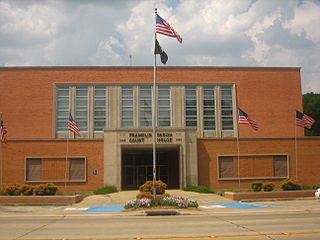
Franklin Parish is a parish located in the northeastern part of the U.S. state of Louisiana. As of the 2020, its population was 19,774. The parish seat is Winnsboro. The parish was founded in 1843 and named for Benjamin Franklin.

<span class="mw-page-title-main">Catahoula Parish, Louisiana</span> Parish in Louisiana, United States

Catahoula Parish is a parish in the U.S. state of Louisiana. As of the 2020 census, the population was 8,906. Its seat is Harrisonburg, on the Ouachita River. The parish was formed in 1808, shortly after the United States acquired this territory in the Louisiana Purchase of 1803.

<span class="mw-page-title-main">Bossier Parish, Louisiana</span> Parish in Louisiana, United States

Bossier Parish is a parish located in the northwestern part of the U.S. state of Louisiana. At the 2020 census, the population was 128,746.

<span class="mw-page-title-main">Bienville Parish, Louisiana</span> Parish in Louisiana, United States

Bienville Parish is a parish located in the northwestern portion of the U.S. state of Louisiana. At the 2020 census, the population was 12,981. The parish seat and most populous municipality is Arcadia.

<span class="mw-page-title-main">Columbia, Louisiana</span> Town in Louisiana, United States

Columbia is a town in, and the parish seat of, Caldwell Parish, Louisiana, United States. The population was 277 in 2020.

<span class="mw-page-title-main">Grayson, Louisiana</span> Village in Louisiana, United States

Grayson is a village in Caldwell Parish, Louisiana, United States. The population was 532 at the 2010 census.

References

  1. 1 2 3 "Explore Census Data". data.census.gov. Retrieved December 29, 2021.
  2. "Find a County". National Association of Counties. Archived from the original on May 31, 2011. Retrieved June 7, 2011.
  3. "2010 Census Gazetteer Files". United States Census Bureau. August 22, 2012. Archived from the original on September 28, 2013. Retrieved August 27, 2014.
  4. "U.S. Decennial Census". United States Census Bureau. Retrieved August 27, 2014.
  5. "Historical Census Browser". University of Virginia Library. Retrieved August 27, 2014.
  6. "Population of Counties by Decennial Census: 1900 to 1990". United States Census Bureau. Retrieved August 27, 2014.
  7. "Census 2000 PHC-T-4. Ranking Tables for Counties: 1990 and 2000" (PDF). United States Census Bureau. Archived (PDF) from the original on March 27, 2010. Retrieved August 27, 2014.
  8. "Caldwell Parish, Louisiana". quickfacts.census.gov. Archived from the original on June 6, 2011. Retrieved November 21, 2012.
  9. "U.S. Census website". United States Census Bureau . Retrieved January 31, 2008.
  10. "CALDWELL PARISH SHERIFF'S OFFICE – Committed to our Community". cpso.us. Retrieved August 4, 2023.
  11. Leip, David. "Dave Leip's Atlas of U.S. Presidential Elections". uselectionatlas.org. Retrieved March 7, 2018.

32°05′N92°07′W / 32.09°N 92.12°W / 32.09; -92.12