Iberville Parish, Louisiana

Last updated

Iberville Parish
OldPlaquCourtWM.JPG
Iberville Parish Courthouse building, originally the Courthouse, then the Plaquemine City Hall, now used as the Iberville Museum
Map of Louisiana highlighting Iberville Parish.svg
Location within the U.S. state of Louisiana
Louisiana in United States.svg
Louisiana's location within the U.S.
Coordinates: 30°16′N91°21′W / 30.26°N 91.35°W / 30.26; -91.35
CountryFlag of the United States.svg United States
StateFlag of Louisiana.svg  Louisiana
Founded1807
Named for Pierre Le Moyne d'Iberville
Seat Plaquemine
Largest city St. Gabriel
Area
  Total653 sq mi (1,690 km2)
  Land619 sq mi (1,600 km2)
  Water34 sq mi (90 km2)  5.2%
Population
 (2020)
  Total30,241
  Density46/sq mi (18/km2)
Time zone UTC−6 (Central)
  Summer (DST) UTC−5 (CDT)
Congressional districts 2nd, 6th
Website www.ibervilleparish.com

Iberville Parish (French : Paroisse d'Iberville) is a parish located south of Baton Rouge in the U.S. state of Louisiana, formed in 1807. [1] The parish seat is Plaquemine. [2] The population was 30,241 at the 2020 census. [3]

Contents

History

The parish is named for Pierre Le Moyne d'Iberville, who founded the French colony of Louisiana. [4]

A few archeological efforts have been made in the Parish, mainly to excavate the Native American burial mounds that have been identified there. The first expedition, led by Clarence B. Moore, was an attempt at collecting data from a couple of the sites, and it set the groundwork for later projects. Moore was mainly interested in the skeletal remains of the previous inhabitants, rather than excavating for archeological items. Archeologists are especially interested in these sites because of their uniformity and size. Some of the mounds are seven hundred feet long, a hundred feet wide and six feet tall. Most of them contain human remains. [5]

There were at least 2 wooden forts in the area by 1779, also represent St. Gabriel Parish.

"Plano a la estima de la causta de Ybervil, desde Manchac hasta la Larga-vista, de la ysla des Marais". By Raimundo Dubreuil San Gabriel.jpg
"Plano a la estima de la causta de Ybervil, desde Manchac hasta la Larga-vista, de la ysla des Marais". By Raimundo Dubreuil

Iberville Parish is represented in the Louisiana State Senate by a Republican, attorney Rick Ward III, a former member of the Louisiana House of Representatives, who has served in the Senate since 2012. The parish is currently represented in the state House by Democrat Major Thibaut of Oscar in Pointe Coupee Parish.

Geography

According to the U.S. Census Bureau, the parish has a total area of 653 square miles (1,690 km2), of which 619 square miles (1,600 km2) is land and 34 square miles (88 km2) (5.2%) is water. [6] Iberville Parish is part of the Baton Rouge metropolitan statistical area.

Major highways

Adjacent parishes

National protected area

Communities

Cities

Towns

Villages

Unincorporated areas

Census-designated places

Other unincorporated communities

Demographics

Historical population
CensusPop.Note
1820 4,414
1830 7,04959.7%
1840 8,49520.5%
1850 12,27844.5%
1860 14,66119.4%
1870 12,347−15.8%
1880 17,54442.1%
1890 21,84824.5%
1900 27,00623.6%
1910 30,95414.6%
1920 26,806−13.4%
1930 24,638−8.1%
1940 27,72112.5%
1950 26,750−3.5%
1960 29,93911.9%
1970 30,7462.7%
1980 32,1594.6%
1990 31,049−3.5%
2000 33,3207.3%
2010 33,3870.2%
2020 30,241−9.4%
U.S. Decennial Census [7]
1790-1960 [8] 1900-1990 [9]
1990-2000 [10] 2010 [11]
Iberville Parish, Louisiana – Racial and ethnic composition
Note: the US census treats Hispanic/Latino as an ethnic category. This table excludes Latinos from the racial categories and assigns them to a separate category. Hispanics/Latinos may be of any race.
Race / Ethnicity (NH = Non-Hispanic)Pop 2000 [12] Pop 2010 [13] Pop 2020 [14] % 2000% 2010% 2020
White alone (NH)16,20215,98714,63248.63%47.88%48.38%
Black or African American alone (NH)16,48616,33813,31349.48%48.94%44.02%
Native American or Alaska Native alone (NH)5861580.17%0.18%0.19%
Asian alone (NH)841011230.25%0.30%0.41%
Pacific Islander alone (NH)42130.01%0.01%0.04%
Some Other Race alone (NH)118750.03%0.02%0.25%
Mixed Race or Multi-Racial (NH)1322266090.40%0.68%2.01%
Hispanic or Latino (any race)3436641,4181.03%1.99%4.69%
Total33,32033,38730,241100.00%100.00%100.00%

As of the 2020 United States census, there were 30,241 people, 10,903 households, and 7,372 families residing in the parish. The 2019 census-estimates determined 32,822 people lived in the parish, [15] down from 33,387 at the 2010 United States census, and up from 33,320 at the 2000 U.S. census. [16]

In 2020, the racial and ethnic makeup of the parish was 48.2% Black and African American, 49.6% non-Hispanic white, 0.1% American Indian and Alaska Native, 0.5% some other race, and 1.5% two or more races. Approximately 2.6% of the population were Hispanic and Latin American of any race. In 2010, its racial and ethnic makeup was 49.3% Black and African American, 48.8% non-Hispanic white, 0.3% Asian, 0.2% American Indian and Alaska Native, 0.6% some other race, and 0.8% from two or more races; 2.0% were Hispanic and Latin American of any race. At the 2000 census. 49.26% were non-Hispanic white, 49.7% African American, 0.18% American Indian and Alaska Native, 0.26% Asian, 0.01% Native Hawaiian and other Pacific Islander, 0.14% from other races, and 0.45% from two or more races; 1.03% were Hispanic and Latin American of any race.

There were 10,903 households at the 2019 census-estimates, and 13,396 housing units. Of the 2,697 businesses operating in the parish, 1,339 were minority-owned. The parish had an employment rate of 47.9%. [15] There was a home-ownership rate of 73.4%, and the median housing value was $143,700; the median gross rent was $755. The median income for a household was $50,161; males had a median income of $54,655 versus $30,773 for females; 27.6% of the population lived at or below the poverty line.

Among its religious population in 2020, the Association of Religion Data Archives determined there were 1,700 non-denominational Protestants, and 7,901 Roman Catholics. Non-denominational Christianity was the largest non-Catholic demographic, reflecting the rise of non/inter-denominationalism. [17]

Government and infrastructure

The Louisiana Department of Public Safety and Corrections operates two prisons, Elayn Hunt Correctional Center and Louisiana Correctional Institute for Women (LCIW), in St. Gabriel in Iberville Parish. [18] [19] LCIW houses the female death row. [20] [21]

United States presidential election results for Iberville Parish, Louisiana [22]
Year Republican Democratic Third party
No.%No.%No.%
2020 7,89347.21%8,51450.92%3121.87%
2016 7,32045.63%8,32451.89%3992.49%
2012 7,27142.74%9,54856.12%1951.15%
2008 7,18543.75%9,02354.95%2131.30%
2004 6,33342.71%8,25955.70%2351.58%
2000 5,57338.43%8,35557.61%5753.96%
1996 4,03127.09%9,55364.20%1,2958.70%
1992 5,21133.42%8,21852.70%2,16513.88%
1988 5,85539.46%8,67858.49%3032.04%
1984 6,45542.58%8,58756.65%1170.77%
1980 4,46331.57%9,36166.23%3112.20%
1976 3,82233.56%7,25463.69%3132.75%
1972 3,97246.92%3,65043.11%8449.97%
1968 1,41314.44%4,08441.73%4,29043.83%
1964 3,43243.57%4,44556.43%00.00%
1960 1,00015.85%4,55872.25%75111.90%
1956 1,84346.97%2,01851.43%631.61%
1952 1,71032.84%3,49767.16%00.00%
1948 50616.50%1,69755.33%86428.17%
1944 43216.02%2,26583.98%00.00%
1940 49616.53%2,50583.47%00.00%
1936 26311.87%1,95388.13%00.00%
1932 43024.74%1,30875.26%00.00%
1928 27814.57%1,63085.43%00.00%
1924 39140.99%55658.28%70.73%
1920 46554.71%38545.29%00.00%
1916 16024.46%47172.02%233.52%
1912 10013.57%48766.08%15020.35%

Education

Primary and secondary schools

Iberville Parish School Board operates the public schools within all of Iberville Parish. [23]

Public libraries

Iberville Parish Library operates libraries in the parish. The Parish Headquarters Library is located in Plaquemine. Branches include Bayou Pigeon ( Unincorporated area ), Bayou Sorrel (Unincorporated area), East Iberville (St. Gabriel), Grosse Tete (Grosse Tete), Maringouin (Maringouin), Rosedale (Rosedale), White Castle (White Castle). [24]

Colleges and universities

It is in the service area of South Louisiana Community College. [25]

National Guard

The Gillis W. Long Center, located on the outskirts of Carville, LA, is operated by the Louisiana Army National Guard. This post is home to the 415TH MI (Military Intelligence) Battalion, the 241ST MPAD, and the 61st Troop Command. The 415TH MI is a subunit of the 139TH RSG (regional support group).

See also

Related Research Articles

<span class="mw-page-title-main">West Baton Rouge Parish, Louisiana</span> Parish in Louisiana, United States

West Baton Rouge Parish is one of the sixty-four parishes in the U.S. state of Louisiana. Established in 1807, its parish seat is Port Allen. With a 2020 census population of 27,199 residents, West Baton Rouge Parish is part of the Baton Rouge metropolitan statistical area.

<span class="mw-page-title-main">Pointe Coupee Parish, Louisiana</span> Parish in Louisiana, United States

Pointe Coupee Parish is a parish located in the U.S. state of Louisiana. As of the 2020 census, the population was 20,758. The parish seat is New Roads.

<span class="mw-page-title-main">East Feliciana Parish, Louisiana</span> Parish in Louisiana, United States

East Feliciana Parish is a parish located in the U.S. state of Louisiana. At the 2020 census, the population was 19,531. The parish seat is Clinton.

<span class="mw-page-title-main">East Baton Rouge Parish, Louisiana</span> Parish in Louisiana, United States

East Baton Rouge Parish is the most populous parish in the U.S. state of Louisiana. Its population was 456,781 at the 2020 census. The parish seat is Baton Rouge, Louisiana's state capital. East Baton Rouge Parish is located within the Greater Baton Rouge area.

<span class="mw-page-title-main">Ascension Parish, Louisiana</span> Parish in Louisiana, United States

Ascension Parish is a parish located in the U.S. state of Louisiana. As of the 2020 census, the population was 126,500. Its parish seat is Donaldsonville. The parish was created in 1807. Ascension Parish is part of the Baton Rouge metropolitan statistical area.

<span class="mw-page-title-main">Gardere, Louisiana</span> Census-designated place in Louisiana, United States

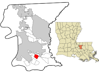
Gardere is an unincorporated area and census-designated place (CDP) in East Baton Rouge Parish, Louisiana, United States. The area is also known as Riverland. The population was 10,580 at the 2010 census, up from 8,992 in 2000. It is part of the Baton Rouge Metropolitan Statistical Area.

<span class="mw-page-title-main">Inniswold, Louisiana</span> Census-designated place in Louisiana, United States

Inniswold is an unincorporated area and census-designated place (CDP) in East Baton Rouge Parish, Louisiana, United States. The population was 6,180 at the 2010 census, up from 4,944 in 2000. In 2020, its population was 5,987. It is part of the Baton Rouge metropolitan statistical area.

<span class="mw-page-title-main">Shenandoah, Louisiana</span> Census-designated place in Louisiana, United States

Shenandoah is an unincorporated area and census-designated place (CDP) in East Baton Rouge Parish, Louisiana, United States. It is part of the Baton Rouge Metropolitan Statistical Area. The population was 18,399 at the 2010 census, up from 17,070 in 2000. Shenandoah consists of a number of residential subdivisions, including Shenandoah Estates, Shenandoah Park, White Oak Landing, White Oak Estates, The Woods and The Lake at White Oak.

<span class="mw-page-title-main">Grosse Tête, Louisiana</span> Village in Louisiana, United States

Grosse Tête is a village in Iberville Parish, Louisiana, United States. The population was 647 at the 2010 census, and 731 at the 2019 American Community Survey. The village name is French for "Big Head". Grosse Tête is part of the Baton Rouge metropolitan statistical area.

<span class="mw-page-title-main">Maringouin, Louisiana</span> Town in Louisiana, United States

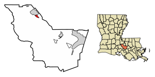
Maringouin is a town in Iberville Parish, Louisiana, United States. The population was 1,098 at the 2010 census, down from 1,262 at the 2000 census. At the 2020 population estimates program, its population was 966. It is part of the Baton Rouge metropolitan statistical area.

<span class="mw-page-title-main">Plaquemine, Louisiana</span> City in Louisiana, United States

Plaquemine is a city in and the parish seat of Iberville Parish, Louisiana, United States. It is part of the Baton Rouge metropolitan statistical area. At the 2010 United States census, the population was 7,119; the 2020 census determined its population was 6,269.

<span class="mw-page-title-main">Rosedale, Louisiana</span> Village in Louisiana, United States

Rosedale is a village in Iberville Parish, Louisiana, United States. The population was 664 in 2020. It is part of the Baton Rouge metropolitan statistical area.

<span class="mw-page-title-main">St. Gabriel, Louisiana</span> City in Louisiana, United States

St. Gabriel is a city in Iberville Parish, Louisiana, United States. The city of St. Gabriel includes the Carville neighborhood and portions of Sunchine. Part of the Baton Rouge metropolitan statistical area, it had a population of 6,677 at the 2010 U.S. census, and 6,433 at the 2020 census.

<span class="mw-page-title-main">White Castle, Louisiana</span> Town in Louisiana, United States

White Castle is a town in Iberville Parish, Louisiana, United States. At the 2010 U.S. census the town population was 1,883, and 1,640 at the 2020 population estimates program. It is part of the Baton Rouge metropolitan area.

<span class="mw-page-title-main">Baton Rouge metropolitan area</span> Metropolitan Statistical Area in Louisiana, United States

The Baton Rouge metropolitan statistical area, as defined by the United States Office of Management and Budget, or simply the Baton Rouge metropolitan area or Greater Baton Rouge, is a sprawling metropolitan statistical area surrounding the city of Baton Rouge. Including the western edge of the Florida Parishes regions, it is known as "Plantation Country", the "Capital Region", and "The 225". At the 2010 U.S. census, the metropolitan area had a population of 802,484, up from 705,973 in 2000. At the 2020 census, its population increased to 870,569, up from 2020 estimates at 858,571.

<span class="mw-page-title-main">Louisiana Highway 77</span> State highway in Louisiana, United States

Louisiana Highway 77 is a state highway in Louisiana that serves Iberville and Pointe Coupee parishes. It spans 49.2 miles (79.2 km).

<span class="mw-page-title-main">Louisiana Highway 76</span> State highway in Louisiana, United States

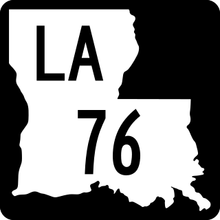
Louisiana Highway 76 (LA 76) is a state highway located in southeastern Louisiana. It runs 25.52 miles (41.07 km) in a general east–west direction from LA 77 in Maringouin to the junction of LA 1 and LA 987-4 in Port Allen.

Bayou Goula is an unincorporated community and census-designated place (CDP) in Iberville Parish, Louisiana, United States. Its population was 514 in 2020.

<span class="mw-page-title-main">Louisiana Highway 75</span> State highway in Louisiana, United States

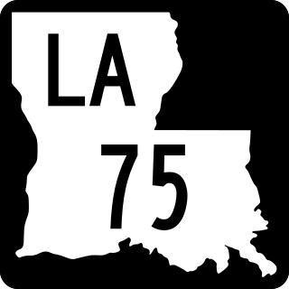
Louisiana Highway 75 (LA 75) is a state highway located in southeastern Louisiana. It runs 46.86 miles (75.41 km) in a general east–west direction from a dead end in Bayou Pigeon to the junction of LA 22 and LA 942 in Darrow.

Crescent is an unincorporated community and census-designated place in Iberville Parish, Louisiana, United States. It was first listed as a CDP in the 2010 Census with a population of 959. In 2020, its population was 811.

References

  1. "Iberville Parish". Center for Cultural and Eco-Tourism. Retrieved September 6, 2014.
  2. "Find a County". National Association of Counties. Archived from the original on May 31, 2011. Retrieved June 7, 2011.
  3. "QuickFacts: Iberville Parish, Louisiana". U.S. Census Bureau.
  4. Gannett, Henry (1905). The Origin of Certain Place Names in the United States. Govt. Print. Off. p. 164.
  5. Ford, James A: "Measuring the Flow of Time", page 415. The University of Alabama Press, 1999
  6. "2010 Census Gazetteer Files". United States Census Bureau. August 22, 2012. Archived from the original on September 28, 2013. Retrieved August 20, 2014.
  7. "U.S. Decennial Census". United States Census Bureau. Retrieved August 20, 2014.
  8. "Historical Census Browser". University of Virginia Library. Retrieved August 20, 2014.
  9. "Population of Counties by Decennial Census: 1900 to 1990". United States Census Bureau. Retrieved August 20, 2014.
  10. "Census 2000 PHC-T-4. Ranking Tables for Counties: 1990 and 2000" (PDF). United States Census Bureau. Archived (PDF) from the original on March 27, 2010. Retrieved August 20, 2014.
  11. "State & County QuickFacts". United States Census Bureau. Archived from the original on June 6, 2011. Retrieved August 9, 2013.
  12. "P004 Hispanic or Latino, and Not Hispanic or Latino by Race – 2000: DEC Summary File 1 – Iberville Parish, Louisiana". United States Census Bureau .
  13. "P2 Hispanic or Latino, and Not Hispanic or Latino by Race – 2010: DEC Redistricting Data (PL 94-171) – Iberville Parish, Louisiana". United States Census Bureau .
  14. "P2 Hispanic or Latino, and Not Hispanic or Latino by Race – 2020: DEC Redistricting Data (PL 94-171) - Iberville Parish, Louisiana". United States Census Bureau .
  15. 1 2 "Geography Profile: Iberville Parish, Louisiana". data.census.gov. Retrieved August 4, 2021.
  16. "U.S. Census website". United States Census Bureau . Retrieved January 31, 2008.
  17. "Maps and data files for 2020 | U.S. Religion Census | Religious Statistics & Demographics". www.usreligioncensus.org. Retrieved March 11, 2023.
  18. "Elayn Hunt Correctional Center Archived 2010-09-24 at the Wayback Machine ." (Profile) Louisiana Department of Public Safety and Corrections. Retrieved July 20, 2010
  19. "Directions to EHCC Archived 2009-09-16 at the Wayback Machine ." Elayn Hunt Correctional Center. Retrieved on July 20, 2010.
  20. "Louisiana Correctional Institute for Women Archived 2010-09-24 at the Wayback Machine ." Louisiana Department of Public Safety & Corrections. 14/40. Retrieved August 24, 2010
  21. "Classification–Where Inmates Serve Their Time." Inside the System: How Inmates Live and Work [ permanent dead link ]. Louisiana Department of Public Safety & Corrections. 14/40. Retrieved June 30, 2010
  22. Leip, David. "Dave Leip's Atlas of U.S. Presidential Elections". uselectionatlas.org. Retrieved March 9, 2018.
  23. "2020 CENSUS - SCHOOL DISTRICT REFERENCE MAP: Iberville Parish, LA" (PDF). U.S. Census Bureau. Archived (PDF) from the original on July 31, 2022. Retrieved July 31, 2022. - Text list
  24. "to the Library Catalog [ permanent dead link ]." Iberville Parish Library. Retrieved January 29, 2011
  25. "Our Colleges". Louisiana's Technical and Community Colleges . Retrieved June 3, 2021.

Geology

30°16′N91°21′W / 30.26°N 91.35°W / 30.26; -91.35