List of counties in Delaware

Last updated

Counties of Delaware
Location State of Delaware
Number3
Populations189,789 (Kent) – 578,592 (New Castle)
Areas494 square miles (1,280 km2) (New Castle) – 1,196 square miles (3,100 km2) (Sussex)
Government
Subdivisions

The U.S. state of Delaware is divided into three counties, the fewest of any state in the United States: New Castle, Kent and Sussex. [1] The origin of the county boundaries goes back to their former court districts.

Contents

Politics and government

Each county elects a legislative body (known in New Castle and Sussex counties as the County Council, and in Kent County as the Levy Court). The counties are able to raise taxes and borrow money. They also have control over garbage disposal, water supply, sewerage, zoning, development, and building codes. [2]

Most functions which are handled on a county-by-county basis in other states—such as court and law enforcement—have been centralized in Delaware, leading to a significant concentration of power in the Delaware state government. The counties were historically divided into hundreds, which were used as tax reporting and voting districts until the 1960s. However, the hundreds now serve no administrative role; their only current official legal use is in real-estate title descriptions. [3]

History

Following the English conquest of 1664, all of the land on the western side of the Delaware River and Delaware Bay was governed as part of the New York Colony and administered from the town of New Castle. During the brief recapture of the colony by the Dutch in 1673, additional court districts were created around Upland and Whorekill. [4] The latter was also known as Hoornkill, and is now the town of Lewes. [5] The court at New Castle was left with the central portion of the colony. The jurisdiction left to the court at became New Castle County, and the county seat remained at New Castle until 1881 when it was moved to Wilmington. In 1680, Whorekill District was divided into Deale County and St. Jones County. [6] After this division, Lewes became the county seat of Deale, which was later renamed Sussex County. [6] The former Upland District was named after the New Sweden settlement of Upland, and was renamed Chester County in 1682. [7] Chester County is now located within the present boundaries of Pennsylvania. [8]

Lord Baltimore, the Proprietor of Maryland, claimed all present-day Delaware, and organized its northern and eastern portions as Durham County, Maryland. However, this county existed only on paper. The southern and western portions of present-day Sussex County were organized as portions of several adjacent Maryland counties and were not recognized as part of Delaware until the Mason-Dixon Survey was run in 1767. [9] In 1791, with the expansion of Sussex County to the south and west, the county seat was moved to Georgetown. [6] The county seat of St. Jones (renamed Kent County in 1681 [6] ) is at Dover. [6]

After 2000, a fourth "Appoquinimink County" was proposed to be carved out of New Castle County. The effort intended to end the zoning restrictions of the Unified Development Code on the undeveloped farmland. [10] The proposed boundaries extended beyond the Appoquinimink Hundred to include all land south of the C&D Canal, with Middletown as the proposed seat.[ citation needed ]

County list

The Federal Information Processing Standard (FIPS) code, which is used by the United States government to uniquely identify counties, is provided with each entry. The FIPS code for each county links to census data for that county.

County
FIPS code [11] County seat [6] [12] Est. [6] [12] History [6] [13] Etymology [13] Population [14] Area [12] Map
KentCounty 001 Dover 1680Created from Whorekill (Hoarkill) District. Formerly known as St. Jones County.named in 1682 by William Penn for the English county of Kent 189,789800 sq mi
(2,072 km2)
Map of Delaware highlighting Kent County.svg
New CastleCounty 003 Wilmington 1664Original County (Formally New Amstel)named in 1673 by Dutch Governor Anthony Colve for the town of New Castle, Delaware as an Anglicization of Nieuw Amstel.578,592494 sq mi
(1,279 km2)
Map of Delaware highlighting New Castle County.svg
SussexCounty 005 Georgetown 1664Created from Whorekill (Hoarkill) District. Formerly known as Deale Countynamed in 1682 by William Penn for the English county of Sussex, which was his home county263,5091,196 sq mi
(3,098 km2)
Map of Delaware highlighting Sussex County.svg

Related Research Articles

<span class="mw-page-title-main">Delaware</span> U.S. state

Delaware is a state in the Mid-Atlantic region of the United States. It borders Maryland to its south and west, Pennsylvania to its north, New Jersey to its northeast, and the Atlantic Ocean to its east. The state's name derives from the adjacent Delaware Bay, which in turn was named after Thomas West, 3rd Baron De La Warr, an English nobleman and the Colony of Virginia's first colonial-era governor.

<span class="mw-page-title-main">New Sweden</span> Former Swedish colony in North America

New Sweden was a colony of the Swedish Empire along the lower reaches of the Delaware River between 1638 and 1655 in present-day Delaware, Maryland, New Jersey, and Pennsylvania in the United States. Established during the Thirty Years' War when Sweden was a great power, New Sweden formed part of the Swedish efforts to colonize the Americas.

<span class="mw-page-title-main">Delmarva Peninsula</span> Large peninsula on the East Coast of the US

The Delmarva Peninsula, or simply Delmarva, is a large peninsula on the East Coast of the United States, occupied by the vast majority of the state of Delaware and parts of the Eastern Shore of Maryland and Eastern Shore of Virginia.

<span class="mw-page-title-main">Kent County, Delaware</span> County in Delaware, United States

Kent County is a county located in the central part of the U.S. state of Delaware. As of the 2020 census, the population was 181,851, making it the least populous county in Delaware. The county seat is Dover, the state capital of Delaware. It is named for Kent, an English county.

<span class="mw-page-title-main">New Castle County, Delaware</span> County in Delaware, United States

New Castle County is the northernmost of the three counties of the U.S. state of Delaware. As of the 2020 census, the population was 570,719, making it the most populous county in Delaware, with nearly 60% of the state's population of 989,948. The county seat is Wilmington, which is also the state's most populous city.

<span class="mw-page-title-main">Sussex County, Delaware</span> County in Delaware, United States

Sussex County is located in the southern part of the U.S. state of Delaware, on the Delmarva Peninsula. As of the 2020 census, the population was 237,378, making it the state's second most populated county only behind New Castle and ahead of Kent. The county seat is Georgetown.

<span class="mw-page-title-main">Lewes, Delaware</span> City in Delaware, United States

Lewes is an incorporated city on the Delaware Bay in eastern Sussex County, Delaware, United States. According to the 2020 census, its population was 3,303. Along with neighboring Rehoboth Beach, Lewes is one of the principal cities of Delaware's rapidly growing Cape Region. The city lies within the Salisbury, Maryland–Delaware Metropolitan Statistical Area. Lewes proudly claims to be "The First Town in The First State."

<span class="mw-page-title-main">Georgetown, Delaware</span> Town and county seat in Delaware, US

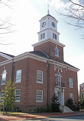
Georgetown is a town and the county seat of Sussex County, Delaware, United States. According to the 2010 census, the population of the town is 6,422, an increase of 38.3% over the previous decade.

<span class="mw-page-title-main">Upland, Pennsylvania</span> Borough in Pennsylvania, United States

Upland is a borough in Delaware County, Pennsylvania, United States. Upland is governed by an elected seven-member borough council. The population was 3,239 at the 2010 census, up from 2,974 at the 2000 census.

<span class="mw-page-title-main">Delaware Bay</span> Estuary outlet of the Delaware River on the northeast seaboard of the United States

Delaware Bay is the estuary outlet of the Delaware River on the northeast seaboard of the United States, lying between the states of Delaware and New Jersey. It is approximately 782 square miles (2,030 km2) in area, the bay's freshwater mixes for many miles with the saltwater of the Atlantic Ocean.

Blackbird Hundred is an unincorporated subdivision of New Castle County, Delaware. Hundreds were once used as a basis for representation in the Delaware General Assembly, and while their names still appear on all real estate transactions, they now have no purpose except as a geographical point of reference.

Appoquinimink Hundred is an unincorporated subdivision of New Castle County, Delaware. Hundreds were once used as a basis for representation in the Delaware General Assembly, and while their names still appear on all real estate transactions, they presently have no meaningful use or purpose except as a geographical point of reference.

St. Georges Hundred is an unincorporated subdivision of New Castle County, Delaware. Hundreds were once used as a basis for representation in the Delaware General Assembly, and while their names still appear on all real estate transactions, they presently have no meaningful use or purpose except as a geographical point of reference.

<span class="mw-page-title-main">David Hall (Delaware politician)</span> American politician

David Hall was an American lawyer and politician from Lewes, in Sussex County, Delaware. He was an officer in the Continental Army during the American Revolution, and member of the Democratic-Republican Party, who served as Governor of Delaware.

<span class="mw-page-title-main">John Grubb</span>

John Grubb (1652–1708) was a two-term member of the Pennsylvania Provincial Assembly and was one of the original settlers in a portion of Brandywine Hundred that became Claymont, Delaware. He founded a large tannery that continued in operation for over 100 years at what became known as Grubb's Landing. He was also one of the 150 signers of the Concessions and Agreements for Province of West Jersey.

<span class="mw-page-title-main">2010 Delaware elections</span> Election in the United States

Elections were held in Delaware on Tuesday, November 2, 2010. Primary elections were held on September 14, 2010.

References

  1. "How Many Counties are in Your State?". Click and Learn. Archived from the original on 2009-04-22. Retrieved 2009-08-26.
  2. "Chapter Title 9 Counties". Online Delaware Code. Government of Delaware.
  3. "The Hundreds of Delaware: 1700–1800, Delaware Department of State:Division of Historical and Cultural Affairs website". The Official Website of the Government of Delaware. Government of Delaware. Archived from the original on 2008-02-20. Retrieved 2008-02-25.
  4. The Historical Society of Delaware (1997). "Delaware Counties". Archived from the original on 2006-07-19. Retrieved 2006-06-01.
  5. Hazel D. Brittingham (1997). "The Name of Whorekill". Lewestown Publishers. Archived from the original on 2011-07-13. Retrieved 2007-04-24.
  6. 1 2 3 4 5 6 7 8 Delaware Genealogical Society (1997). "Delaware Counties and Hundreds". Delaware Genealogical Society. Archived from the original on 2006-06-13. Retrieved 2006-06-01.
  7. J. Thomas Scharf and Thompson Westcott. "Chapter 1: Topography of Philadelphia". History of Philadelphia 1609–1884. Philadelphia Water Department. Retrieved 2008-02-24.
  8. "Chester County website". Archived from the original on 2008-04-19. Retrieved 2008-04-02.
  9. John Mackenzie. "A brief history of the Mason-Dixon survey line". University of Delaware. Retrieved 2007-04-24.
  10. "Unified Development Code". New Castle County. Archived from the original on December 16, 2004. Retrieved 2008-10-01.
  11. "EPA County FIPS Code Listing". EPA.gov. Retrieved 2008-02-23.
  12. 1 2 3 National Association of Counties. "NACo – Find a county". Archived from the original on April 10, 2005. Retrieved 2008-04-30.
  13. 1 2 The Historical Society of Delaware (1997). "Delaware Counties". Archived from the original on 2006-07-19. Retrieved 2006-06-01.
  14. Delaware Census Data