Clayton, Delaware

Last updated

Clayton, Delaware
DE 6 EB past Smyrna Avenue Clayton.jpeg
Main Street in Clayton
Etymology: John Middleton Clayton
Kent County Delaware Incorporated and Unincorporated areas Clayton Highlighted 1015440.svg
Location of Clayton in Kent County, Delaware.
USA Delaware location map.svg
Red pog.svg
Clayton
Location within the state of Delaware
Usa edcp location map.svg
Red pog.svg
Clayton
Clayton (the United States)
Coordinates: 39°17′26″N75°38′04″W / 39.29056°N 75.63444°W / 39.29056; -75.63444
CountryFlag of the United States.svg  United States
State Flag of Delaware.svg  Delaware
County Kent, New Castle
Cargo Hub1765
Government
  Type Mayor-council
  MayorNick Smith
Area
[1]
  Total1.95 sq mi (5.04 km2)
  Land1.95 sq mi (5.04 km2)
  Water0.00 sq mi (0.00 km2)
Elevation
[2]
46 ft (14 m)
Population
 (2020)
  Total3,961
  Density2,033.37/sq mi (785.26/km2)
Time zone UTC−5 (Eastern (EST))
  Summer (DST) UTC−4 (EDT)
ZIP code
19938
Area code 302
FIPS code 10-15440
GNIS feature ID213805 [2]
Website www.clayton.delaware.gov

Clayton is a town in Kent and New Castle counties in the U.S. state of Delaware. Located almost entirely in Kent County, it is part of the Dover, Delaware Metropolitan Statistical Area. The population was 2,918 at the 2010 census. [3]

Contents

History

Byrd's AME Church, the Clayton Railroad Station, Enoch Jones House, and St. Joseph's Industrial School are listed on the National Register of Historic Places. [4]

Geography

Clayton is located at 39°17′26″N75°38′04″W / 39.29056°N 75.63444°W / 39.29056; -75.63444 (39.2906671, –75.6343727). [5]

According to the United States Census Bureau, the town has a total area of 1.0 square mile (2.6 km2), all land. It was named after John Middleton Clayton, a prominent 19th-century Delaware lawyer and politician.

Demographics

Historical population
CensusPop.Note
1880 148
1890 540264.9%
1900 81951.7%
1910 764−6.7%
1920 87214.1%
1930 824−5.5%
1940 8908.0%
1950 825−7.3%
1960 1,02824.6%
1970 1,015−1.3%
1980 1,21619.8%
1990 1,163−4.4%
2000 1,2739.5%
2010 2,918129.2%
2020 3,96135.7%
U.S. Decennial Census [6]

As of the census [7] of 2000, there were 1,273 people, 499 households, and 346 families living in the town. The population density was 1,242.3 inhabitants per square mile (479.7/km2). There were 524 housing units at an average density of 511.4 per square mile (197.5/km2). The racial makeup of the town was 90.26% White, 8.09% African American, 0.31% Native American, 0.08% Asian, 0.08% Pacific Islander, 0.47% from other races, and 0.71% from two or more races. Hispanic or Latino of any race were 1.34% of the population.

There were 499 households, out of which 32.1% had children under the age of 18 living with them, 49.9% were married couples living together, 15.2% had a female householder with no husband present, and 30.5% were non-families. Of all households 25.7% were made up of individuals, and 11.4% had someone living alone who was 65 years of age or older. The average household size was 2.55 and the average family size was 3.05.

In the town, the population was spread out, with 27.2% under the age of 18, 7.3% from 18 to 24, 31.2% from 25 to 44, 20.3% from 45 to 64, and 14.0% who were 65 years of age or older. The median age was 36 years. For every 100 females, there were 89.2 males. For every 100 females age 18 and over, there were 81.1 males.

The median income for a household in the town was $43,462, and the median income for a family was $48,000. Males had a median income of $34,792 versus $25,862 for females. The per capita income for the town was $18,268. About 4.0% of families and 7.0% of the population were below the poverty line, including 5.6% of those under age 18 and 8.1% of those age 65 or over.

Infrastructure

Transportation

DE 6 eastbound in Clayton 2022-07-16 09 17 56 View east along Delaware State Route 6 (Main Street) at Hudson Street and School Lane in Clayton, Kent County, Delaware.jpg
DE 6 eastbound in Clayton

Delaware Route 6 is the main east–west road in Clayton, passing through town on Main Street and heading west to Blackiston and east to Smyrna. In Smyrna, DE 6 intersects U.S. Route 13, which connects to the Delaware Route 1 toll road at two interchanges on each side of town. Delaware Route 300 passes through the southern part of Clayton on Wheatleys Pond Road, heading southwest to Kenton and northeast to Smyrna, where it joins DE 6 and follows that route to the US 13 intersection. Delaware Route 15 passes through the western part of Clayton, following DE 6 from the west before heading north on Duck Creek Road toward Middletown. [8] The Delmarva Subdivision line of the Delmarva Central Railroad passes through Clayton, with the Delmarva Central Railroad having an interchange point with the Norfolk Southern Railway in the town. [9]

Utilities

The Public Works department provides various utility services to Clayton. The public works department provides electricity to about 1,200 customers in Clayton. The town is a member of the Delaware Municipal Electric Corporation, a wholesale electric utility which provides electricity to municipal electric departments across Delaware. [10] The department provides water to 1,100 customers in the town, with four underwater wells and two elevated storage tanks. [11] The public works department serves 1,100 sewer customers in Clayton, operating eight pumping stations and contracting with Kent County for wastewater treatment. [12] The department contracts with Waste Industries for trash collection in Clayton. [13] Natural gas service in Clayton is provided by Chesapeake Utilities, cable service is provided by Xfinity, and telephone service is provided by Verizon. [14]

Related Research Articles

<span class="mw-page-title-main">Kent County, Delaware</span> County in Delaware, United States

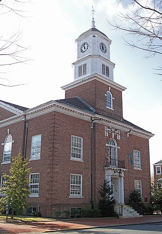
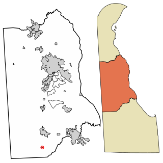
Kent County is a county located in the central part of the U.S. state of Delaware. As of the 2020 census, the population was 181,851, making it the least populous county in Delaware. The county seat is Dover, the state capital of Delaware. It is named for Kent, an English county.

<span class="mw-page-title-main">Cheswold, Delaware</span> Town in Delaware, United States

Cheswold is a town in Kent County in the U.S. state of Delaware. It is part of the Dover, Delaware Metropolitan Statistical Area. The population was 1,923 in 2020.

<span class="mw-page-title-main">Farmington, Delaware</span> Town in Delaware, United States

Farmington is a town in Kent County, Delaware, United States. It is part of the Dover, Delaware Metropolitan Statistical Area. The population was 92 in 2020.

<span class="mw-page-title-main">Felton, Delaware</span> Town in Delaware, United States

Felton is a town in Kent County, Delaware, United States. It is part of the Dover metropolitan statistical area. The population was 1,568 in 2020.

<span class="mw-page-title-main">Frederica, Delaware</span> Town in Delaware, United States

Frederica is a town in Kent County, Delaware, United States. It is part of the Dover, Delaware Metropolitan Statistical Area. The population was 1,073 in 2020. ILC Dover, the company which manufactured the spacesuits for the Apollo and Skylab astronauts of the 1960s and 1970s, along with fabricating the suit component of the Space Shuttle's Extravehicular Mobility Unit (EMU), is located nearby.

<span class="mw-page-title-main">Harrington, Delaware</span> City in Delaware, United States

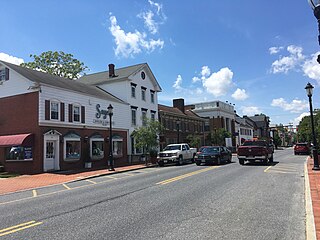
Harrington is a city in Kent County, Delaware, United States. It is part of the Dover metropolitan statistical area. Harrington hosts the annual Delaware State Fair each July. The population was 3,774 in 2020.

<span class="mw-page-title-main">Hartly, Delaware</span> Town in Delaware, United States

Hartly is a town in Kent County, Delaware, United States. It is part of the Dover, Delaware Metropolitan Statistical Area. The population was 73 in 2020, making it the least populous municipality in Delaware.

<span class="mw-page-title-main">Houston, Delaware</span> Town in Delaware, United States

Houston is a town in Kent County, Delaware, United States. It is part of the Dover metropolitan area. The population was 381 in 2020. It was named for John W. Houston.

<span class="mw-page-title-main">Kenton, Delaware</span> Town in Delaware, United States

Kenton is a town in Kent County, Delaware, United States. It is part of the Dover metropolitan statistical area. The population was 215 in 2020.

<span class="mw-page-title-main">Leipsic, Delaware</span> Town in Delaware, United States

Leipsic is a town in Kent County, Delaware, United States. It is part of the Dover, Delaware Metropolitan Statistical Area. The population was 178 in 2020.

<span class="mw-page-title-main">Little Creek, Delaware</span> Town in Delaware, United States

Little Creek is a town in Kent County, Delaware, United States. It is part of the Dover metropolitan statistical area. The population was 195 in 2020.

<span class="mw-page-title-main">Magnolia, Delaware</span> Town in Delaware, United States

Magnolia is a town in Kent County, Delaware, United States. It is part of the Dover, Delaware Metropolitan Statistical Area. Recent estimates put the population at around 235, however, the population was 277 in 2020.

<span class="mw-page-title-main">Smyrna, Delaware</span> Town in Delaware, United States

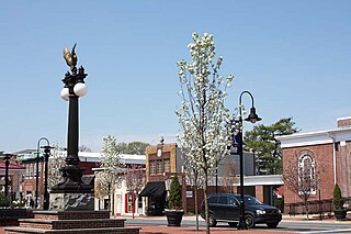
Smyrna is a town in Kent and New Castle counties in the U.S. state of Delaware. It is part of the Dover metropolitan statistical area. According to the U.S. Census Bureau, as of 2020, the population of the town is 12,883.

<span class="mw-page-title-main">Viola, Delaware</span> Town in Delaware, United States

Viola is a town in Kent County, Delaware, United States. It is part of the Dover, Delaware Metropolitan Statistical Area. The population was 140 in 2020.

<span class="mw-page-title-main">Woodside, Delaware</span> Town in Delaware, United States

Woodside is a town in Kent County, Delaware, United States. It is part of the Dover, Delaware Metropolitan Statistical Area. The population was 190 in 2020.

<span class="mw-page-title-main">Wyoming, Delaware</span> Town in Delaware, United States

Wyoming is a town in Kent County, Delaware, United States. It was named after the Wyoming Valley in Pennsylvania. It is part of the Dover, Delaware, Metropolitan Statistical Area. The population was 1,680 in 2020.

<span class="mw-page-title-main">Middletown, Delaware</span> Town in Delaware, United States

Middletown is a town in New Castle County, Delaware, United States. According to the 2021 Census, the population of the town is 24,164.

<span class="mw-page-title-main">Odessa, Delaware</span> Town in Delaware, United States

Odessa is a town in New Castle County, Delaware, United States. The population was 364 at the 2010 census. Founded as Cantwell's Bridge in the 18th century, the name was changed in the 19th century, after the Ukrainian port city of the same name. Today a significant part of the town is a historic district list on the National Register of Historic Places.

<span class="mw-page-title-main">Townsend, Delaware</span> Town in Delaware, United States

Townsend is a town in New Castle County, Delaware, United States. The population was 2,049 at the 2010 census, an increase of 492.2% from 2000. The center of population of Delaware is located in Townsend.

<span class="mw-page-title-main">Dagsboro, Delaware</span> Town in Delaware, United States

Dagsboro is a town in Sussex County, Delaware, United States. The population was 805 at the 2010 census. It is part of the Salisbury, Maryland-Delaware Metropolitan Statistical Area.

References

  1. "2020 U.S. Gazetteer Files". United States Census Bureau. Retrieved October 31, 2021.
  2. 1 2 U.S. Geological Survey Geographic Names Information System: Clayton, Delaware
  3. "The Delaware Census State Data Center". Archived from the original on December 31, 2016. Retrieved January 11, 2014.
  4. "National Register Information System". National Register of Historic Places . National Park Service. July 9, 2010.
  5. "US Gazetteer files: 2010, 2000, and 1990". United States Census Bureau. February 12, 2011. Retrieved April 23, 2011.
  6. "Census of Population and Housing". Census.gov. Retrieved June 4, 2016.
  7. "U.S. Census website". United States Census Bureau . Retrieved January 31, 2008.
  8. Delaware Department of Transportation (2008). Delaware Official Transportation Map (PDF) (Map). Dover: Delaware Department of Transportation.
  9. "Delmarva Central Railroad". Carload Express. Retrieved March 27, 2017.
  10. "Electric". Town of Clayton, DE. Archived from the original on August 14, 2017. Retrieved August 13, 2017.
  11. "Water". Town of Clayton, DE. Archived from the original on August 14, 2017. Retrieved August 13, 2017.
  12. "Sewer". Town of Clayton, DE. Archived from the original on August 14, 2017. Retrieved August 13, 2017.
  13. "Trash". Town of Clayton, DE. Archived from the original on August 14, 2017. Retrieved August 13, 2017.
  14. "Understanding Utilities". Town of Clayton, DE. Archived from the original on August 14, 2017. Retrieved August 13, 2017.