
Bowers is a town in Kent County, Delaware, United States. It is part of the Dover, Delaware Metropolitan Statistical Area. According to the 2010 Census, the population of the city is 335.

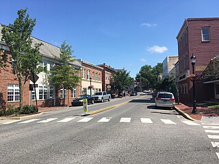
Camden is a town in Kent County, Delaware, United States. It is part of the Dover, Delaware Metropolitan Statistical Area. The population was 3,464 at the 2010 census.

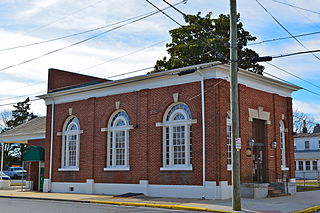
Felton is a town in Kent County, Delaware, United States. It is part of the Dover, Delaware Metropolitan Statistical Area. The population was 1,298 at the 2010 census.
Frederica is a town in Kent County, Delaware, United States. It is part of the Dover, Delaware Metropolitan Statistical Area. The population was 774 at the 2010 census. ILC Dover, the company which manufactured the spacesuits for the Apollo and Skylab astronauts of the 1960s and 1970s, along with fabricating the suit component of the Space Shuttle's Extravehicular Mobility Unit (EMU), is located nearby.

Kenton is a town in Kent County, Delaware, United States. It is part of the Dover, Delaware Metropolitan Statistical Area. The population was 261 at the 2010 census.

Little Creek is a town in Kent County, Delaware, United States. It is part of the Dover, Delaware Metropolitan Statistical Area. The population was 224 at the 2010 census.
Milford is a city in Kent and Sussex counties in the U.S. state of Delaware. According to the 2010 census, the population of the city is 9,559.

Hockessin is a census-designated place (CDP) in New Castle County, Delaware, United States. The population was 13,527 at the 2010 census.

Talleyville is an unincorporated community in New Castle County, Delaware, United States. Talleyville is located at the intersection of U.S. Route 202, Mt. Lebanon Road, and Silverside Road to the north of Wilmington. Its ZIP code is 19803.
Mount Cuba is an unincorporated community in New Castle County, Delaware, United States. Mount Cuba is located at the intersection of Delaware Route 82 and Mount Cuba Road along the east bank of the Red Clay Creek. The Mount Cuba Historic District was listed on the National Register of Historic Places in 1979.
Stanton is an unincorporated community in New Castle County, Delaware, United States, near the confluence of the Red Clay and White Clay Creeks. It is located in the southern end of Mill Creek Hundred.
Sandtown is an unincorporated community in Kent County, Delaware, United States. Sandtown is located on Delaware Route 10 just east of the Maryland border.

Woodland Beach is an unincorporated community in Kent County, Delaware, United States. Woodland Beach is along the Delaware Bay east of Smyrna at the eastern terminus of Delaware Route 6. The Woodland Beach Wildlife Area is located in Woodland Beach.

Pearsons Corner is an unincorporated community in Kent County, Delaware, United States. Pearsons Corner is located at the intersection of Delaware Route 8 and Delaware Route 44 west of Dover.
Mount Pleasant is an unincorporated community located largely in St. George's Hundred, New Castle County, Delaware, United States. Mount Pleasant is located at the intersection of Delaware Route 71 and Delaware Route 896 north of Middletown. The A. Eliason House, Idalia Manor, and Woodside are listed on the National Register of Historic Places.
Dutch Neck Crossroads is an unincorporated community in Kent County, Delaware, United States. Dutch Neck Crossroads is located on Delaware Route 9 4.9 miles (7.9 km) east of Smyrna. The Allee House, which is listed on the National Register of Historic Places, is located in Dutch Neck Crossroads.

Cowgills Corner is an unincorporated community in Kent County, Delaware, United States. Cowgills Corner is located on Delaware Route 9 3.5 miles (5.6 km) northeast of Dover. The Octagonal Schoolhouse, which is listed on the National Register of Historic Places, is located in Cowgills Corner.
Chapeltown is an unincorporated community in Kent County, Delaware, United States. Chapeltown is located on Westville Road 10 miles (16 km) west-southwest of Dover. Thomas' Methodist Episcopal Chapel, which is listed on the National Register of Historic Places, is located in Chapeltown.

Mastens Corner is an unincorporated community in Kent County, Delaware, United States. Mastens Corner is located at the intersection of Hopkins Cemetery Road and Hills Market Road 3.8 miles (6.1 km) northwest of Harrington.
Williamsville is an unincorporated community in Kent County, Delaware, United States. Williamsville is located at the intersection of Williamsville Road and Deep Grass Lane south of Houston.


