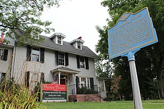
Claymont is a census-designated place (CDP) in New Castle County, Delaware. The estimated 2017 population of the 19703 ZIP code, which Claymont encompasses, was 15,292.
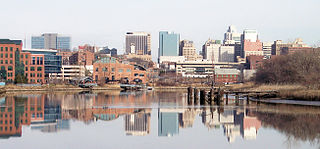
Wilmington is the largest city in the U.S. state of Delaware. The city was built on the site of Fort Christina, the first Swedish settlement in North America. It lies at the confluence of the Christina River and Brandywine Creek, near where the Christina flows into the Delaware River. It is the county seat of New Castle County and one of the major cities in the Delaware Valley metropolitan area. Wilmington was named by Proprietor Thomas Penn after his friend Spencer Compton, Earl of Wilmington, who was prime minister during the reign of George II of Great Britain.

Brandywine Creek is a tributary of the Christina River in southeastern Pennsylvania and northern Delaware in the United States. The Lower Brandywine is 20.4 miles (32.8 km) long and is a designated Pennsylvania Scenic River with several tributary streams. The East Branch and West Branch of the creek originate within 2 miles (3 km) of each other on the slopes of Welsh Mountain in Honey Brook Township, Pennsylvania, about 20 miles (32 km) northwest of their confluence.
Centerville is an unincorporated community in New Castle County, Delaware, United States. Centerville is now known primarily for being the location of Du Pont family estates, as well as several other wealthy business families from nearby Wilmington, and the home of Governor Jack Markell.

Delaware Route 52 (DE 52) is a state highway in New Castle County, Delaware. The route runs from U.S. Route 13 Business in downtown Wilmington north to Pennsylvania Route 52 (PA 52) at the Pennsylvania border near Centerville. DE 52 runs through the city of Wilmington and passes through areas of the Brandywine Valley north of Wilmington. DE 52 intersects Interstate 95 (I-95)/US 202 and DE 2 in Wilmington and DE 100/DE 141 and DE 82 in Greenville. The entire route is designated as part of the Brandywine Valley National Scenic Byway, a National Scenic Byway and Delaware Byway, while most of the route is also designated as part of the Harriet Tubman Underground Railroad Byway of the Delaware Byways system. The road was built as the Kennett Pike, a turnpike, between 1811 and 1813. The Kennett Pike was bought by Pierre S. du Pont in 1919 and was widened and paved before being sold to the State of Delaware for $1. The road received the DE 52 designation by 1936.
Talleyville is an unincorporated community in New Castle County, Delaware, United States. Talleyville is located at the intersection of U.S. Route 202, Mt. Lebanon Road, and Silverside Road to the north of Wilmington. Its ZIP code is 19803.

Beaver Valley straddles the Pennsylvania and Delaware border in Delaware County, PA and New Castle County, DE. An unincorporated place name, it is traversed by several streams which drain to Beaver Run which itself empties into the Brandywine River. It is approximately bounded by US Route 202 to the east, The Brandywine River to the west, Thompsons Bridge Road to the south, and Smithbridge Road to the north, with Beaver Valley Road encircling a large portion of the valley.
Foulk Woods is an unincorporated community in New Castle County, Delaware, United States.
Penarth is an unincorporated community in New Castle County, Delaware, United States, 4.6 miles (7.4 km) northeast of Wilmington in the Brandywine Hundred. Penarth is located west of the intersection of Delaware Route 261 and Silverside Road, east of Talleyville.
Tavistock is an unincorporated community in New Castle County, Delaware, United States. It is within ZIP Code Tabulation Area for 19803.
Sharpley is an unincorporated community in New Castle County, Delaware, United States in the Brandywine Hundred. It is within ZIP Code Tabulation Area for 19803.
Holly Oak is an unincorporated town in New Castle County, Delaware, United States. Holly Oak is located northwest of U.S. Route 13 Business between Silverside Road and Harvey Road to the northeast of Wilmington and southwest of Claymont. It was once served by the Philadelphia, Wilmington and Baltimore Railroad. Perkins Run, a Delaware River tributary, mouths at Holly Oak.

Mayfield is an suburban community in New Castle County, Delaware, United States. It was the teenage home of President Joe Biden.
Edenridge is an unincorporated community in New Castle County, Delaware, United States in the Brandywine Hundred, north of Wilmington.

Woodbrook is a suburban community in New Castle County, Delaware.
Green Meadow, originally Greenmeadow, and also called Green Meadows, is an suburban community in New Castle County, Delaware, United States.
Delaire is a suburban community in New Castle County, Delaware, United States.
Holloway Terrace is an unincorporated community in New Castle County, Delaware, United States. Holloway Terrace is located on the outskirts of the city of Wilmington along Delaware Route 9 and Interstate 295, southwest of the Port of Wilmington.

The Beaver Valley Rock Shelter Site is the only formally recognized cave in the US state of Delaware. It is located in New Castle County near Wilmington and the state line with Pennsylvania.
Riverside–11th Street Bridge is a district in the northeastern section of Wilmington, Delaware.


