County
| FIPS code [10] | County Seat [11] | Est. [12] | Origin [13] | Etymology [12] [13] | Population
(2023) [10] [11] [14] | Area [11] | Map |
|---|
| AdamsCounty | 001 | West Union | Jul 10, 1797 | Hamilton County | John Adams (1735–1826), President of the United States when the county was organized | 27,521 | 583.91 sq mi
(1,512 km2) |  |
|---|
| AllenCounty | 003 | Lima | Mar 1, 1820 | Shelby County | John Allen (1771/2-1813), a War of 1812 colonel [15] | 100,838 | 404.43 sq mi
(1,047 km2) |  |
|---|
| AshlandCounty | 005 | Ashland | Feb 24, 1846 | Wayne, Richland, Huron, and Lorain Counties | Ashland, home of U.S. Senator from Kentucky Henry Clay | 52,190 | 424.37 sq mi
(1,099 km2) |  |
|---|
| AshtabulaCounty | 007 | Jefferson | Jun 7, 1807 | Trumbull and Geauga Counties | Ashtabula River, which means "fish river" in an Algonquian language [16] | 96,845 | 702.44 sq mi
(1,819 km2) |  |
|---|
| AthensCounty | 009 | Athens | Mar 1, 1805 | Washington County | Athens in Greece | 62,706 | 506.76 sq mi
(1,313 km2) |  |
|---|
| AuglaizeCounty | 011 | Wapakoneta | Feb 14, 1848 | Allen, Mercer, Darke, Hardin, Logan, Shelby, and Van Wert Counties | Auglaize River, which means "fallen timbers river" in the Shawnee Indian language | 46,050 | 401.25 sq mi
(1,039 km2) |  |
|---|
| BelmontCounty | 013 | St. Clairsville | Sep 7, 1801 | Jefferson and Washington Counties | French for "beautiful mountain" | 64,918 | 537.35 sq mi
(1,392 km2) |  |
|---|
| BrownCounty | 015 | Georgetown | Mar 1, 1818 | Adams and Clermont Counties | General Jacob Brown (1775–1828), an officer of the War of 1812 | 43,777 | 491.76 sq mi
(1,274 km2) |  |
|---|
| ButlerCounty | 017 | Hamilton | May 1, 1803 | Hamilton County | General Richard Butler (1743–1791), killed at the Battle of the Wabash | 393,043 | 467.27 sq mi
(1,210 km2) |  |
|---|
| CarrollCounty | 019 | Carrollton | Jan 1, 1833 | Columbiana, Stark, Harrison, Jefferson, and Tuscarawas Counties | Charles Carroll (1737–1832), last surviving signer of the United States Declaration of Independence | 26,758 | 394.67 sq mi
(1,022 km2) |  |
|---|
| ChampaignCounty | 021 | Urbana | Mar 1, 1805 | Greene and Franklin Counties | French for "a plain", describing the land in the area | 38,845 | 428.56 sq mi
(1,110 km2) |  |
|---|
| ClarkCounty | 023 | Springfield | Mar 1, 1818 | Champaign, Madison, and Greene Counties | General George Rogers Clark (1752–1818), defeated the Shawnee Indians in a battle near the Springfield area | 134,610 | 399.86 sq mi
(1,036 km2) |  |
|---|
| ClermontCounty | 025 | Batavia | Dec 6, 1800 | Hamilton County | French for "clear mountain" | 211,972 | 451.99 sq mi
(1,171 km2) | 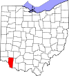 |
|---|
| ClintonCounty | 027 | Wilmington | Mar 1, 1810 | Highland and Warren Counties | George Clinton (1739–1812), vice-president when the county was organized | 41,938 | 410.88 sq mi
(1,064 km2) |  |
|---|
| ColumbianaCounty | 029 | Lisbon | May 1, 1803 | Jefferson and Washington Counties | Christopher Columbus, European explorer of the Americas | 100,182 | 532.46 sq mi
(1,379 km2) |  |
|---|
| CoshoctonCounty | 031 | Coshocton | Jan 31, 1810 | Muskingum and Tuscarawas Counties | Delaware Indian word meaning "union of waters" | 36,869 | 564.07 sq mi
(1,461 km2) |  |
|---|
| CrawfordCounty | 033 | Bucyrus | Apr 1, 1820 | Delaware County | Colonel William Crawford (1732–1782), Revolutionary War officer | 41,529 | 402.11 sq mi
(1,041 km2) |  |
|---|
| CuyahogaCounty | 035 | Cleveland | Jun 7, 1807 | Geauga County | Cuyahoga River, which means "crooked river" in an Iroquoian language [17] | 1,233,088 | 458.49 sq mi
(1,187 km2) |  |
|---|
| DarkeCounty | 037 | Greenville | Jan 3, 1809 | Miami County | General William Darke (1736–1801), Revolutionary War officer | 51,415 | 599.80 sq mi
(1,553 km2) | 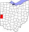 |
|---|
| DefianceCounty | 039 | Defiance | Apr 7, 1845 | Williams, Henry, and Paulding Counties | Fort Defiance, built in 1794 by General Anthony Wayne | 38,315 | 411.16 sq mi
(1,065 km2) | 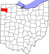 |
|---|
| DelawareCounty | 041 | Delaware | Apr 1, 1808 | Franklin County | Delaware Indians | 231,636 | 442.41 sq mi
(1,146 km2) |  |
|---|
| ErieCounty | 043 | Sandusky | Mar 15, 1838 | Huron and Sandusky Counties | Erie Indians | 74,035 | 254.88 sq mi
(660 km2) |  |
|---|
| FairfieldCounty | 045 | Lancaster | Dec 9, 1800 | Ross and Washington Counties | Named for the beauty of its "fair fields" | 165,360 | 505.11 sq mi
(1,308 km2) |  |
|---|
| FayetteCounty | 047 | Washington Court House | Mar 1, 1810 | Ross and Highland Counties | Gilbert du Motier, marquis de La Fayette, French military officer and aristocrat who participated in both the American and French revolutions | 28,817 | 406.58 sq mi
(1,053 km2) |  |
|---|
| FranklinCounty | 049 | Columbus | Apr 30, 1803 | Ross and Wayne Counties | Benjamin Franklin (1706–1791), Founding Father, author, printer, political theorist, scientist, inventor, and statesman | 1,326,063 | 539.87 sq mi
(1,398 km2) | 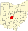 |
|---|
| FultonCounty | 051 | Wauseon | Apr 1, 1850 | Lucas, Henry, and Williams Counties | Robert Fulton (1765–1815), inventor of the steamboat [18] | 42,007 | 406.78 sq mi
(1,054 km2) |  |
|---|
| GalliaCounty | 053 | Gallipolis | Apr 30, 1803 | Washington and Adams Counties | Gaul, the ancient name of France | 28,986 | 468.78 sq mi
(1,214 km2) |  |
|---|
| GeaugaCounty | 055 | Chardon | Mar 1, 1806 | Trumbull County | An Indian word meaning "raccoon" | 95,407 | 403.66 sq mi
(1,045 km2) |  |
|---|
| GreeneCounty | 057 | Xenia | May 1, 1803 | Hamilton and Ross Counties | General Nathanael Greene (1742–1786), Revolutionary War officer | 169,691 | 414.88 sq mi
(1,075 km2) |  |
|---|
| GuernseyCounty | 059 | Cambridge | Mar 1, 1810 | Belmont and Muskingum Counties | Island of Guernsey, from where most of the settlers originated | 38,089 | 521.90 sq mi
(1,352 km2) |  |
|---|
| HamiltonCounty | 061 | Cincinnati | Jan 2, 1790 | One of the original counties | Alexander Hamilton (1755/7-1804), Secretary of the Treasury when the county was organized | 827,058 | 407.36 sq mi
(1,055 km2) | 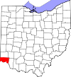 |
|---|
| HancockCounty | 063 | Findlay | Apr 1, 1820 | Logan County | John Hancock (1737–1793), president of the Continental Congress | 74,704 | 531.35 sq mi
(1,376 km2) | 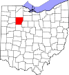 |
|---|
| HardinCounty | 065 | Kenton | Apr 1, 1820 | Logan County | General John Hardin (1753–1792), Revolutionary War officer | 30,368 | 470.29 sq mi
(1,218 km2) |  |
|---|
| HarrisonCounty | 067 | Cadiz | Feb 1, 1813 | Jefferson and Tuscarawas Counties | General William Henry Harrison (1773–1841), an officer of the War of 1812 and future President of the United States | 14,159 | 403.53 sq mi
(1,045 km2) |  |
|---|
| HenryCounty | 069 | Napoleon | Apr 1, 1820 | Shelby County | Patrick Henry (1736–1799), Revolutionary War-era legislator, orator, and scholar | 27,520 | 416.50 sq mi
(1,079 km2) | 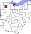 |
|---|
| HighlandCounty | 071 | Hillsboro | May 1, 1805 | Ross, Adams, and Clermont Counties | Descriptive of the county's terrain | 43,614 | 553.28 sq mi
(1,433 km2) |  |
|---|
| HockingCounty | 073 | Logan | Mar 1, 1818 | Athens, Ross, and Fairfield Counties | Possibly derived from the Delaware Indian word "Hoch-Hoch-ing", meaning "bottle" | 27,540 | 422.75 sq mi
(1,095 km2) |  |
|---|
| HolmesCounty | 075 | Millersburg | Jan 20, 1824 | Coshocton, Wayne, and Tuscarawas Counties | Major Andrew Holmes (died 1814), a War of 1812 officer | 44,386 | 422.99 sq mi
(1,096 km2) |  |
|---|
| HuronCounty | 077 | Norwalk | Mar 7, 1809 | Portage and Cuyahoga Counties | Huron Indians | 58,199 | 492.69 sq mi
(1,276 km2) |  |
|---|
| JacksonCounty | 079 | Jackson | Mar 1, 1816 | Scioto, Gallia, Athens, and Ross Counties | General Andrew Jackson (1767–1845), future President of the United States | 32,606 | 420.28 sq mi
(1,089 km2) |  |
|---|
| JeffersonCounty | 081 | Steubenville | Jul 29, 1797 | Washington County | Thomas Jefferson (1743–1826), Vice President when the county was organized, future President of the United States, and principal author of the Declaration of Independence | 64,026 | 409.61 sq mi
(1,061 km2) | 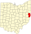 |
|---|
| KnoxCounty | 083 | Mount Vernon | Mar 1, 1808 | Fairfield County | General Henry Knox, the first Secretary of War | 63,320 | 527.12 sq mi
(1,365 km2) |  |
|---|
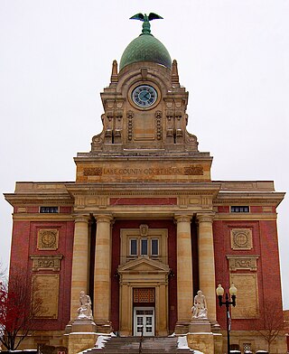
| LakeCounty | 085 | Painesville | Mar 6, 1840 | Geauga and Cuyahoga Counties | Its location on Lake Erie | 231,640 | 228.21 sq mi
(591 km2) | 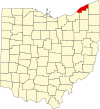 |
|---|
| LawrenceCounty | 087 | Ironton | Dec 21, 1815 | Gallia and Scioto Counties | Captain James Lawrence (1781–1813), naval hero in the War of 1812 | 56,118 | 454.96 sq mi
(1,178 km2) |  |
|---|
| LickingCounty | 089 | Newark | Mar 1, 1808 | Fairfield County | Licking River, named for the salt licks in the area, or an English pronunciation of the Lenape word W'li/'ik'/nk meaning "where the flood waters recede" [19] | 183,201 | 686.50 sq mi
(1,778 km2) | 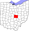 |
|---|
| LoganCounty | 091 | Bellefontaine | Mar 1, 1818 | Champaign County | General Benjamin Logan (c. 1742 – 1802), who destroyed Shawnee Indian towns in the county | 46,057 | 458.44 sq mi
(1,187 km2) |  |
|---|
| LorainCounty | 093 | Elyria | Dec 26, 1822 | Huron, Cuyahoga, and Medina Counties | Province of Lorraine, France | 317,910 | 492.50 sq mi
(1,276 km2) |  |
|---|
| LucasCounty | 095 | Toledo | Jun 20, 1835 | Wood, Sandusky, and Huron Counties | Robert Lucas (1781–1853), Governor of Ohio when the county was created | 425,484 | 340.46 sq mi
(882 km2) |  |
|---|
| MadisonCounty | 097 | London | Mar 1, 1810 | Franklin County | James Madison (1751–1836), fourth President of the United States | 44,602 | 465.44 sq mi
(1,205 km2) |  |
|---|
| MahoningCounty | 099 | Youngstown | Mar 1, 1846 | Columbiana and Trumbull Counties | Mahoning River, from a Lenape word meaning "at the licks" | 225,596 | 415.25 sq mi
(1,075 km2) |  |
|---|
| MarionCounty | 101 | Marion | Apr 1, 1820 | Delaware County | General Francis Marion (1732–1795), lieutenant colonel in the Continental Army and later brigadier general in the American Revolutionary War | 64,851 | 403.84 sq mi
(1,046 km2) |  |
|---|
| MedinaCounty | 103 | Medina | Feb 18, 1812 | Portage County | Medina, world-renowned religious site in western Saudi Arabia | 184,042 | 423 sq mi
(1,096 km2) |  |
|---|
| MeigsCounty | 105 | Pomeroy | Apr 1, 1819 | Gallia and Athens Counties | Return Jonathan Meigs Jr. (1764–1825), Governor of Ohio and Postmaster General at the time the county was organized | 21,767 | 429.42 sq mi
(1,112 km2) | 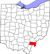 |
|---|
| MercerCounty | 107 | Celina | Apr 1, 1820 | Darke County | General Hugh Mercer (1726–1777), a Revolutionary War officer | 42,439 | 463.27 sq mi
(1,200 km2) |  |
|---|
| MiamiCounty | 109 | Troy | Mar 1, 1807 | Montgomery County | Miami Indians | 110,876 | 407.04 sq mi
(1,054 km2) |  |
|---|
| MonroeCounty | 111 | Woodsfield | Jan 29, 1813 | Belmont, Washington, and Guernsey Counties | James Monroe (1758–1831), Secretary of State when the county was organized and future President of the United States | 13,153 | 455.54 sq mi
(1,180 km2) | 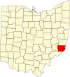 |
|---|
| MontgomeryCounty | 113 | Dayton | May 1, 1803 | Hamilton and Wayne Counties | General Richard Montgomery (1738–1775), a Revolutionary War officer | 533,796 | 461.68 sq mi
(1,196 km2) |  |
|---|
| MorganCounty | 115 | McConnelsville | Dec 29, 1817 | Washington, Guernsey, and Muskingum Counties | General Daniel Morgan (c. 1735 – 1802), a Revolutionary War officer | 13,646 | 417.66 sq mi
(1,082 km2) |  |
|---|
| MorrowCounty | 117 | Mount Gilead | Mar 1, 1848 | Knox, Marion, Delaware, and Richland Counties | Jeremiah Morrow (1771–1852), Governor of Ohio | 35,595 | 406.22 sq mi
(1,052 km2) |  |
|---|
| MuskingumCounty | 119 | Zanesville | March 1, 1804 | Washington and Fairfield Counties | An Indian word meaning "A town by the river" or "by the river side" | 86,305 | 664.63 sq mi
(1,721 km2) |  |
|---|
| NobleCounty | 121 | Caldwell | Apr 1, 1851 | Monroe, Washington, Morgan, and Guernsey Counties | James Noble, an early settler in the area | 14,311 | 399.00 sq mi
(1,033 km2) |  |
|---|
| OttawaCounty | 123 | Port Clinton | Mar 6, 1840 | Erie, Sandusky, and Lucas Counties | Named for the Ottawa Indians; Ottawa means "trader" in their language | 39,803 | 254.95 sq mi
(660 km2) | 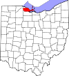 |
|---|
| PauldingCounty | 125 | Paulding | Apr 1, 1820 | Darke County | John Paulding (1758–1818), captor of spy John André during the Revolutionary War | 18,706 | 416.26 sq mi
(1,078 km2) |  |
|---|
| PerryCounty | 127 | New Lexington | Mar 1, 1818 | Washington, Fairfield, and Muskingum Counties | Commodore Oliver Hazard Perry (1785–1819), a naval officer of the War of 1812 | 35,551 | 409.78 sq mi
(1,061 km2) |  |
|---|
| PickawayCounty | 129 | Circleville | Mar 1, 1810 | Ross, Fairfield, and Franklin Counties | A misspelling of the Piqua tribe, a branch of the Shawnee | 61,086 | 501.91 sq mi
(1,300 km2) |  |
|---|
| PikeCounty | 131 | Waverly | Feb 1, 1815 | Ross, Scioto, and Adams Counties | General Zebulon M. Pike (1779–1813), a War of 1812 officer and discoverer of Pikes Peak in Colorado in 1806 | 27,001 | 441.49 sq mi
(1,143 km2) | 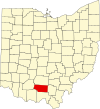 |
|---|
| PortageCounty | 133 | Ravenna | Jun 7, 1807 | Trumbull County | Derived from an Indian portage | 162,665 | 492.39 sq mi
(1,275 km2) |  |
|---|
| PrebleCounty | 135 | Eaton | Mar 1, 1808 | Montgomery and Butler Counties | Captain Edward Preble (1761–1807), a Naval commander in the Revolutionary War | 40,556 | 424.80 sq mi
(1,100 km2) |  |
|---|
| PutnamCounty | 137 | Ottawa | Apr 1, 1820 | Shelby County | General Israel Putnam (1718–1790), a Revolutionary War officer | 34,199 | 483.87 sq mi
(1,253 km2) | 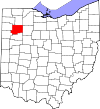 |
|---|
| RichlandCounty | 139 | Mansfield | Mar 1, 1808 | Fairfield County | Descriptive of the soil in the area | 125,064 | 496.88 sq mi
(1,287 km2) |  |
|---|
| RossCounty | 141 | Chillicothe | Aug 20, 1798 | Adams and Washington Counties | Named for U.S. Senator from Pennsylvania James Ross by territorial governor Arthur St. Clair | 76,501 | 688.41 sq mi
(1,783 km2) | 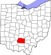 |
|---|
| SanduskyCounty | 143 | Fremont | Apr 1, 1820 | Huron County | An Iroquois word meaning "cold water" | 58,709 | 409.18 sq mi
(1,060 km2) |  |
|---|
| SciotoCounty | 145 | Portsmouth | May 1, 1803 | Adams County | Scioto River; Scioto is a Wyandot Indian word meaning "deer" | 71,969 | 612.27 sq mi
(1,586 km2) | 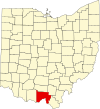 |
|---|
| SenecaCounty | 147 | Tiffin | Apr 1, 1820 | Huron County | Seneca Indians, who had a reservation in the county area at the time | 54,527 | 550.59 sq mi
(1,426 km2) | 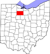 |
|---|
| ShelbyCounty | 149 | Sidney | Apr 1, 1819 | Miami County | General Isaac Shelby (1750–1826), a Revolutionary War officer and Governor of Kentucky | 47,765 | 409.27 sq mi
(1,060 km2) | 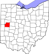 |
|---|
| StarkCounty | 151 | Canton | Feb 13, 1808 | Columbiana County | General John Stark (1728–1822), a Revolutionary War officer; known as the "Hero of Bennington" for his exemplary service at the Battle of Bennington in 1777 | 372,716 | 576.14 sq mi
(1,492 km2) |  |
|---|
| SummitCounty | 153 | Akron | Mar 3, 1840 | Medina, Portage, and Stark Counties | Its location at the highest elevation along the Ohio and Erie Canal | 535,733 | 419.38 sq mi
(1,086 km2) |  |
|---|
| TrumbullCounty | 155 | Warren | Jul 10, 1800 | Jefferson and Wayne Counties | Jonathan Trumbull (1710–1785), Governor of Connecticut when the county was organized | 200,373 | 616.48 sq mi
(1,597 km2) |  |
|---|
| TuscarawasCounty | 157 | New Philadelphia | Mar 15, 1808 | Muskingum County | Tuscarawas River, meaning "open mouth river"
or
the Tuscarawas tribe who lived on the river | 91,874 | 567.58 sq mi
(1,470 km2) |  |
|---|
| UnionCounty | 159 | Marysville | Apr 1, 1820 | Delaware, Franklin, Logan, and Madison Counties | Its formation by a union of four counties | 69,637 | 436.65 sq mi
(1,131 km2) |  |
|---|
| Van WertCounty | 161 | Van Wert | Apr 1, 1820 | Darke County | Isaac Van Wart (1760–1828), captor of spy John André during the Revolutionary War | 28,704 | 410.09 sq mi
(1,062 km2) |  |
|---|
| VintonCounty | 163 | McArthur | Mar 23, 1850 | Athens, Gallia, Hocking, Jackson, and Ross Counties | Samuel Finley Vinton (1792–1862), Ohio Statesman and U.S. Congressman | 12,474 | 414.08 sq mi
(1,072 km2) |  |
|---|
| WarrenCounty | 165 | Lebanon | May 1, 1803 | Hamilton County | General Joseph Warren (1741–1775), a Revolutionary War officer | 252,148 | 399.63 sq mi
(1,035 km2) | 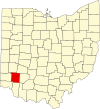 |
|---|
| WashingtonCounty | 167 | Marietta | Jul 27, 1788 | One of the original counties | George Washington (1732–1799), commander of the Continental Army, president of the Constitutional Convention, and future President of the United States | 58,577 | 635.15 sq mi
(1,645 km2) | 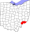 |
|---|
| WayneCounty | 169 | Wooster | Mar 1, 1812 | Stark County | General Anthony Wayne (1745–1796), a Revolutionary War officer | 116,510 | 555.36 sq mi
(1,438 km2) |  |
|---|
| WilliamsCounty | 171 | Bryan | Apr 1, 1820 | Darke County | David Williams (1754–1831), captor of spy John André during the Revolutionary War | 36,591 | 421.74 sq mi
(1,092 km2) |  |
|---|
| WoodCounty | 173 | Bowling Green | Apr 1, 1820 | Refactored from non-county territory | Eleazer D. Wood (1783–1814), founder of Fort Meigs | 132,650 | 617.32 sq mi
(1,599 km2) |  |
|---|
| WyandotCounty | 175 | Upper Sandusky | Feb 3, 1845 | Marion, Crawford, and Hardin Counties | Wyandot Indians | 21,457 | 405.61 sq mi
(1,051 km2) | 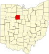 |
|---|