Champaign County, Ohio

Last updated

Champaign County
Champaign County Courthouse, Ohio.jpg
Flag of Champaign County, Ohio.png
Seal of Champaign County Ohio.svg
Map of Ohio highlighting Champaign County.svg
Location within the U.S. state of Ohio
Ohio in United States.svg
Ohio's location within the U.S.
Coordinates: 40°08′N83°46′W / 40.14°N 83.77°W / 40.14; -83.77
CountryFlag of the United States.svg United States
StateFlag of Ohio.svg  Ohio
FoundedMarch 1, 1805 [1]
Named for "plain" in French
Seat Urbana
Largest cityUrbana
Area
  Total430 sq mi (1,100 km2)
  Land429 sq mi (1,110 km2)
  Water1.2 sq mi (3 km2)  0.3%
Population
 (2020)
  Total38,714
  Density90/sq mi (35/km2)
Time zone UTC−5 (Eastern)
  Summer (DST) UTC−4 (EDT)
Congressional district 4th
Website www.co.champaign.oh.us

Champaign County is a county located in the U.S. state of Ohio. As of the 2020 census, the population was 38,714. [2] Its county seat and largest city is Urbana. [3] The county takes its name from the French word for "open level country". [4] Champaign County became the 18th of 88 Ohio counties on March 1, 1805. It was formed from parts of Greene and Franklin counties by legislative action. [5]

Contents

Champaign County comprises the Urbana, OH Micropolitan Statistical Area, which is also included in the Dayton–Springfield–Sidney, OH Combined Statistical Area.

Geography

According to the U.S. Census Bureau, the county has a total area of 430 square miles (1,100 km2), of which 429 square miles (1,110 km2) is land and 1.2 square miles (3.1 km2) (0.3%) is water. [6]

Adjacent counties

Demographics

Historical population
CensusPop.Note
1810 6,303
1820 8,47934.5%
1830 12,13143.1%
1840 16,72137.8%
1850 19,78218.3%
1860 22,69814.7%
1870 24,1886.6%
1880 27,81715.0%
1890 26,980−3.0%
1900 26,642−1.3%
1910 26,351−1.1%
1920 25,071−4.9%
1930 24,103−3.9%
1940 25,2584.8%
1950 26,7936.1%
1960 29,71410.9%
1970 30,4912.6%
1980 33,64910.4%
1990 36,0197.0%
2000 38,8908.0%
2010 40,0973.1%
2020 38,714−3.4%
U.S. Decennial Census [7]
1790-1960 [8] 1900-1990 [9]
1990-2000 [10] 2020 [2]

2000 census

As of the census [11] of 2000, there were 38,890 people, 14,952 households, and 10,870 families living in the county. The population density was 91 inhabitants per square mile (35/km2). There were 15,890 housing units at an average density of 37 units per square mile (14/km2). The racial makeup of the county was 95.73% White, 2.30% Black or African American, 0.31% Native American, 0.25% Asian, 0.02% Pacific Islander, 0.31% from other races, and 1.08% from two or more races. 0.69% of the population were Hispanic or Latino of any race.

There were 14,952 households, out of which 34.00% had children under the age of 18 living with them, 59.70% were married couples living together, 9.20% had a female householder with no husband present, and 27.30% were non-families. 23.50% of all households were made up of individuals, and 9.40% had someone living alone who was 65 years of age or older. The average household size was 2.56 and the average family size was 3.01.

In the county, the population was spread out, with 26.20% under the age of 18, 7.90% from 18 to 24, 28.70% from 25 to 44, 24.60% from 45 to 64, and 12.60% who were 65 years of age or older. The median age was 37 years. For every 100 females, there were 95.90 males. For every 100 females age 18 and over, there were 92.90 males.

The median income for a household in the county was $43,139, and the median income for a family was $50,430. Males had a median income of $38,265 versus $26,241 for females. The per capita income for the county was $19,542. About 5.10% of families and 7.60% of the population were below the poverty line, including 9.90% of those under age 18 and 7.60% of those age 65 or over.

2010 census

As of the 2010 United States Census, there were 40,097 people, 15,329 households, and 10,925 families living in the county. [12] The population density was 93.5 inhabitants per square mile (36.1/km2). There were 16,755 housing units at an average density of 39.1 units per square mile (15.1 units/km2). [13] The racial makeup of the county was 94.7% white, 2.2% black or African American, 0.4% Asian, 0.4% American Indian, 0.4% from other races, and 1.9% from two or more races. Those of Hispanic or Latino origin made up 1.1% of the population. [12] In terms of ancestry, 27.6% were German, 14.9% were Irish, 14.3% were American, and 11.8% were English. [14]

Of the 15,329 households, 33.7% had children under the age of 18 living with them, 55.9% were married couples living together, 10.2% had a female householder with no husband present, 28.7% were non-families, and 23.9% of all households were made up of individuals. The average household size was 2.56 and the average family size was 3.02. The median age was 39.7 years. [12]

The median income for a household in the county was $49,246 and the median income for a family was $58,433. Males had a median income of $44,920 versus $32,847 for females. The per capita income for the county was $23,438. About 10.0% of families and 12.9% of the population were below the poverty line, including 18.4% of those under age 18 and 6.3% of those age 65 or over. [15]

2020 census

As of the 2020 census, there were 38,714 people, and 15,506 households in the county. [2] The population density was 90.2 people per square mile (34.8 people/km2). The racial makeup of the county was 94.4% White, 2.2% African American, 0.5% Asian, 0.5% Native American, and 2.4% two or more races. Those of Hispanic or Latino origin made up 1.8% of the population. [2]

22% of the population was under 18, and 5.4% were under 5. 18.7% of the population were over 65. 50% of the population was female, and 50% was male. [2]

The median income for a household in the county was $62,865. The per capita income for the county was $30,090. 10.6% of the population were below the poverty line. [2]

Politics

Champaign County is a Republican stronghold county in presidential elections. It has only voted Democratic three times since 1856.

United States presidential election results for Champaign County, Ohio [16]
Year Republican Democratic Third party
No.%No.%No.%
2020 14,58972.93%5,06225.31%3521.76%
2016 12,63169.24%4,59425.18%1,0185.58%
2012 11,04559.81%7,04438.14%3792.05%
2008 11,14158.84%7,38539.00%4102.17%
2004 11,71862.41%6,96837.11%900.48%
2000 9,22058.80%5,95537.98%5053.22%
1996 6,56844.10%5,99040.22%2,33515.68%
1992 7,00443.10%5,20132.00%4,04724.90%
1988 8,99567.29%4,27231.96%1010.76%
1984 9,93573.05%3,54426.06%1210.89%
1980 7,35660.17%4,10933.61%7606.22%
1976 6,52656.74%4,74841.28%2281.98%
1972 8,75669.48%3,62628.77%2211.75%
1968 6,86353.83%4,26433.44%1,62312.73%
1964 5,58843.91%7,13856.09%00.00%
1960 9,14166.72%4,56033.28%00.00%
1956 8,76769.48%3,85130.52%00.00%
1952 8,88066.06%4,56333.94%00.00%
1948 6,49258.49%4,58541.31%230.21%
1944 7,79561.89%4,80038.11%00.00%
1940 7,84156.94%5,92943.06%00.00%
1936 6,87250.09%6,48547.27%3622.64%
1932 6,19148.70%6,39650.31%1250.98%
1928 7,65169.52%3,29629.95%590.54%
1924 6,18160.33%3,57534.90%4894.77%
1920 7,28560.07%4,77539.37%680.56%
1916 3,69551.80%3,33846.80%1001.40%
1912 2,39235.08%2,76340.53%1,66324.39%
1908 4,15355.69%3,16042.38%1441.93%
1904 4,19261.98%2,33634.54%2353.47%
1900 4,30656.32%3,19241.75%1481.94%
1896 4,31455.13%3,43243.86%791.01%
1892 3,70853.97%2,79140.62%3725.41%
1888 3,93353.58%3,04941.53%3594.89%
1884 4,15756.41%3,07841.77%1341.82%
1880 4,10058.38%2,86540.79%580.83%
1876 3,52854.99%2,87244.76%160.25%
1872 3,05958.08%2,18541.48%230.44%
1868 2,95458.01%2,13841.99%00.00%
1864 2,76661.06%1,76438.94%00.00%
1860 2,32552.12%1,81040.57%3267.31%
1856 1,99549.55%1,71142.50%3207.95%

Communities

Map of Champaign County, Ohio with Municipal and Township Labels Map of Champaign County Ohio With Municipal and Township Labels.PNG
Map of Champaign County, Ohio with Municipal and Township Labels

City

Villages

Townships

Census-designated place

Unincorporated communities

Libraries

The following libraries serve the communities of Champaign County.

Notable people

See also

Related Research Articles

<span class="mw-page-title-main">Miami County, Ohio</span> County in Ohio, United States

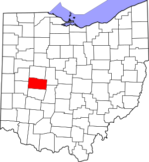
Miami County is a county located in the U.S. state of Ohio. As of the 2020 census, the population was 108,774. Its county seat is Troy. The county is named in honor of the Miami people.

<span class="mw-page-title-main">Crawford County, Ohio</span> County in Ohio, United States

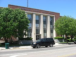
Crawford County is a county located in the north central portion of the U.S. state of Ohio. As of the 2020 census, the population was 42,025. Its county seat and largest city is Bucyrus. The county was created in 1820 and later organized in 1836. It was named for Colonel William Crawford, a soldier during the American Revolution. Crawford County comprises the Bucyrus, OH Micropolitan Statistical Area, which is also included in the Mansfield-Ashland-Bucyrus, OH Combined Statistical Area.

<span class="mw-page-title-main">Philo, Illinois</span> Village in Illinois, United States

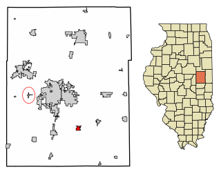
Philo is a village about nine miles south of Urbana in Champaign County, Illinois, United States. The population was 1,392 at the 2020 census.

<span class="mw-page-title-main">Savoy, Illinois</span> Village in Illinois, United States

Savoy is a village in Champaign County, Illinois, United States. The population was 8,857 at the 2020 census. It is part of the Champaign–Urbana metropolitan area.

<span class="mw-page-title-main">Christiansburg, Ohio</span> Village in Ohio, United States

Christiansburg is a village in Champaign County, Ohio, United States. The population was 505 at the 2020 census.

<span class="mw-page-title-main">Mechanicsburg, Ohio</span> Village in Ohio, United States

Mechanicsburg is a village in Champaign County, Ohio, United States. The population was 1,681 at the 2020 census.

<span class="mw-page-title-main">Mutual, Ohio</span> Village in Ohio, United States

Mutual is a village in Champaign County, Ohio, United States. The population was 127 at the 2020 census.

<span class="mw-page-title-main">North Lewisburg, Ohio</span> Village in Ohio, United States

North Lewisburg is a village in Champaign County, Ohio The population was 1,636 at the time of the 2020 census.

<span class="mw-page-title-main">Urbana, Ohio</span> City in Ohio, United States

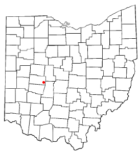
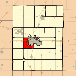
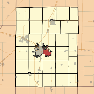
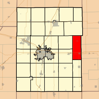
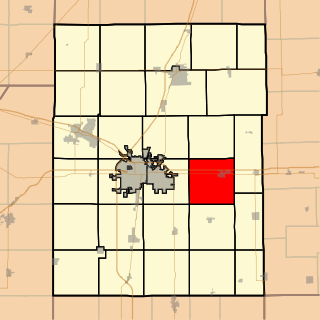
Urbana is a city in and the county seat of Champaign County, Ohio, United States, about 34 miles (55 km) northeast of Dayton and 41 miles (66 km) west of Columbus. The population was 11,115 at the 2020 census. It is the principal city of the Urbana micropolitan area. Urbana was laid out in 1805, and for a time in 1812 was the headquarters of the Northwestern army during the War of 1812. It is the burial place of the explorer and Indian fighter Simon Kenton. The city was home to Urbana University and Curry Normal and Industrial Institute, a school for African American students.

<span class="mw-page-title-main">Woodstock, Ohio</span> Village in Ohio, United States

Woodstock is a village in Champaign County, Ohio, United States. The population was 287 at the 2020 census.

<span class="mw-page-title-main">Chilo, Ohio</span> Village in Ohio, United States

Chilo or is a village in Clermont County, Ohio, United States, along the Ohio River. The population was 71 at the 2020 census.

<span class="mw-page-title-main">Ayers Township, Champaign County, Illinois</span> Township in Illinois, United States

Ayers Township is one of thirty townships in Champaign County, Illinois, USA. As of the 2020 census, its population was 421 and it contained 198 housing units.

<span class="mw-page-title-main">Champaign Township, Champaign County, Illinois</span> Township in Illinois, United States

Champaign Township is a township in Champaign County, Illinois, USA. As of the 2020 census, its population was 11,264 and it contained 5,091 housing units.

<span class="mw-page-title-main">Compromise Township, Champaign County, Illinois</span> Township in Illinois, United States

Compromise Township is a township in Champaign County, Illinois, USA. As of the 2020 census, its population was 1,323 and it contained 586 housing units.

<span class="mw-page-title-main">Cunningham Township, Champaign County, Illinois</span> Township in Illinois, United States

Cunningham Township is a township in Champaign County, Illinois, USA. As of the 2020 census, its population was 38,336 and it contained 18,321 housing units. Cunningham Township is coterminous with the City of Urbana. It is one of two coterminous townships in Champaign County and one of seventeen coterminous townships statewide.

<span class="mw-page-title-main">East Bend Township, Champaign County, Illinois</span> Township in Illinois, United States

East Bend Township is a township in Champaign County, Illinois, USA. As of the 2020 census, its population was 623 and it contained 261 housing units. East Bend Township was named for a meander of the Sangamon River.

<span class="mw-page-title-main">Kerr Township, Champaign County, Illinois</span> Township in Illinois, United States

Kerr Township is a township in Champaign County, Illinois, USA. As of the 2020 census, its population was 183 and it contained 64 housing units.

<span class="mw-page-title-main">Ogden Township, Champaign County, Illinois</span> Township in Illinois, United States

Ogden Township is a township in Champaign County, Illinois, United States. As of the 2020 census, its population was 1,531 and it contained 683 housing units.

<span class="mw-page-title-main">Somer Township, Champaign County, Illinois</span> Township in Illinois, United States

Somer Township is a township in Champaign County, Illinois, USA. As of the 2020 census, its population was 988 and it contained 469 housing units.

<span class="mw-page-title-main">St. Joseph Township, Champaign County, Illinois</span> Township in Illinois, United States

Saint Joseph Township is a township in Champaign County, Illinois, USA. As of the 2020 census, its population was 5,597 and it contained 2,244 housing units.

References

  1. "Ohio County Profiles: Champaign County" (PDF). Ohio Department of Development. Archived from the original (PDF) on June 21, 2007. Retrieved April 28, 2007.
  2. 1 2 3 4 5 6 2020 census
  3. "Find a County". National Association of Counties. Archived from the original on May 31, 2011. Retrieved June 7, 2011.
  4. "Agriculture & Natural Resources in Champaign County". Ohio State University Extension. Archived from the original on July 16, 2011. Retrieved September 23, 2010.
  5. The History of Champaign County, Ohio. W. H. Beers & Co. 1881.
  6. "2010 Census Gazetteer Files". United States Census Bureau. August 22, 2012. Archived from the original on May 4, 2014. Retrieved February 7, 2015.
  7. "U.S. Decennial Census". United States Census Bureau. Retrieved February 7, 2015.
  8. "Historical Census Browser". University of Virginia Library. Archived from the original on August 11, 2012. Retrieved February 7, 2015.
  9. Forstall, Richard L., ed. (March 27, 1995). "Population of Counties by Decennial Census: 1900 to 1990". United States Census Bureau. Retrieved February 7, 2015.
  10. "Census 2000 PHC-T-4. Ranking Tables for Counties: 1990 and 2000" (PDF). United States Census Bureau. April 2, 2001. Archived (PDF) from the original on March 27, 2010. Retrieved February 7, 2015.
  11. "U.S. Census website". United States Census Bureau . Retrieved January 31, 2008.
  12. 1 2 3 "DP-1 Profile of General Population and Housing Characteristics: 2010 Demographic Profile Data". United States Census Bureau. Archived from the original on February 13, 2020. Retrieved December 27, 2015.
  13. "Population, Housing Units, Area, and Density: 2010 - County". United States Census Bureau. Archived from the original on February 13, 2020. Retrieved December 27, 2015.
  14. "DP02 SELECTED SOCIAL CHARACTERISTICS IN THE UNITED STATES – 2006-2010 American Community Survey 5-Year Estimates". United States Census Bureau. Archived from the original on February 13, 2020. Retrieved December 27, 2015.
  15. "DP03 SELECTED ECONOMIC CHARACTERISTICS – 2006-2010 American Community Survey 5-Year Estimates". United States Census Bureau. Archived from the original on February 13, 2020. Retrieved December 27, 2015.
  16. Leip, David. "Dave Leip's Atlas of U.S. Presidential Elections". uselectionatlas.org. Retrieved May 1, 2018.

40°08′N83°46′W / 40.14°N 83.77°W / 40.14; -83.77