Fayette County, Ohio

Last updated

Fayette County
Washington Courthouse Ohio.jpg
Flag of Fayette County, Ohio.png
Seal of Fayette County Ohio.svg
Map of Ohio highlighting Fayette County.svg
Location within the U.S. state of Ohio
Ohio in United States.svg
Ohio's location within the U.S.
Coordinates: 39°34′N83°27′W / 39.56°N 83.45°W / 39.56; -83.45
CountryFlag of the United States.svg United States
StateFlag of Ohio.svg  Ohio
FoundedMarch 1, 1810 [1]
Named for Marquis de Lafayette
Seat Washington Court House
Largest cityWashington Court House
Area
  Total407 sq mi (1,050 km2)
  Land406 sq mi (1,050 km2)
  Water0.7 sq mi (2 km2)  0.2%
Population
 (2020)
  Total28,951
  Density71/sq mi (27/km2)
Time zone UTC−5 (Eastern)
  Summer (DST) UTC−4 (EDT)
Congressional districts 2nd, 15th
Website www.fayette-co-oh.com

Fayette County is a county located in the U.S. state of Ohio. As of the 2020 census, the population was 28,951. [2] Its county seat and largest city is Washington Court House. [3] The county was named for the Marquis de Lafayette, [4] a Frenchman who was an officer in the American Army in the Revolution, when established on March 1, 1810.

Contents

Fayette County comprises the Washington Court House, OH Micropolitan Statistical Area, which is also included in the Columbus-Marion-Zanesville, OH Combined Statistical Area.

History

Fayette County was formed on March 1, 1810, from portions of Highland and Ross Counties. It was named after Marie-Joseph Motier, Marquis de La Fayette, a French general and politician who took the side of the Colonials during the American Revolutionary War and who played an important role in the French Revolution. [5]

Parks

Trails

Tri-County Triangle Trail - This trail goes between Washington Court House and Chillicothe.

Clinton-Fayette Friendship Trail - This trail goes between Melvin to Borum RD and starts backup at Bush RD to Jamison RD.

The trail was extended from Greene County Line to Octa. The Connection into Fayette County was opened in 2022, allowing travel all the way to Octa, OH from Xenia, OH. There are 18.5 miles of this trail to enjoy in rural Greene and Fayette Counties.

Rechord Herald Newspaper link talking about the opening

Geography

According to the U.S. Census Bureau, the county has a total area of 407 square miles (1,050 km2), of which 406 square miles (1,050 km2) is land and 0.7 square miles (1.8 km2) (0.2%) is water. [6]

Adjacent counties

Major highways

Demographics

Historical population
CensusPop.Note
1810 1,854
1820 6,316240.7%
1830 8,18229.5%
1840 10,98434.2%
1850 12,72615.9%
1860 15,93525.2%
1870 17,1707.8%
1880 20,36418.6%
1890 22,3099.6%
1900 21,725−2.6%
1910 21,7440.1%
1920 21,518−1.0%
1930 20,755−3.5%
1940 21,3853.0%
1950 22,5545.5%
1960 24,7759.8%
1970 25,4612.8%
1980 27,4677.9%
1990 27,4660.0%
2000 28,4333.5%
2010 29,0302.1%
2020 28,951−0.3%
U.S. Decennial Census [7]
1790-1960 [8] 1900-1990 [9]
1990-2000 [10] 2020 [11]

2000 census

As of the census [12] of 2010, there were 29,030 people, 11,436 households, and 7,834 families living in the county. The population density was 71.4 inhabitants per square mile (27.6/km2). There were 12,693 housing units at an average density of 31.2 units per square mile (12.0 units/km2). The racial makeup of the county was 94.63% White, 2.02% Black or African American, 0.23% Native American, 0.54% Asian, 0.03% Pacific Islander, 0.80% from other races, and 1.74% from two or more races. 1.79% of the population were Hispanic or Latino of any race.

There were 11,436 households, out of which 32.53% had children under the age of 18 living with them, 49.05% were married couples living together, 13.50% had a female householder with no husband present, and 31.50% were non-families. 25.80% of all households were made up of individuals, and 10.34% had someone living alone who was 65 years of age or older. The average household size was 2.49 and the average family size was 2.95.

In the county, the population was spread out, with 24.67% under the age of 18, 7.88% from 18 to 24, 24.89% from 25 to 44, 27.59% from 45 to 64, and 14.97% who were 65 years of age or older. The median age was 39.4 years. For every 100 females there were 96.69 males. For every 100 females age 18 and over, there were 93.56 males.

As of 2013, the median income for a household in the county was $37,619, and the median income for a family was $45,108. Males had a median income of $30,516 versus $20,223 for females. The per capita income for the county was $20,603. About 16.1% of families and 20.1% of the population were below the poverty line, including 27.4% of those under age 18 and 9.1% of those age 65 or over.

2010 census

As of the 2010 United States Census, there were 29,030 people, 11,436 households, and 7,834 families living in the county. [13] The population density was 71.4 inhabitants per square mile (27.6/km2). There were 12,693 housing units at an average density of 31.2 units per square mile (12.0 units/km2). [14] The racial makeup of the county was 94.6% white, 2.0% black or African American, 0.5% Asian, 0.2% American Indian, 0.8% from other races, and 1.7% from two or more races. Those of Hispanic or Latino origin made up 1.8% of the population. [13] In terms of ancestry, 21.9% were German, 15.4% were American, 10.6% were Irish, and 9.7% were English. [15]

Of the 11,436 households, 33.4% had children under the age of 18 living with them, 49.0% were married couples living together, 13.5% had a female householder with no husband present, 31.5% were non-families, and 25.8% of all households were made up of individuals. The average household size was 2.49 and the average family size was 2.95. The median age was 39.4 years. [13]

The median income for a household in the county was $39,599 and the median income for a family was $48,424. Males had a median income of $39,078 versus $31,434 for females. The per capita income for the county was $20,525. About 12.9% of families and 17.4% of the population were below the poverty line, including 22.6% of those under age 18 and 9.6% of those age 65 or over. [16]

Politics

Fayette County is a stronghold of the Republican party in presidential elections; it has voted Democratic only four times since 1856.

United States presidential election results for Fayette County, Ohio [17]
Year Republican Democratic Third party
No.%No.%No.%
2020 9,47375.03%2,97523.56%1781.41%
2016 7,99571.18%2,73924.39%4984.43%
2012 6,62059.97%4,24938.49%1691.53%
2008 7,10260.61%4,40137.56%2151.83%
2004 7,37662.74%4,33436.86%470.40%
2000 5,68561.27%3,36336.25%2302.48%
1996 4,83150.29%3,66538.15%1,11111.56%
1992 4,91648.74%2,97629.51%2,19421.75%
1988 6,18669.72%2,62329.56%640.72%
1984 6,83875.80%2,12623.57%570.63%
1980 5,82764.26%2,81030.99%4314.75%
1976 5,71955.18%4,47743.20%1681.62%
1972 6,97073.25%2,34424.63%2012.11%
1968 5,33951.99%2,96628.88%1,96419.13%
1964 4,56742.70%6,12857.30%00.00%
1960 7,08564.11%3,96635.89%00.00%
1956 6,69666.00%3,44934.00%00.00%
1952 6,80063.66%3,88236.34%00.00%
1948 4,86557.95%3,51341.85%170.20%
1944 5,93360.06%3,94539.94%00.00%
1940 5,98453.27%5,24946.73%00.00%
1936 4,84145.29%5,80754.33%410.38%
1932 4,25444.74%5,15754.24%971.02%
1928 5,25165.23%2,75234.19%470.58%
1924 4,54260.27%2,69635.77%2983.95%
1920 5,44658.55%3,81240.98%430.46%
1916 2,77250.53%2,61647.69%981.79%
1912 2,18639.72%2,26141.08%1,05719.20%
1908 3,34356.84%2,45141.68%871.48%
1904 3,33162.47%1,88035.26%1212.27%
1900 3,38057.25%2,43841.29%861.46%
1896 3,35754.54%2,74844.65%500.81%
1892 2,83855.26%1,98938.73%3096.02%
1888 3,31658.44%2,19238.63%1662.93%
1884 3,17158.87%2,16040.10%551.02%
1880 2,83056.99%2,11142.51%250.50%
1876 2,43655.59%1,87442.77%721.64%
1872 2,14057.88%1,54541.79%120.32%
1868 1,97058.88%1,37641.12%00.00%
1864 1,84859.83%1,24140.17%00.00%
1860 1,45850.59%1,12138.90%30310.51%
1856 1,20949.11%88035.74%37315.15%

Government

Fayette County has a 3-member Board of County Commissioners that oversee the various County departments, similar to all but 2 of the 88 Ohio counties. As of 2021, Fayette County's elected commissioners are Tony Anderson, Dan Dean, and Jim Garland. [18]

Transportation

Airport

Fayette County Airport is a general aviation facility owned by the county and located northeast of the city of Washington Court House.

Communities

Map of Fayette County, Ohio with Municipal and Township Labels Map of Fayette County Ohio With Municipal and Township Labels.PNG
Map of Fayette County, Ohio with Municipal and Township Labels

City

Villages

Townships

Census-designated places

Unincorporated communities

See also

Related Research Articles

<span class="mw-page-title-main">Clinton County, Ohio</span> County in Ohio, United States

Clinton County is a county located in the U.S. state of Ohio. As of the 2020 census, the population was 42,018. Its county seat and largest city is Wilmington. The county is named for former U.S. Vice President George Clinton. Clinton County comprises the Wilmington, Ohio Micropolitan Statistical Area, which is also included in the Cincinnati-Wilmington-Maysville, OH-KY-IN Combined Statistical Area.

<span class="mw-page-title-main">Washington County, Ohio</span> County in Ohio, United States

Washington County is a county located in the southeastern part of the U.S. state of Ohio. As of the 2020 census, the population was 59,711. Its county seat is Marietta. The county, the oldest in the state, is named for George Washington. Washington County comprises the Marietta, OH Micropolitan Statistical Area, which is also included in the Parkersburg-Marietta-Vienna, WV-OH Combined Statistical Area.

<span class="mw-page-title-main">Monroe County, Ohio</span> County in Ohio, United States

Monroe County is a county located on the eastern border of the U.S. state of Ohio, across the Ohio River from West Virginia. As of the 2020 census, the population was 13,385, making it the second-least populous county in Ohio. Its county seat is Woodsfield. The county was created in 1813 and later organized in 1815.

<span class="mw-page-title-main">Madison County, Ohio</span> County in Ohio, United States

Madison County is a county located in the central portion of the U.S. state of Ohio. As of the 2020 census, the population was 43,824. Its county seat is London. The county is named for James Madison, President of the United States and was established on March 1, 1810.

<span class="mw-page-title-main">Licking County, Ohio</span> County in Ohio, United States

Licking County is a county located in the central portion of the U.S. state of Ohio. At the 2020 census, the population was 178,519. Its county seat is Newark. The county was formed on January 30, 1808, from portions of Fairfield County.

<span class="mw-page-title-main">Lake County, Ohio</span> County in Ohio, United States

Lake County is a county in the U.S. state of Ohio. As of the 2020 census, the population was 232,603. Its county seat is Painesville, and its largest city is Mentor.

<span class="mw-page-title-main">Hardin County, Ohio</span> County in Ohio, United States

Hardin County is a county located in the west central portion of the U.S. state of Ohio. As of the 2020 census, the population was 30,696. Its county seat and largest city is Kenton. The county was created in 1820 and later organized in 1833. It is named for John Hardin, an officer in the American Revolution.

<span class="mw-page-title-main">Greene County, Ohio</span> County in Ohio, United States

Greene County is located in the southwestern portion of Ohio. As of the 2020 census, the population was 167,966. Its county seat is Xenia and its largest city is Beavercreek. The county was established on March 24, 1803 and named for General Nathanael Greene, an officer in the Revolutionary War. Greene County is part of the Dayton, OH Metropolitan Statistical Area.

<span class="mw-page-title-main">Fulton County, Ohio</span> County in Ohio, United States

Fulton County is a county located in the U.S. state of Ohio west of Toledo. As of the 2020 census, the population was 42,713. Its county seat and largest city is Wauseon. The county was created in 1850 with land from Henry, Lucas, and Williams counties and is named for Robert Fulton, inventor of the steamboat. Fulton County is a part of the Toledo metropolitan area.

<span class="mw-page-title-main">Champaign County, Ohio</span> County in Ohio, United States

Champaign County is a county located in the U.S. state of Ohio. As of the 2020 census, the population was 38,714. Its county seat and largest city is Urbana. The county takes its name from the French word for "open level country". Champaign County became the 18th of 88 Ohio counties on March 1, 1805. It was formed from parts of Greene and Franklin counties by legislative action.

<span class="mw-page-title-main">Carroll County, Ohio</span> County in Ohio, United States

Carroll County is a county located in the state of Ohio. As of the 2020 census, the population was 26,721. Its county seat is Carrollton, while its largest village is Minerva. It is named for Charles Carroll of Carrollton, the last surviving signer of the Declaration of Independence. Carroll County is part of the Canton-Massillon, OH Metropolitan Statistical Area, which is also included in the Cleveland-Akron-Canton, OH Combined Statistical Area. It is in the Appalachian Ohio region.

<span class="mw-page-title-main">Fayette, Alabama</span> City in and county seat of Fayette County, Alabama

Fayette is a city and the county seat of Fayette County, Alabama, United States. The population was 4,619 at the 2010 census, down from 4,922 at the 2000 census.

<span class="mw-page-title-main">Akron, Indiana</span> Town in Indiana, United States

Akron is a town in Henry Township, Fulton County, Indiana, United States. The population was 1,167 at the 2010 census.

<span class="mw-page-title-main">Fayette, Maine</span> Town in the state of Maine, United States

Fayette is a town in Kennebec County, Maine, United States. The population was 1,160 as of the 2020 census. A popular recreation spot in central Maine, Fayette is part of the Winthrop Lakes Region.

<span class="mw-page-title-main">Sabina, Ohio</span> Village in Ohio, United States

Sabina is a village in Clinton County, Ohio, United States. As of the 2020 census, the village had a total population of 2,499.

<span class="mw-page-title-main">Jeffersonville, Ohio</span> Village in Ohio, United States

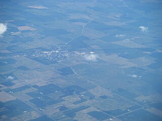
Jeffersonville is a village in Fayette County, Ohio, United States. The population was 1,258 at the 2020 census.

<span class="mw-page-title-main">Octa, Ohio</span> Village in Ohio, United States

Octa is a village in Fayette County, Ohio, United States, along Rattlesnake Creek. The population was 58 at the 2020 census.

<span class="mw-page-title-main">Old Washington, Ohio</span> Village in Ohio, United States

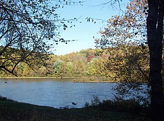
Old Washington is a village in Guernsey County, Ohio, United States. The population was 223 at the 2020 census.

<span class="mw-page-title-main">Perry Township, Fayette County, Pennsylvania</span> Township in Pennsylvania, United States

Perry Township is a township in Fayette County, Pennsylvania, United States. The population was 2,339 at the 2020 census, a decline from the figure of 2,552 tabulated in 2010. The Frazier School District serves the township.

<span class="mw-page-title-main">Robinson Township, Washington County, Pennsylvania</span> Township in Pennsylvania, United States

Robinson Township is a township in Washington County, Pennsylvania, United States. The population was 1,707 at the 2020 census. It was formerly an area of interest concerning coal mining. A portion of the Montour Trail passes through Robinson Township.

References

  1. "Ohio County Profiles: Fayette County" (PDF). Ohio Department of Development. Archived from the original (PDF) on June 21, 2007. Retrieved April 28, 2007.
  2. "2020 Population and Housing State Data". Census.gov. Retrieved January 7, 2022.
  3. "Find a County". National Association of Counties. Archived from the original on May 3, 2015. Retrieved June 7, 2011.
  4. Gannett, Henry (1905). The Origin of Certain Place Names in the United States. Govt. Print. Off. pp.  124.
  5. Kilbourn, John (1833). The Ohio Gazetteer, or, a Topographical Dictionary. Scott and Wright. pp.  194 . Retrieved December 12, 2013.
  6. "2010 Census Gazetteer Files". United States Census Bureau. August 22, 2012. Archived from the original on May 4, 2014. Retrieved February 7, 2015.
  7. "U.S. Decennial Census". United States Census Bureau. Retrieved February 7, 2015.
  8. "Historical Census Browser". University of Virginia Library. Archived from the original on August 11, 2012. Retrieved February 7, 2015.
  9. Forstall, Richard L., ed. (March 27, 1995). "Population of Counties by Decennial Census: 1900 to 1990". United States Census Bureau. Retrieved February 7, 2015.
  10. "Census 2000 PHC-T-4. Ranking Tables for Counties: 1990 and 2000" (PDF). United States Census Bureau. April 2, 2001. Archived (PDF) from the original on March 27, 2010. Retrieved February 7, 2015.
  11. 2020 census
  12. "U.S. Census website". United States Census Bureau . Retrieved January 31, 2008.
  13. 1 2 3 "DP-1 Profile of General Population and Housing Characteristics: 2010 Demographic Profile Data". United States Census Bureau. Archived from the original on February 13, 2020. Retrieved December 27, 2015.
  14. "Population, Housing Units, Area, and Density: 2010 - County". United States Census Bureau. Archived from the original on February 13, 2020. Retrieved December 27, 2015.
  15. "DP02 SELECTED SOCIAL CHARACTERISTICS IN THE UNITED STATES – 2006-2010 American Community Survey 5-Year Estimates". United States Census Bureau. Archived from the original on February 13, 2020. Retrieved December 27, 2015.
  16. "DP03 SELECTED ECONOMIC CHARACTERISTICS – 2006-2010 American Community Survey 5-Year Estimates". United States Census Bureau. Archived from the original on February 13, 2020. Retrieved December 27, 2015.
  17. Leip, David. "Dave Leip's Atlas of U.S. Presidential Elections". uselectionatlas.org. Retrieved May 1, 2018.
  18. "County Commissioners". Fayette County Ohio Home Page. Retrieved April 14, 2021.

39°34′N83°27′W / 39.56°N 83.45°W / 39.56; -83.45