
Irwin is an unincorporated community in southwestern Union Township, Union County, Ohio, United States. It is located at 40°07′21″N83°29′22″W, at the intersection of Ohio State Route 4 and 161. Irwin has a post office which serves the surrounding area, including the community of Rosedale.
Kiousville is an unincorporated community in southern Fairfield Township, Madison County, Ohio, United States. It is located at the intersection of Kiousville-Georgesville Road and McKendree Road.
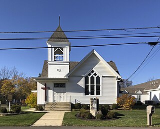
Jerome is an unincorporated community in Jerome Township, Union County, Ohio, United States. It is located at 40°09′59″N83°10′33″W, at the intersection of Jerome Road and Scioto Road, about 2 miles east of New California.
Bookwalter is an unincorporated community in Pawnee County, Nebraska, United States.
Calumet is an unincorporated community in Knox Township, Jefferson County, Ohio, United States. It is located just north of Toronto between Ohio State Route 7 and the Ohio River, at 40°28′55″N80°36′24″W. North 4th Street and North River Avenue both run continuously from Toronto to Calumet.
Afton is an unincorporated community in Clermont County, in the U.S. state of Ohio.
Lindale is an unincorporated community in Clermont County, in the U.S. state of Ohio.
Glen Roy is an unincorporated community in Coal Township, Jackson County, Ohio, United States. It is located east of Coalton along Ohio State Route 93, between Altoona and Goldsboro, at 39°06′45″N82°34′47″W.
Plano is an unincorporated community in Fayette and Ross counties, in the U.S. state of Ohio.
Stanhope is an unincorporated community in Ashtabula and Trumbull counties, in the U.S. state of Ohio.
Western Star is an unincorporated community in Medina and Summit counties, in the U.S. state of Ohio.
Limerick is an unincorporated community in Jackson Township, Jackson County, Ohio, United States. It is located at 39°07′29″N82°44′58″W.
Chapman is an unincorporated community in Coal Township, Jackson County, Ohio, United States. It is located south of Coalton at 39°05′21″N82°37′06″W, at the intersection of Ohio State Route 93 and Jackson Hill Road.
Clay is an unincorporated community in Franklin Township, Jackson County, Ohio, United States. It is located between Jackson and Oak Hill at the intersection of Ohio State Route 93 and Clay Banner Road/Pyro Road.
Banner is an unincorporated community in Franklin Township, Jackson County, Ohio, United States. It is located between Jackson and Oak Hill near the intersection of Clay Banner Road and Franklin Valley Road.
Kitchen is an unincorporated community in Madison Township, Jackson County, Ohio, United States. It is located southeast of Oak Hill at the intersection of Ohio State Route 233 and CH&D Road, at 38°52′11″N82°32′34″W.
Mabee Corner is an unincorporated community in Hamilton Township, Jackson County, Ohio, United States. It is located west of Oak Hill at the intersection of Bucklick Creek Road and Ohio State Route 139, at 38°54′10″N82°43′16″W.
Chandler is an unincorporated community in Wayne Township, Jefferson County, Ohio, United States. It is located south of Bloomingdale at the intersection of Bloomingdale-Smithfield-Chandler Road and County Road 24, at 40°18′28″N80°48′15″W.
Holt is an unincorporated community in Knox Township, Jefferson County, Ohio, United States. It is located about 3 miles (4.8 km) west of New Somerset at the intersection of County Highway 53 and Township Road 218, at 40°30′44″N80°45′06″W.
Robyville is an unincorporated community in Smithfield Township, Jefferson County, Ohio, United States. It is located southwest of Adena on Hanna Avenue, at 40°12′25″N80°52′45″W.

