F-41 is a county-designated highway in the Lower Peninsula of Michigan. It was previously designated as M-171, a former state trunkline highway, until 1960, running from US Highway 23 (US 23) just north of Oscoda, and coming back to US 23 about 20 miles (32 km) south of Alpena. The road runs through rural, forested areas of Iosco and Alcona counties, inland from Lake Huron.

New York State Route 96 (NY 96) is a 126.01-mile-long (202.79 km) northwest–southeast state highway in the Finger Lakes region of New York in the United States. The southern terminus of the route is at an interchange with NY 17 in the Southern Tier village of Owego, Tioga County. Its northern terminus is at a junction with East Main Street in the city of Rochester, Monroe County. Between the two endpoints, NY 96 passes through the city of Ithaca and the villages of Waterloo, Victor, and Pittsford. NY 96 is signed north–south for its entire length, although most of the route in Ontario County travels in an east–west direction.

New York State Route 318 (NY 318) is an east–west state highway in the Finger Lakes region of New York in the United States. The western terminus of the route is at an intersection with NY 14 at New York State Thruway exit 42 in the town of Phelps. The eastern terminus is at an intersection with U.S. Route 20 (US 20) and NY 5 northeast of the hamlet of Seneca Falls. All but 0.70 miles (1.13 km) of the 10.90-mile (17.54 km) route is located in Seneca County.

New York State Route 414 (NY 414) is a north–south state highway in the Southern Tier and Finger Lakes regions of New York in the United States. It extends for 83.20 miles (133.90 km) from an intersection with NY 352 in the Steuben County city of Corning to a junction with NY 104 in the Wayne County town of Huron. NY 414 spans five counties and roughly parallels NY 14 between Watkins Glen and Huron. It intersects every major east–west arterial in western New York, including the Southern Tier Expressway, U.S. Route 20 (US 20) and NY 5, and the New York State Thruway (I-90). The route passes through mostly rural areas as it travels between the several villages and cities along its routing.

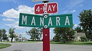
New York State Route 336 (NY 336) is an east–west state highway located within Seneca County in the Finger Lakes region of New York in the United States. It extends for 4.64 miles (7.47 km), mostly along the Fayette–Varick town line, from an intersection with NY 96A in the town of Fayette to a junction with NY 414 south of the hamlet of Fayette on the Fayette–Varick border. The section of NY 336 that runs along the town line is known as Townline Road. NY 336 was assigned to its current alignment in the early 1930s.

State Route 38 is a south–north state highway in the state of Ohio. Its southern terminus is near Bloomingburg and Washington Court House at the U.S. Route 62 / SR 3 concurrency and its northern terminus is in Marysville at the intersection of 5th Street and Main Street where the road continues north as SR 31.
Doris and Bethel are twin town sites in Buchanan County, Iowa, United States, both located just north of Highway 939 in central Buchanan County near Independence. Founded as whistle-stops along the Chicago and North Western Railway, the sites are abandoned today.

State Route 238 was a short northwest–southeast state highway in the southwestern portion of Ohio. At just over 1 mile (1.6 km) in length, State Route 238 had its southern terminus at the U.S. Route 62 /SR 3 concurrency less than 1 mile (1.6 km) southeast of Bloomingburg. Its northern terminus was at SR 38 in the downtown of the Fayette County village.

U.S. Route 62 (US 62) in Kentucky runs for a total of 391.207 miles (629.587 km) across 20 counties in western, north-central, and northeastern Kentucky. It enters the state by crossing the Ohio River near Wickliffe, then begins heading eastward at Bardwell, and traversing several cities and towns across the state up to Maysville, where it crosses the Ohio River a second time to enter the state of Ohio.
Lunda is an unincorporated community in Liberty Township, Union County, Ohio, United States. It is located at 40°21′53″N83°30′42″W, at the intersection of Lunda Road and Perkins Road, about three miles southeast of West Mansfield.
Woodland is an unincorporated community in Jackson Township, Union County, Ohio, United States. It is located at 40°28′44″N83°15′27″W, at the intersection of Woodland Road and Fox Road, about five miles northeast of Richwood.
Pancoastburg is an unincorporated community and census-designated place (CDP) in Madison Township, Fayette County, Ohio, United States. It is located along Ohio State Route 207, about 6 miles (10 km) south of Mount Sterling. As of the 2020 census the population of Pancoastburg was 68.

Madison Mills is an unincorporated community in Madison Township, Fayette County, Ohio, United States. It is located along Harrison Road, between Bloomingburg and Mount Sterling.

Yankeetown is an unincorporated community in Madison Township, Fayette County, Ohio, United States. It is located at the intersection of State Route 207 and Cook-Yankeetown Road, about 3 miles south of Mount Sterling.
Cook is an unincorporated community in Madison Township, Fayette County, Ohio, United States. It is located along Cook-Yankeetown Road, just west of its intersection with U.S. Route 62/State Route 3.
Buena Vista is an unincorporated community in Green Township, Fayette County, Ohio, United States. It is located at the intersection of Greenfield-Sabina Road and Stafford Road, about 5 miles south of Washington Court House. Rattlesnake Creek flows near the town site.
Boyds is an unincorporated community in Union Township, Fayette County, Ohio, United States. It is located southeast of Washington Court House along Bogus Road SE near its intersection with Ohio State Route 753.
Georgetown is an unincorporated community in Green Township, Fayette County, Ohio, United States. It is located southwest of Washington Court House.
Holt is an unincorporated community in Knox Township, Jefferson County, Ohio, United States. It is located about 3 miles (4.8 km) west of New Somerset at the intersection of County Highway 53 and Township Road 218, at 40°30′44″N80°45′06″W.
Shady Glen is an unincorporated community in Knox Township, Jefferson County, Ohio, United States. It is located west of Calumet along the John F. Kennedy Highway at its intersection with Brandywine Road, at 40°28′48″N80°38′23″W.