
Buena Vista is an independent city located in the Blue Ridge Mountains region of Virginia in the United States. As of the 2020 census, the population was 6,641. The Bureau of Economic Analysis combines the independent cities of Buena Vista and Lexington, along with surrounding Rockbridge County, for statistical purposes.

Lewis County is a county located in the U.S. state of Kentucky. As of the 2020 census, the population was 13,080. Its county seat is Vanceburg.

Buena Vista County is a county located in the U.S. state of Iowa. As of the 2020 census, the population was 20,823. Its county seat is Storm Lake. The county is named for the final victory of Field General Zachary Taylor in the Mexican–American War.

Fayette County is one of 92 counties in U.S. state of Indiana located in the east central portion of the state. As of 2020, the population was 23,398. Most of the county is rural; land use is farms, pasture and unincorporated woodland. The county seat and only incorporated town is Connersville, which holds a majority of the county's population.

Vista is a city in San Diego County, California. Vista is a medium-sized city within the San Diego-Carlsbad, CA Metropolitan Area. As of the 2020 Census, Vista had a population of 98,381. Current data estimates a 2023 population of 99,835. Vista's sphere of influence also includes portions of unincorporated San Diego County to the north and east, with a county island in the central west. Located just 7 mi (11 km) inland from the Pacific Ocean, it has a Mediterranean climate.

Buena Vista is a Statutory Town located in Chaffee County, Colorado, United States. The town population was 2,855 at the 2020 United States Census.

Connersville is a city in Fayette County, east central Indiana, United States, 66 miles (106 km) east by southeast of Indianapolis. The population was 13,481 at the 2010 census. The city is the county seat of and the largest and only incorporated town in Fayette County. The city is in the center of a large rural area of east central Indiana; the nearest significant city is Richmond, 26 miles (42 km) to the northeast by road. Connersville is home to the county's only high school. The local economy relies on manufacturing, retail, and healthcare to sustain itself. However, there has been a consistent decline in both employment and population since the 1960s, placing it among the least affluent areas in the state, as indicated by measures such as median household income and other economic indicators.

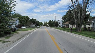
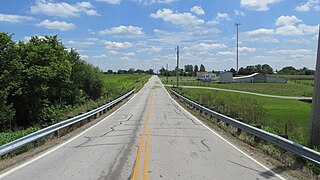
Sioux Rapids is a city in Buena Vista County, Iowa, United States. The population was 748 at the time of the 2020 census.
Buena Vista, meaning "good view" in Spanish, may refer to:
Vineland is an unincorporated community in southwest Orange County, Florida, United States, located just north of Interstate 4 along State Road 535 and continues along County Road 435, which is South Apopka Vineland Road. The name is no longer often used since the more well-known City of Lake Buena Vista lies just to the south and west. Orange County officially calls the area Buena Vista North or Orange Center, its original name. Mailing addresses for residents in the area are typically Orlando, Florida except many businesses in the area use Lake Buena Vista as their address. The area is most famous due to the name appearing on many major Orange County roads, including Apopka-Vineland Road, Winter Garden-Vineland Road, Kissimmee-Vineland Road and Taft-Vineland Road. There was also a small town which was abandoned in the 1960s called Vineland. An ACL Railway Depot, Housing, a schoolhouse, a church, the Vineland Cemetery, and many more community facilities were a part of the original town. These roads begin/terminate in the area known as Vineland and Lake Buena Vista, Florida.

Good Hope is an unincorporated community and census-designated place (CDP) in central Wayne Township, Fayette County, Ohio, United States. The population was 202 at the 2020 census.
Chicago Park is a residential and unincorporated historic agricultural community in Nevada County, California. It is located along Highway 174, with its center at the intersection of Mt. Olive Road. The neighborhood gets its name from its founding residents, who came from Chicago to California in the late 1800s to grow fruit, which was often shipped back to Illinois for consumption. Chicago Park is about 9 miles southeast of Grass Valley and about 3 miles north of Colfax.

U.S. Route 27 (US 27) in Kentucky runs 201.120 miles (323.671 km) from the Tennessee border to the Ohio border at Cincinnati. It crosses into the state in the Lake Cumberland area, passing near or through many small towns, including Somerset, Stanford, and Nicholasville. The road then passes straight through the heart of Lexington, including past the University of Kentucky (UK) and Transylvania University. North of Lexington, it passes through Cynthiana and Falmouth before entering Campbell County and passing through many Northern Kentucky suburbs before ending at the Ohio state line on the Taylor–Southgate Bridge in Cincinnati.
Pancoastburg is an unincorporated community and census-designated place (CDP) in Madison Township, Fayette County, Ohio, United States. It is located along Ohio State Route 207, about 6 miles (10 km) south of Mount Sterling. As of the 2020 census the population of Pancoastburg was 68.
Cook is an unincorporated community in Madison Township, Fayette County, Ohio, United States. It is located along Cook-Yankeetown Road, just west of its intersection with U.S. Route 62/State Route 3.
Manara is an unincorporated community in Marion Township, Fayette County, Ohio, United States. It is located at the intersection of Washington-Waterloo Road and Bloomingburg-New Holland Road.

Thomas Williamson Means was a settler of Hanging Rock, Ohio, and a native of South Carolina. Together with his brother Hugh he became notable in Ashland, Kentucky, after he built the Buena Vista Furnace and became a director of the Kentucky Coal, Iron & Manufacturing Company. He was also the father of Ashland Mayor John Means. Means owned furnaces in Alabama, Kentucky, Ohio, and Virginia.
Liberty is an unincorporated community in Harrisburg Township, Saline County, Illinois, United States. Liberty is located on County Route 37 along the southwestern border of Harrisburg.
Buena Vista, also known as Monterey, is an unincorporated community in Chickasaw County, Mississippi, United States.
Juniata was an unincorporated community in Buena Vista County, located in the U.S. state of Iowa.


