Summit County | |
---|---|
Coordinates: 41°08′N81°32′W / 41.13°N 81.53°W | |
Country | United States |
State | Ohio |
Founded | March 3 [1] [2] , 1840 |
Named for | the highest elevation on the Ohio and Erie Canal |
Seat | Akron |
Largest city | Akron |
Area | |
• Total | 419.38 sq mi (1,086.2 km2) |
• Land | 412.08 sq mi (1,067.3 km2) |
• Water | 7.3 sq mi (19 km2) 1.7% |
Population (2020) | |
• Total | 540,428 |
• Estimate (2022) | 535,882 |
• Density | 1,300/sq mi (500/km2) |
Time zone | UTC−5 (Eastern) |
• Summer (DST) | UTC−4 (EDT) |
Congressional district | 13th |
Website | co |
Summit County is an urban county in the U.S. state of Ohio. As of the 2020 census, the population was 540,428, [3] making it the fourth-most populous county in Ohio. Its county seat and largest city is Akron. [4] The county was formed on March 3, 1840, from portions of Medina, Portage and Stark Counties. It was named Summit County because the highest elevation on the Ohio and Erie Canal is located in the county. [5]
Summit County is part of the Akron, OH Metropolitan Statistical Area, which is also included in the Cleveland-Akron-Canton, OH Combined Statistical Area.
According to the United States Census Bureau, the county has a total area of 419.38 square miles (1,086 km2), of which 412.08 square miles (1,067 km2) is land and 7.3 square miles (19 km2) (1.7%) is water. [6] The largest portion of Cuyahoga Valley National Park is located in the northern part of the county. The southern border of the former Connecticut Western Reserve passes through the southern part of the county, leading to jogs in the east and west borders of the county.
Summit County, along with Cuyahoga County, is one of two of Ohio's 88 counties that have a charter government, as authorized by Article X of the Ohio Constitution. Under its charter, rather than three elected commissioners, Summit County has an elected County Executive and an eleven-member County Council. Eight members of the council are elected from individual districts; the other three are elected at large. Summit County also has an appointed Medical Examiner rather than an elected Coroner, and an elected Fiscal Officer, who exercises the powers and performs the duties of a county auditor, treasurer and recorder. The remaining officials are similar to the officials in other counties. They include the following:
Summit County currently has 14 Common Pleas judges. They are:
Summit County has an 11-member council. Three members are elected at-large in mid-term cycles, while eight members are elected from districts coinciding with the presidential election. The current members of Summit County Council are:
* Indicates Council President [14]
Like much of Northeast Ohio, Summit is heavily Democratic. It has only voted Republican three times since 1932, all in national Republican landslides– Dwight D. Eisenhower's 1956 victory, and the 49-state sweeps by Richard Nixon and Ronald Reagan in 1972 and 1984, respectively.
Year | Republican | Democratic | Third party | |||
---|---|---|---|---|---|---|
No. | % | No. | % | No. | % | |
2020 | 124,833 | 44.38% | 151,668 | 53.92% | 4,779 | 1.70% |
2016 | 112,026 | 43.03% | 134,256 | 51.57% | 14,064 | 5.40% |
2012 | 111,001 | 41.36% | 153,041 | 57.03% | 4,316 | 1.61% |
2008 | 113,284 | 40.66% | 160,858 | 57.73% | 4,487 | 1.61% |
2004 | 118,558 | 42.91% | 156,587 | 56.67% | 1,175 | 0.43% |
2000 | 96,721 | 43.02% | 119,759 | 53.26% | 8,359 | 3.72% |
1996 | 73,555 | 34.18% | 112,050 | 52.07% | 29,590 | 13.75% |
1992 | 77,530 | 32.10% | 107,881 | 44.67% | 56,081 | 23.22% |
1988 | 101,155 | 46.92% | 112,612 | 52.23% | 1,822 | 0.85% |
1984 | 115,637 | 50.99% | 109,569 | 48.32% | 1,574 | 0.69% |
1980 | 92,299 | 43.35% | 102,459 | 48.12% | 18,161 | 8.53% |
1976 | 80,415 | 38.41% | 123,711 | 59.09% | 5,224 | 2.50% |
1972 | 112,419 | 49.92% | 108,534 | 48.19% | 4,263 | 1.89% |
1968 | 82,649 | 39.56% | 100,068 | 47.89% | 26,224 | 12.55% |
1964 | 68,000 | 32.33% | 142,319 | 67.67% | 0 | 0.00% |
1960 | 109,066 | 49.59% | 110,852 | 50.41% | 0 | 0.00% |
1956 | 102,872 | 52.42% | 93,378 | 47.58% | 0 | 0.00% |
1952 | 91,168 | 48.34% | 97,443 | 51.66% | 0 | 0.00% |
1948 | 60,174 | 42.69% | 78,096 | 55.41% | 2,680 | 1.90% |
1944 | 64,696 | 41.61% | 90,783 | 58.39% | 0 | 0.00% |
1940 | 63,405 | 41.45% | 89,555 | 58.55% | 0 | 0.00% |
1936 | 38,991 | 29.16% | 91,836 | 68.69% | 2,869 | 2.15% |
1932 | 47,691 | 45.03% | 53,965 | 50.95% | 4,255 | 4.02% |
1928 | 78,504 | 70.86% | 31,506 | 28.44% | 775 | 0.70% |
1924 | 53,774 | 65.28% | 17,533 | 21.29% | 11,064 | 13.43% |
1920 | 43,721 | 59.60% | 27,857 | 37.97% | 1,785 | 2.43% |
1916 | 11,593 | 35.63% | 19,343 | 59.45% | 1,603 | 4.93% |
1912 | 3,502 | 15.10% | 7,786 | 33.57% | 11,904 | 51.33% |
1908 | 10,365 | 47.31% | 9,930 | 45.32% | 1,614 | 7.37% |
1904 | 12,451 | 66.04% | 4,618 | 24.49% | 1,786 | 9.47% |
1900 | 10,072 | 53.08% | 8,413 | 44.33% | 491 | 2.59% |
1896 | 8,584 | 51.25% | 8,020 | 47.88% | 146 | 0.87% |
1892 | 6,322 | 46.45% | 6,499 | 47.75% | 790 | 5.80% |
1888 | 6,455 | 51.43% | 5,495 | 43.78% | 602 | 4.80% |
1884 | 6,588 | 55.97% | 4,586 | 38.96% | 597 | 5.07% |
1880 | 5,890 | 57.73% | 4,071 | 39.90% | 241 | 2.36% |
1876 | 5,055 | 56.59% | 3,804 | 42.59% | 73 | 0.82% |
1872 | 4,534 | 62.01% | 2,738 | 37.45% | 40 | 0.55% |
1868 | 4,634 | 65.47% | 2,444 | 34.53% | 0 | 0.00% |
1864 | 4,204 | 69.88% | 1,812 | 30.12% | 0 | 0.00% |
1860 | 3,607 | 65.52% | 1,785 | 32.43% | 113 | 2.05% |
1856 | 3,185 | 63.64% | 1,746 | 34.89% | 74 | 1.48% |
Census | Pop. | Note | %± |
---|---|---|---|
1840 | 22,560 | — | |
1850 | 27,485 | 21.8% | |
1860 | 27,344 | −0.5% | |
1870 | 34,674 | 26.8% | |
1880 | 43,788 | 26.3% | |
1890 | 54,089 | 23.5% | |
1900 | 71,715 | 32.6% | |
1910 | 108,253 | 50.9% | |
1920 | 286,065 | 164.3% | |
1930 | 344,131 | 20.3% | |
1940 | 339,405 | −1.4% | |
1950 | 410,032 | 20.8% | |
1960 | 513,569 | 25.3% | |
1970 | 553,371 | 7.8% | |
1980 | 524,472 | −5.2% | |
1990 | 514,990 | −1.8% | |
2000 | 542,899 | 5.4% | |
2010 | 541,781 | −0.2% | |
2020 | 540,428 | −0.2% | |
2022 (est.) | 535,882 | [24] | −0.8% |
U.S. Decennial Census [25] 1790-1960 [26] 1900-1990 [27] 1990-2000 [28] 2010-2020 [3] |
As of the census of 2010, there were 541,781 people, 222,781 households, and 141,110 families residing in the county. [29] The population density was 1,312.6 inhabitants per square mile (506.8/km2). There were 245,109 housing units at an average density of 593.8 per square mile (229.3/km2). [30] The racial makeup of the county was 80.6% white, 14.4% black or African American, 2.2% Asian, 0.2% American Indian, 0.5% from other races, and 2.1% from two or more races. Those of Hispanic or Latino origin made up 1.6% of the population. [29] In terms of ancestry, 24.9% were German, 15.3% were Irish, 10.6% were English, 10.1% were Italian, 5.1% were Polish, and 4.5% were American. [31]
Of the 222,781 households, 29.8% had children under the age of 18 living with them, 45.3% were married couples living together, 13.6% had a female householder with no husband present, 36.7% were non-families, and 30.0% of all households were made up of individuals. The average household size was 2.39 and the average family size was 2.98. The median age was 40.0 years. [29]
The median income for a household in the county was $47,926 and the median income for a family was $62,271. Males had a median income of $47,892 versus $35,140 for females. The per capita income for the county was $26,676. About 10.0% of families and 13.8% of the population were below the poverty line, including 19.8% of those under age 18 and 8.0% of those age 65 or over. [32]
School districts in Ohio do not strictly follow city corporation limits or township borders. Many of the school districts in Summit County overlap community borders. [33] Below is a list of all public school districts in the county.
Summit County Public School Enrollment Trends (K-12) [34] | ||||||||||||
School System | 1965 [35] | 1970 [36] | 1974-75 [37] | 1980 | 1985 | 1990 | 1995 | 2000 | 2005 | 2010 | 2015 | 2019 |
Akron | 52,632 | 55,000 | 49,835 | 38,974 | 35,037 | 33,230 | 31,072 | 30,360 | 27,764 | 23,210 | 21,001 | 20,723 |
Cuyahoga Falls | 12,000 | 11,778 | 10,382 | 7,846 | 6,353 | 5,919 | 5,807 | 5,516 | 5,294 | 4,964 | 4,838 | 4,604 |
Barberton | 7,707 | 7,444 | 6,647 | 5,091 | 4,635 | 4,498 | 4,357 | 4,237 | 4,182 | 3,761 | 3,802 | 3,813 |
Springfield | 5,078 | 5,369 | 5,114 | 4,271 | 3,780 | 3,167 | 3,369 | 3,258 | 2,976 | 2,394 | 2,319 | 2,153 |
Stow | 5,048 | 6,650 | 6,712 | 5,971 | 5,252 | 5,507 | 5,938 | 5,926 | 5,998 | 5,695 | 5,215 | 5,265 |
Nordonia | 4,199 | 4,927 | 5,618 | 4,552 | 3,390 | 2,917 | 3,153 | 3,642 | 3,768 | 4,013 | 3,692 | 3,600 |
Green | 3,615 | 3,973 | 3,853 | 3,639 | 3,130 | 3,084 | 3,494 | 3,871 | 4,120 | 4,197 | 4,052 | 3,993 |
Tallmadge | 3,527 | 4,430 | 4,171 | 3,265 | 2,502 | 2,202 | 2,585 | 2,626 | 2,720 | 2,601 | 2,414 | 2,412 |
Norton | 3,503 | 4,114 | - | 3,213 | 2,560 | 2,379 | 2,528 | 2,543 | 2,426 | 2,647 | 2,489 | 2,449 |
Coventry | 3,423 | 3,004 | 2,763 | 2,180 | 1,836 | 1,684 | 2,197 | 2,428 | 2,305 | 2,419 | 2,123 | 1,864 |
Copley | 3,196 | 3,790 | - | 3,018 | 2,342 | 2,215 | 2,471 | 2,924 | 3,301 | 3,322 | 3,054 | 2,819 |
Revere | 2,957 | 3,449 | 3,404 | 2,967 | 2,554 | 2,516 | 2,741 | 2,846 | 2,829 | 2,860 | 2,593 | 2,696 |
Hudson | 2,429 | 2,983 | 3,553 | 3,721 | 3,514 | 3,880 | 5,154 | 5,049 | 5,421 | 4,866 | 4,476 | 4,517 |
Manchester | 2,373 | 2,919 | 2,729 | 2,107 | 1,702 | 1,490 | 1,545 | 1,470 | 1,529 | 1,517 | 1,328 | 1,306 |
Twinsburg | 2,146 | 2,448 | 2,456 | 2,321 | 2,161 | 2,166 | 2,694 | 3,531 | 4,008 | 4,242 | 4,102 | 4,080 |
Woodridge | 1,689 | 1,853 | 1,735 | 1,298 | 1,008 | 1,019 | 1,192 | 1,688 | 1,757 | 1,936 | 1,988 | 1,867 |
Mogadore | 1,478 | 1,544 | 1,338 | 1,074 | 893 | 807 | 805 | 857 | 881 | 919 | 883 | 857 |
County Total | 117,000 | 125,675 | 110,310 | 95,508 | 82,649 | 78,680 | 81,102 | 82,772 | 81,279 | 75,563 | 70,369 | 69,018 |
Portage County is a county in the U.S. state of Ohio. As of the 2020 census, the population was 161,791. Located in Northeast Ohio, Portage County is part of the Akron Metropolitan Statistical Area, which is also included in the Cleveland–Akron–Canton Combined Statistical Area. Its county seat is Ravenna and its largest city is Kent.
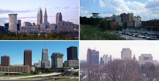
Cuyahoga County is a large urban county located in the northeastern part of the U.S. state of Ohio. The county seat and largest city is Cleveland. As of the 2020 census, its population was 1,264,817, making it the second-most populous county in the state.
Aurora is a city in northwestern Portage County, Ohio, United States. A suburb in between Akron and Cleveland, the population was 17,239 at the 2020 census. It is part of the Akron metropolitan area.
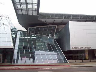
Akron is a city in and the county seat of Summit County, Ohio, United States. At the 2020 census, the city proper had a total population of 190,469, making it the fifth-most populous city in Ohio and 136th-most populous city in the United States. The Akron metropolitan area, covering Summit and Portage counties, had a population of 702,219. It is located on the western edge of the Glaciated Allegheny Plateau in Northeast Ohio about 40 miles (64 km) south of downtown Cleveland.
Cuyahoga Falls is a city in Summit County, Ohio, United States. As of the 2020 census, the city population was 51,114. The second-largest city in Summit County, it is located directly north of Akron and is a suburb of the Akron metropolitan area. The city was founded in 1812 by William Wetmore and was originally named Manchester, but renamed for the Cuyahoga River and the series of waterfalls that run along the southern boundary of the city.
Green is a city in southeastern Summit County, Ohio, United States. The population was 27,475 at the 2020 census. It is a suburban community between Akron and Canton and is part of the Akron metropolitan area.
Munroe Falls is a city in east-central Summit County, Ohio, United States, along the Cuyahoga River. The population was 5,044 at the 2020 census. It is a suburb of Akron and is part of the Akron metropolitan area.
Reminderville is a city in northeastern Summit County, Ohio, United States. The population was 5,412 at the 2020 census. It is part of the Akron metropolitan area.
Stow is a city in Summit County, Ohio, United States. The population was 34,483 at the 2020 census. It is a suburban community within the Akron metropolitan area.
Tallmadge is a city in eastern Summit County, Ohio, United States, with a small district in neighboring Portage County. It is a suburb of Akron and part of the Akron metropolitan area. The population was 18,394 at the 2020 census. Tallmadge was founded in 1807 and is the second-oldest city in Summit County, following Hudson, which was founded in 1799.
The region Northeast Ohio, in the US state of Ohio, in its most expansive usage contains six metropolitan statistical areas: Cleveland–Elyria, Akron, Canton–Massillon, Youngstown–Warren, Mansfield, and Weirton–Steubenville along with eight micropolitan statistical areas. Most of the region is considered either part of the Cleveland–Akron–Canton, OH Combined Statistical Area and media market or the Youngstown–Warren, OH–PA Combined Statistical Area and media market. In all, the region is home to: 4,502,460 residents. It is also a part of the Great Lakes megalopolis, containing over 54 million people. Northeast Ohio also includes most of the area known historically as the Connecticut Western Reserve.
Bath Township is one of the nine townships of Summit County, Ohio, United States. A suburb of Akron, the 2020 census found 10,024 people in the township.
Springfield Township is one of the nine townships of Summit County, Ohio, United States. The population was 14,162 at the 2020 census.
Boston Township is one of the nine townships of Summit County, Ohio, United States, about 15 miles north of Akron and 23 miles south of Cleveland. It is part of the Akron metropolitan area. The 2020 census found 1,401 people in the township.
Franklin Township is a civil township in Portage County, Ohio, United States. It is on the Cuyahoga River in Northeast Ohio on the western edge of the county. The 2010 Census found 5,527 people in the township and the 2020 census recorded 6,283 people. The township is part of the Akron Metropolitan Statistical Area and the larger Cleveland–Akron–Canton Combined Statistical Area.
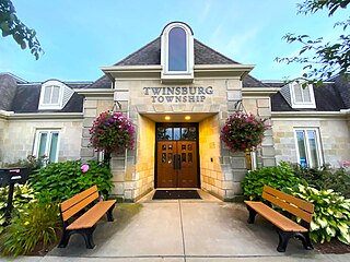
Twinsburg Township is one of the nine townships of Summit County, Ohio, United States. The 2020 census found 3,857 people in the township.
The Akron, OH Metropolitan Statistical Area, sometimes referred to as Greater Akron, is defined by the United States Office of Management and Budget as an area consisting of two counties, Summit and Portage, in Northeast Ohio and anchored by the city of Akron. As of the 2020 census, the MSA had a population of 702,219. The Akron MSA is also part of the larger Cleveland–Akron–Canton, OH Combined Statistical Area, which has a population of 3,633,962 people as of the 2020 census, the largest metropolitan area in Ohio.
Kent is a city in the U.S. state of Ohio and the largest city in Portage County. It is located along the Cuyahoga River in Northeast Ohio on the western edge of the county. The population was 28,215 at the 2020 Census. The city is counted as part of the Akron metropolitan area and the larger Cleveland–Akron–Canton combined statistical area.
The Suburban League is an Ohio High School Athletic Association (OHSAA) athletics league made up of 16 high schools from Cuyahoga, Medina, Portage, and Summit counties in Northeast Ohio. It was formed in 1949 and expanded into two divisions in 2015.
The 2023 Akron mayoral election was held on November 7, 2023, to elect the mayor of Akron, Ohio. Party primaries were held on May 2. Incumbent Democratic mayor Dan Horrigan chose not to seek re-election to a third term in office.