Logan County, Ohio

Last updated

Logan County
Bellefontaine-ohio-courthouse-fountain.jpg
Logan County, Ohio flag.svg
Seal of Logan County Ohio.svg
Map of Ohio highlighting Logan County.svg
Location within the U.S. state of Ohio
Ohio in United States.svg
Ohio's location within the U.S.
Coordinates: 40°23′N83°46′W / 40.39°N 83.77°W / 40.39; -83.77
CountryFlag of the United States.svg United States
StateFlag of Ohio.svg  Ohio
FoundedMarch 1, 1818 [1]
Named for Benjamin Logan
Seat Bellefontaine
Largest cityBellefontaine
Area
  Total467 sq mi (1,210 km2)
  Land458 sq mi (1,190 km2)
  Water8.3 sq mi (21 km2)  1.8%
Population
 (2020)
  Total46,150
  Density99/sq mi (38/km2)
Time zone UTC−5 (Eastern)
  Summer (DST) UTC−4 (EDT)
Congressional district 4th
Website www.co.logan.oh.us

Logan County is a county in the west central portion of the U.S. state of Ohio. As of the 2020 census, the population was 46,150. [2] The county seat is Bellefontaine. [3] The county is named for Benjamin Logan, who fought Native Americans in the area. [4]

Contents

Logan County comprises the Bellefontaine, OH Micropolitan Statistical Area, which is also included in the Columbus-Marion-Zanesville, OH Combined Statistical Area.

Geography

According to the U.S. Census Bureau, the county has an area of 467 square miles (1,210 km2), of which 458 square miles (1,190 km2) is land and 8.3 square miles (21 km2) (1.8%) is water. [5] Campbell Hill, the highest natural point in Ohio at 1,549 feet (472 m), is northeast of Bellefontaine.

Adjacent counties

Major highways

Demographics

Historical population
CensusPop.Note
1820 3,159
1830 6,440103.9%
1840 14,015117.6%
1850 19,16236.7%
1860 20,9969.6%
1870 23,0289.7%
1880 26,26714.1%
1890 27,3864.3%
1900 30,42011.1%
1910 30,084−1.1%
1920 30,1040.1%
1930 28,981−3.7%
1940 29,6242.2%
1950 31,3295.8%
1960 34,80311.1%
1970 35,0720.8%
1980 39,15511.6%
1990 42,3108.1%
2000 46,0058.7%
2010 45,858−0.3%
2020 46,1500.6%
U.S. Decennial Census [6]
1790-1960 [7] 1900-1990 [8]
1990-2000 [9] 2020 [2]

2000 census

As of the census [10] of 2000, there were 46,005 people, 17,956 households, and 12,730 families living in the county. The population density was 100 inhabitants per square mile (39/km2). There were 21,571 housing units at an average density of 47 units per square mile (18/km2). The racial makeup of the county was 96.15% White, 1.71% Black or African American, 0.20% Native American, 0.40% Asian, 0.03% Pacific Islander, 0.27% from other races, and 1.24% from two or more races. 0.72% of the population were Hispanic or Latino of any race. 96.8% spoke English, 1.0% German and 1.0% Spanish as their first language.

There were 17,956 households, out of which 33.30% had children under the age of 18 living with them, 57.00% were married couples living together, 9.50% had a female householder with no husband present, and 29.10% were non-families. 24.80% of all households were made up of individuals, and 10.30% had someone living alone who was 65 years of age or older. The average household size was 2.53 and the average family size was 3.01.

In the county, the population was spread out, with 26.70% under the age of 18, 8.20% from 18 to 24, 27.90% from 25 to 44, 23.30% from 45 to 64, and 13.90% who were 65 years of age or older. The median age was 37 years. For every 100 females there were 96.10 males. For every 100 females age 18 and over, there were 93.60 males.

The median income for a household in the county was $41,479, and the median income for a family was $47,516. Males had a median income of $37,134 versus $24,739 for females. The per capita income for the county was $18,984. About 7.10% of families and 9.30% of the population were below the poverty line, including 11.80% of those under age 18 and 8.50% of those age 65 or over.

2010 census

As of the 2010 United States Census, there were 45,858 people, 18,111 households, and 12,569 families living in the county. [11] The population density was 100.0 inhabitants per square mile (38.6/km2). There were 23,181 housing units at an average density of 50.6 units per square mile (19.5 units/km2). [12] The racial makeup of the county was 95.3% white, 1.6% black or African American, 0.5% Asian, 0.3% American Indian, 0.3% from other races, and 1.9% from two or more races. Those of Hispanic or Latino origin made up 1.2% of the population. [11] In terms of ancestry, 30.9% were German, 13.5% were Irish, 11.5% were American, and 9.1% were English. [13]

Of the 18,111 households, 32.9% had children under the age of 18 living with them, 53.9% were married couples living together, 10.5% had a female householder with no husband present, 30.6% were non-families, and 25.5% of all households were made up of individuals. The average household size was 2.51 and the average family size was 2.98. The median age was 39.9 years. [11]

The median income for a household in the county was $46,493 and the median income for a family was $53,601. Males had a median income of $42,702 versus $29,537 for females. The per capita income for the county was $22,974. About 11.0% of families and 14.8% of the population were below the poverty line, including 25.3% of those under age 18 and 7.1% of those age 65 or over. [14]

Politics

Logan County is a strongly Republican county, having backed Democratic Party presidential nominees only twice since 1856, in 1912 and 1964.

United States presidential election results for Logan County, Ohio [15]
Year Republican Democratic Third party
No.%No.%No.%
2020 17,96476.74%5,05521.59%3901.67%
2016 15,95773.49%4,64721.40%1,1085.10%
2012 13,63364.31%7,06233.31%5042.38%
2008 13,84862.15%7,93635.61%4992.24%
2004 14,47167.63%6,82531.90%1020.48%
2000 11,84964.20%5,94532.21%6613.58%
1996 8,32548.56%6,39737.31%2,42314.13%
1992 9,36449.84%4,88926.02%4,53424.13%
1988 11,09970.71%4,48428.57%1140.73%
1984 12,23076.54%3,64522.81%1040.65%
1980 9,72764.87%4,31928.80%9486.32%
1976 9,09259.03%5,94938.62%3612.34%
1972 10,93871.12%3,78624.62%6564.27%
1968 8,36256.12%4,88932.81%1,64811.06%
1964 6,68344.06%8,48455.94%00.00%
1960 11,31168.18%5,27931.82%00.00%
1956 11,22972.66%4,22627.34%00.00%
1952 11,08469.81%4,79330.19%00.00%
1948 8,11861.01%5,14938.70%380.29%
1944 9,88266.65%4,94433.35%00.00%
1940 9,86160.83%6,35139.17%00.00%
1936 8,36352.58%7,35346.23%1891.19%
1932 7,46952.04%6,67846.53%2051.43%
1928 9,60276.63%2,85822.81%710.57%
1924 7,18661.03%3,17626.97%1,41211.99%
1920 8,52163.21%4,90436.38%560.42%
1916 4,34554.80%3,48343.93%1011.27%
1912 1,97727.07%2,72737.34%2,60035.60%
1908 4,75658.44%3,18639.15%1962.41%
1904 4,99469.21%1,93926.87%2833.92%
1900 4,80660.38%2,95137.08%2022.54%
1896 4,72259.56%3,12539.42%811.02%
1892 3,79657.85%2,33235.54%4346.61%
1888 4,11559.34%2,53336.52%2874.14%
1884 3,99858.83%2,62538.63%1732.55%
1880 3,73959.16%2,46839.05%1131.79%
1876 3,25957.98%2,28640.67%761.35%
1872 2,79558.74%1,95541.09%80.17%
1868 2,77861.08%1,77038.92%00.00%
1864 2,63761.86%1,62638.14%00.00%
1860 2,41559.28%1,54237.85%1172.87%
1856 2,09356.75%1,32836.01%2677.24%

Government

Communities

Map of Logan County with municipalities and townships Map of Logan County Ohio With Municipal and Township Labels.PNG
Map of Logan County with municipalities and townships

City

Villages

Townships

Census-designated places

Unincorporated communities

Notable people

Historical marker in downtown Bellefontaine marking the site of Blue Jacket's Town Blue Jackets Town Historical Marker.jpg
Historical marker in downtown Bellefontaine marking the site of Blue Jacket's Town

See also

Related Research Articles

<span class="mw-page-title-main">Logan County, West Virginia</span> County in West Virginia, United States

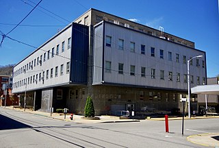
Logan County is a county in the U.S. state of West Virginia. As of the 2020 census, the population was 32,567. Its county seat is Logan. Logan County comprises the Logan, WV Micropolitan Statistical Area, which is also included in the Charleston–Huntington–Ashland, WV–OH–KY Combined Statistical Area.

<span class="mw-page-title-main">Hocking County, Ohio</span> County in Ohio, United States

Hocking County is a county located in the U.S. state of Ohio. As of the 2020 census, the population was 28,050. Its county seat is Logan. The county was organized on March 1, 1818, from land given by Athens, Fairfield, and Ross counties. Its name is from the Hocking River, the origins of which are disputed but is said to be a Delaware Indian word meaning "bottle river". Hocking County is included in the Columbus, OH Metropolitan Statistical Area.

<span class="mw-page-title-main">Quay County, New Mexico</span> County in New Mexico, United States

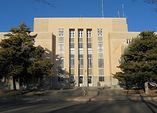
Quay County is a county in the state of New Mexico. As of the 2020 U.S. census, the population was 8,746. Its county seat is Tucumcari. The county was named for Pennsylvania senator Matthew Quay, who supported statehood for New Mexico. Its eastern border is the Texas state line, approximately 103.04 degrees west longitude.

<span class="mw-page-title-main">Logan County, Illinois</span> County in Illinois, United States

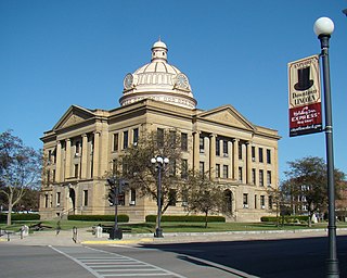
Logan County is a county located in the U.S. state of Illinois. According to the 2020 census, it had a population of 27,987. Its county seat is Lincoln.

<span class="mw-page-title-main">White County, Georgia</span> County in Georgia, United States

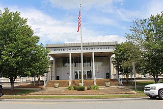
White County is a county located in the northeastern part of the U.S. state of Georgia. As of the 2020 census, the population was 28,003. The county seat is Cleveland. The county was created on December 22, 1857, formerly a part of Habersham County and most likely was named for Newton County Representative David T. White, who helped a Habersham representative successfully attain passage of an act creating the new county.

<span class="mw-page-title-main">Morrison Bluff, Arkansas</span> Town in Arkansas, United States

Morrison Bluff is a town in Logan County, Arkansas, United States. The population was 64 at the 2010 census and an estimated 81 in 2017.

<span class="mw-page-title-main">Raymore, Missouri</span> City in Missouri, United States

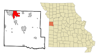
Raymore is a city in Cass County, Missouri, United States, within the Kansas City Metropolitan Area. Raymore is one of the fastest-growing cities in the state of Missouri. The population was 22,941 at the 2020 census.

<span class="mw-page-title-main">Bellefontaine Neighbors, Missouri</span> City in Missouri, United States

Bellefontaine Neighbors is an inner-ring suburb city in St. Louis County, Missouri, United States. The population was 10,860 at the 2010 census.

<span class="mw-page-title-main">Logan, Ohio</span> City in Ohio, United States

Logan is a city in and county seat of Hocking County, Ohio, United States, along the on the Hocking River about 43 miles (69 km) southeast of Columbus. The population was 7,296 at the time of the 2020 census. The current mayor of Logan is Republican Greg Fraunfelter, who began a four-year term in January 2016 and was re-elected in 2019.

<span class="mw-page-title-main">De Graff, Ohio</span> Village in Ohio, United States

De Graff is a village located in Logan County, Ohio, United States. The population was 1,250 at the 2020 census.

<span class="mw-page-title-main">Huntsville, Ohio</span> Village in Ohio, United States

Huntsville is a village in Logan County, Ohio, United States. The population was 408 at the 2020 census.

<span class="mw-page-title-main">Lakeview, Ohio</span> Village in Ohio, United States

Lakeview is a village in Logan County, Ohio, United States. The population was 1,184 at the 2020 census.

<span class="mw-page-title-main">West Liberty, Ohio</span> Village in Ohio, United States

West Liberty is a village in Logan County, Ohio, United States. The population was 1,770 at the 2020 census.

<span class="mw-page-title-main">West Mansfield, Ohio</span> Village in Ohio, United States

West Mansfield is a village located in Logan County, Ohio, United States. The population was 749 at the 2020 census.

<span class="mw-page-title-main">Zanesfield, Ohio</span> Village in Ohio, United States

Zanesfield is a village in Logan County, Ohio, United States of America. The population was 194 at the 2020 census. It is the smallest incorporated village in Logan County.

<span class="mw-page-title-main">Loganton, Pennsylvania</span> Borough in Pennsylvania, United States

Loganton is a borough in Clinton County, Pennsylvania, United States. The population was 469 at the 2020 census. Loganton is named after Chief James Logan.

<span class="mw-page-title-main">Mitchell Heights, West Virginia</span> Town in West Virginia, United States

Mitchell Heights is a town in Logan County, West Virginia, United States. The population was 315 at the 2020 census. The town was named for an early farm on which it was established.

<span class="mw-page-title-main">Ridgeway, Ohio</span> Village in Ohio, United States

Ridgeway is a village in Hardin and Logan counties in the U.S. state of Ohio. The population was 314 at the 2020 census.

Manchester is a village located within the Town of Manchester in Ontario County, New York, United States. The population was 1,709 at the 2010 census. The village was named after Manchester in England.

<span class="mw-page-title-main">Belle Center, Ohio</span> Village in Ohio, United States

Belle Center is a village in Logan County, Ohio, United States. The population was 809 at the 2020 census. It is a Tree City USA, one of the smallest in the state.

References

  1. "Ohio County Profiles: Logan County" (PDF). Ohio Department of Development. Archived from the original (PDF) on June 21, 2007. Retrieved April 28, 2007.
  2. 1 2 2020 census
  3. "Find a County". National Association of Counties. Retrieved June 7, 2011.
  4. Gannett, Henry (1905). The Origin of Certain Place Names in the United States. U.S. Government Printing Office. p.  189.
  5. "2010 Census Gazetteer Files". United States Census Bureau. August 22, 2012. Archived from the original on May 4, 2014. Retrieved February 8, 2015.
  6. "U.S. Decennial Census". United States Census Bureau. Retrieved February 8, 2015.
  7. "Historical Census Browser". University of Virginia Library. Retrieved February 8, 2015.
  8. Forstall, Richard L., ed. (March 27, 1995). "Population of Counties by Decennial Census: 1900 to 1990". United States Census Bureau. Retrieved February 8, 2015.
  9. "Census 2000 PHC-T-4. Ranking Tables for Counties: 1990 and 2000" (PDF). United States Census Bureau. April 2, 2001. Archived (PDF) from the original on March 27, 2010. Retrieved February 8, 2015.
  10. "U.S. Census website". United States Census Bureau . Retrieved January 31, 2008.
  11. 1 2 3 "DP-1 Profile of General Population and Housing Characteristics: 2010 Demographic Profile Data". United States Census Bureau. Archived from the original on February 13, 2020. Retrieved December 27, 2015.
  12. "Population, Housing Units, Area, and Density: 2010 - County". United States Census Bureau. Archived from the original on February 13, 2020. Retrieved December 27, 2015.
  13. "DP02 SELECTED SOCIAL CHARACTERISTICS IN THE UNITED STATES – 2006-2010 American Community Survey 5-Year Estimates". United States Census Bureau. Archived from the original on February 13, 2020. Retrieved December 27, 2015.
  14. "DP03 SELECTED ECONOMIC CHARACTERISTICS – 2006-2010 American Community Survey 5-Year Estimates". United States Census Bureau. Archived from the original on February 13, 2020. Retrieved December 27, 2015.
  15. Leip, David. "Dave Leip's Atlas of U.S. Presidential Elections". uselectionatlas.org. Retrieved May 2, 2018.
  16. 1 2 Logan County Board of Elections http://www.electionsonthe.net/oh/logan/electoff/county.pdf. Archived (PDF) from the original on January 28, 2016. Retrieved June 16, 2015.{{cite web}}: Missing or empty |title= (help)

40°23′N83°46′W / 40.39°N 83.77°W / 40.39; -83.77