De Graff, Ohio

Last updated

De Graff, Ohio
Aerial De Graff, Ohio from south.jpg
Aerial view of De Graff from the southeast
OHMap-doton-De Graff.png
Location of De Graff, Ohio
Detailed map of De Graff, Ohio.png
Detailed map of De Graff
Coordinates: 40°18′46″N83°55′00″W / 40.31278°N 83.91667°W / 40.31278; -83.91667
Country United States
State Ohio
County Logan
Townships Miami, Pleasant
Area
[1]
  Total1.00 sq mi (2.60 km2)
  Land1.00 sq mi (2.60 km2)
  Water0.00 sq mi (0.00 km2)
Elevation
[2]
1,004 ft (306 m)
Population
 (2020)
  Total1,250
  Density1,246.26/sq mi (481.40/km2)
Time zone UTC-5 (Eastern (EST))
  Summer (DST) UTC-4 (EDT)
ZIP code
43318
Area code(s) 937, 326
FIPS code 39-21378 [3]
GNIS feature ID2398692 [2]

De Graff is a village located in Logan County, Ohio, United States. The population was 1,250 at the 2020 census.

Contents

History

De Graff was named in honor of a railroad official. [4] Different sources format the community's name in several different ways: besides the official De Graff, the name has been rendered De Graft, DeGraff, Degraff, and Degraft. [5]

Geography

According to the United States Census Bureau, the village has a total area of 1.01 square miles (2.62 km2), all of it land. [6]

Demographics

Historical population
CensusPop.Note
1870 624
1880 96554.6%
1890 1,07611.5%
1900 1,1506.9%
1910 1,082−5.9%
1920 932−13.9%
1930 849−8.9%
1940 796−6.2%
1950 97222.1%
1960 9962.5%
1970 1,11712.1%
1980 1,35821.6%
1990 1,331−2.0%
2000 1,212−8.9%
2010 1,2856.0%
2020 1,250−2.7%
U.S. Decennial Census [7]

2010 census

As of the census [8] of 2010, there were 1,285 people, 476 households, and 347 families residing in the village. The population density was 1,272.3 inhabitants per square mile (491.2/km2). There were 536 housing units at an average density of 530.7 per square mile (204.9/km2). The racial makeup of the village was 97.5% White, 0.9% African American, 0.3% Native American, 0.2% Asian, 0.2% Pacific Islander, 0.2% from other races, and 0.7% from two or more races. Hispanic or Latino of any race were 0.2% of the population.

There were 476 households, of which 40.3% had children under the age of 18 living with them, 56.7% were married couples living together, 11.1% had a female householder with no husband present, 5.0% had a male householder with no wife present, and 27.1% were non-families. 25.6% of all households were made up of individuals, and 11.2% had someone living alone who was 65 years of age or older. The average household size was 2.70 and the average family size was 3.21.

The median age in the village was 34.8 years. 30.7% of residents were under the age of 18; 5.8% were between the ages of 18 and 24; 25.9% were from 25 to 44; 24.6% were from 45 to 64; and 12.9% were 65 years of age or older. The gender makeup of the village was 48.9% male and 51.1% female.

2000 census

As of the census [3] of 2000, there were 1,212 people, 479 households, and 329 families residing in the village. The population density was 1,414.4 inhabitants per square mile (546.1/km2). There were 515 housing units at an average density of 601.0 per square mile (232.0/km2). The racial makeup of the village was 99.67% White, 0.17% African American and 0.17% Asian. Hispanic or Latino of any race were 0.17% of the population.

There were 479 households, out of which 31.9% had children under the age of 18 living with them, 54.7% were married couples living together, 9.0% had a female householder with no husband present, and 31.3% were non-families. 29.2% of all households were made up of individuals, and 14.6% had someone living alone who was 65 years of age or older. The average household size was 2.53 and the average family size was 3.12.

In the village, the population was spread out, with 26.7% under the age of 18, 10.3% from 18 to 24, 27.0% from 25 to 44, 23.2% from 45 to 64, and 12.9% who were 65 years of age or older. The median age was 35 years. For every 100 females, there were 99.0 males. For every 100 females age 18 and over, there were 92.4 males.

The median income for a household in the village was $34,833, and the median income for a family was $43,365. Males had a median income of $35,859 versus $25,500 for females. The per capita income for the village was $18,548. About 8.0% of families and 8.2% of the population were below the poverty line, including 12.6% of those under age 18 and 6.9% of those age 65 or over.

Government

Until 2007, the mayor of De Graff was Stephanie Orsborne. [9] She was defeated by a 3-1 margin in the elections of November 2007 by Philip Fawcett. [10]

The chief of police is George Piersall. [11]

Education

Riverside School District, including Riverside High School, serves the children of the De Graff area. It also owns WDEQ, a non-commercial community radio station.

A branch of the Logan County District Library serves the De Graff community. [12]

Transportation

De Graff is located at the intersection of State Routes 235 and 508.

Notable people

Related Research Articles

<span class="mw-page-title-main">De Graff, Minnesota</span> City in Minnesota, United States

De Graff is a city in Swift County, Minnesota, United States. The population was 110 at the 2020 census.

<span class="mw-page-title-main">Parkway, Missouri</span> Village in Missouri, United States

Parkway is a village in Franklin County, Missouri, United States. The population was 439 at the 2010 census.

<span class="mw-page-title-main">Marlborough, Missouri</span> Village in Missouri, United States

Marlborough is a village in St. Louis County, Missouri, United States. The population was 2,179 at the 2010 census.

<span class="mw-page-title-main">Uplands Park, Missouri</span> Village in Missouri, United States

Uplands Park is a village in St. Louis County, Missouri, United States. The population was 445 at the 2010 census. The village is one of many small majority black communities located in the Natural Bridge corridor of mid-St. Louis County, characterized by small homes on small lots.

<span class="mw-page-title-main">Jacksonville, Ohio</span> Village in Ohio, United States

Jacksonville is a village in Athens County, Ohio, United States. The population was 400 at the 2020 census.

<span class="mw-page-title-main">Warsaw, Ohio</span> Village in Ohio, United States

Warsaw is a village in Coshocton County, Ohio, United States, along the Walhonding River. The population was 624 at the 2020 census.

<span class="mw-page-title-main">Riverlea, Ohio</span> Village in Ohio, United States

Riverlea is a village in Franklin County, Ohio, United States, surrounded by Worthington on its north, south, and east sides, and bordered on the west by the Olentangy River, across which is Columbus. Riverlea was incorporated in 1939, a small community that formed on former farmland. The population was 599 at the 2020 census.

<span class="mw-page-title-main">Valleyview, Ohio</span> Village in Ohio, United States

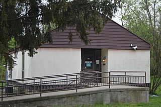
Valleyview is a village in Franklin County, Ohio, United States. The population was 669 at the 2020 census.

<span class="mw-page-title-main">Addyston, Ohio</span> Village in Ohio, United States

Addyston is a village in Miami Township, Hamilton County, Ohio, United States. Located along the Ohio River, it is a western suburb of the neighboring city of Cincinnati. The population was 927 at the 2020 census.

<span class="mw-page-title-main">Cleves, Ohio</span> City in Ohio, United States

Cleves is a village in Miami Township, Hamilton County, Ohio, United States. Located along the Ohio River, it is a western suburb of Cincinnati. The population was 3,414 at the 2020 census.

<span class="mw-page-title-main">Gann, Ohio</span> Village in Ohio, United States

Brinkhaven, once known as Mount Holly and Gann, is a village in Knox County, Ohio, United States. The population was 114 at the 2020 census.

<span class="mw-page-title-main">West Liberty, Ohio</span> Village in Ohio, United States

West Liberty is a village in Logan County, Ohio, United States. The population was 1,770 at the 2020 census.

<span class="mw-page-title-main">Clinton, Ohio</span> Village in Ohio, United States

Clinton is a village in southwestern Summit County, Ohio, United States. The population was 1,197 at the 2020 Census. It is part of the Akron metropolitan area.

<span class="mw-page-title-main">Windsor Heights, West Virginia</span> Village in West Virginia, United States

Windsor Heights is a village in Brooke County, West Virginia, United States. It is part of the Wheeling, West Virginia Metropolitan Statistical Area. The population was 423 at the 2010 census. Grace Davis was the mayor as of June 2017.

<span class="mw-page-title-main">Sherwood, Wisconsin</span> Village in Wisconsin, United States

Sherwood is a village in Calumet County, Wisconsin, United States. The population was 2,713 at the 2010 census. The former historical unincorporated community of High Cliff is located within present-day Sherwood.

<span class="mw-page-title-main">Kekoskee, Wisconsin</span> Village in Wisconsin, United States

Kekoskee is a village in Dodge County, Wisconsin, United States. The population was 161 at the 2010 census.

<span class="mw-page-title-main">Avoca, Wisconsin</span> Village in Wisconsin, United States

Avoca is a village in Iowa County, Wisconsin, United States. The population was 637 at the 2010 census. It is part of the Madison Metropolitan Statistical Area. It is named after Avoca in Ireland.

<span class="mw-page-title-main">Verona, Ohio</span> Village in Ohio, United States

Verona is a village in Montgomery and Preble counties in the U.S. state of Ohio. The population was 403 at the 2020 census. It is part of the Dayton Metropolitan Statistical Area.

<span class="mw-page-title-main">Windsor, Wisconsin</span> Village in Wisconsin, United States

Windsor is a village and former town in Dane County, Wisconsin. The population was 8,754 at the time of the 2020 census. The communities of Lake Windsor, Morrisonville, and Token Creek are located within the village. Windsor voted to incorporate as a village on November 3, 2015; prior to its incorporation, it was a town, and a portion of the town was a census-designated place. Windsor is a part of the Census Bureau's Madison metropolitan statistical area.

<span class="mw-page-title-main">Darien, Wisconsin</span> Village in Wisconsin, United States

Darien is a village in Walworth County, Wisconsin, United States. The population was 1,573 at the 2020 census. The village is located within the Town of Darien.

References

  1. "ArcGIS REST Services Directory". United States Census Bureau. Retrieved September 20, 2022.
  2. 1 2 U.S. Geological Survey Geographic Names Information System: De Graff, Ohio
  3. 1 2 "U.S. Census website". United States Census Bureau . Retrieved January 31, 2008.
  4. Overman, William Daniel (1958). Ohio Town Names. Akron, OH: Atlantic Press. p. 37.
  5. Geographic Names Information System Feature Detail Report, Geographic Names Information System, July 12, 1979. Accessed 2008-01-10.
  6. "US Gazetteer files 2010". United States Census Bureau. Archived from the original on July 2, 2012. Retrieved January 6, 2013.
  7. "Census of Population and Housing". Census.gov. Retrieved June 4, 2015.
  8. "U.S. Census website". United States Census Bureau . Retrieved January 6, 2013.
  9. Indian Lake Community Information Archived August 8, 2007, at the Wayback Machine , IndianLake.com, 2007. Accessed August 15, 2007.
  10. Examiner Staff, The. "Village results", Bellefontaine Examiner, 2007-11-07, p. 2.
  11. Piersall accepts DeGraff Chief of Police office, council updated on water tower project [ permanent dead link ], WPKO/WBLL, June 17, 2008. Accessed 2008-06-28.
  12. "Branches". Logan County Libraries. Retrieved February 26, 2018.