Belle Center, Ohio

Last updated

Belle Center, Ohio
Aerial Belle Center.jpg
Aerial picture of "downtown" Belle Center
OHMap-doton-Belle Center.png
Location of Belle Center, Ohio
Detailed map of Belle Center, Ohio.png
Detailed map of Belle Center
Coordinates: 40°30′30″N83°44′58″W / 40.50833°N 83.74944°W / 40.50833; -83.74944
Country United States
State Ohio
County Logan
Township Richland
Government
   Mayor Lance Houchin[ citation needed ]
Area
[1]
  Total0.71 sq mi (1.84 km2)
  Land0.70 sq mi (1.81 km2)
  Water0.01 sq mi (0.03 km2)
Elevation
[2]
1,043 ft (318 m)
Population
 (2020)
  Total809
  Estimate 
(2023) [3]
805
  Density1,159.03/sq mi (447.54/km2)
Time zone UTC-5 (Eastern (EST))
  Summer (DST) UTC-4 (EDT)
ZIP code
43310
Area codes 937, 326
FIPS code 39-05116 [4]
GNIS feature ID2398075 [2]
Website bellecenterohio.com

Belle Center is a village in Logan County, Ohio, United States. The population was 809 at the 2020 census. It is a Tree City USA, one of the smallest in the state. [5]

Contents

History

Historically, some areas in what is now northern Richland Township were covered by swampland. During the 1840s, however, settlers moved in, and a town was platted around 1846, by which time a small town named Richland had become well established in the southern part of what is now Richland Township. In this year, the Mad River and Lake Erie Railroad began to plan for a railroad line through the area. A competition developed between the two towns for the location of a water stop for the railroad (essentially requiring the basics of a station), which eventually was won by the upstart town. Five years later, the village of Belle Center was officially incorporated by the Ohio General Assembly. The presence of the railroad led to growth for Belle Center but decline for Richland (since renamed New Richland). This railroad origin is responsible for Belle Center's "diagonal" street layout.

Etymology

Belle Center was named for its relatively central location between the cities of Bellefontaine and Kenton. [6] Historically, the community's name has also been spelled Belle Centre, Bellecenter, and even Bellecente. The Board on Geographic Names officially decided in favor of the current spelling in 1891. [7]

Geography

View of Belle Center's small business district, taken from atop a former railroad crossing. Belle Center.jpg
View of Belle Center's small business district, taken from atop a former railroad crossing.

According to the United States Census Bureau, the village has a total area of 0.71 square miles (1.84 km2), of which, 0.70 square miles (1.81 km2) is land and 0.01 square miles (0.03 km2) is water. [8]

Demographics

Historical population
CensusPop.Note
1850 153
1860 23452.9%
1870 27617.9%
1880 43457.2%
1890 927113.6%
1900 9623.8%
1910 889−7.6%
1920 9092.2%
1930 861−5.3%
1940 835−3.0%
1950 8896.5%
1960 9496.7%
1970 9853.8%
1980 930−5.6%
1990 796−14.4%
2000 8071.4%
2010 8130.7%
2020 809−0.5%
2023 (est.)805 [3] −0.5%
U.S. Decennial Census [9]

2010 census

As of the census [10] of 2010, there were 813 people, 322 households, and 232 families living in the village. The population density was 1,161.4 inhabitants per square mile (448.4/km2). There were 345 housing units at an average density of 492.9 per square mile (190.3/km2). The racial makeup of the village was 98.2% White, 0.1% African American, 0.1% Native American, 0.2% Asian, 0.2% from other races, and 1.1% from two or more races. Hispanic or Latino of any race were 0.6% of the population.

There were 322 households, of which 36.3% had children under the age of 18 living with them, 54.0% were married couples living together, 13.4% had a female householder with no husband present, 4.7% had a male householder with no wife present, and 28.0% were non-families. 23.3% of all households were made up of individuals, and 11.2% had someone living alone who was 65 years of age or older. The average household size was 2.50 and the average family size was 2.88.

The median age in the village was 37.2 years. 26.6% of residents were under the age of 18; 5.4% were between the ages of 18 and 24; 28% were from 25 to 44; 24.7% were from 45 to 64; and 15.5% were 65 years of age or older. The gender makeup of the village was 48.1% male and 51.9% female.

2000 census

As of the census [4] of 2000, there were 807 people, 326 households, and 241 families living in the village. The population density was 1,171.0 inhabitants per square mile (452.1/km2). There were 345 housing units at an average density of 500.6 per square mile (193.3/km2). The racial makeup of the village was 99.88% White and 0.12% from other races. Hispanic or Latino of any race were 0.74% of the population.

There were 326 households, out of which 34.0% had children under the age of 18 living with them, 60.7% were married couples living together, 9.8% had a female householder with no husband present, and 25.8% were non-families. 24.5% of all households were made up of individuals, and 12.0% had someone living alone who was 65 years of age or older. The average household size was 2.45 and the average family size was 2.88.

In the village, the population was spread out, with 25.9% under the age of 18, 7.1% from 18 to 24, 29.7% from 25 to 44, 21.3% from 45 to 64, and 16.0% who were 65 years of age or older. The median age was 36 years. For every 100 females there were 93.1 males. For every 100 females age 18 and over, there were 86.9 males.

The median income for a household in the village was $45,486, and the median income for a family was $48,594. Males had a median income of $36,467 versus $28,846 for females. The per capita income for the village was $20,173. About 6.0% of families and 8.5% of the population were below the poverty line, including 11.9% of those under the age of 18 and 5.8% of those 65 and older.

Government

As of 2007, the mayor of Belle Center was Donald Ruble. [11] In the elections of November 2007, Teresa Johnston defeated two other candidates for the mayoral position, and Rhonda Fulmer and John Lowery were elected from a five-candidate pool for two at-large village council seats. [12]

Old Belle Center Depot Old Belle Center depot.jpg
Old Belle Center Depot

Transportation

Belle Center was founded as a stop along a railroad. Since the end of passenger rail service, transportation in Belle Center has relied on local roads and state highways. Today, State Route 273 forms Belle Center's main street, and the north end of State Route 638 is at an intersection with State Route 273 at the southern corner of Belle Center.

Education

Belle Center has a public library, the Belle Center Public Library. [13]

Notable people

Related Research Articles

<span class="mw-page-title-main">Richland County, Ohio</span> County in Ohio, United States

Richland County is a county located in the U.S. state of Ohio. As of the 2020 census, the population was 124,936. Its county seat is Mansfield. The county was created in 1808 and later organized in 1813. It is named for the fertile soil found there. Richland County is included in the Mansfield, OH Metropolitan Statistical Area as well as the Mansfield-Ashland-Bucyrus, OH Combined Statistical Area. The county is one of the six Metropolitan Statistical Areas that make up Northeast Ohio.

<span class="mw-page-title-main">Richland, New York</span> Town in New York, United States

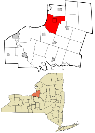
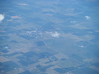
Richland is a town in the northeastern part of Oswego County, New York, United States. The population was 5,718 at the 2010 census.

<span class="mw-page-title-main">Sabina, Ohio</span> Village in Ohio, United States

Sabina is a village in Clinton County, Ohio, United States. As of the 2020 census, the village had a total population of 2,499.

<span class="mw-page-title-main">Gordon, Ohio</span> Village in Ohio, United States

Gordon is a village in Darke County, Ohio, United States. The population was 245 at the 2020 census.

<span class="mw-page-title-main">Rossburg, Ohio</span> Village in Ohio, United States

Rossburg is a village in Darke County, Ohio, United States. The population was 159 at the 2020 census.

<span class="mw-page-title-main">Ostrander, Ohio</span> Village in Ohio, United States

Ostrander is a village in Delaware County, Ohio, United States. The population was 1,094 at the 2020 census.

<span class="mw-page-title-main">Deshler, Ohio</span> Village in Ohio, United States

Deshler is a village in Henry County, Ohio, United States. The population was 1,588 at the 2020 census.

<span class="mw-page-title-main">Kipton, Ohio</span> Village in Ohio, United States

Kipton is a village in Lorain County, Ohio, United States. The population was 209 at the 2020 census.

<span class="mw-page-title-main">Belle Valley, Ohio</span> Village in Ohio, United States

Belle Valley is a village in Noble County, Ohio, United States. The population was 201 at the 2020 census.

<span class="mw-page-title-main">Cloverdale, Ohio</span> Village in Ohio, United States

Cloverdale is a village in Perry Township, Putnam County, Ohio, United States. The population was 170 at the 2020 census.

<span class="mw-page-title-main">Bellville, Ohio</span> Village in Ohio, United States

Bellville is a village in Richland County in the U.S. state of Ohio. It is part of the Mansfield, Ohio Metropolitan Statistical Area. The population was 1,963 at the 2020 census.

<span class="mw-page-title-main">Butler, Ohio</span> Village in Ohio, United States

Butler is a village in Richland County in the U.S. state of Ohio. It is part of the Mansfield, Ohio Metropolitan Statistical Area. The population was 941 at the 2020 census.

<span class="mw-page-title-main">Lucas, Ohio</span> Village in Ohio, United States

Lucas is a village in southeastern Richland County, Ohio, United States. Lucas is part of the Mansfield, Ohio Metropolitan Statistical Area. The population was 589 at the 2020 census.

<span class="mw-page-title-main">Ontario, Ohio</span> City in Ohio, United States

Ontario is a city in Richland County in the U.S. state of Ohio. It was founded in 1834 on the western edge of the Allegheny Plateau, just west of the city of Mansfield. After being incorporated in 1958, Ontario became a heavy manufacturing center because of the Erie Railroad line, and its proximity to Mansfield. However, its status in that regard began to decline in the late 20th century, when much of the Erie Railroad that once ran through the city was abandoned; and shifts in the manufacturing industry led to the relocation or repositioning of many factories. The city's industry has since diversified into the service economy, including education, finance and healthcare. The city is also a major regional retail hub serving the entire North-Central Ohio area, with a shopping population of over 150,000.

<span class="mw-page-title-main">Shiloh, Richland County, Ohio</span> Village in Ohio, United States

Shiloh is a village in Richland County in the U.S. state of Ohio. It is part of the Mansfield, Ohio Metropolitan Statistical Area. The population was 619 at the 2020 census.

<span class="mw-page-title-main">Dennison, Ohio</span> Village in Ohio, United States

Dennison is a village in Tuscarawas County, Ohio, United States. The population was 2,709 at the 2020 census.

<span class="mw-page-title-main">Richland Center, Wisconsin</span> City in Wisconsin, United States

Richland Center is a city in Richland County, Wisconsin, United States that also serves as the county seat. The population was 5,114 at the 2020 census.

<span class="mw-page-title-main">Yuba, Wisconsin</span> Village in Wisconsin, United States

Yuba is a village in Richland County, Wisconsin, United States. The population was 74 at the 2010 census. Yuba is 11 miles southwest of Hillsboro and 17 miles north of Richland Center. County Hwy C runs through the village.

<span class="mw-page-title-main">Crestline, Ohio</span> American village in Crawford and Richland Counties in the U.S. state of Ohio

Crestline is a village in Crawford and Richland Counties in the U.S. state of Ohio. Crestline's population was 4,525 at the 2020 census. It is the third largest municipality in Crawford County. The Crawford County portion of Crestline is part of the Bucyrus Micropolitan Statistical Area, while the small portion of the village that extends into Richland County is considered part of the Mansfield Metropolitan Statistical Area. Both sections form the Mansfield–Bucyrus, OH Combined Statistical Area.

<span class="mw-page-title-main">Plymouth, Ohio</span> Village in Ohio, United States

Plymouth is a village in Huron and Richland counties in the U.S. state of Ohio. The population was 1,707 at the 2020 census.

References

  1. "ArcGIS REST Services Directory". United States Census Bureau. Retrieved September 20, 2022.
  2. 1 2 U.S. Geological Survey Geographic Names Information System: Belle Center, Ohio
  3. 1 2 "Annual Estimates of the Resident Population for Incorporated Places in Ohio: April 1, 2020 to July 1, 2023". United States Census Bureau. Retrieved May 24, 2024.
  4. 1 2 "U.S. Census website". United States Census Bureau . Retrieved January 31, 2008.
  5. Tree Cities in Ohio, arborday.org. Accessed November 24, 2007.
  6. Overman, William Daniel (1958). Ohio Town Names. Akron, OH: Atlantic Press. p. 11.
  7. U.S. Geological Survey Geographic Names Information System: Belle Center, Ohio
  8. "US Gazetteer files 2010". United States Census Bureau. Archived from the original on January 25, 2012. Retrieved January 6, 2013.
  9. "Census of Population and Housing". Census.gov. Retrieved June 4, 2015.
  10. "U.S. Census website". United States Census Bureau . Retrieved January 6, 2013.
  11. Indian Lake Community Information Archived August 8, 2007, at the Wayback Machine , IndianLake.com, 2007. Accessed August 15, 2007.
  12. Examiner Staff, The. "Village results", Bellefontaine Examiner, 2007-11-07, p. 2.
  13. "Home - Belle Center Public Library". www.bellecenterlibrary.com. Retrieved July 1, 2023.
  14. "Betty White was beloved, but she did not love this Ohio community".

Further reading