Russells Point, Ohio | |
---|---|
Coordinates: 40°28′06″N83°53′38″W / 40.46833°N 83.89389°W | |
Country | United States |
State | Ohio |
County | Logan |
Townships | Washington, Stokes |
Area | |
• Total | 1.01 sq mi (2.63 km2) |
• Land | 0.93 sq mi (2.41 km2) |
• Water | 0.08 sq mi (0.22 km2) |
Elevation | 1,001 ft (305 m) |
Population (2020) | |
• Total | 1,320 |
• Density | 1,419.35/sq mi (548.25/km2) |
Time zone | UTC-5 (Eastern (EST)) |
• Summer (DST) | UTC-4 (EDT) |
ZIP code | 43348 |
Area code(s) | 937, 326 |
FIPS code | 39-69302 [3] |
GNIS feature ID | 2399146 [2] |
Website | russellspoint-oh |
Russells Point is a village located in northwest Logan County, Ohio, United States. The population was 1,320 at the 2020 census. It is situated on Indian Lake, which had long been a popular summer resort destination.
A post office called Russells Point has been in operation since 1913. [4] The village was named after James Russell, owner of the town site. [5]
On March 14, 2024, Russell's Point as well as several other communities nearby Indian Lake (Ohio) were struck by a large, considerable tornado at approximately 7:51 pm EST. [6] At least three fatalities were reported as a result of the tornado along with many injuries and a great deal of damage, some catastrophic, to both homes and businesses. It has been reported that some structures were completely destroyed. The tornado was later identified as an EF-3 rated tornado by NWS survey teams. [7]
According to the United States Census Bureau, the village has a total area of 1.01 square miles (2.62 km2), of which, 0.93 square miles (2.41 km2) is land and 0.08 square miles (0.21 km2) is water. [8]
Census | Pop. | Note | %± |
---|---|---|---|
1930 | 344 | — | |
1940 | 554 | 61.0% | |
1950 | 909 | 64.1% | |
1960 | 1,111 | 22.2% | |
1970 | 1,104 | −0.6% | |
1980 | 1,156 | 4.7% | |
1990 | 1,504 | 30.1% | |
2000 | 1,619 | 7.6% | |
2010 | 1,391 | −14.1% | |
2020 | 1,320 | −5.1% | |
U.S. Decennial Census [9] |
As of the census [10] of 2010, there were 1,391 people, 618 households, and 342 families living in the village. The population density was 1,495.7 inhabitants per square mile (577.5/km2). There were 1,144 housing units at an average density of 1,230.1 per square mile (474.9/km2). The racial makeup of the village was 97.3% White, 0.6% African American, 0.2% Native American, 0.1% Asian, 0.4% from other races, and 1.3% from two or more races. Hispanic or Latino of any race were 1.1% of the population.
There were 618 households, of which 31.9% had children under the age of 18 living with them, 35.1% were married couples living together, 15.7% had a female householder with no husband present, 4.5% had a male householder with no wife present, and 44.7% were non-families. 38.7% of all households were made up of individuals, and 17.3% had someone living alone who was 65 years of age or older. The average household size was 2.25 and the average family size was 2.97.
The median age in the village was 38 years. 25.7% of residents were under the age of 18; 9.1% were between the ages of 18 and 24; 25.2% were from 25 to 44; 23.3% were from 45 to 64; and 16.9% were 65 years of age or older. The gender makeup of the village was 48.6% male and 51.4% female.
As of the census [3] of 2000, there were 1,619 people, 727 households, and 415 families living in the village. The population density was 1,733.1 inhabitants per square mile (669.2/km2). There were 1,081 housing units at an average density of 1,157.2 per square mile (446.8/km2). The racial makeup of the village was 98.15% White, 0.12% African American, 0.19% Native American, 0.43% Asian, 0.49% from other races, and 0.62% from two or more races. Hispanic or Latino of any race were 1.42% of the population.
There were 727 households, out of which 28.5% had children under the age of 18 living with them, 38.5% were married couples living together, 13.8% had a female householder with no husband present, and 42.8% were non-families. 37.7% of all households were made up of individuals, and 17.3% had someone living alone who was 65 years of age or older. The average household size was 2.23 and the average family size was 2.91.
In the village, the population was spread out, with 26.7% under the age of 18, 8.2% from 18 to 24, 24.5% from 25 to 44, 24.3% from 45 to 64, and 16.4% who were 65 years of age or older. The median age was 36 years. For every 100 females, there were 87.0 males. For every 100 females age 18 and over, there were 82.6 males.
The median income for a household in the village was $27,589, and the median income for a family was $37,434. Males had a median income of $35,326 versus $21,667 for females. The per capita income for the village was $15,835. About 17.7% of families and 20.2% of the population were below the poverty line, including 26.3% of those under age 18 and 13.3% of those age 65 or over.
The village of Russells Point also owns local low power WRPO (93.5 FM), operated by Gray Fox Broadcasting as its locally originating community radio station.
Due to its location on the south shore of Indian Lake, Russells Point includes several highways. U.S. Route 33 is the main street in Russells Point, and State Routes 366 and 708 are also important. State Route 720 begins on the northwestern side of the village.
Maritime access is available at several commercial establishments, including restaurants, which have docks for boats. [11]
Indian Point is a village in Stone County, Missouri, United States. The population was 550 at the 2020 census. It is part of the Branson, Missouri Micropolitan Statistical Area.
Moscow is a village in Clermont County, Ohio. The population was 155 at the time of the 2020 census. The William H. Zimmer Power Station, a coal-fired power plant that was converted from a planned nuclear power plant during construction, is partially located within village limits. It is located near the Ulysses S. Grant Birthplace.
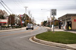
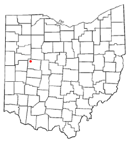
North Robinson is a village in Crawford County, Ohio, United States. The population was 219 at the 2020 census.
Wayne Lakes is a village in Darke County, Ohio, United States. The population was 693 at the 2020 census.
Jeffersonville is a village in Fayette County, Ohio, United States. The population was 1,258 at the 2020 census.
Cleves is a village in Miami Township, Hamilton County, Ohio, United States. Located along the Ohio River, it is a western suburb of Cincinnati. The population was 3,414 at the 2020 census.
Mowrystown is a village in Highland County, Ohio, United States. The population was 385 at the 2020 census.
Coalton is a village in Jackson County, Ohio, United States. The population was 445 at the 2020 census.
Wintersville is a village in central Jefferson County, Ohio, United States. The population was 3,609 as of the 2020 Census. It is part of the Weirton–Steubenville metropolitan area. The village is suburban in nature and is governed by a mayor and council elected by non-partisan ballot.
Fairport Harbor is a village in Lake County, Ohio, United States, along Lake Erie at the mouth of the Grand River. The population was 3,108 at the 2020 census. A far-eastern suburb of Cleveland, it is part of the Cleveland metropolitan area.
Lakeview is a village in Logan County, Ohio, United States. The population was 1,184 at the 2020 census.
Grafton is a village in Lorain County, Ohio, United States, along the East Branch of the Black River. The population was 5,895 at the 2020 census. The Lorain Correctional Institution and several other prisons are located in and near Grafton.
Spencer is a village in Spencer Township located in Medina County, Ohio, United States. The population was 684 at the 2020 census.
Cardington is a village in Morrow County, Ohio, United States. The population was 2,051 at the 2020 census. Mount Gilead, Ohio, the county seat, is located northeast of Cardington on U.S. Route 42.
Cloverdale is a village in Perry Township, Putnam County, Ohio, United States. The population was 170 at the 2020 census.
Millbury is a village in Wood County, Ohio, United States. The population was 1,193 at the 2020 census.
Risingsun is a village in Wood County, Ohio, United States. The population was 541 at the 2020 census.
Upper Sandusky is a city in and the county seat of Wyandot County, Ohio, United States, along the upper Sandusky River. The city lies approximately 59 miles (95 km) south of Toledo and 62 miles (100 km) north of Columbus. The population was 6,698 at the 2020 census.
Timber Lake is a city in and the county seat of Dewey County, South Dakota, United States. The population was 509 at the 2020 census.
Crestline is a village in Crawford and Richland Counties in the U.S. state of Ohio. Crestline's population was 4,525 at the 2020 census. It is the third largest municipality in Crawford County. The Crawford County portion of Crestline is part of the Bucyrus Micropolitan Statistical Area, while the small portion of the village that extends into Richland County is considered part of the Mansfield Metropolitan Statistical Area. Both sections form the Mansfield–Bucyrus, OH Combined Statistical Area.