Greene County, Ohio

Last updated

Greene County
Greene County Courthouse.JPG
Flag of Greene County, Ohio.png
Seal of Greene County Ohio.svg
Map of Ohio highlighting Greene County.svg
Location within the U.S. state of Ohio
Ohio in United States.svg
Ohio's location within the U.S.
Coordinates: 39°41′N83°53′W / 39.69°N 83.89°W / 39.69; -83.89
CountryFlag of the United States.svg United States
StateFlag of Ohio.svg  Ohio
FoundedMay 1, 1803 [1]
Named for General Nathanael Greene
Seat Xenia
Largest city Beavercreek
Area
  Total416 sq mi (1,080 km2)
  Land414 sq mi (1,070 km2)
  Water2.5 sq mi (6 km2)  0.6%
Population
 (2020)
  Total167,966
  Estimate 
(2022)
168,456
  Density400/sq mi (160/km2)
Time zone UTC−5 (Eastern)
  Summer (DST) UTC−4 (EDT)
Congressional district 10th
Website www.greenecountyohio.gov

Greene County is located in the southwestern portion of Ohio. As of the 2020 census, the population was 167,966. [2] Its county seat is Xenia and its largest city is Beavercreek. [3] The county was established on March 24, 1803 [4] and named for General Nathanael Greene, [5] an officer in the Revolutionary War. Greene County is part of the Dayton, OH Metropolitan Statistical Area.

Contents

Geography

According to the United States Census Bureau, the county has a total area of 416 square miles (1,080 km2), of which 414 square miles (1,070 km2) is land and 2.5 square miles (6.5 km2) (0.6%) is water. [6]

Adjacent counties

National protected area

Major highways

Demographics

Historical population
CensusPop.Note
1810 5,870
1820 10,52979.4%
1830 14,80140.6%
1840 17,52818.4%
1850 21,94625.2%
1860 26,19719.4%
1870 28,0387.0%
1880 31,64912.9%
1890 29,820−5.8%
1900 31,6136.0%
1910 29,733−5.9%
1920 31,2215.0%
1930 33,2596.5%
1940 35,8637.8%
1950 58,89264.2%
1960 94,64260.7%
1970 125,05732.1%
1980 129,7693.8%
1990 136,7315.4%
2000 147,8868.2%
2010 161,5739.3%
2020 167,9664.0%
2022 (est.)168,456 [7] 0.3%
U.S. Decennial Census [8]
1790-1960 [9] 1900-1990 [10]
1990-2000 [11] 2010-2020 [2]

2020 census

As of the census [12] of 2020, there were 167,996 people, 65,915 households, and 42,983 families living in the county. The population density was 406.1 inhabitants per square mile (156.8/km2). There were 71,336 housing units at an average density of 172.5 per square mile (66.6/km2). The racial makeup of the county was 81.5% White, 6.8% African American, 0.2% Native American, 3.3% Asian, 1.1% from other races, and 6.3% from two or more races. Hispanic or Latino of any race were 3.1% of the population. [13]

There were 65,915 households, of which 28.7% had children under the age of 18 living with them, 59.1% were married couples living together, 9.5% had a female householder with no spouse present, 3.6% had a male householder with no spouse present, and 34.7% were non-families. 27.7% of all households were made up of individuals, and 10.8% had someone living alone who was 65 years of age or older. The average household size was 2.41 and the average family size was 2.94. [14]

The median age in the county was 39.0 years. 20.5% of residents were under the age of 18; 11.6% were between the ages of 18 and 24; 25.5% were from 25 to 44; 23.3% were from 45 to 64; and 19.1% were 65 years of age or older. The gender makeup of the county was 50.2% male and 49.8% female. [15]

The median income for a household in the county was $70,055, and the median income for a family was $90,453. [16] 10.6% of the population were below the poverty line, including 13.6% of those under age 18 and 6.2% of those age 65 or over. [17] The labor force participation rate for those aged 20 to 64 was 77.6%. [18] 94.0% of the population over the age of 25 had obtained a high school diploma or equivalency, 39.7% of those over the age of 25 held bachelor's degrees. [19]

2010 census

As of the 2010 United States census, there were 161,573 people, 62,770 households, and 41,696 families living in the county. [20] The population density was 390.5 inhabitants per square mile (150.8/km2). There were 68,241 housing units at an average density of 164.9 units per square mile (63.7 units/km2). [21] The racial makeup of the county was 86.4% white, 7.2% black or African American, 2.9% Asian, 0.3% American Indian, 0.1% Pacific islander, 0.5% from other races, and 2.6% from two or more races. Those of Hispanic or Latino origin made up 2.1% of the population. [20] In terms of ancestry, 26.4% were German, 15.7% were American, 13.0% were Irish, and 10.9% were English. [22]

Of the 62,770 households, 30.1% had children under the age of 18 living with them, 51.9% were married couples living together, 10.6% had a female householder with no husband present, 33.6% were non-families, and 26.5% of all households were made up of individuals. The average household size was 2.43 and the average family size was 2.95. The median age was 37.2 years. [20]

The median income for a household in the county was $56,679 and the median income for a family was $70,817. Males had a median income of $53,614 versus $37,056 for females. The per capita income for the county was $28,328. About 7.8% of families and 11.4% of the population were below the poverty line, including 15.3% of those under age 18 and 5.1% of those age 65 or over. [23]

2000 census

As of the census of 2010, there were 161,573 people, 61,825 households, and 39,160 families living in the county. The population density was 356 inhabitants per square mile (137/km2). There were 58,224 housing units at an average density of 140 units per square mile (54 units/km2). The racial makeup of the county was 86.4% White, 7.2% Black or African American, 0.3% Native American, 2.9% Asian, 0.1% Pacific Islander, 0.38% from other races, and 1.66% from two or more races. 1.23% of the population were Hispanic or Latino of any race.

There were 55,312 households, out of which 32.80% had children under the age of 18 living with them, 58.00% were married couples living together, 9.60% had a female householder with no husband present, and 29.20% were non-families. 23.00% of all households were made up of individuals, and 7.70% had someone living alone who was 65 years of age or older. The average household size was 2.53 and the average family size was 3.00.

In the county, the population was spread out, with 23.90% under the age of 18, 13.70% from 18 to 24, 27.00% from 25 to 44, 23.60% from 45 to 64, and 11.80% who were 65 years of age or older. The median age was 36 years. For every 100 females there were 94.80 males. For every 100 females age 18 and over, there were 91.40 males.

The median income for a household in the county was $48,656, and the median income for a family was $57,954. Males had a median income of $42,338 versus $28,457 for females. The per capita income for the county was $23,057. About 5.20% of families and 8.50% of the population were below the poverty line, including 8.70% of those under age 18 and 6.90% of those age 65 or over.

Politics

Greene County is a Republican stronghold in presidential elections. The only times the county has voted for the Democratic nominee were for Franklin D. Roosevelt in 1936 and Lyndon B. Johnson in 1964, both of them decisive Democratic victories at the national level.

United States presidential election results for Greene County, Ohio [24]
Year Republican Democratic Third party
No.%No.%No.%
2020 52,07258.74%34,79839.26%1,7732.00%
2016 48,54058.53%28,94334.90%5,4546.58%
2012 49,81959.57%32,25638.57%1,5511.85%
2008 48,93658.45%33,54040.06%1,2531.50%
2004 48,38861.03%30,53138.51%3630.46%
2000 37,94658.20%25,05938.43%2,1993.37%
1996 30,67749.65%25,08240.60%6,0239.75%
1992 27,65146.47%20,13933.85%11,71219.68%
1988 34,43265.14%18,02534.10%3990.75%
1984 34,26766.27%17,12933.12%3160.61%
1980 24,92251.03%20,06841.09%3,8527.89%
1976 22,59851.27%20,24545.93%1,2342.80%
1972 25,34965.15%12,73632.73%8242.12%
1968 17,58945.36%15,17839.14%6,00815.49%
1964 14,57140.65%21,27659.35%00.00%
1960 19,64258.12%14,15541.88%00.00%
1956 15,47161.07%9,86138.93%00.00%
1952 12,90058.58%9,12341.42%00.00%
1948 9,18650.20%8,97049.02%1440.79%
1944 9,68054.95%7,93745.05%00.00%
1940 9,27351.08%8,88148.92%00.00%
1936 7,44944.57%8,94653.53%3171.90%
1932 8,45554.62%6,60042.63%4262.75%
1928 10,03074.14%3,38525.02%1130.84%
1924 8,41072.98%2,47121.44%6425.57%
1920 8,60067.25%4,01631.40%1721.35%
1916 4,45857.93%2,91337.86%3244.21%
1912 3,24246.03%2,10729.92%1,69424.05%
1908 4,90260.14%2,88235.36%3674.50%
1904 5,04367.38%2,00426.78%4375.84%
1900 5,10062.95%2,74333.86%2593.20%
1896 5,29662.51%3,00335.45%1732.04%
1892 4,21059.07%2,44234.26%4756.66%
1888 4,89361.70%2,68233.82%3554.48%
1884 4,92063.39%2,62433.81%2182.81%
1880 4,92766.29%2,45533.03%510.69%
1876 4,48863.67%2,49435.38%670.95%
1872 4,06966.63%1,96132.11%771.26%
1868 4,23369.83%1,82930.17%00.00%
1864 3,88771.40%1,55728.60%00.00%
1860 3,26063.06%1,75133.87%1593.08%
1856 3,03264.36%1,46531.10%2144.54%

Government

Parks

Greene County Parks & Trails manages over 3000 acres of parkland, 62 miles of paved multiuse trails, 36 miles of river trails, and 24 miles of hiking trails. [26]

Education

Higher education

The following colleges and universities are located in Greene County:

Public

Private

Public schools

Private schools

Communities

Map of Greene County, Ohio with municipal and township labels Map of Greene County Ohio With Municipal and Township Labels.PNG
Map of Greene County, Ohio with municipal and township labels

Cities

Villages

Townships

Census-designated places

Unincorporated communities

See also

Related Research Articles

<span class="mw-page-title-main">Clinton County, Ohio</span> County in Ohio, United States

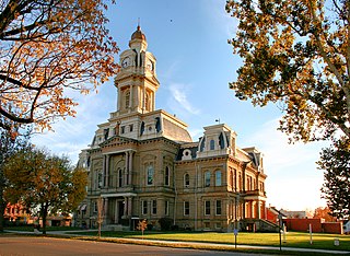
Clinton County is a county located in the U.S. state of Ohio. As of the 2020 census, the population was 42,018. Its county seat and largest city is Wilmington. The county is named for former U.S. Vice President George Clinton. Clinton County comprises the Wilmington, Ohio Micropolitan Statistical Area, which is also included in the Cincinnati-Wilmington-Maysville, OH-KY-IN Combined Statistical Area.

<span class="mw-page-title-main">Montgomery County, Ohio</span> County in Ohio, United States

Montgomery County is in the southwestern part of the U.S. state of Ohio. At the 2020 census, the population was 537,309, making it the fifth-most populous county in Ohio. The county seat is Dayton. The county was named in honor of Richard Montgomery, an American Revolutionary War general, who was killed in 1775 while attempting to capture Quebec City, Canada. Montgomery County is part of the Dayton, Ohio, Metropolitan Statistical Area.

<span class="mw-page-title-main">Monroe County, Ohio</span> County in Ohio, United States

Monroe County is a county located on the eastern border of the U.S. state of Ohio, across the Ohio River from West Virginia. As of the 2020 census, the population was 13,385, making it the second-least populous county in Ohio. Its county seat is Woodsfield. The county was created in 1813 and later organized in 1815.

<span class="mw-page-title-main">Marion County, Ohio</span> County in Ohio, United States

Marion County is a county located in the U.S. state of Ohio. As of the 2020 census, the population was 65,359. Its county seat is Marion. The county was created in 1820 and later organized in 1824. It is named for General Francis "The Swamp Fox" Marion, a South Carolinian officer in the Revolutionary War.

<span class="mw-page-title-main">Madison County, Ohio</span> County in Ohio, United States

Madison County is a county located in the central portion of the U.S. state of Ohio. As of the 2020 census, the population was 43,824. Its county seat is London. The county is named for James Madison, President of the United States and was established on March 1, 1810.

<span class="mw-page-title-main">Fayette County, Ohio</span> County in Ohio, United States

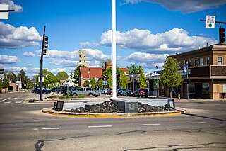
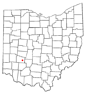
Fayette County is a county located in the U.S. state of Ohio. As of the 2020 census, the population was 28,951. Its county seat and largest city is Washington Court House. The county was named for the Marquis de Lafayette, a Frenchman who was an officer in the American Army in the Revolution, when established on March 1, 1810.

<span class="mw-page-title-main">Clark County, Ohio</span> County in Ohio, United States

Clark County is a county located in the west central portion of the U.S. state of Ohio. As of the 2020 census, the population was 136,001. Its county seat and largest city is Springfield. The county was created on March 1, 1818, and was named for General George Rogers Clark, a hero of the American Revolution.

<span class="mw-page-title-main">Leo-Cedarville, Indiana</span> Town in Indiana, United States

Leo-Cedarville is a town in Cedar Creek Township, Allen County, Indiana, United States. The population was 3,603 at the 2010 census.

<span class="mw-page-title-main">Beavercreek, Ohio</span> City in Ohio, United States

Beavercreek is the largest city in Greene County, Ohio, United States. The population was 46,549 at the 2020 census. Part of the Dayton metropolitan area, it is the second-largest suburb of Dayton.

<span class="mw-page-title-main">Bellbrook, Ohio</span> City in Ohio, United States

Bellbrook is a city in Greene County, Ohio, United States. The population was 7,317 at the 2020 census. It is part of the Dayton Metropolitan Statistical Area. It sits about 10.7 miles (17.2 km) southeast of Dayton.

<span class="mw-page-title-main">Cedarville, Ohio</span> Village in Ohio, United States

Cedarville is a village in Greene County, Ohio, United States. The village is within the Dayton Metropolitan Statistical Area. The population was 4,257 at the 2020 census.

<span class="mw-page-title-main">Fairborn, Ohio</span> City in Ohio, United States

Fairborn is a city in Greene County, Ohio, United States. The population was 34,620 at the 2020 census. It is a suburb of Dayton and part of the Dayton metropolitan area. The city is home to Wright State University, which serves nearly 12,000 undergraduate and graduate students. The city also hosts the disaster training facility known informally as Calamityville.

<span class="mw-page-title-main">Shawnee Hills, Greene County, Ohio</span> Census-designated place in Ohio, United States

Shawnee Hills is a census-designated place (CDP) in Greene County, Ohio, United States. Shawnee Hills consists of a planned community centered on the 250-acre (1.0 km2) Shawnee Lake. The population was 2,230 at the 2020 census. It is part of the Dayton Metropolitan Statistical Area, and should not be confused with the incorporated village of Shawnee Hills in Delaware County.

<span class="mw-page-title-main">Wilberforce, Ohio</span> Census-designated place in Ohio, United States

Wilberforce is a census-designated place (CDP) in Greene County, Ohio, United States. The population was 2,410 at the 2020 census.

<span class="mw-page-title-main">Xenia, Ohio</span> City in Ohio, United States

Xenia is a city in and the county seat of Greene County, Ohio, United States. Located in southwestern Ohio, it is 15 miles (24 km) east of Dayton and is part of the Dayton metropolitan area as well as the Miami Valley region. As of the 2020 census, the city had a population of 25,441. The city's name comes from the Greek word Xenia (ξενία), which means "hospitality".

<span class="mw-page-title-main">Riverside, Ohio</span> City in Ohio, United States

Riverside is a city in Montgomery County, Ohio, United States. The population was 24,474 at the 2020 census. A suburb of Dayton, it is part of the Dayton metropolitan area.

The Greene County Public Library serves the communities of Greene County, Ohio. The library system's administrative offices are in Xenia, and other branches are located in Beavercreek, Cedarville, Fairborn, Jamestown, Bellbrook, and Yellow Springs. Greene County Library is a member of the Miami Valley Libraries, one of eleven regional library cooperatives in Ohio.

<span class="mw-page-title-main">Xenia Township, Greene County, Ohio</span> Township in Ohio, United States

Xenia Township is one of the twelve townships of Greene County, Ohio, United States. As of the 2020 census, the population was 6,742.

<span class="mw-page-title-main">Beavercreek Township, Ohio</span> Township in Ohio, United States

Beavercreek Township is one of the twelve townships of Greene County, Ohio, United States. As of the 2020 census the township population was 56,026.

<span class="mw-page-title-main">Dayton metropolitan area</span> Metropolitan Statistical Area in Ohio, United States

Greater Dayton or the Miami Valley, or more formally the Dayton–Kettering–Beavercreek, OH Metropolitan Statistical Area, as defined by the United States Census Bureau, is an area consisting of three counties in the Miami Valley region of Ohio and is anchored by the city of Dayton. As of 2020, it is the fourth-largest metropolitan area in Ohio and the 73rd-largest metropolitan area by population in the United States with a population of 814,049.

References

  1. "Ohio County Profiles: Greene County" (PDF). Ohio Department of Development. Archived from the original (PDF) on June 21, 2007. Retrieved April 28, 2007.
  2. 1 2 "State & County QuickFacts". United States Census Bureau. Retrieved October 24, 2022.
  3. "Find a County". National Association of Counties. Archived from the original on May 31, 2011. Retrieved June 7, 2011.
  4. "Greene County data". Ohio State University Extension Data Center. Retrieved April 28, 2007.[ dead link ]
  5. Gannett, Henry (1905). The Origin of Certain Place Names in the United States. Govt. Print. Off. pp.  143.
  6. "2010 Census Gazetteer Files". United States Census Bureau. August 22, 2012. Archived from the original on May 4, 2014. Retrieved February 8, 2015.
  7. "Greene County, Ohio Quick Facts". U.S. Census Bureau. Retrieved January 11, 2024.
  8. "U.S. Decennial Census". United States Census Bureau. Retrieved February 8, 2015.
  9. "Historical Census Browser". University of Virginia Library. Retrieved February 8, 2015.
  10. Forstall, Richard L., ed. (March 27, 1995). "Population of Counties by Decennial Census: 1900 to 1990". United States Census Bureau. Retrieved February 8, 2015.
  11. "Census 2000 PHC-T-4. Ranking Tables for Counties: 1990 and 2000" (PDF). United States Census Bureau. April 2, 2001. Archived (PDF) from the original on March 27, 2010. Retrieved February 8, 2015.
  12. "U.S. Census website". United States Census Bureau . Retrieved January 11, 2024.
  13. "U.S. Census Bureau 2020 Decennial Census, Greene County, Ohio - P1: Race". United States Census Bureau . Retrieved January 11, 2024.
  14. "U.S. Census Bureau 2020 American Community Survey - 5 year estimates, Greene County, Ohio - S1101: Households & Families". United States Census Bureau . Retrieved January 11, 2024.
  15. "U.S. Census Bureau 2020 American Community Survey - 5 year estimates, Greene County, Ohio - S0101: Age & Sex". United States Census Bureau . Retrieved January 11, 2024.
  16. "U.S. Census Bureau 2020 American Community Survey - 5 year estimates, Greene County, Ohio - S1901: Income in the Past 12 Months (in 2020-inflation adjusted dollars)". United States Census Bureau . Retrieved January 11, 2024.
  17. "U.S. Census Bureau 2020 American Community Survey - 5 year estimates, Greene County, Ohio - S1701: Poverty Status in the Past 12 Months". United States Census Bureau . Retrieved January 11, 2024.
  18. "U.S. Census Bureau 2020 American Community Survey - 5 year estimates, Greene County, Ohio - S2301: Employment Status". United States Census Bureau . Retrieved January 11, 2024.
  19. "U.S. Census Bureau 2020 American Community Survey - 5 year estimates, Greene County, Ohio - S1501: Educational Attainment". United States Census Bureau . Retrieved January 11, 2024.
  20. 1 2 3 "DP-1 Profile of General Population and Housing Characteristics: 2010 Demographic Profile Data". United States Census Bureau. Archived from the original on February 13, 2020. Retrieved December 27, 2015.
  21. "Population, Housing Units, Area, and Density: 2010 - County". United States Census Bureau. Archived from the original on February 13, 2020. Retrieved December 27, 2015.
  22. "DP02 SELECTED SOCIAL CHARACTERISTICS IN THE UNITED STATES – 2006-2010 American Community Survey 5-Year Estimates". United States Census Bureau. Archived from the original on February 13, 2020. Retrieved December 27, 2015.
  23. "DP03 SELECTED ECONOMIC CHARACTERISTICS – 2006-2010 American Community Survey 5-Year Estimates". United States Census Bureau. Archived from the original on February 13, 2020. Retrieved December 27, 2015.
  24. Leip, David. "Dave Leip's Atlas of U.S. Presidential Elections". uselectionatlas.org. Retrieved May 2, 2018.
  25. "Archived copy" (PDF). Archived from the original (PDF) on April 16, 2021. Retrieved April 16, 2021.{{cite web}}: CS1 maint: archived copy as title (link)
  26. "Spring Lakes Park" (PDF). Greene County Parks & Trails. Archived (PDF) from the original on July 3, 2020. Retrieved July 2, 2020.

39°41′N83°53′W / 39.69°N 83.89°W / 39.69; -83.89