History
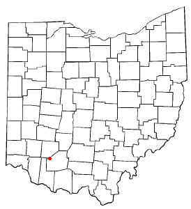
Noble County was formed on March 11, 1851, from portions of Guernsey, Morgan, Monroe and Washington counties. [5] It was the last and youngest county to be formed in the state. [6] [7] It was named for either James Noble or Warren P. Noble, each of whom was an early settler in this region. [8]
Noble County was home to the first North American oil well, the Thorla-McKee Well, which struck oil in 1814. [9] For a time this was a center of oil production in the state.
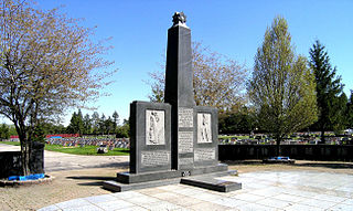
In 1925, a United States Navy dirigible, USS Shenandoah (ZR-1), was caught in a storm over Noble County. It broke into several pieces, resulting in the deaths of 14 persons on board; 29 survived.
Demographics
Historical population| Census | Pop. | Note | %± |
|---|
| 1860 | 20,751 | | — |
|---|
| 1870 | 19,949 | | −3.9% |
|---|
| 1880 | 21,138 | | 6.0% |
|---|
| 1890 | 20,753 | | −1.8% |
|---|
| 1900 | 19,466 | | −6.2% |
|---|
| 1910 | 18,601 | | −4.4% |
|---|
| 1920 | 17,849 | | −4.0% |
|---|
| 1930 | 14,961 | | −16.2% |
|---|
| 1940 | 14,587 | | −2.5% |
|---|
| 1950 | 11,750 | | −19.4% |
|---|
| 1960 | 10,982 | | −6.5% |
|---|
| 1970 | 10,428 | | −5.0% |
|---|
| 1980 | 11,310 | | 8.5% |
|---|
| 1990 | 11,336 | | 0.2% |
|---|
| 2000 | 14,058 | | 24.0% |
|---|
| 2010 | 14,645 | | 4.2% |
|---|
| 2020 | 14,115 | | −3.6% |
|---|
| 2021 (est.) | 14,176 | [11] | 0.4% |
|---|
|
2000 census
As of the census of 2000, there were 14,058 people, 4,546 households, and 3,318 families living in the county. The population density was 35 people per square mile (14 people/km2). There were 5,480 housing units at an average density of 14 units per square mile (5.4/km2). The racial makeup of the county was 92.55% White, 6.69% Black or African American, 0.26% Native American, 0.09% Asian, 0.03% from other races, and 0.38% from two or more races. 0.43% of the population were Hispanic or Latino of any race.
There were 4,546 households, out of which 33.50% had children under the age of 18 living with them, 61.50% were married couples living together, 7.70% had a female householder with no husband present, and 27.00% were non-families. 24.30% of all households were made up of individuals, and 12.60% had someone living alone who was 65 years of age or older. The average household size was 2.61 and the average family size was 3.10.
In the county, the population was spread out, with 22.60% under the age of 18, 11.70% from 18 to 24, 31.80% from 25 to 44, 20.80% from 45 to 64, and 13.10% who were 65 years of age or older. The median age was 36 years. For every 100 females there were 130.80 males. For every 100 females age 18 and over, there were 140.50 males.
The median income for a household in the county was $32,940, and the median income for a family was $38,939. Males had a median income of $30,911 versus $20,222 for females. The per capita income for the county was $14,100. About 8.30% of families and 11.40% of the population were below the poverty line, including 13.90% of those under age 18 and 11.90% of those age 65 or over.
2010 census
As of the 2010 United States census, there were 14,645 people, 4,852 households, and 3,394 families living in the county. [16] The population density was 36.8 inhabitants per square mile (14.2/km2). There were 6,053 housing units at an average density of 15.2 units per square mile (5.9 units/km2). [17] The racial makeup of the county was 96.1% white, 2.5% black or African American, 0.3% American Indian, 0.1% Asian, 0.2% from other races, and 0.8% from two or more races. Those of Hispanic or Latino origin made up 0.4% of the population. [16] In terms of ancestry, 25.9% were German, 13.1% were Irish, 9.1% were American, and 9.0% were English. [18]
Of the 4,852 households, 30.4% had children under the age of 18 living with them, 55.8% were married couples living together, 8.6% had a female householder with no husband present, 30.0% were non-families, and 25.7% of all households were made up of individuals. The average household size was 2.47 and the average family size was 2.94. The median age was 48.6 years. [16]
The median income for a household in the county was $39,500 and the median income for a family was $44,773. Males had a median income of $42,456 versus $29,551 for females. The per capita income for the county was $20,029. About 11.6% of families and 14.9% of the population were below the poverty line, including 22.9% of those under age 18 and 13.8% of those age 65 or over. [19]
Van Wert County is a county located in the U.S. state of Ohio. As of the 2020 census, the population was 28,931. Its county seat is Van Wert. The county was created on February 12, 1820, and later organized on March 18, 1837. It is named for Isaac Van Wart, one of the captors of John André in the American Revolutionary War.
Morgan County is a county located in the U.S. state of Ohio. As of the 2020 census, the population was 13,802, making it the third-least populous county in Ohio. Its county seat is McConnelsville. The county was created in 1817 and later organized in 1819. It is named for Daniel Morgan, an officer in the American Revolutionary War.
Guernsey County is a county located in the U.S. state of Ohio. As of the 2020 census, the population was 38,438. Its county seat and largest city is Cambridge. It is named for the Isle of Guernsey in the English Channel, from which many of the county's early settlers emigrated.

Defiance County is a county located in the U.S. state of Ohio. As of the 2020 census, the population was 38,286. Its county seat and largest city is Defiance. The county was named after an early Army fortification, Fort Defiance, which was so named by Mad Anthony Wayne to signify the settlers' "defiance" of the Indians. The Defiance, OH Micropolitan Statistical Area includes all of Defiance County.

Darke County is a county in the U.S. state of Ohio. As of the 2020 census, the population was 51,881. Its county seat and largest city is Greenville. The county was created in 1809 and later organized in 1817. It is named for William Darke, an officer in the American Revolutionary War. Darke County comprises the Greenville, OH Micropolitan Statistical Area, which is also included in the Dayton-Springfield-Sidney, OH Combined Statistical Area.

Champaign County is a county located in the U.S. state of Ohio. As of the 2020 census, the population was 38,714. Its county seat and largest city is Urbana. The county takes its name from the French word for "open level country". Champaign County became the 18th of 88 Ohio counties on March 1, 1805. It was formed from parts of Greene and Franklin counties by legislative action.

Carroll County is a county located in the state of Ohio. As of the 2020 census, the population was 26,721. Its county seat is Carrollton, while its largest village is Minerva. It is named for Charles Carroll of Carrollton, the last surviving signer of the Declaration of Independence.

Powhatan Point is a village in southeastern Belmont County, Ohio, United States, along the Ohio River. The population was 1,461 at the 2020 census. It is part of the Wheeling metropolitan area.
Bedford Heights is a city in Cuyahoga County, Ohio, United States. The population was 11,020 at the 2020 census. A suburb of Cleveland, it is a part of the Cleveland metropolitan area.

Dillonvale is a village in southern Jefferson County, Ohio, United States. The population was 589 at the 2020 census. It is part of the Weirton–Steubenville metropolitan area. Charles Eberle was the very first mayor of Dillonvale and was the first Postmaster as well.

South Solon is a village in Madison County, Ohio, United States. The population was 329 at the 2020 census. Despite their similar names, South Solon is not adjacent to the city of Solon, Ohio, a suburb of Cleveland in Cuyahoga County. The two towns are approximately 170 miles (270 km) apart.

Brookville is a small city in northwestern Montgomery County, Ohio, United States. It is a suburb of Dayton. The population was 5,989 at the 2020 census.
Marengo is a village in Morrow County, Ohio, United States. The population was 283 at the 2020 census. Marengo is south of Mount Gilead, the county seat.

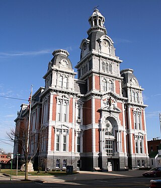
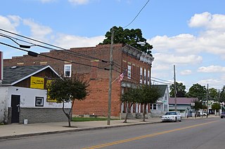
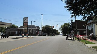
Caldwell is a village and the county seat of Noble County, Ohio, United States. It is located along the West Fork of Duck Creek about 23 miles (37 km) north of Marietta. The population was 1,691 at the 2020 census.

Dexter City is a village in Noble County, Ohio, United States, along the West Fork of Duck Creek. The population was 81 at the 2020 census. Dexter City was laid out in 1870, and named after Dexter W. Sullivan, an early settler.

Summerfield is a village in Noble County, Ohio, United States. The population was 237 at the 2020 census, down from 254 at the 2010 census.
Clarksburg is a village in Ross County, Ohio, United States. The population was 409 at the 2020 census.

Belmont is a town in Pleasants County, West Virginia, United States. It is part of the Parkersburg–Vienna metropolitan area. The population was 872 at the 2020 census. Belmont was incorporated on April 19, 1946 by the Circuit Court of Pleasants County. The city was named for the beautiful hills in the area.
Lynchburg is a village in Clinton and Highland counties in the U.S. state of Ohio. The population was 1,510 at the 2020 census.

Loveland Park is a census-designated place (CDP) located in Symmes Township, Hamilton County and Deerfield Township, Warren County, in the southwestern part of the U.S. state of Ohio. The CDP is named after the city of Loveland. The population was 1,737 at the 2020 census.