Hamilton County, Ohio

Last updated

Hamilton County
County
Hamilton County Courthouse, Cincinnati, OH.jpg
Flag of Hamilton County, Ohio.svg
Seal of Hamilton County (Ohio).svg
Emblem of Hamilton County, Ohio.svg
Map of Ohio highlighting Hamilton County.svg
Location within the U.S. state of Ohio
Ohio in United States.svg
Ohio's location within the U.S.
Coordinates: 39°12′N84°32′W / 39.2°N 84.54°W / 39.2; -84.54
CountryFlag of the United States.svg United States
StateFlag of Ohio.svg  Ohio
FoundedJanuary 2, 1790 [1]
Named for Alexander Hamilton
Seat Cincinnati
Largest cityCincinnati
Area
  Total413 sq mi (1,070 km2)
  Land406 sq mi (1,050 km2)
  Water6.7 sq mi (17 km2)  1.6%
Population
 (2020)
  Total830,639
  Estimate 
(2022)
825,037 Decrease2.svg
  Density2,000/sq mi (780/km2)
Time zone UTC−5 (Eastern)
  Summer (DST) UTC−4 (EDT)
Congressional districts 1st, 8th
Website www.hamilton-co.org

Hamilton County is located in the southwestern corner of the U.S. state of Ohio. As of the 2020 census, the population was 830,639, [2] making it the third-most populous county in Ohio. The county seat and largest city is Cincinnati. [3] The county is named for the first Secretary of the Treasury, Alexander Hamilton. [4] Hamilton County is part of the Cincinnati-Middletown, OH-KY-IN Metropolitan Statistical Area.

Contents

History

The southern portion of Hamilton County was originally owned and surveyed by John Cleves Symmes, and the region was a part of the Symmes Purchase. The first settlers rafted down the Ohio River in 1788 following the American Revolutionary War. They established the towns of Losantiville (later Cincinnati), North Bend, and Columbia.

Hamilton County was organized in 1790 by order of Arthur St. Clair, governor of the Northwest Territory, as the second county in the Northwest Territory. Cincinnati was named as the seat. Residents named the county in honor of Alexander Hamilton, who was the first Secretary of the Treasury of the United States and a founder of the Federalist Party. Its original boundaries were those defined for the Symmes purchase contract in 1788: [5] the Ohio River in the South, Great Miami River to the west, the Lesser Miami River to the east, and the Cuyahoga River to the North. Its area then included about one-eighth of Ohio and had about 2,000 inhabitants (not including the remaining Native Americans).

The county was greatly expanded in 1792 to include what is today the lower peninsula of Michigan. Since 1796, other counties were created from Hamilton, reducing the county to its present size. The county was the location of much of the Northwest Indian War before and after its organization.

The United States forcibly removed most of the Shawnee and other Indian peoples to move to locations west of the Mississippi River in the 1820s.

Rapid growth occurred during the 1830s and 1840s as the area attracted many German and Irish immigrants, especially after the Great Famine in Ireland and the revolutions in Germany in 1848.

During the Civil War, Morgan's Raid (a Confederate cavalry campaign from Kentucky) passed through the northern part of the county during the summer of 1863.

The Sharonville Engineer Depot was constructed by the United States Army in northern Hamilton County in 1942, and continued to be used by the General Services Administration and then the Defense Logistics Agency after 1949. It is currently mostly redeveloped for industrial purposes.

Geography

Chateau Laroche in Symmes Township lies in the Little Miami Valley. Loveland Castle (9).jpg
Château Laroche in Symmes Township lies in the Little Miami Valley.

According to the U.S. Census Bureau, the county has a total area of 413 square miles (1,070 km2), of which 406 square miles (1,050 km2) is land and 6.7 square miles (17 km2) (1.6%) is water. [6]

Adjacent counties

Geographic features

Cincinnati, Ohio viewed from the SW, across the Ohio River, in Kentucky. Cincinnati oh skyline.jpg
Cincinnati, Ohio viewed from the SW, across the Ohio River, in Kentucky.

The county lies in a region of gentle hills formed by the slopes of the Ohio River valley and its tributaries. The Great Miami River, the Little Miami River, and the Mill Creek also contribute to this system of hillsides and valleys. No naturally occurring lakes exist, but three major humanmade lakes are part of the Great Parks of Hamilton County. [7] The largest lake by far is Winton Woods Lake, covering 188 surface acres, followed by Miami Whitewater Lake, covering 85 surface acres, and Sharon Lake, covering 36 surface acres.

The county boundaries include the lowest point in Ohio, in Miami Township, where the Ohio River flows out of Ohio and into Indiana. This is the upper pool elevation behind the Markland Dam, 455 feet (139 m) above sea level. [8]

The highest land elevation in Hamilton County is the Rumpke Sanitary Landfill at 1,045 feet (319 m) above sea level in Colerain Township.

Major highways

Demographics

Population of Hamilton County 1800–2020
YearPop.±%
1800 14,692    
1810 15,258+3.9%
1820 31,764+108.2%
1830 52,317+64.7%
1840 80,145+53.2%
1850 156,844+95.7%
1860 216,410+38.0%
1870 260,370+20.3%
1880 313,374+20.4%
1890 374,573+19.5%
1900 409,479+9.3%
1910 460,732+12.5%
YearPop.±%
1920 493,678+7.2%
1930 589,356+19.4%
1940 621,987+5.5%
1950 723,952+16.4%
1960 864,121+19.4%
1970 924,018+6.9%
1980 873,224−5.5%
1990 866,228−0.8%
2000 845,303−2.4%
2010 802,374−5.1%
2020 830,639+3.5%
2022825,037−0.7%
U.S. Decennial Census [9]
1790-1960 [10] 1900-1990 [11]
1990-2000 [12] 2010-2020 [13]

2020 census

As of the census of 2020, there were 830,639 people living in the county, for a population density of 2,045.91 people per square mile (791.08/km2). There were 379,015 housing units. The racial makeup of the county was 63.3% White, 25.2% Black or African American, 0.3% Native American, 3.0% Asian, 0.1% Pacific Islander, 2.4% from some other race, and 5.7% from two or more races. 4.4% of the population were Hispanic or Latino of any race. [14]

There were 355,784 households, out of which 26.3% had children under the age of 18 living with them, 39.3% were married couples living together, 20.5% had a male householder with no spouse present, and 32.5% had a female householder with no spouse present. 34.3% of all households were made up of individuals, and 12.0% were someone living alone who was 65 years of age or older. The average household size was 2.26, and the average family size was 2.96. [14]

22.6% of the county's population were under the age of 18, 60.5% were 18 to 64, and 16.9% were 65 years of age or older. The median age was 37.0. For every 100 females, there were 94.7 males. [14]

According to the U.S. Census American Community Survey, for the period 2016-2020 the estimated median annual income for a household in the county was $66,878, and the median income for a family was $92,480. About 15.3% of the population were living below the poverty line, including 17.6% of those under age 18 and 10.8% of those age 65 or over. About 64.1% of the population were employed, and 41.8% had a bachelor's degree or higher. [14]

2010 census

As of the 2010 census, there were 802,374 people, 333,945 households, and 197,571 families living in the county. [15] The population density was 1,976.7 inhabitants per square mile (763.2/km2). There were 377,364 housing units at an average density of 929.7 per square mile (359.0/km2). [16] The racial makeup of the county was 68.8% white, 25.7% black or African American, 2.0% Asian, 0.2% American Indian, 0.1% Pacific islander, 1.1% from other races, and 2.1% from two or more races. Those of Hispanic or Latino origin made up 2.6% of the population. [15] In terms of ancestry, 31.0% were German, 14.7% were Irish, 7.7% were English, and 6.6% were American. [17]

Of the 333,945 households, 29.7% had children under the age of 18 living with them, 39.4% were married couples living together, 15.4% had a female householder with no husband present, 40.8% were non-families, and 33.9% of all households were made up of individuals. The average household size was 2.34 and the average family size was 3.04. The median age was 37.1 years. [15]

The median income for a household in the county was $48,234 and the median income for a family was $64,683. Males had a median income of $48,344 versus $37,310 for females. The per capita income for the county was $28,799. About 11.1% of families and 15.4% of the population were below the poverty line, including 22.9% of those under age 18 and 9.0% of those age 65 or over. [18]

2000 census

As of the 2000 census, there were 845,303 people, 346,790 households, and 212,582 families living in the county. The population density was 2,075 inhabitants per square mile (801/km2). There were 373,393 housing units at an average density of 917 per square mile (354/km2). The racial makeup of the county was 69.2% White, 26.0% Black or African American, 0.1% Native American, 2.3% Asian, 0.01% Pacific Islander, 0.51% from other races, and 2.2% from two or more races. 2.8% of the population were Hispanic or Latino of any race.

There were 346,790 households, out of which 30.20% had children under the age of 18 living with them, 43.40% were married couples living together, 14.30% had a female householder with no husband present, and 38.70% were non-families. 32.90% of all households were made up of individuals, and 10.60% had someone living alone who was 65 years of age or older. The average household size was 2.38 and the average family size was 3.07.

Hamilton County property value, dollars per square foot-2011 Hamilton county ohio property value 2011.png
Hamilton County property value, dollars per square foot-2011

In the county, the population was spread out, with 25.80% under the age of 18, 9.60% from 18 to 24, 29.70% from 25 to 44, 21.50% from 45 to 64, and 13.50% who were 65 years of age or older. The median age was 36 years. For every 100 females there were 91.10 males. For every 100 females age 18 and over, there were 86.80 males.

The median income for a household in the county was $40,964, and the median income for a family was $53,449. Males had a median income of $39,842 versus $28,550 for females. The per capita income for the county was $24,053. About 8.80% of families and 11.80% of the population were below the poverty line, including 16.20% of those under age 18 and 8.70% of those age 65 or over.

Population

The county's highest population was recorded in the 1970 U.S. Census. Since then, the county has lost population at an average rate of three percent per decade. Although Hamilton County is experiencing a decline in birth rates and has higher death rates in older age groups (cohorts), out-migration of residents is the key factor in population loss. In the last decade, this population loss has been reversed, and it is estimated that both Hamilton County and the City of Cincinnati have grown their populations. [19] The Cincinnati Metropolitan Statistical Area, over the last three decades has seen a 19 percent increase in population. Much of the region's growth has been through movement of Cincinnati and Hamilton County residents into neighboring counties. [19]

Government

As of 2020, the members of the Hamilton Board of County Commissioners are Denise Driehaus, Stephanie Summerow Dumas, and Alicia Reece. [20]

Since 1963, the Board has employed an administrator to run the day-to-day operations of the county; the current administrator is Jeffrey Aluotto. [21] Other elected officers include Dusty Rhodes (Auditor), Joe Deters (Prosecutor), Charmaine McGuffey (Sheriff), Eric Beck (Engineer), Scott Crowley (Recorder), Jill Schiller (Treasurer), and Lakshmi Sammarco (Coroner). [21]

As of 2021, the elected Common Pleas Court include: Judge Jody Luebbers, Judge Lisa Allen, Judge Jennifer Branch, Judge Wende Cross, Judge Leslie Ghiz, Judge Robert Goering, Judge Tom Heekin, Judge Christian Jenkins, Judge Charles Kubicki, Judge Melba Marsh, Judge Terry Nestor, Judge Robert Ruehlman, Judge Nicole Sanders, Judge Megan Shanahan, Judge Alan Triggs, and Judge Christopher Wagner. [22]

Politics

Hamilton County was historically rather conservative for an urban county. It long favored Republican candidates in national elections, but has trended Democratic in recent years. In 2008, Barack Obama was the first Democratic presidential candidate to win the county since 1964, and only the second since 1936. The county continued to lean Democratic, voting for Obama again in 2012 and for Democratic candidate Hillary Clinton in 2016. In fact, it was one of the few counties in Ohio to swing toward the Democrats in 2016 even as the state as a whole swung toward the Republicans.

In other state elections, the county also tended to favor Republican candidates. Richard Cordray in his failed 2018 bid was the first Democrat to win the county in a gubernatorial election since Dick Celeste in 1982, and only the second since Michael DiSalle in 1958. [23] [24] In Senate elections, the county also tended to back Republicans, but has been won by Frank Lausche in 1962, John Glenn in all four of his elections and Howard Metzenbaum and Sherrod Brown in two out of three elections for both (1982 and 1988, and 2012 and 2018). [25] In the 2006 Ohio elections, both Ted Strickland and Sherrod Brown lost the county by less than 2,000 votes while winning statewide by 24 and 12 points, respectively.

With the election of Democrat Stephanie Summerow Dumas in 2018 midterm elections, the Hamilton County Board of Commissioners was entirely Democratic for the first time ever. [26] Democrats had previously regained majority control of the Board of Commissioners in 2016 with the election of Denise Driehaus. In 2019, longtime Democratic Commissioner Todd Portune announced his resignation from the Board due to health problems. Portune's Chief of Staff, Victoria Parks, was appointed to serve the remainder of his term (through the November 2020 general election). With Parks' appointment, the Board of Commissioners became for the first time all-female and majority Black. [27] In the November 2020 election, Democrat Alicia Reece was elected to fill Parks' seat, thereby retaining the Board's status as all-female and majority Black. [20]

Historically, due to its tight races and its position in the swing state of Ohio, Hamilton County was regarded as a crucial county to win in presidential elections. In 2012, The Washington Post named Hamilton as one of the seven most important counties in the country for that year's election. [28] Time characterized Hamilton County's political scene as "a battle between conservative suburbs and a Democratic urban center, though Cincinnati is one of the most conservative metro areas in the Midwest." [29] Those characterizations became less true in recent years. While many of Cincinnati's western suburbs, like Green and Delhi Townships, continue to strongly support Republican candidates, the city itself and most of its northern suburbs vote strongly Democratic.

United States presidential election results for Hamilton County, Ohio [30]
Year Republican Democratic Third party
No.%No.%No.%
2020 177,88641.28%246,26657.15%6,7771.57%
2016 173,66542.45%215,71952.73%19,7254.82%
2012 193,32646.15%219,92752.50%5,6411.35%
2008 195,53046.00%225,21352.98%4,3431.02%
2004 222,61652.50%199,67947.09%1,7300.41%
2000 204,17554.03%161,57842.76%12,1463.21%
1996 186,49350.12%160,45843.13%25,1176.75%
1992 192,44747.70%148,40936.79%62,56415.51%
1988 227,00461.29%140,35437.89%3,0260.82%
1984 246,28863.34%140,35036.10%2,1770.56%
1980 206,97957.73%129,11436.01%22,4486.26%
1976 211,26759.84%135,60538.41%6,2071.76%
1972 239,21265.65%119,05432.67%6,1191.68%
1968 183,61150.24%135,05736.95%46,81512.81%
1964 161,17944.73%199,12755.27%00.00%
1960 211,06854.50%176,21545.50%00.00%
1956 222,00966.11%113,79733.89%00.00%
1952 207,69059.60%140,78540.40%00.00%
1948 151,05552.37%135,29046.91%2,0680.72%
1944 154,96051.75%144,47048.25%00.00%
1940 154,73350.96%148,90749.04%00.00%
1936 108,50638.69%153,11754.60%18,8136.71%
1932 118,80447.70%123,10949.43%7,1632.88%
1928 147,53457.03%110,15142.58%1,0070.39%
1924 115,95060.70%34,91618.28%40,16321.02%
1920 112,59057.16%77,59839.40%6,7783.44%
1916 64,03053.33%51,99043.30%4,0493.37%
1912 42,11938.31%42,90939.03%24,92122.67%
1908 63,80356.49%45,42940.22%3,7143.29%
1904 65,12966.43%24,93625.44%7,9738.13%
1900 55,46656.88%40,22841.25%1,8211.87%
1896 57,74959.86%38,16539.56%5610.58%
1892 41,96351.15%38,39246.80%1,6852.05%
1888 41,50751.50%37,66146.73%1,4231.77%
1884 38,74453.45%33,24845.87%4940.68%
1880 35,17353.76%30,12246.04%1330.20%
1876 28,86949.46%29,45150.46%430.07%
1872 20,08344.60%24,94155.39%10.00%
1868 24,16756.29%18,76843.71%00.00%
1864 22,83357.89%16,60642.11%00.00%
1860 16,18245.37%15,43143.27%4,05111.36%
1856 9,34533.28%13,05146.48%5,68520.25%

Hamilton County Officials

Office [31] OfficeholderParty
County Commissioner Stephanie Summerow Dumas Democratic
County Commissioner Alicia Reece Democratic
County Commissioner Denise Driehaus Democratic
Auditor Brigid Kelly Democratic
Clerk of CourtsPavan Parikh Democratic
CoronerLakshmi Kode Sammarco Democratic
EngineerEric Beck Republican
ProsecutorMelissa Powers Republican
RecorderScott Crowley Democratic
SheriffCharmaine McGuffey Democratic
Treasurer Jill Schiller Democratic

Ohio House of Representatives

DistrictRepresentativeParty
27 Rachel Baker Democratic
28 Jessica Miranda Democratic
29 Cindy Abrams Republican
30 Bill Seitz Republican
24 Dani Isaacsohn Democratic
25 Cecil Thomas Democratic
26 Sedrick Denson Democratic

Ohio State Senate

DistrictSenatorParty
7 Steve Wilson Republican
8 Louis Blessing Republican
9 Catherine Ingram Democratic

United States House of Representatives

DistrictRepresentativeParty
1 Greg Landsman Democratic
8 Warren Davidson Republican

United States Senate

SenatorParty
Sherrod Brown Democratic
J. D. Vance Republican

Education

K-12 education

School districts in Hamilton County School districts in Hamilton County, Ohio.png
School districts in Hamilton County

Public elementary and secondary education is provided by 23 school districts: [32]

In 2016, Cincinnati Public Schools had 35,000 students, 63% of which were African-American. [33] The county also has a vocational school district, the Great Oaks Institute of Technology and Career Development. Parochial schools of various denominations add to this base. Among these the Roman Catholic Archdiocese of Cincinnati maintains a system of 108 elementary and 22 secondary schools, the ninth largest private school system in the United States.

Colleges and universities

The University of Cincinnati was founded in 1819; The Engineering Research Center, designed by UC Alumnus Michael Graves, was designed to look like a 4-cylinder engine. ERC-wiki.jpg
The University of Cincinnati was founded in 1819; The Engineering Research Center, designed by UC Alumnus Michael Graves, was designed to look like a 4-cylinder engine.

Transportation

Major highways

Interstate 71, Interstate 74, Interstate 75, Interstate 471, and Interstate 275 serve the county. The Norwood Lateral and Ronald Reagan Cross County Highway are also prominent east–west thoroughfares in the county.

Railroads

CSX Transportation, Norfolk Southern, RailAmerica, and Amtrak. [34]

Recreation

Miami Whitewater Forest was the second park to join the Great Parks of Hamilton County in 1949; it now spans 4,279 acres. Miami Whitewater Forest 1.JPG
Miami Whitewater Forest was the second park to join the Great Parks of Hamilton County in 1949; it now spans 4,279 acres.

The county, in cooperation with the City of Cincinnati, operates the Public Library of Cincinnati and Hamilton County system with a main library and 41 branches. Major sports teams are listed under the communities in which they are located, primarily Cincinnati. The Great Parks of Hamilton County district resides within Hamilton County and maintains a series of preserves and educational facilities. Three of the largest parks within the system are Miami Whitewater Forest, Winton Woods, and Sharon Woods. The Hamilton County Fair is the oldest county fair in Ohio.

Communities

Map of Hamilton County, Ohio, with independent cities and villages in gray, and townships in colors Municipalities in Hamilton County, Ohio.png
Map of Hamilton County, Ohio, with independent cities and villages in gray, and townships in colors

Cities

Villages

Townships

The following list includes townships that have existed within present-day Hamilton County, including those that no longer exist or remain only as paper townships. It does not include townships that became part of Butler, Warren, Clermont, Montgomery, and other counties.

Census-designated places

Unincorporated communities

Neighborhoods of Cincinnati

See also

Related Research Articles

<span class="mw-page-title-main">Fairfield, Ohio</span> City in Ohio, United States

Fairfield is a city in southern Butler County, Ohio, United States. It is a suburb located about 25 miles (40 km) north of Cincinnati and is situated on the east bank of the Great Miami River. The population was 44,907 as of the 2020 census. Incorporated in 1955 from portions of Fairfield Township, it includes the former hamlets of Symmes Corner, Fair Play, Furmandale, and Stockton. The Fairfield City School District is one of the largest in Ohio and serves both the City of Fairfield and Fairfield Township.

<span class="mw-page-title-main">Butler County, Ohio</span> County in Ohio, United States

Butler County is a county located in the southwestern part of the U.S. state of Ohio. As of the 2020 census, the population was 390,357. Its county seat and largest city is Hamilton. It is named for General Richard Butler, who died in 1791 during St. Clair's Defeat. Located along the Great Miami River, it is also home to Miami University, a public university founded in 1809. Butler County is part of the Cincinnati, OH-KY-IN Metropolitan Statistical Area. The majority of the county is in District 52 of the State House.

<span class="mw-page-title-main">Clermont County, Ohio</span> County in Ohio, United States

Clermont County, popularly called Clermont, is a county in the U.S. state of Ohio. As of the 2020 census, the population was 208,601. Ordinanced in 1800 as part of the Virginia Military District, Clermont is Ohio's eighth oldest county, the furthest county west in Appalachian Ohio, and the eleventh oldest county of the former Northwest Territory. Clermont County is part of the Cincinnati, OH-KY-IN Metropolitan Statistical Area. The county is named from the French "clear hills or mountain." Its county seat is Batavia, while its largest city is Milford.

<span class="mw-page-title-main">Blue Ash, Ohio</span> City in Ohio, United States

Blue Ash is a city in Hamilton County, Ohio. An inner suburb of Cincinnati, the population was 13,394 at the time of the 2020 census.

<span class="mw-page-title-main">Cleves, Ohio</span> City in Ohio, United States

Cleves is a village in Miami Township, Hamilton County, Ohio, United States. Located along the Ohio River, it is a western suburb of Cincinnati. The population was 3,414 at the 2020 census.

<span class="mw-page-title-main">North College Hill, Ohio</span> City in Ohio, United States

North College Hill is a city in Hamilton County in the southwestern part of the U.S. state of Ohio approximately ten miles north of downtown Cincinnati. As of the 2020 census, the city population was 9,663. The city takes its name from its proximity to the Cincinnati neighborhood of College Hill which borders it to the south.

<span class="mw-page-title-main">Indian Hill, Ohio</span> City in Ohio, United States

The Village of Indian Hill is a city in Hamilton County, Ohio, United States, and a suburb of the Greater Cincinnati area. The population was 6,087 at the 2020 census. Prior to 1970, Indian Hill was incorporated as a village, but under Ohio law became designated as a city once its population was verified as exceeding 5,000. The municipality then changed its name to add "Village" into the official name; legally it is "The City of The Village of Indian Hill". The Village of Indian Hill is served by the Indian Hill Exempted Village School District.

<span class="mw-page-title-main">Sharonville, Ohio</span> City in Ohio, United States

Sharonville is a city largely in Hamilton County in the U.S. state of Ohio. The population was 14,117 at the 2020 census.

<span class="mw-page-title-main">Anderson Township, Ohio</span> Township in Ohio, United States

Anderson Township is a township located southeastern Hamilton County along the Ohio and Little Miami Rivers, approximately 13 miles southeast of downtown Cincinnati. The population was 44,088 at the 2020 census.

<span class="mw-page-title-main">Colerain Township, Hamilton County, Ohio</span> Township in Ohio, United States

Colerain Township is one of the twelve townships of Hamilton County, Ohio, United States. The population of the township was 59,037 at the 2020 census. It is the second-largest township in Ohio by area, surpassed by Madison Township, Lake County, Ohio.

<span class="mw-page-title-main">Columbia Township, Hamilton County, Ohio</span> Township in Ohio, United States

Columbia Township is one of the twelve townships of Hamilton County, Ohio, United States. The 2020 census found 4,446 people in the township. Originally one of Ohio's largest townships by area at its inception in 1791, it gradually shrank to one of the smallest by the early 1950s.

<span class="mw-page-title-main">Green Township, Hamilton County, Ohio</span> Township in Ohio, United States

Green Township is one of the twelve townships of Hamilton County, Ohio, United States. It is a suburb of the neighboring city of Cincinnati. With a population of 60,424 at the 2020 census, Green Township is the most populous township in Hamilton County, and the second most populous township in Ohio. It was founded in 1809.

<span class="mw-page-title-main">Miami Township, Hamilton County, Ohio</span> Township in Ohio, United States

Miami Township is one of the twelve townships of Hamilton County, Ohio, United States. The population was 15,969 as of the 2020 census.

<span class="mw-page-title-main">Symmes Township, Hamilton County, Ohio</span> Township in Ohio, United States

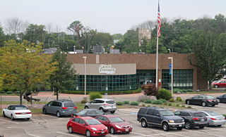
Symmes Township is one of the twelve townships of Hamilton County, Ohio, United States. The population was 15,642 as of the 2020 census.

<span class="mw-page-title-main">Camp Dennison, Ohio</span> Census-designated place in Ohio, United States

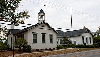
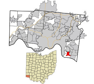
Camp Dennison is a census-designated place (CDP) just outside Indian Hill in southern Symmes Township, Hamilton County, Ohio, United States. It has a post office with the ZIP code 45111. The population was 384 at the 2020 census.

<span class="mw-page-title-main">Mack, Ohio</span> Census-designated place in Ohio, United States

Mack is a census-designated place (CDP) in Green and Miami townships, Hamilton County, Ohio, United States. The population was 11,088 at the 2020 census. At prior censuses, the community was listed as two separate CDPs, Mack North and Mack South.

<span class="mw-page-title-main">Miami Heights, Ohio</span> Census-designated place in Ohio, United States

Miami Heights is a census-designated place (CDP) in Miami Township, Hamilton County, Ohio, United States. The population was 5,166 at the 2020 census.

<span class="mw-page-title-main">Salem Heights, Hamilton County, Ohio</span> Census-designated place in Ohio, United States

Salem Heights is a census-designated place (CDP) in Anderson Township, Hamilton County, Ohio, United States, adjacent to the city of Cincinnati. The population of Salem Heights was 3,862 at the 2020 census.

<span class="mw-page-title-main">Shawnee, Hamilton County, Ohio</span> Census-designated place in Ohio, United States

Shawnee is a census-designated place (CDP) in Miami Township, Hamilton County, Ohio, United States, 21 miles (34 km) west of downtown Cincinnati. The population of Shawnee was 747 at the 2020 census.

<span class="mw-page-title-main">Sixteen Mile Stand, Ohio</span> Census-designated place in Ohio, United States

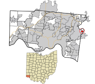
Sixteen Mile Stand is a census-designated place (CDP) in Symmes Township, Hamilton County, Ohio, United States, 19 miles (31 km) northeast of downtown Cincinnati. The population of Sixteen Mile Stand was 3,091 at the 2020 census.

References

  1. "Ohio County Profiles: Hamilton County" (PDF). Ohio Department of Development. Archived from the original (PDF) on June 21, 2007. Retrieved April 28, 2007.
  2. "U.S. Census Bureau QuickFacts: Hamilton County, Ohio". www.census.gov. United States Census Bureau. Retrieved April 1, 2022.
  3. "Find a County". National Association of Counties. Retrieved June 7, 2011.
  4. "Hamilton County data". Ohio State University Extension Data Center. Archived from the original on December 3, 2007. Retrieved April 28, 2007.
  5. However, the Symmes purchase was later reduced to just the southern third of the original tract.
  6. "2010 Census Gazetteer Files". United States Census Bureau. August 22, 2012. Archived from the original on May 4, 2014. Retrieved February 8, 2015.
  7. Hamilton County Water Resources
  8. "Markland". United States Army Corps of Engineers: Louisville District. Archived from the original on December 12, 2012.
  9. "U.S. Decennial Census". United States Census Bureau. Retrieved February 8, 2015.
  10. "Historical Census Browser". University of Virginia Library. Retrieved February 8, 2015.
  11. Forstall, Richard L., ed. (March 27, 1995). "Population of Counties by Decennial Census: 1900 to 1990". United States Census Bureau. Retrieved February 8, 2015.
  12. "Census 2000 PHC-T-4. Ranking Tables for Counties: 1990 and 2000" (PDF). United States Census Bureau. April 2, 2001. Archived (PDF) from the original on March 27, 2010. Retrieved February 8, 2015.
  13. Wetterich, Chris (March 26, 2015). "How much has Greater Cincinnati grown in population during this decade?". Cincinnati Business Courier. Archived from the original on April 2, 2015. Retrieved March 1, 2020.
  14. 1 2 3 4 "Hamilton County, Ohio - Census Bureau Profile". United States Census Bureau. Retrieved December 7, 2023.
  15. 1 2 3 "DP-1 Profile of General Population and Housing Characteristics: 2010 Demographic Profile Data". United States Census Bureau. Archived from the original on February 13, 2020. Retrieved December 27, 2015.
  16. "Population, Housing Units, Area, and Density: 2010 - County". United States Census Bureau. Archived from the original on February 13, 2020. Retrieved December 27, 2015.
  17. "DP02 SELECTED SOCIAL CHARACTERISTICS IN THE UNITED STATES – 2006-2010 American Community Survey 5-Year Estimates". United States Census Bureau. Archived from the original on February 13, 2020. Retrieved December 27, 2015.
  18. "DP03 SELECTED ECONOMIC CHARACTERISTICS – 2006-2010 American Community Survey 5-Year Estimates". United States Census Bureau. Archived from the original on February 13, 2020. Retrieved December 27, 2015.
  19. 1 2 "Population COMMUNITY COMPASS REPORT NO. 15-1". Hamilton County Regional Planning Commission. 2004. Retrieved March 1, 2020.
  20. 1 2 WKRC (January 2, 2021). "New Hamilton County Commissioner Alicia Reese takes office". WKRC. Retrieved January 26, 2021.
  21. 1 2 "Government". www.hamiltoncountyohio.gov. Retrieved January 26, 2021.
  22. "Hamilton County Common Pleas Judges" . Retrieved January 16, 2020.
  23. "1982 Gubernatorial General Election Results - Ohio".
  24. "1958 Gubernatorial General Election Results - Ohio".
  25. "Our Campaigns - OH US Senate Race - November 6, 1962". www.ourcampaigns.com. Retrieved April 19, 2022.
  26. Rinehart, Bill. "New Hamilton County Commission Will Be One Of Firsts". www.wvxu.org. Retrieved January 16, 2020.
  27. London, John (January 14, 2020). "Hamilton County has first all-female commission". WLWT. Retrieved January 16, 2020.
  28. Blake, Aaron (November 6, 2012). "The 7 most important counties in Election 2012". The Washington Post . Retrieved January 23, 2018.
  29. Altman, Alex (October 29, 2012). "The Keys to Ohio: Five Counties that Could Decide the Presidency". Time . Retrieved January 23, 2018.
  30. Leip, David. "Dave Leip's Atlas of U.S. Presidential Elections". uselectionatlas.org. Retrieved May 2, 2018.
  31. "HAMILTON COUNTY ELECTED OFFICIALS 2022" (PDF).
  32. "2020 CENSUS - SCHOOL DISTRICT REFERENCE MAP: Hamilton County, OH" (PDF). U.S. Census Bureau. Archived (PDF) from the original on July 23, 2022. Retrieved July 23, 2022. - Text list - The Census Bureau includes all districts with any territory, no matter how slight
    See also: "School Districts". Hamilton County, Ohio. Retrieved March 1, 2020.
  33. "CPS History | Cincinnati Public Schools".
  34. Railroads of Cincinnati

39°12′N84°32′W / 39.20°N 84.54°W / 39.20; -84.54