Terrace Park, Ohio

Last updated

Terrace Park, Ohio
Hamilton County Ohio Incorporated and Unincorporated areas Terrace Park highlighted.svg
Location in Hamilton County and the state of Ohio
Coordinates: 39°09′30″N84°18′40″W / 39.15833°N 84.31111°W / 39.15833; -84.31111
Country United States
State Ohio
County Hamilton
Government
  MayorThomas Tepe, Jr. (R) [1]
Area
[2]
  Total1.24 sq mi (3.21 km2)
  Land1.19 sq mi (3.07 km2)
  Water0.05 sq mi (0.13 km2)
Elevation
[3]
571 ft (174 m)
Population
 (2020)
  Total2,355
  Density1,985.67/sq mi (766.48/km2)
Time zone UTC-5 (Eastern (EST))
  Summer (DST) UTC-4 (EDT)
ZIP code
45174
Area code 513
FIPS code 39-76428 [4]
GNIS feature ID1086233 [3]
Website www.terracepark.org/village

Terrace Park is a village in Hamilton County, Ohio, and a suburb of Greater Cincinnati. The population was 2,355 at the 2020 census.

Contents

History

St. Thomas Episcopal Church in Terrace Park Terrace Park St Johns.jpg
St. Thomas Episcopal Church in Terrace Park

The primary document for the history of Terrace Park is "A Place Called Terrace Park" by Ellis Rawnsley (1992). [5]

Rawnsley notes that the earliest human inhabitants of Terrace Park may have arrived as early as 12,000 years ago—the Paleo-Indians. Although "no traces of established settlements have ever been found," flints showing evidence of these nomadic people have been found in various locations in the areas surrounding Terrace Park.

Circa approximately 1000 B.C., settlements appeared in Hamilton County, Ohio.

According to Rawnsley, "Two thousand or more years ago, a primitive people built, in what is now Terrace Park, one of the largest of its kind of the 295 prehistoric earthworks ever found in Hamilton County." [5]

Mounds from the Adena culture are found throughout a wide area which contains Terrace Park.

In January 1789, Abraham Covalt established a small fortified settlement called Covalt Station in what is now Terrace Park. The area was surrounded by Shawnee settlements, and the Shawnee were hostile towards the white settlement in their midst. Covalt Station had to be abandoned in 1792 due to continuing attacks by the Shawnee, and white settlers only returned after General "Mad Anthony" Wayne defeated the Native American Western Confederacy at the Battle of Fallen Timbers and secured the Treaty of Greenville which ceded all of southern Ohio (and other territory) to the United States. Before roads and railroads connected the village to other nearby settlements, such as Milford, most residents of Terrace Park kept cattle and chickens, and engaged in other agricultural activities for their own subsistence, and had "homesteads" as opposed to the ordered residential village of today. [5]

Terrace Park was incorporated in 1893.

Geography

According to the United States Census Bureau, the village has a total area of 1.22 square miles (3.16 km2), of which 1.17 square miles (3.03 km2) is land and 0.05 square miles (0.13 km2) is water. [6] Terrace Park feeds into the Mariemont City School District, which includes Mariemont High School.

Demographics

Historical population
CensusPop.Note
1900 290
1910 44854.5%
1920 410−8.5%
1930 71373.9%
1940 85820.3%
1950 1,26547.4%
1960 2,02359.9%
1970 2,26612.0%
1980 2,044−9.8%
1990 2,1334.4%
2000 2,2736.6%
2010 2,251−1.0%
2020 2,3554.6%
U.S. Decennial Census [7]

2020 census

As of the census of 2020, there were 2,355 people living in the village, for a population density of 1,985.67 people per square mile (766.48/km2). There were 800 housing units. The racial makeup of the village was 94.2% White, 0.1% Black or African American, 0.1% Native American, 1.1% Asian, 0.1% Pacific Islander, 0.3% from some other race, and 4.2% from two or more races. 2.9% of the population were Hispanic or Latino of any race. [8]

There were 648 households, out of which 50.8% had children under the age of 18 living with them, 81.6% were married couples living together, 5.2% had a male householder with no spouse present, and 11.3% had a female householder with no spouse present. 12.5% of all households were made up of individuals, and 5.9% were someone living alone who was 65 years of age or older. The average household size was 3.10, and the average family size was 3.42. [8]

35.7% of the village's population were under the age of 18, 54.3% were 18 to 64, and 10.0% were 65 years of age or older. The median age was 37.1. For every 100 females, there were 112.7 males. [8]

According to the U.S. Census American Community Survey, for the period 2016-2020 the estimated median annual income for a household in the village was $183,750, and the median income for a family was $191,250. About 0.4% of the population were living below the poverty line, including 0.0% of those under age 18 and 0.0% of those age 65 or over. About 67.1% of the population were employed, and 83.1% had a bachelor's degree or higher. [8]

2010 census

As of the census [9] of 2010, there were 2,251 people, 758 households, and 615 families living in the village. The population density was 1,923.9 inhabitants per square mile (742.8/km2). There were 806 housing units at an average density of 688.9 per square mile (266.0/km2). The racial makeup of the village was 98.6% White, 0.1% African American, 0.4% Asian, 0.2% from other races, and 0.7% from two or more races. Hispanic or Latino of any race were 0.8% of the population.

There were 758 households, of which 48.9% had children under the age of 18 living with them, 73.6% were married couples living together, 5.3% had a female householder with no husband present, 2.2% had a male householder with no wife present, and 18.9% were non-families. 16.8% of all households were made up of individuals, and 7.9% had someone living alone who was 65 years of age or older. The average household size was 2.97 and the average family size was 3.38.

The median age in the village was 41.4 years. 35% of residents were under the age of 18; 3.7% were between the ages of 18 and 24; 18.6% were from 25 to 44; 32.3% were from 45 to 64; and 10.5% were 65 years of age or older. The gender makeup of the village was 50.2% male and 49.8% female.

2000 census

As of the census [4] of 2000, there were 2,273 people, 760 households, and 646 families living in the village. The population density was 1,889.7 inhabitants per square mile (729.6/km2). There were 794 housing units at an average density of 660.1 per square mile (254.9/km2). The racial makeup of the village was 98.90% White, 0.18% African American, 0.57% Asian, 0.04% from other races, and 0.31% from two or more races. Hispanic or Latino of any race were 0.79% of the population.

There were 760 households, out of which 51.8% had children under the age of 18 living with them, 76.1% were married couples living together, 7.2% had a female householder with no husband present, and 15.0% were non-families. 14.6% of all households were made up of individuals, and 8.7% had someone living alone who was 65 years of age or older. The average household size was 2.99 and the average family size was 3.33.

In the village, the population was spread out, with 35.6% under the age of 18, 3.6% from 18 to 24, 23.8% from 25 to 44, 24.6% from 45 to 64, and 12.4% who were 65 years of age or older. The median age was 39 years. For every 100 females there were 99.9 males. For every 100 females age 18 and over, there were 88.8 males.

The median income for a household in the village was $95,530, and the median income for a family was $104,250. Males had a median income of $72,321 versus $41,500 for females. The per capita income for the village was $42,391. About 1.7% of families and 2.0% of the population were below the poverty line, including 2.7% of those under age 18 and none of those age 65 or over.

Notable people

Notable animal

See also

Related Research Articles

<span class="mw-page-title-main">Vinita Terrace, Missouri</span> Former Village in Missouri, United States

Vinita Terrace was a village in St. Louis County, Missouri, United States. The population was 277 at the 2010 census.

<span class="mw-page-title-main">Glouster, Ohio</span> Village in Ohio, United States

Glouster is a village in Trimble Township, Athens County, Ohio, United States. The population was 1,659 at the 2020 census. It is close to Burr Oak State Park.

<span class="mw-page-title-main">Belmont, Ohio</span> Village in Ohio, United States

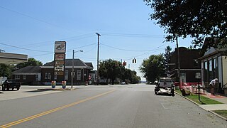
Belmont is a village in central Belmont County, Ohio, United States. The population was 414 at the 2020 census. It is part of the Wheeling metropolitan area.

<span class="mw-page-title-main">Aberdeen, Ohio</span> Village in Ohio, United States

Aberdeen is a village in Huntington Township, Brown County, Ohio, United States, along the Ohio River 50 miles (80 km) southeast of Cincinnati. The population was 1,515 at the 2020 census.

<span class="mw-page-title-main">Warsaw, Ohio</span> Village in Ohio, United States

Warsaw is a village in Coshocton County, Ohio, United States, along the Walhonding River. The population was 624 at the 2020 census.

<span class="mw-page-title-main">Osgood, Ohio</span> Village in Ohio, United States

Osgood is a village in Darke County, Ohio, United States. The population was 306 at the 2020 census.

<span class="mw-page-title-main">Brice, Ohio</span> Village in Ohio, United States

Brice is a village in Franklin County, Ohio, United States, on the southeast side of the Columbus metropolitan area. The population was 93 at the 2020 census.

<span class="mw-page-title-main">Minerva Park, Ohio</span> Village in Ohio, United States

Minerva Park is a village in Franklin County, Ohio, United States. The population was 2,009 at the 2020 census.

<span class="mw-page-title-main">Valleyview, Ohio</span> Village in Ohio, United States

Valleyview is a village in Franklin County, Ohio, United States. The population was 669 at the 2020 census.

<span class="mw-page-title-main">Metamora, Ohio</span> Village in Ohio, United States

Metamora is a village in Fulton County, Ohio, United States. The population was 566 at the 2020 census.

<span class="mw-page-title-main">Addyston, Ohio</span> Village in Ohio, United States

Addyston is a village in Miami Township, Hamilton County, Ohio, United States. Located along the Ohio River, it is a western suburb of the neighboring city of Cincinnati. The population was 927 at the 2020 census.

<span class="mw-page-title-main">Amberley, Ohio</span> Village in Ohio, United States

Amberley, locally known as Amberley Village, is a village in Hamilton County, Ohio, United States. The population was 3,840 at the 2020 census.

<span class="mw-page-title-main">Newtown, Ohio</span> Village in Ohio, United States

Newtown is a village in southeastern Hamilton County, Ohio, United States, near Cincinnati. The population was 2,702 at the 2020 census. Newtown was settled in 1792 and incorporated as a village in 1901.

<span class="mw-page-title-main">Montezuma, Ohio</span> Village in Ohio, United States

Montezuma is a village in Mercer County, Ohio, United States. The population was 152 at the 2020 census.

<span class="mw-page-title-main">Clarksburg, Ohio</span> Village in Ohio, United States

Clarksburg is a village in Ross County, Ohio, United States. The population was 409 at the 2020 census.

<span class="mw-page-title-main">Limaville, Ohio</span> Census-designated place in Ohio, United States

Limaville is a census-designated place (CDP) and former village in Stark County, Ohio, United States. The population was 151 at the 2020 census. It is part of the Canton–Massillon Metropolitan Statistical Area.

<span class="mw-page-title-main">Port Washington, Ohio</span> Village in Ohio, United States

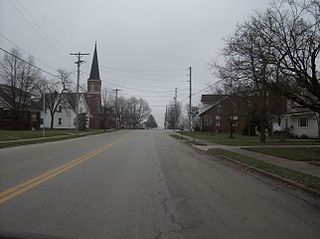
Port Washington is a village in Tuscarawas County, Ohio, United States. The population was 548 at the 2020 census.

<span class="mw-page-title-main">Macksburg, Ohio</span> Village in Ohio, United States

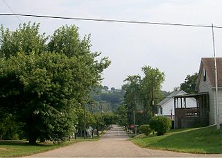
Macksburg is a village in Washington County, Ohio, United States, along the West Fork of Duck Creek. The population was 120 at the 2020 census. The village is about 28 miles (45 km) south of Cambridge, Ohio.

<span class="mw-page-title-main">Loveland Park, Ohio</span> Census-designated place in Ohio, United States

Loveland Park is a census-designated place (CDP) located in Symmes Township, Hamilton County and Deerfield Township, Warren County, in the southwestern part of the U.S. state of Ohio. The CDP is named after the city of Loveland. The population was 1,737 at the 2020 census.

<span class="mw-page-title-main">Gratiot, Ohio</span> Village in Ohio, United States

Gratiot is a village in Licking and Muskingum counties in the U.S. state of Ohio. The population was 215 at the 2020 census.

References

  1. "Hamilton County Officials 2016" (PDF). Hamilton County Board of Elections. January 27, 2016. p. 42. Retrieved February 1, 2016.
  2. "ArcGIS REST Services Directory". United States Census Bureau. Retrieved September 20, 2022.
  3. 1 2 U.S. Geological Survey Geographic Names Information System: Terrace Park, Ohio
  4. 1 2 "U.S. Census website". United States Census Bureau . Retrieved January 31, 2008.
  5. 1 2 3 A Place called Terrace Park by Ellis Rawnsley, 1992
  6. "US Gazetteer files 2010". United States Census Bureau. Archived from the original on January 25, 2012. Retrieved January 6, 2013.
  7. "Census of Population and Housing". Census.gov. Retrieved June 4, 2015.
  8. 1 2 3 4 "Terrace Park village, Ohio - Census Bureau Profile". United States Census Bureau. Retrieved October 23, 2023.
  9. "U.S. Census website". United States Census Bureau . Retrieved January 6, 2013.