Harrison Township, Hamilton County, Ohio

Last updated

Harrison Township, Hamilton County, Ohio
Othniel Looker House front.jpg
Flag of Harrison Township, Ohio.svg
Seal of Harrison Township, Hamilton County, Ohio.png
Hamilton County Ohio Incorporated and Unincorporated areas Harrison township highlighted.svg
Location in Hamilton County and the state of Ohio.
Coordinates: 39°15′25″N84°47′57″W / 39.25694°N 84.79917°W / 39.25694; -84.79917
Country United States
State Ohio
County Hamilton
Area
  Total17.8 sq mi (46.2 km2)
  Land17.5 sq mi (45.4 km2)
  Water0.3 sq mi (0.9 km2)
Elevation
[1]
610 ft (186 m)
Population
 (2020) [2]
  Total14,288
  Density816.46/sq mi (314.71/km2)
Time zone UTC-5 (Eastern (EST))
  Summer (DST) UTC-4 (EDT)
ZIP code
45030
Area code 513
FIPS code 39-33852 [3]
GNIS feature ID1086214 [1]
Website www.harrisontownshipohio.com

Harrison Township is one of the twelve townships of Hamilton County, Ohio, United States. The 2020 census found 14,288 people in the township.

Contents

Name and history

It is one of nineteen Harrison Townships statewide. [4]

Geography

Located in the northwestern corner of the county, it borders the following townships:

The city of Harrison is located in central Harrison Township but also extends into Crosby Township.

Demographics

Historical population
CensusPop.Note
1860 1,347
1870 758−43.7%
1880 2,277200.4%
1890 2,3915.0%
1900 2,092−12.5%
1910 1,963−6.2%
1920 1,891−3.7%
1930 1,9362.4%
1940 2,43525.8%
1950 2,92320.0%
1960 5,52589.0%
1970 6,22612.7%
1980 9,31049.5%
1990 12,14530.5%
2000 12,4692.7%
2010 13,93411.7%
2020 14,2882.5%
Sources: [5] [2]

2020 census

As of the census of 2020, there were 14,288 people living in the township, for a population density of 816.5 people per square mile (314.7/km2). There were 5,960 housing units. The racial makeup of the township was 93.6% White, 0.7% Black or African American, 0.2% Native American, 0.5% Asian, 0.0% Pacific Islander, 0.7% from some other race, and 4.3% from two or more races. 1.8% of the population were Hispanic or Latino of any race. [2]

There were 5,752 households, out of which 30.7% had children under the age of 18 living with them, 54.2% were married couples living together, 15.1% had a male householder with no spouse present, and 23.9% had a female householder with no spouse present. 27.3% of all households were made up of individuals, and 13.2% were someone living alone who was 65 years of age or older. The average household size was 2.47, and the average family size was 3.00. [2]

23.3% of the township's population were under the age of 18, 59.0% were 18 to 64, and 17.7% were 65 years of age or older. The median age was 40.2. For every 100 females, there were 93.0 males. [2]

According to the U.S. Census American Community Survey, for the period 2016-2020 the estimated median annual income for a household in the township was $80,295, and the median income for a family was $95,255. About 6.1% of the population were living below the poverty line, including 7.9% of those under age 18 and 11.6% of those age 65 or over. About 69.4% of the population were employed, and 24.7% had a bachelor's degree or higher. [2]

Government

The township is governed by a three-member board of trustees, who are elected in November of odd-numbered years to a four-year term beginning on the following January 1. Two are elected in the year after the presidential election and one is elected in the year before it. There is also an elected township fiscal officer, [6] who serves a four-year term beginning on April 1 of the year after the election, which is held in November of the year before the presidential election. Vacancies in the fiscal officership or on the board of trustees are filled by the remaining trustees.

Related Research Articles

<span class="mw-page-title-main">Hamilton County, Ohio</span> County in Ohio, United States

Hamilton County is located in the southwestern corner of the U.S. state of Ohio. As of the 2020 census, the population was 830,639, making it the third-most populous county in Ohio. The county seat and largest city is Cincinnati. The county is named for the first Secretary of the Treasury, Alexander Hamilton. Hamilton County is part of the Cincinnati-Middletown, OH-KY-IN Metropolitan Statistical Area.

<span class="mw-page-title-main">Union County, Indiana</span> County in Indiana, United States

Union County is a county in the U.S. state of Indiana. As of the 2020 United States census, the population was 7,087. The county seat is Liberty.

<span class="mw-page-title-main">Ripley County, Indiana</span> County in Indiana, United States

Ripley County is a county located at the southeastern corner of the U.S. state of Indiana. According to the 2020 Census, the population was 28,995. The county seat is Versailles.

<span class="mw-page-title-main">Ohio County, Indiana</span> County in Indiana, United States

Ohio County is a county located in southeastern Indiana. With a 2020 population of 5,940, and an area of just 87 square miles, Ohio County is the smallest county in Indiana by area and the least populous. The county seat and only incorporated municipality is Rising Sun. The county was officially established in 1844 and was one of the last Indiana counties to be created. Ohio County borders the state of Kentucky across the Ohio River for which it was named. It is part of the Cincinnati, OH-KY-IN Metropolitan Statistical Area. The county is divided into four townships which provide local services. Three state roads pass through or into the county.

<span class="mw-page-title-main">Franklin County, Indiana</span> County in Indiana, United States

Franklin County is a county on the eastern border of the U.S. state of Indiana. In the 2020 United States Census, the county population was 22,785. The county seat is the town of Brookville. Franklin County is part of the Cincinnati, OH–KY–IN Metropolitan Statistical Area. The only incorporated city in Franklin County is Batesville, which lies mostly in adjoining Ripley County.

<span class="mw-page-title-main">Fayette County, Indiana</span> County in Indiana, United States

Fayette County is one of 92 counties in U.S. state of Indiana located in the east central portion of the state. As of 2020, the population was 23,398. Most of the county is rural; land use is farms, pasture and unincorporated woodland. The county seat and only incorporated town is Connersville, which holds a majority of the county's population.

<span class="mw-page-title-main">Dearborn County, Indiana</span> County in Indiana, United States

Dearborn County is one of 92 counties of the U.S. state of Indiana. Located on the Ohio border near the southeast corner of the state, Dearborn County was formed in 1803 from a portion of Hamilton County, Ohio. In 2020, the population was 50,679. The county seat and largest city is Lawrenceburg. Dearborn County is part of the Cincinnati, OH-KY-IN Metropolitan Statistical Area.

<span class="mw-page-title-main">Bright, Indiana</span> Census-designated place in Indiana, United States

Bright is an unincorporated community and census-designated place (CDP) in Dearborn County, Indiana, United States. The population was 5,814 at the 2020 census.

<span class="mw-page-title-main">West Harrison, Indiana</span> Town in Indiana, United States

West Harrison is a town in Harrison Township, Dearborn County, Indiana, United States. The population was 289 at the 2010 census.

<span class="mw-page-title-main">Grandview, Hamilton County, Ohio</span> Census-designated place in Ohio, United States

Grandview is a census-designated place (CDP) in Hamilton County, Ohio, United States. The population was 1,312 at the 2020 census.

<span class="mw-page-title-main">Harrison, Ohio</span> City in Ohio, United States

Harrison is a city in western Hamilton County, Ohio, United States. The population was 12,563 at the 2020 census. It is part of the Cincinnati metropolitan area.

<span class="mw-page-title-main">Colerain Township, Hamilton County, Ohio</span> Township in Ohio, United States

Colerain Township is one of the twelve townships of Hamilton County, Ohio, United States. The population of the township was 59,037 at the 2020 census. It is the second-largest township in Ohio by area, surpassed by Madison Township, Lake County, Ohio.

<span class="mw-page-title-main">Crosby Township, Ohio</span> Township in Ohio, United States

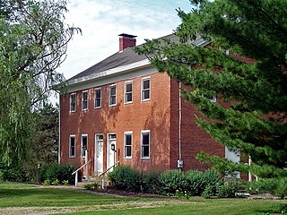
Crosby Township is one of the twelve townships of Hamilton County, Ohio, United States. The 2020 census found 6,030 people in the township.

<span class="mw-page-title-main">Miami Township, Hamilton County, Ohio</span> Township in Ohio, United States

Miami Township is one of the twelve townships of Hamilton County, Ohio, United States. The population was 15,969 as of the 2020 census.

<span class="mw-page-title-main">Sycamore Township, Hamilton County, Ohio</span> Township in Ohio, United States

Sycamore Township is one of the twelve townships of Hamilton County, Ohio, United States. The population was 19,563 as of the 2020 census.

<span class="mw-page-title-main">Whitewater Township, Hamilton County, Ohio</span> Township in Ohio, United States

Whitewater Township is one of the twelve townships of Hamilton County, Ohio, United States. The population was 6,375 as of the 2020 census.

<span class="mw-page-title-main">Morgan Township, Butler County, Ohio</span> Township in Ohio, United States

Morgan Township is one of thirteen townships in Butler County, Ohio, United States. It is located in the southwestern corner of the county, on the state line with Indiana. It had a population of 5,345 at the 2020 census.

<span class="mw-page-title-main">New Haven, Hamilton County, Ohio</span> Census-designated place in Ohio, United States

New Haven is a census-designated place (CDP) in Crosby Township, Hamilton County, Ohio, United States. The population was 572 at the 2020 census.

<span class="mw-page-title-main">Blue Jay, Ohio</span> Census-designated place in Ohio, United States

Blue Jay is a census-designated place (CDP) in Whitewater Township, Hamilton County, Ohio, United States. The population was 1,427 at the 2020 census.

<span class="mw-page-title-main">Shawnee, Hamilton County, Ohio</span> Census-designated place in Ohio, United States

Shawnee is a census-designated place (CDP) in Miami Township, Hamilton County, Ohio, United States, 21 miles (34 km) west of downtown Cincinnati. The population of Shawnee was 747 at the 2020 census.

References

  1. 1 2 "US Board on Geographic Names". United States Geological Survey. October 25, 2007. Retrieved January 31, 2008.
  2. 1 2 3 4 5 6 "Harrison township, Hamilton County, Ohio - Census Bureau Profile". United States Census Bureau. Retrieved October 29, 2023.
  3. "U.S. Census website". United States Census Bureau . Retrieved January 31, 2008.
  4. "Detailed map of Ohio" (PDF). United States Census Bureau. 2000. Retrieved February 16, 2007.
  5. "Decennial Census by Decade". United States Census Bureau. Retrieved October 29, 2023.
  6. §503.24, §505.01, and §507.01 of the Ohio Revised Code. Accessed 4/30/2009.